Weather- and climate-related extremes caused economic losses estimated at EUR560 billion in the EU between 1980 and 2021. Nearly 195,000 fatalities...
#climatechange#climate#ClimateCrisis
https://t.co/uhVAO3Ve1k
We are happy to show you our latest application
allowing users to visualise how the environment around them affects their health and well-being.
Enjoy and share.
https://t.co/dxhMLJnkDz
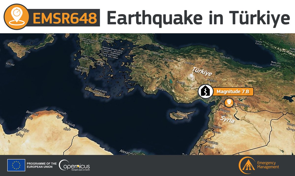
#EMSR648#Earthquake in #Türkiye🇹🇷
A destructive magnitude 7⃣.8⃣ earthquake has struck with the epicentre located near #Gaziantep, close to the border with #Syria🇸🇾
Our #RapidMappingTeam has been activated to monitor its impact
Updates ASAP
More at👇
https://t.co/Rxfhj84v3R
Our annual #EUBathing water briefing is out!
Check what the #water quality has been at your local #swimming spot through our online map: https://t.co/DsNoXWvQbY
More: https://t.co/wJEsJYg8I4
Today in the online class for @ihedelft Environmental Sciences MSc students we used #OpenData from #OpenStreetMap and web map services in #QGIS. We used #CORINE Land Cover from @discomap and downloaded vectors using the QuickOSM plugin. Here's a playlist. https://t.co/dy7ZTWlyXr
Pour la première fois, les conséquences du réchauffement climatique pour l'Europe sont visibles : montée des eaux, feux de forêt... Ces cartes officielles basées sur le dernier rapport du GIEC sont édifiantes.
Découvrez si votre commune est concernée 👉https://t.co/kvAXK62Tr9
"Why does Europe need to limit climate change and adapt to its impacts?"
We proudly share with you the last application of Discomap team:
https://t.co/FKwKtYeNtF