🚀 Today, we officially launch the Open Geospatial Carbon Registry (OGCR) in Doorwerth! 🌍
Our mission: build an open, transparent, and farmer-friendly carbon registry for Europe.
#OGCR#CarbonFarming#EUGreenDeal#CarbonRegistry
We are building ensemble DTM of the world at 30m for #geomorphometry research communities; next we will build series of DTM parameters (slope, northness, eastness, catchment area, openess, erosion risk, TWI etc) and then make them available as COGs: https://t.co/ZjlqyD901g
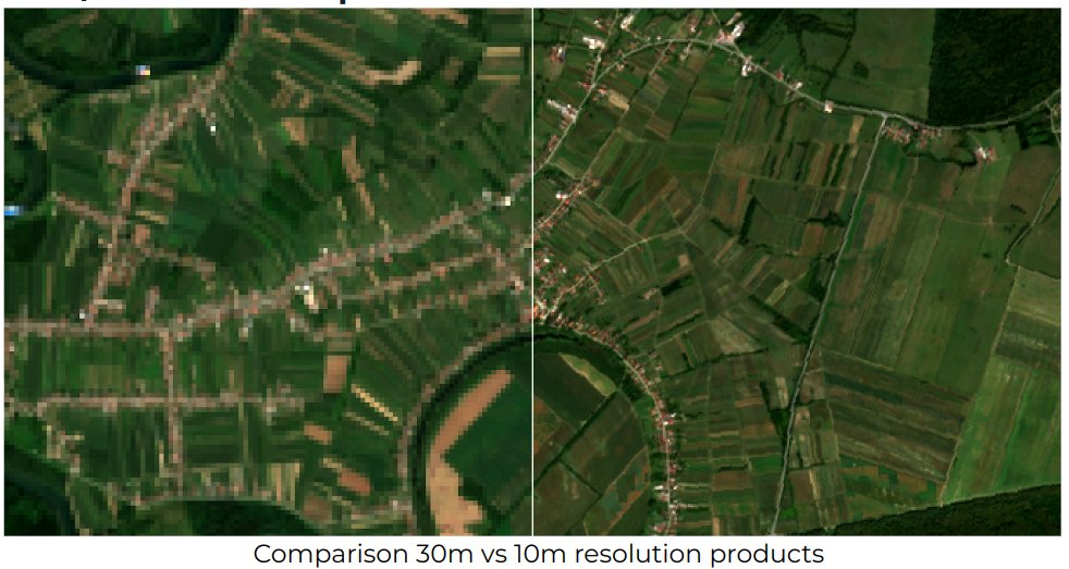
We have added the 10m spatial resolution seamless mosaics for EU for period 2017--2021 to enhance @HarmonizerGeo use cases and support environmental monitoring projects; powered by @DMultione. Visit https://t.co/xdS1My9LWp to import data into your projects #OpenData@EU_HaDEA
[- 7 days to the #OpenEarthMonitor Project Launch💫]
🗓Come and join us in our very first #interactive workshop: meet experts, provide feedback and #TellUsYourStory from the ground!
🔎Info: https://t.co/XY9o2Hk2NO
Register: https://t.co/B1DgYdKTCF
@HorizonEU#EO4Europe
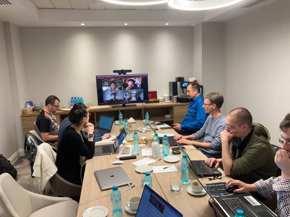
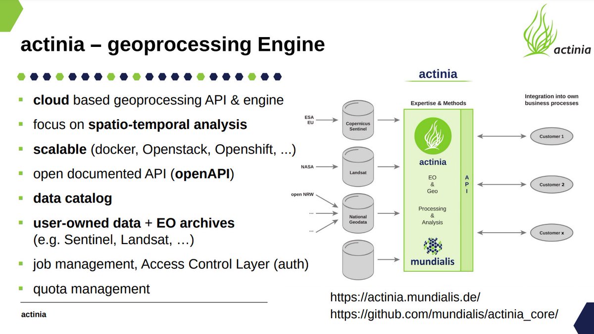
Just watching @MarkusNeteler presenting Actinia cloud services for processing 🌍 data (using GRASS, GDAL and similar in backend) at the #OpenDataScience workshop Prague @CVUTPraha@HarmonizerGeo Examples with jupyter python notebooks are available at: https://t.co/UCSlAOVR3t
Big #EarthObservation Data and upcoming #EO missions🛰️:
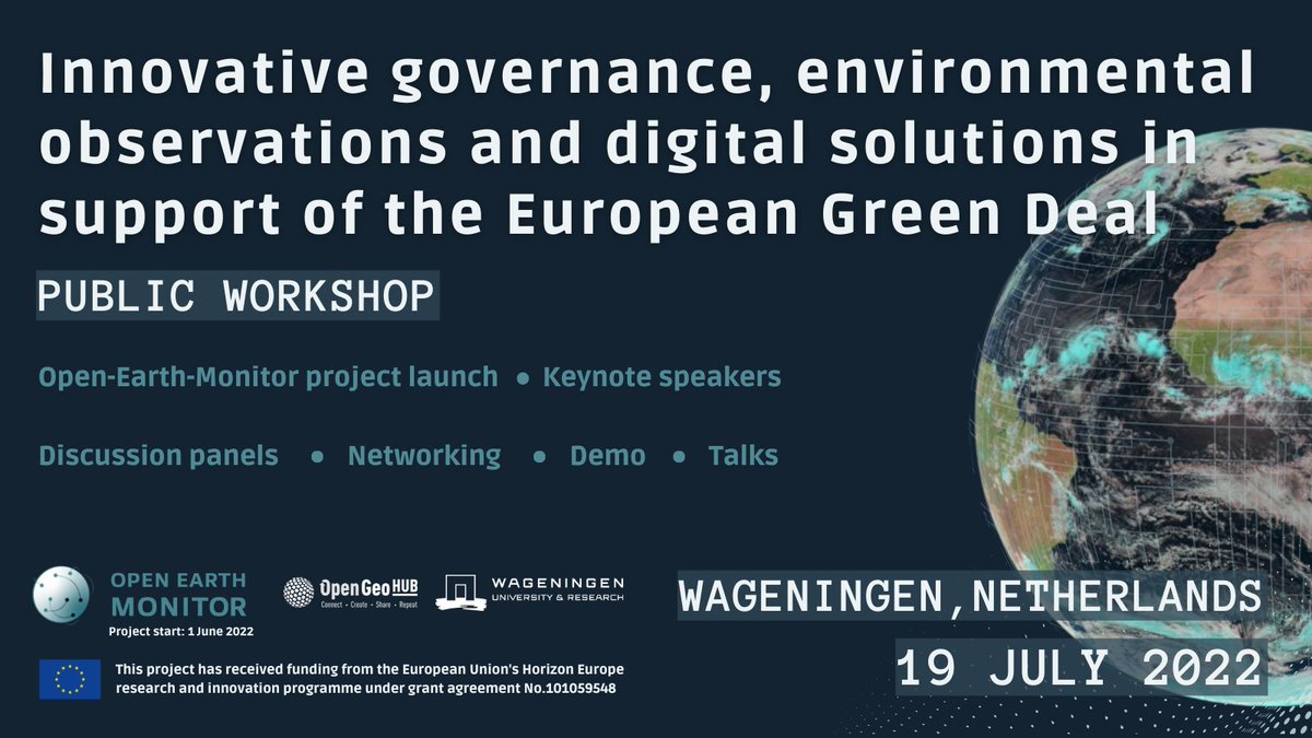
Learn how to contribute to the upcoming @HorizonEU Open-Earth-Monitor through interactive debates, demo sessions & social activities at the public workshop in #Wageningen@WUR
👉Register by 1 June: https://t.co/VENSKiSdd9
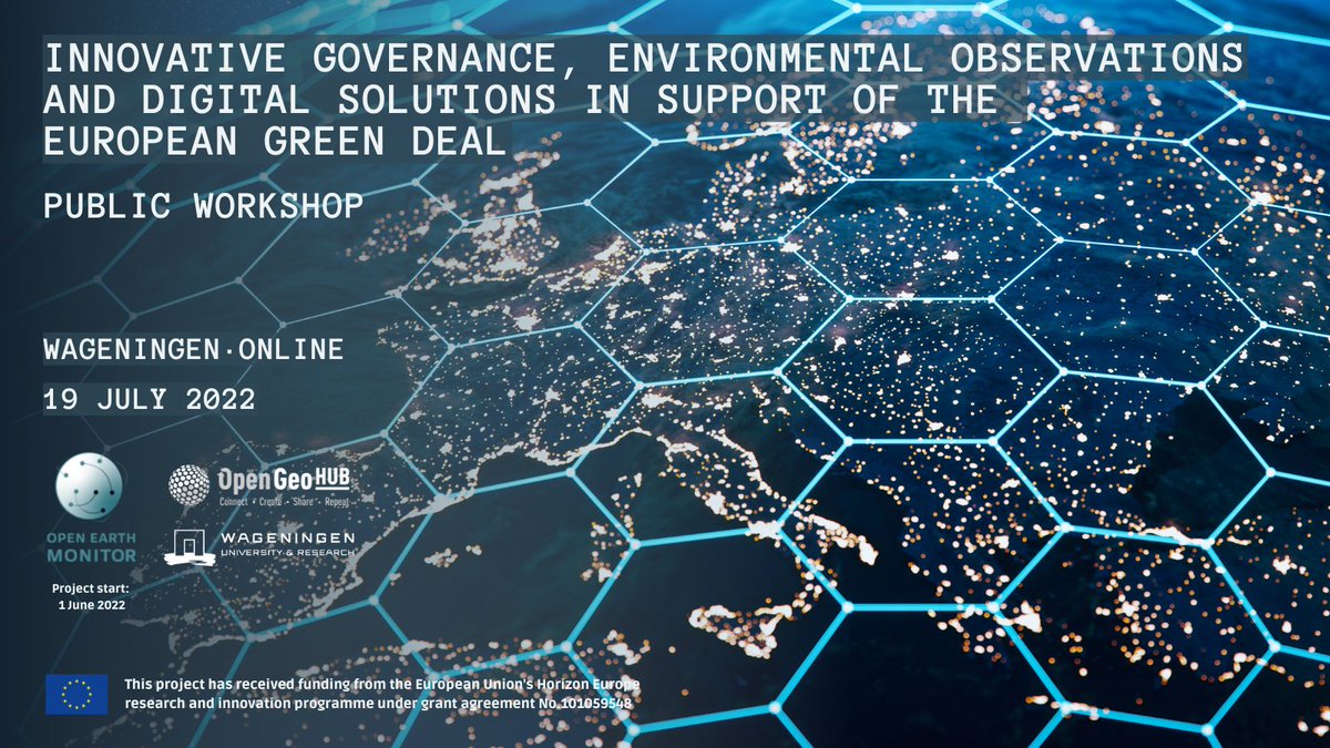
Innovative #governance, environmental observations and digital solutions in support of the European Green Deal —the public workshop of the upcoming @HorizonEU Open-Earth-Monitor project.
👉Info: https://t.co/rNMm9iy8oU
👉Register: https://t.co/VENSKiSdd9
#opendata#EUGreenDeal
Looking for the analysis-ready EO #OpenData for Europe 🇪🇺? The @HarmonizerGeo project has produced 210GB of cloud/artifact-free #sentinel2 images at 30m covering 2018 and 2019 and available as Cloud-optimized GeoTIFFs: https://t.co/JWoEGzt1Ug 👏 @DMultione@EU_HaDEA
We have mapped land cover classes for the 2000-2019 period for continental Europe at 30-m resolution using spatiotemporal ML. Explore the dynamic EU landscapes on your palm using the ODS-Europe viewer: https://t.co/Jfw1iwCcO1
Read more in: https://t.co/tz1bO7neN9 @inea_eu
OpenGeoHub, @CVUT, @MundialisInfo, @TERRASIGNA and @DMultione are starting a 3yrs project “Geo-Harmonizer” (https://t.co/ITz12ypwjn) funded by @inea_eu (1.8M EUR). We look forward to developing software and new harmonized GIS layers for EU citizens. #OpenData#GRASSGIS#Rstats