DIST-ALERT by @UMD_GLAD is helping organizations detect unauthorized land clearing in New England, support sustainable forestry and supply chain transparency across North America and Europe, and protect critical chimpanzee habitat in East Africa:
https://t.co/JPDsyHdpP1
“Generally speaking, a good year is a good year,” said Matt Hansen, ... director of @UMD_GLAD, which contributed forest-loss data to the report. “But you need good years forever if you’re going to conserve the tropical rainforest.”
https://t.co/4eMLsSB7k0
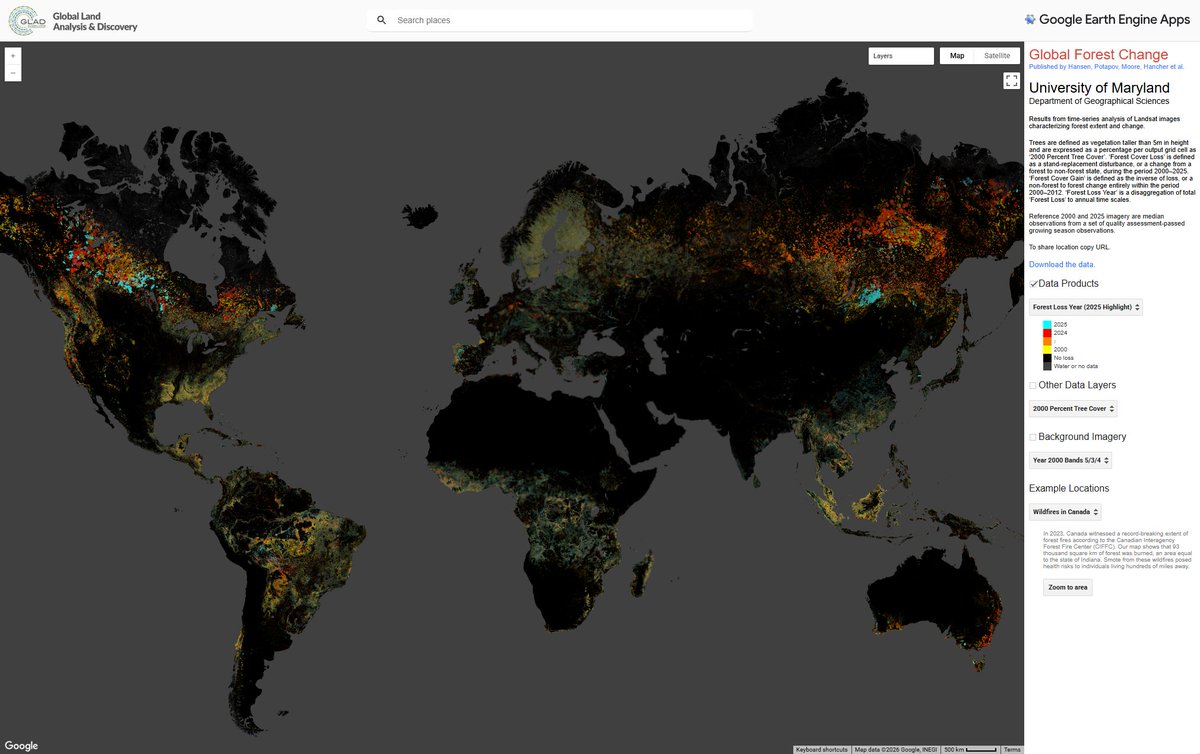
🌳OUT NOW: The latest data on #TreeCoverLoss from @UMD_GLAD, available on @globalforests.
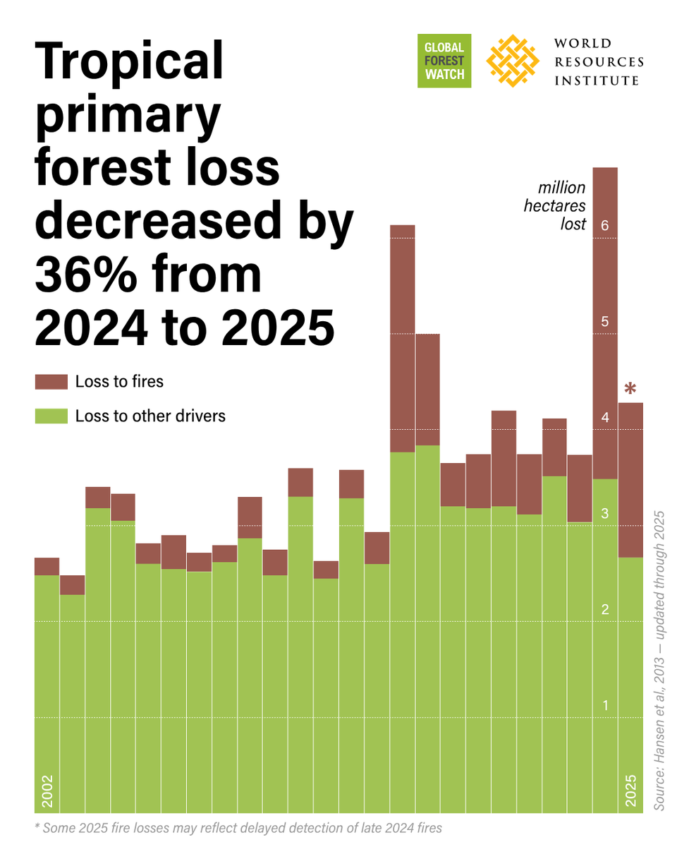
Tropical primary rainforest loss fell 36% in 2025 from the record high of 2024. The findings suggest that strong policies and enforcement can curb forest loss. However, climate-driven fires are a dangerous new normal, threatening to reverse recent gains.
Read the full analysis➡️ https://t.co/Gv7Zy96LS1
🌳OUT NOW: The latest data on #TreeCoverLoss from @UMD_GLAD & @globalforests.
Tropical primary rainforest loss fell by 36% in 2025 from a record high in 2024. But rising, climate-driven fire risk threatens to reverse these gains.
Read the full analysis: https://t.co/3cd316jake
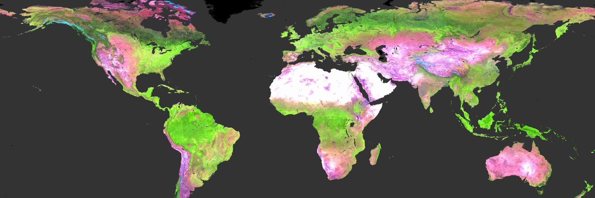
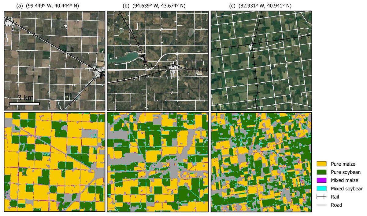
🌍 New from @UMD_GLAD: global annual maps of cropland dynamics (2015–2024) at 30m resolution.
Key insight: cropland ↑ ~6% in a decade, but per capita ↓, highlighting food security pressures.
📊 Data: https://t.co/Hxlxi3WFDz
📄 Paper: https://t.co/7CxvKnXfA6
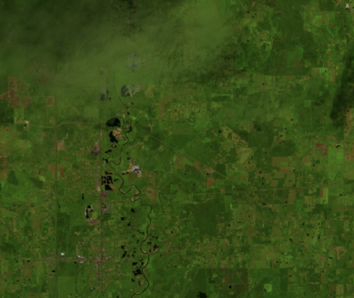
Captured in @UMD_GLAD DIST-ALERTs: Explosion at an oil and chemical plant in Roseland, LA on August 22, 2025 blanketed the communities, waterways, forests, and fields in oily soot for miles downwind https://t.co/Lp3HBL9w2X #remotesensing#disastermonitoring@umdgeography
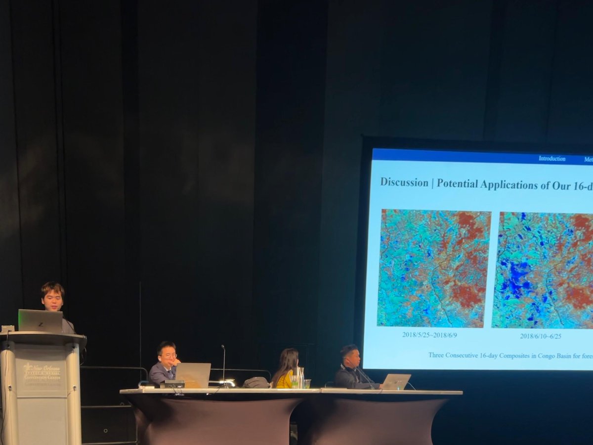
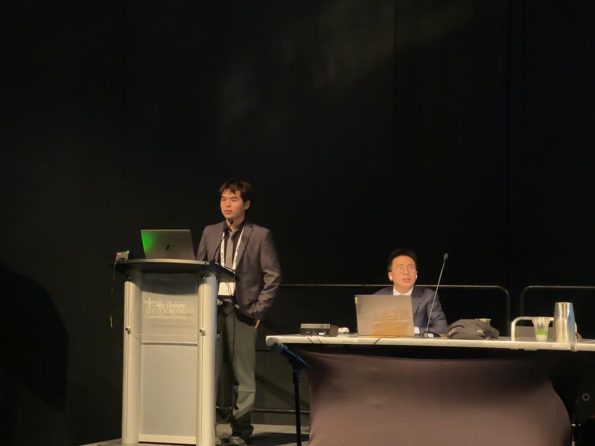
#AGU25 Day 1
PhD student Zhen Liu from @UMD_GLAD presented on 16-day 🌫️Cloudless and Shadowless Composite of Harmonized Landsat Sentinel (HLS) modeling and potential applications.
🛰️🌎 Prof Matthew Hansen will lead a $1.2 million project to improve monitoring of tropical land cover, via @MooreFound.
Using satellite data, his @UMD_GLAD team will map where commodity expansion is replacing forests + other natural areas.
Read more: https://t.co/mGniAp6dq4
3️⃣
As lead author Amy Pickens noted,
“DIST-ALERT monitoring in such a low-latency mode enables data to be more actionable; not just for policymaking, but for actually responding to individual events.”
Read more in the @UMDBSOS feature:
https://t.co/SoPLtjvUeL
@umdgeography
2️⃣
DIST-ALERT tracks land surface change worldwide in near real time using 5 satellites (Landsat 8/9 + Sentinel-2A/B/C), with a 1–4 day revisit rate.
It detects deforestation, fires, drought, mining & more — at 30 m resolution.
Explore the data 👇
https://t.co/z3Fjt7HwPN
1️⃣
📢 Exciting news from @UMD_GLADLab!
Our DIST-ALERT global land change monitoring system led by Amy Pickens is now published in Nature Communications! 🌍🛰
https://t.co/TVAXZqT1EE
#UMD#NatureCommunications#RemoteSensing#EarthObservation
Latest from me - across #Cambodia, #Laos, #Myanmar, #Thailand and #Vietnam, nearly 1 million Ha of forests were lost in 2024, with ~30% of that lost in "protected" areas.
We used @globalforests & @UMD_GLAD data to shine a light on regional deforestation.
https://t.co/xLLCrb4588
🚀 Just released: updated Land Cover Map Validation Guidelines led by @UMD_GLAD's Alexandra (Sasha) Tyukavina.
These best practices help researchers & practitioners worldwide build more accurate, reliable land cover maps. Free & open to use.
https://t.co/NYAR3njPE5
❓Why would a scientist who tracks forests speak out about political AI? 🤖
@UMD_GLAD's Andres Hernandez-Serna @ahernandezserna warns: the AI that maps forests is now shaping political messages without labels or accountability.
Learn more: https://t.co/i2ZpnaRT6D