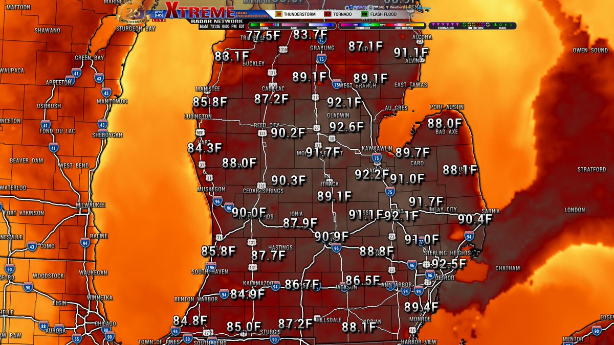
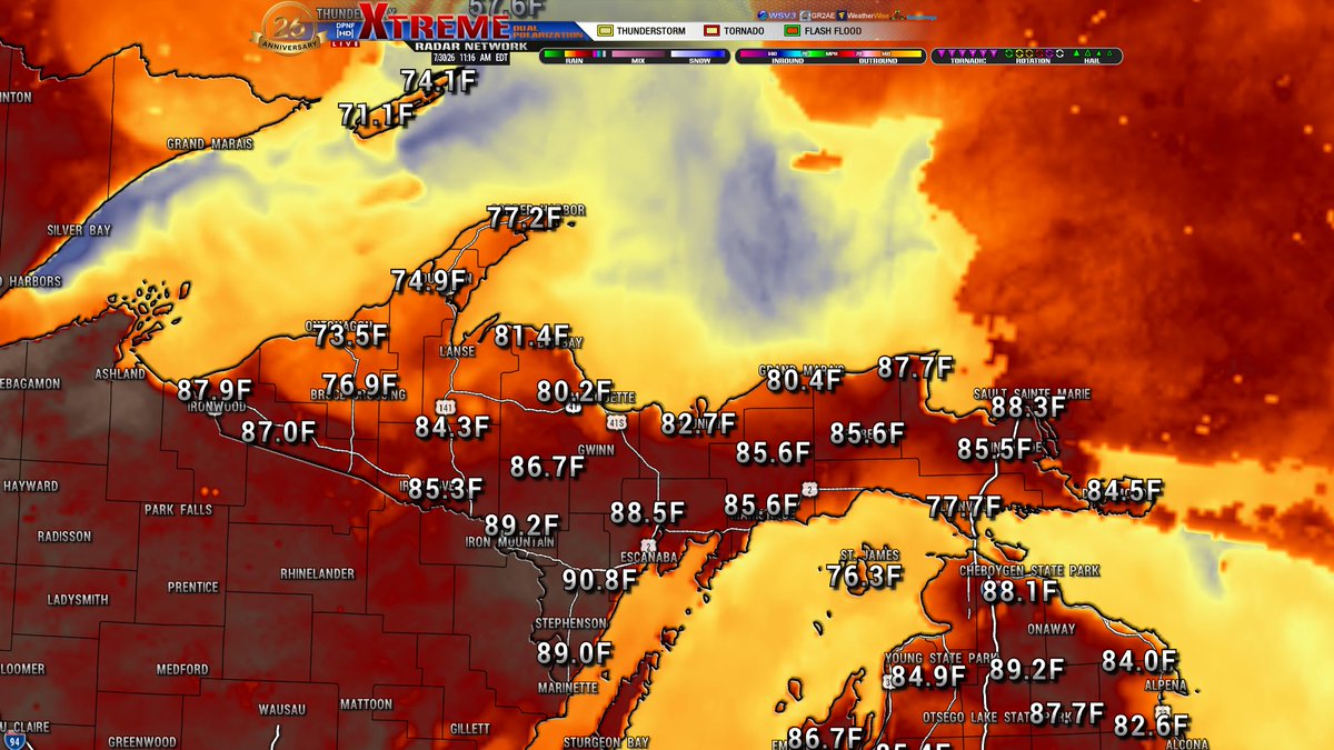
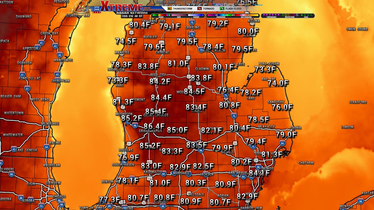
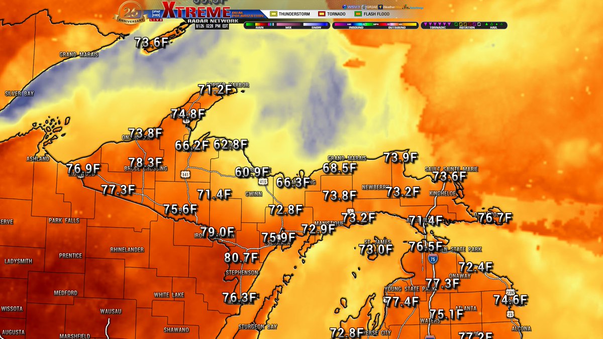
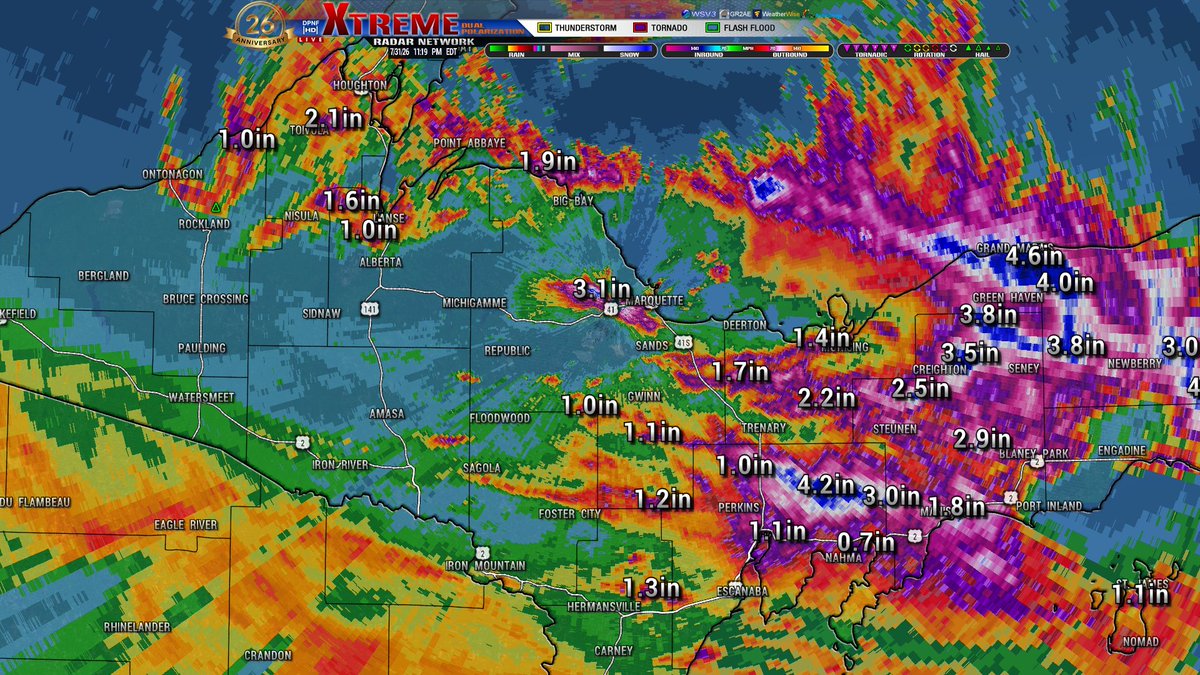
Good late evening Michigan! Update for temperatures tonight, the coolest for the night will be between 4-5a. Rain will be sticking around for parts of Michigan tonight and into the early morning, mainly for the LP. Might hear a rumble of thunder as well. Tomorrow another chance of some rain and non severe thunderstorms for the southern parts of the LP. We will have an update on that later this morning. Have a great night Michiganders!
Good afternoon Michigan. A cooler day for everyone, temperatures struggling to warm up with all of this rain. Speaking of which it has finally let up in the UP for now but doppler is showing a few more showers heading down from Canada currently. Today's high and not so dry temperatures are for the 5p hour. Have a great afternoon Michigan and we will see you back here later this evening.
Doppler update. Rain across the state. Lighter showers on the central and southern parts of the LP. Heavier rain the farther north you go. UP seeing several areas of heavier rain. We might see a few more flood advisories.
Good evening Michigan! A wet night in store for the entire state. Heavy rain continues for the northern LP and eastern UP. State wide showers continuing into the late evening and over night hours until tomorrow morning. Tonight's temperatures dipping down into the upper 60's for most of the state. We will keep you updated throughout the night with any changing details on the system moving across the area. Have a great night Michiganders!
Flash Flood Warning for N Alcona and SW Alpena Co until 930p. Doppler indicated thunderstorms producing heavy rain across the warned area. Between 1 and 2 inches of rain have fallen, with 2.22 inches reported near Ossineke with the previous round of storms. The expected rainfall rate is 1 to 2 inches in 1 hour. Additional rainfall amounts of 1 to 3 inches are possible in the warned area. Flash flooding is ongoing or expected to begin shortly.
Good early morning Michigan! Another beautiful start to our day. Clouds will start to move in this afternoon for the LP, moving in currently for the UP. Models are showing the rain will start making its way into the UP around 5p and the LP by 8p. Nothing severe but the SPC is showing us in a area for some thunderstorms to pop up, might see some Special Weather Statements later this evening. Todays high temperatures are for the 4p hour with central MI being the hot spot yet again today. Have a fantastic morning and afternoon Michigan and we will be checking in again later today!
Good evening Michigan! Clouds are continuing their push into the state tonight; temperatures not drooping to much with the cloud cover either. Lows getting down to the mid and upper 60's for most of the state but that doesn't happen until tomorrow morning at 5a. Tomorrows temperatures warming up nicely, LP will be toasty again. And we will have our next weather system moving in as well. More on that tomorrow morning. Have a great night Michiganders!
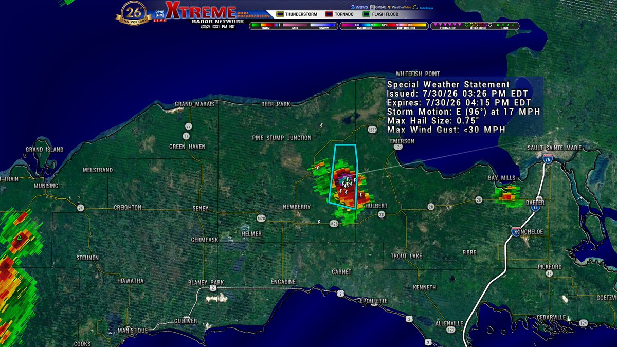
SWS for E Central Luce Co until 415p. Doppler is tracking a strong thunderstorm 8 miles NW of Hulbert, moving E at 15mph. Penny size hail being the main threat with this cell.
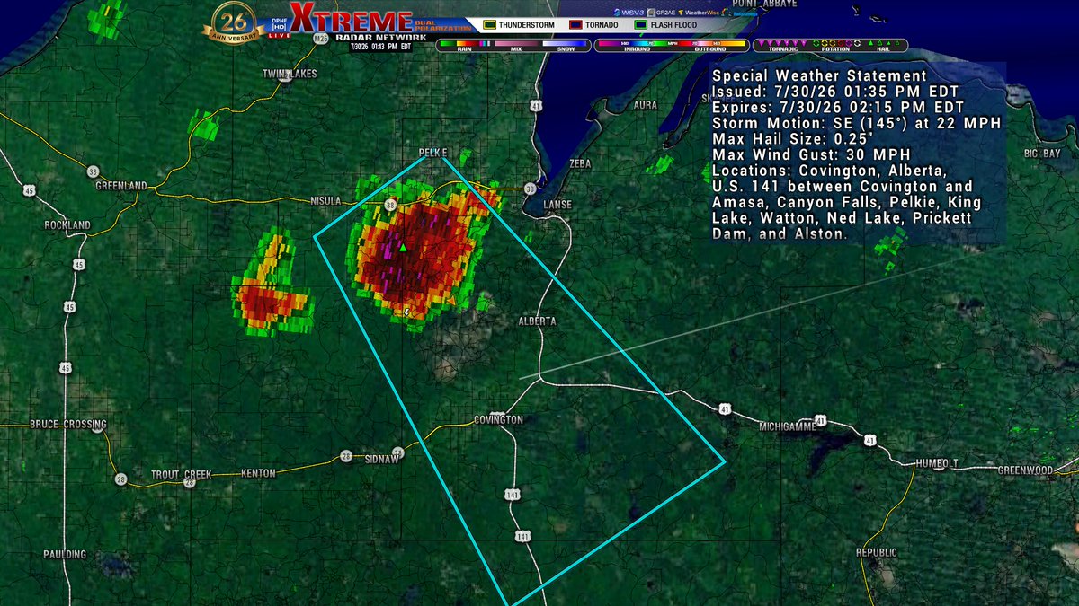
SWS for NW Iron and SW Houghton Co until 345pEDT/245pCDT. Doppler is tracking a strong thunderstorm over Kenton, moving S at 10mph. Winds over 30mph and penny size hail with this storm.
Good morning Michigan! Looking to be like another hot day in store for everyone. Most of the state is currently seeing temperatures in the upper 70's some areas already in the lower 80's. Todays highs are for the 4p hour, the central LP being the hot spot today, Isabella and Midland Co seeing temps around 92. Continuing to track a line of thunderstorms to the north currently, the UP did see a few rumbles of thunder early this morning with most of that fizzling out around 7a. Another round slowly making it was in, currently up near Isle Royal. Have a great morning and afternoon Michiganders and we will keep you updated throughout the day!
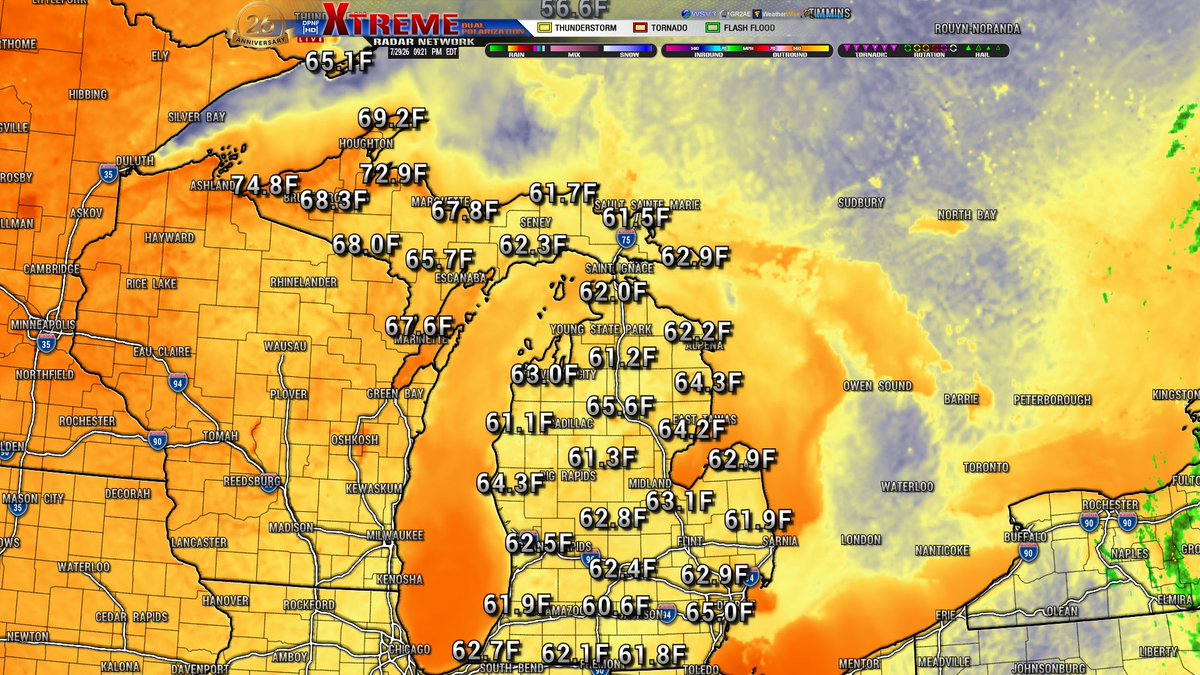
Good evening Michigan! Another beautiful and cool night is in store. Current look at our METAR temperatures (image1) across the state. Beautiful conditions out there throughout the countryside with a gradual decrease into the overnight hours. Tonight's low temperatures (image2) dipping down into the 60s with the western UP having the highest temperatures. Clouds will start to push in over night into the UP keeping those temperatures up, and they may also bring a sprinkle or two for the early morning hours but nothing wide spread. Tomorrows temperatures definitely warm up compared to today, might see some low 90s across the state. We will have an update on those tomorrow morning, but until then Michiganders, have a great night!
Good early morning Michiganders! Another beautiful day is in store for everyone, and I mean beautiful. Clear skies are in store, humidity levels dropping off by the afternoon and a light breeze for most of the day! Ironwood being the hotspot for the UP at 87 and Grand Rapids for the LP at 86. Lakeshore communities as usual seeing those cooler temperatures and slightly higher wind speeds especially in the thumb region and points south for the eastern LP. Peak winds and waves will be around 11a and calm down throughout the afternoon. Todays high temperatures are for the 5p hour with a gradual cool down into the evening. Have a great morning and afternoon Michigan, and we will be checking in later this evening!
Good evening Michigan! Another beautiful and clear night is in store. Clouds have moved off to the E giving us another beautiful night for stargazing. The E coast dealing with a lot of severe weather this evening and into the overnight hours. Here at home, no rain to be expected until this weekend. However, the UP could see some of that rain Friday evening. Tonight's temperatures dip down into the high 50s to low 60s, sporadic across the entire state. The UP being the coolest and the warmest for the overnight hours. Have a great night Michigan and we will see you in the morning!
Good afternoon Michigan. Luckily yesterday was not as severe as the Storm Predication Center made it out to be. We received some well deserved rain to help out with some of these dry conditions across the state. A slightly cooler day for everyone depending on where you are in the state. Humidity levels are high along with the dew point for the LP making it feel not as nice outside. The UP gets the best deal for the day, nice cool temperatures and low on the humidity as well with some sunshine! Clouds still holding in the LP while sky's are clearing up in the UP. Todays high temperatures are for the 5p hour. We will have our next update later this evening, until then have a wonderful afternoon Michigan!
SWS for Monroe Co until 2a. Doppler is tracking a strong thunderstorm over Deerfield, moving SE at 45mph. Hazard is half inch size hail with this cell.
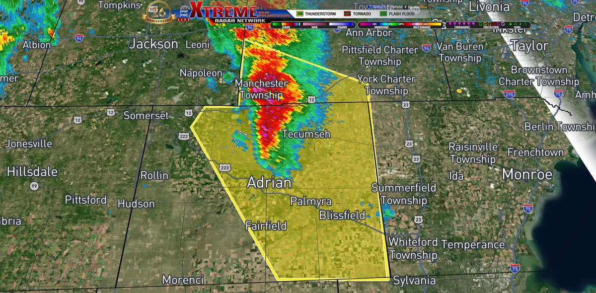
Severe Thunderstorm Warning for Lenawee and SW Washtenaw Co until 145a. Doppler is tracking a severe thunderstorm located by Manchester, moving SE at 40mph. Hazzard is quarter size hail with this storm.