you share your positive experiences on this app and suddenly you have the most miserable people ever in your replies dumping their relationship trauma on you so i don't blame the happily married people for leaving this app
Super Typhoon Sinlaku is now a 175 MPH (280 kph), 902 MBAR CATEGORY 5 megastorm per the JTWC. She is officially the world’s most powerful cyclone of 2026.
Her scorching eye has carved out one of the sharpest and cleanest Stadium Effects I can ever recall, and her CDO is a superchilled whirlpool of the scariest storm conditions imaginable. We are witnessing meteorological insanity.
The last GFS run for Pacific Typhoon Sinlaku is pure nightmare fuel. A possible direct landfall over Guam on Monday at an extreme intensity.
Like before, it is important to note that even a small shift could spare the island from the core of fiercest conditions, and we’re still a few days away from any potential landfall. For now, continue to monitor all updates on Sinlaku if you are in her path.
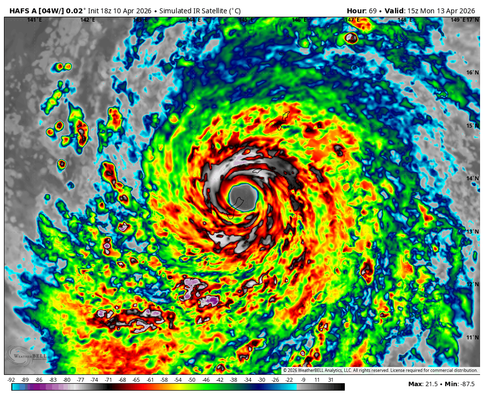
I mean, WOW is justified. Guam may take one of or its strongest typhoons on record Monday next week if HAFS is correct.
Drops the intense eye over the northern half of Guam. There are about 7,000 U.S. troops stationed there, and a population of around 170,000. Building codes are strong, many concrete buildings and homes to withstand 150 MPH winds. Those building codes may be put to the test Monday.
There has been a slight trend north with the eye/track of the super typhoon, which could make the impact a tad less extreme if that continues. Mean of all the models is just on the northern tip of Guam.
The most recent GFS runs are unfortunately showing #Guam could get a DIRECT HIT from #Typhoon#Sinlaku as a CATEGORY 5 SUPER TYPHOON within the next 3 days. If this were to verify, CATASTROPHIC IMPACTS would likely occur. Preparations need to be completed BY TOMORROW NIGHT!