In coastal Robertsport City and the wider Commonwealth District in Liberia, open mapping informed flood-mitigation planning and service delivery, increasing flood-preparedness awareness among approximately 35,000 residents. https://t.co/gyyvOt5D23
This week I’m working with the Freetown City Council and local partners toward a regenerated, smart, Inclusive and sustainable Freetown…. Next week in Ghana for a Risk modeling across six cities… next generating 3cm Hi-res drone imagery to enhance city planning in Dakar…..
We are collaborating with the Myanmar @openstreetmap community to map areas affected by the #earthquakemyanmar. If you need map data, packages are available (refreshed daily) at https://t.co/5uXgSVB2TV If you have other data needs, please reach out.
Women's inclusion in decisions on community development and humanitarian response starts by being knowledgeable of their settlements - Open Data provides a pathway for active participation!
Celebrating Women in Open Mapping!
Join HOT’s Community Working Group for an International Women’s Day 2025 webinar on leadership, innovation, and inclusion in open mapping.
📅 06 March 2025 | ⏰ 12 PM UTC
Register here: https://t.co/N3kEMw4Ley
#AccelerateAction#IWD2025
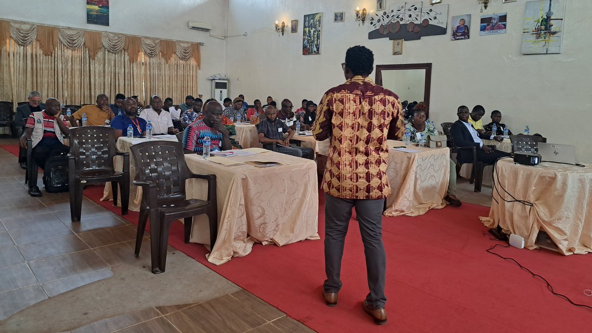
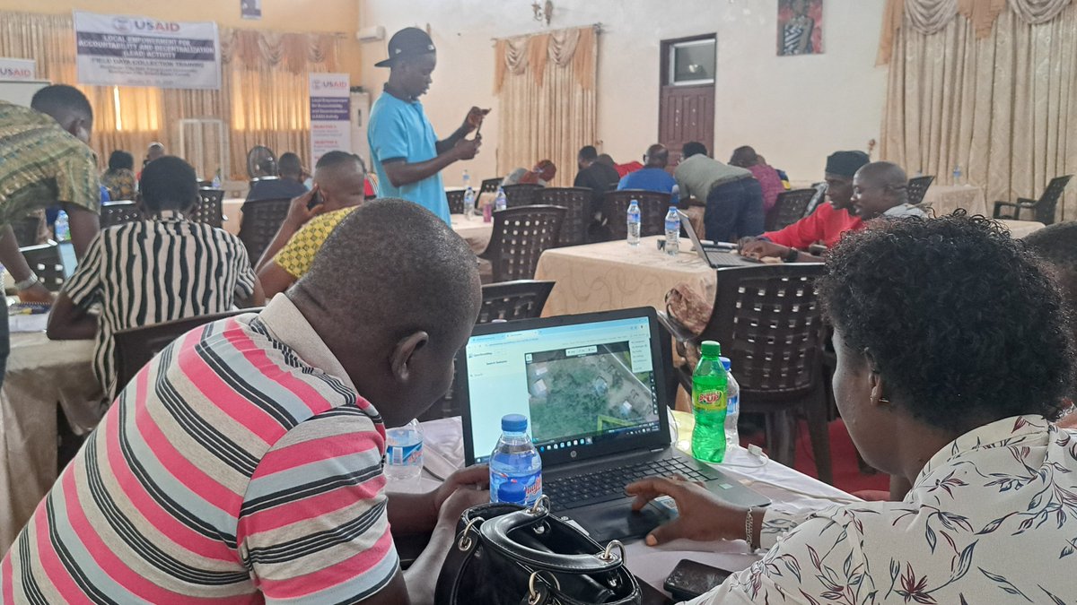
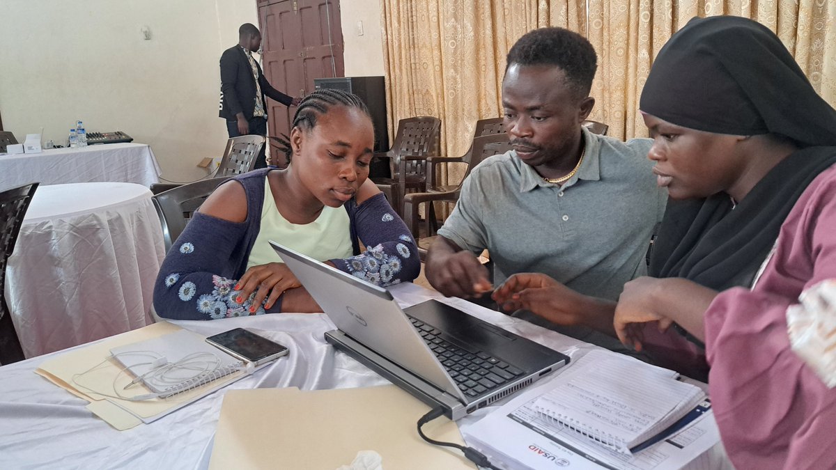
Exciting news from Liberia! Cities like Buchanan, Ganta, & Gbarnga are embracing open mapping through the @USAIDLiberia -LEAD Activity to drive infrastructure growth, boost revenue, enhance commerce, and improve service delivery & public health. @DAIGlobal@hotosm
📢 DEADLINE EXTENDED: End of Year Survey!
Please fill in the End of Year Survey, we’d love to hear from more of our users! The new deadline is end of day, Tuesday, January 14th. Your feedback is invaluable to us, so take a moment to share your thoughts.
https://t.co/DvgfkS7eaa
As 2024 wraps up, we’ve made significant progress creating life-saving maps, supporting local communities and advancing resilience. Thank you for your support.
✨ Wishing you a joyful holiday season and a prosperous new year! ✨
Read our full reflection: https://t.co/du14mk0JYE
🌍 Ready to make a difference with mapping? Join the Humanitarian Use of OSM Data online course! Over 700 learners and 120 completions!
Learn about OSM & HOT, identify data gaps, master QGIS, and apply open data to real projects.
Enroll now: https://t.co/GitFHbvlit
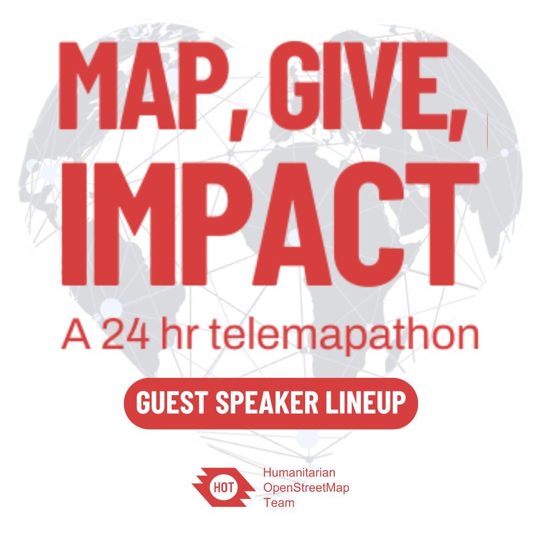
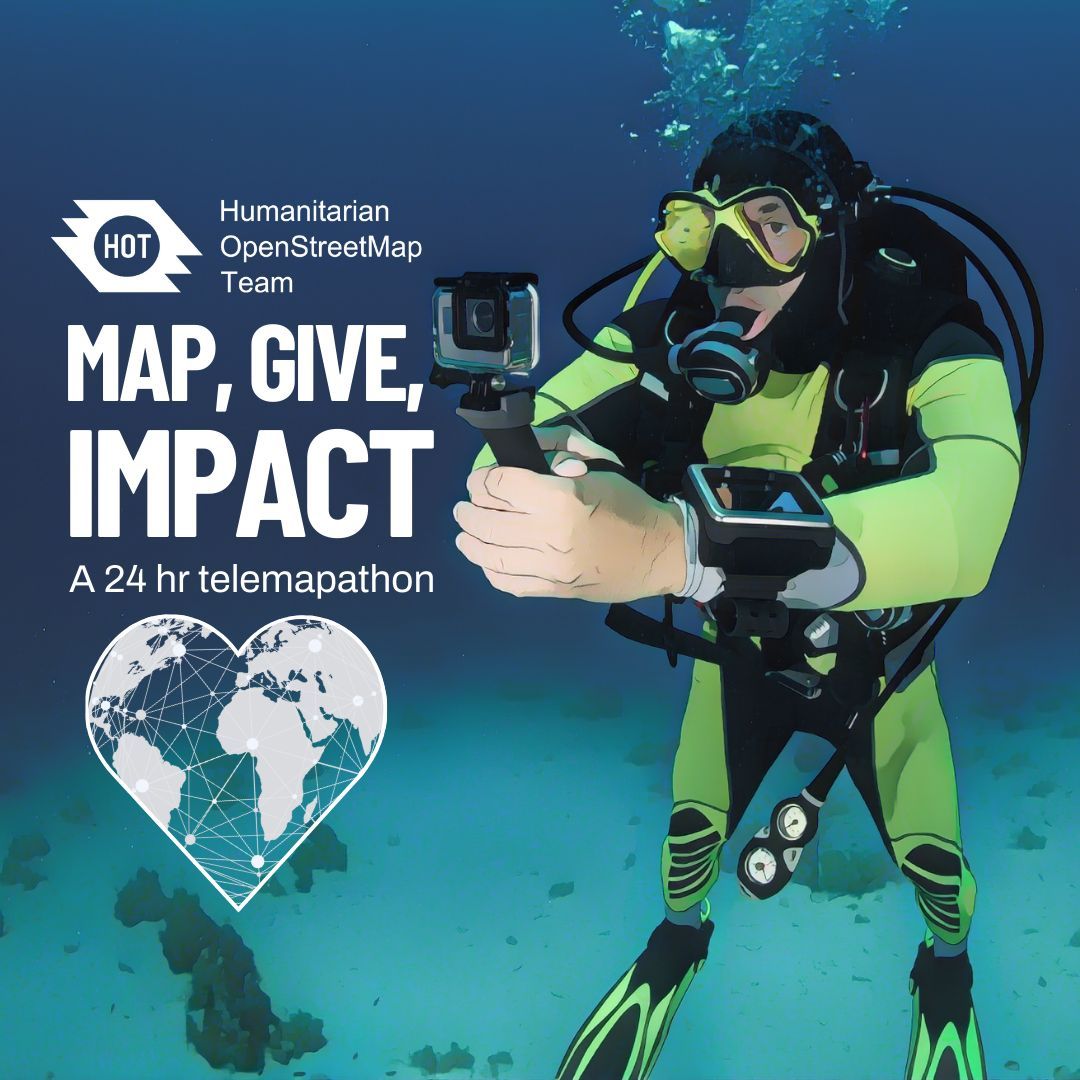
Our #MapGiveImpact global, 24-hour telemapathon is star-studded! Check out who will be the guest speakers during the sessions in your timezone, and get ready to... well...Map, Give, and Make an Impact!
Full lineup: https://t.co/GkV00BnqPz
Sign up here: https://t.co/SHZLetHO8p
Have you witnessed the power of open community mapping and data to address our current climate challenges in cities?
Then you should join our launch event next week!
Register and choose between one of our two 1hr slots:
https://t.co/cEG8w2RJIZ
#OSM Community, we urgently need your help to map roads and pathways in #Valencia and other affected municipalities due to severe flooding from #DANA.
Your contributions can make a huge difference in the response efforts! Let's map: https://t.co/0WdMTK2TTs
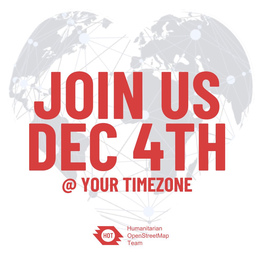
No matter where you are, join us on December 4th to celebrate both #GivingTuesday and #WorldVolunteerDay. Through mapping and other fun activities, we’ll honor the generosity of those who give what they can to support humanitarian open mapping.
https://t.co/Ab13OrbHyu
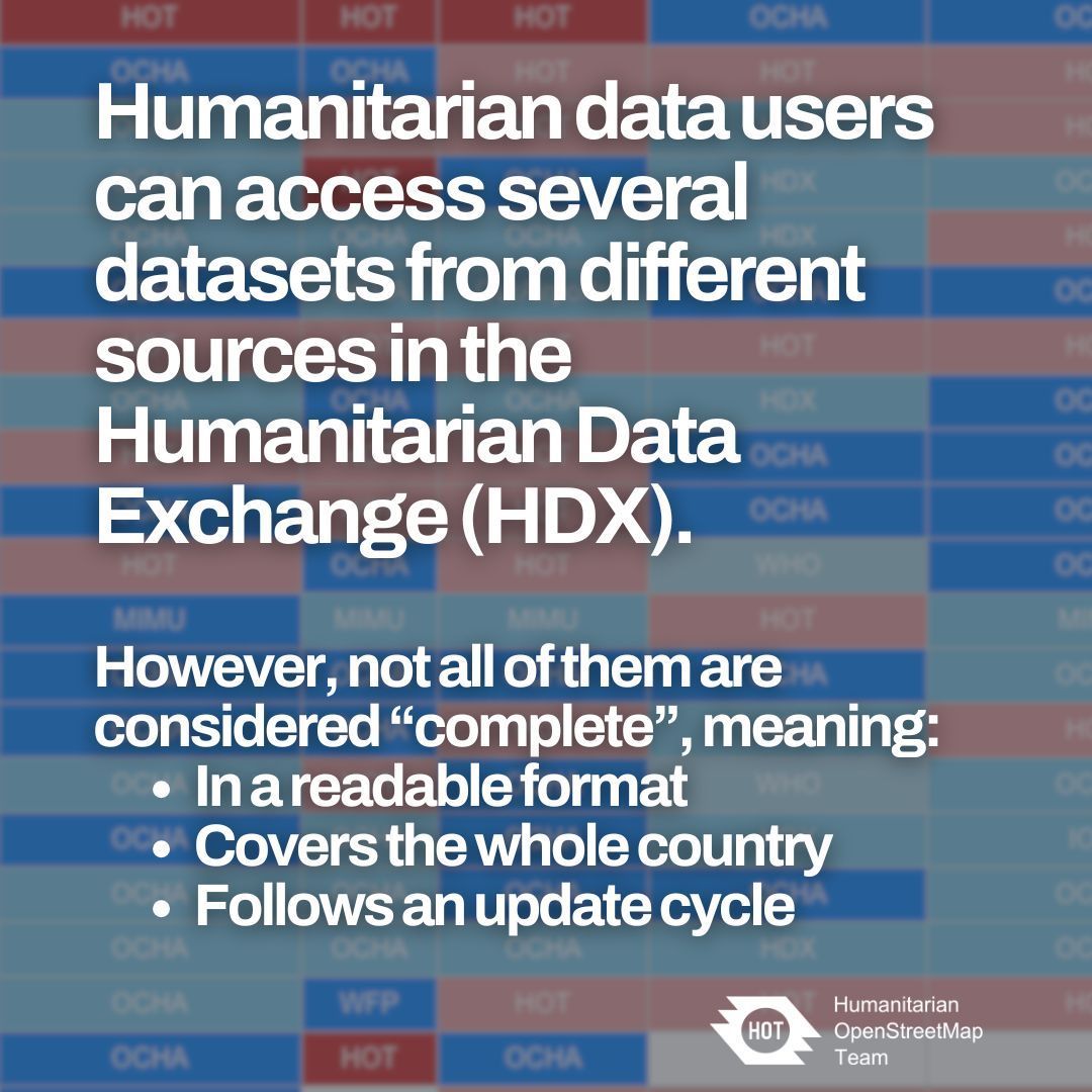
Will @OpenStreetMap meet your humanitarian and anticipatory action needs? Learn about HOT’s move towards more data insights in our latest, interactive, blog: https://t.co/NYEbYeI6X5
Good news humanitarian mappers: New formats and metrics to download OpenStreetMap data just dropped!
Check out this deep dive into HOT's Export Tool latest features:
https://t.co/xUoYQXNsxE
In West & North Africa, we are working with local municipalities, the healthcare sector, academia, etc, to utilize insights from air pollution data and analyses in transforming urban environments into eco-friendly and healthy habitats.
October 13th is the International Day for Disaster Risk Reduction. 🗞️In our latest #newsletter, explore how we're advancing Climate-Ready Cities through open mapping across Latin America, Africa, and Asia-Pacific, impact stories & events to connect!→ https://t.co/gbIHymPg35
October 13th is the International Day for Disaster Risk Reduction. 🗞️In our latest #newsletter, explore how we're advancing Climate-Ready Cities through open mapping across Latin America, Africa, and Asia-Pacific, impact stories & events to connect!→ https://t.co/gbIHymPg35
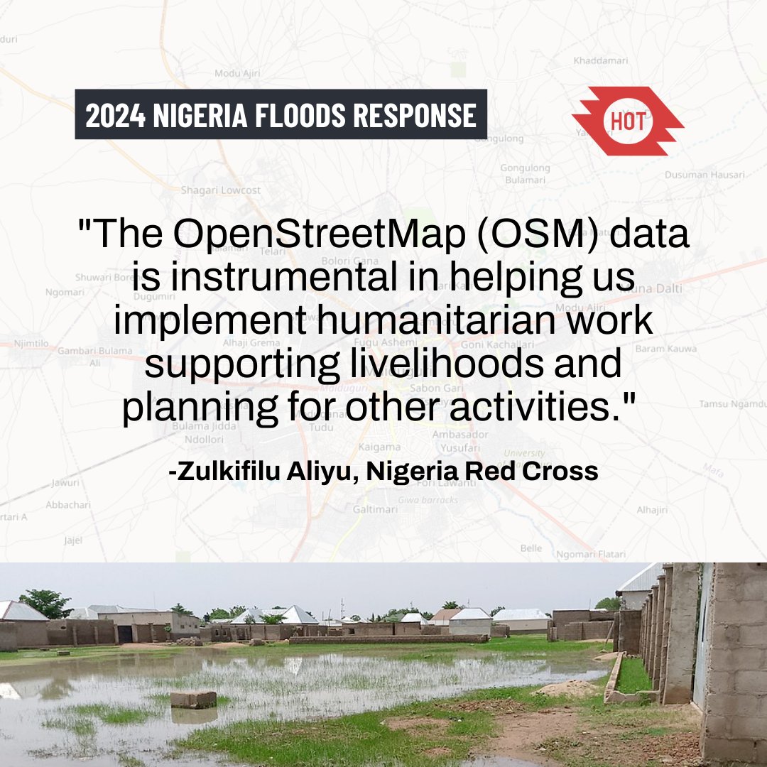
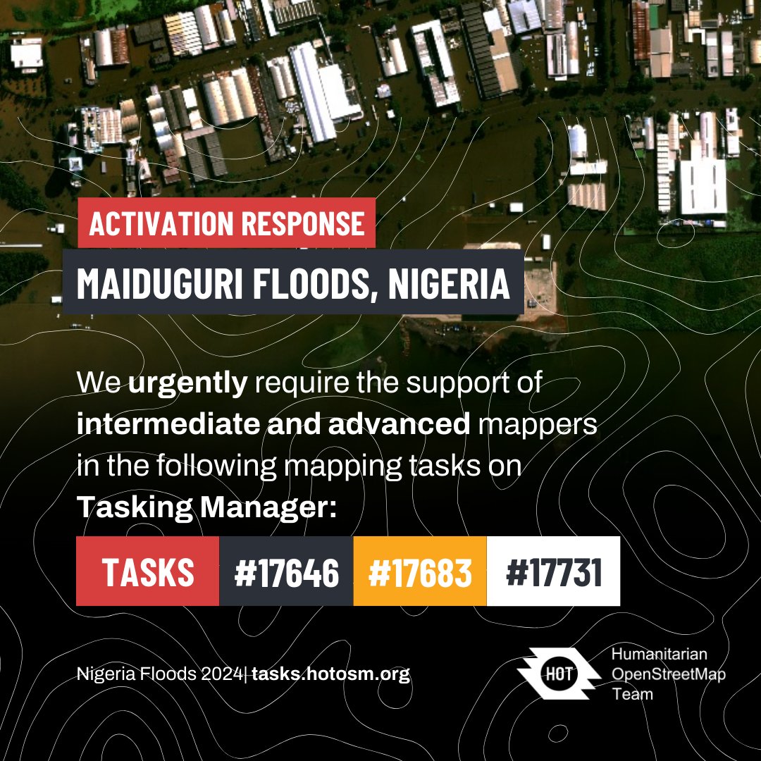
In August 2024, floods in Maiduguri, Nigeria, affected over a million people. After the Alau dam burst on Sept 10, 70% of the city was submerged, displacing 400,000+ residents and worsening health risks.
Help spread the word and make a difference.
#NigeriaFlooding#WNAH#HOT
The data that volunteer mappers are contributing for the #NigeriaFlood response is being used directly by the Nigeria Red Cross to support affected people in Maiduguri...
https://t.co/nAKaX1kRQ2
@hotosm@nrcs_ng@TheMissingMaps
90 amazing volunteer mappers have so far contributed to the mapping for the #maiduguriflood response in #Nigeria 🙌
If you have some mapping experience, more help would be appreciated!