DroneMapper 2020 End of Year Update, https://t.co/KxdDplaatS IOT Resource Monitoring - https://t.co/6gIy4z4sjh
https://t.co/Gtwb2PpCMk #GIS#UAV#photogrammetry#IOT
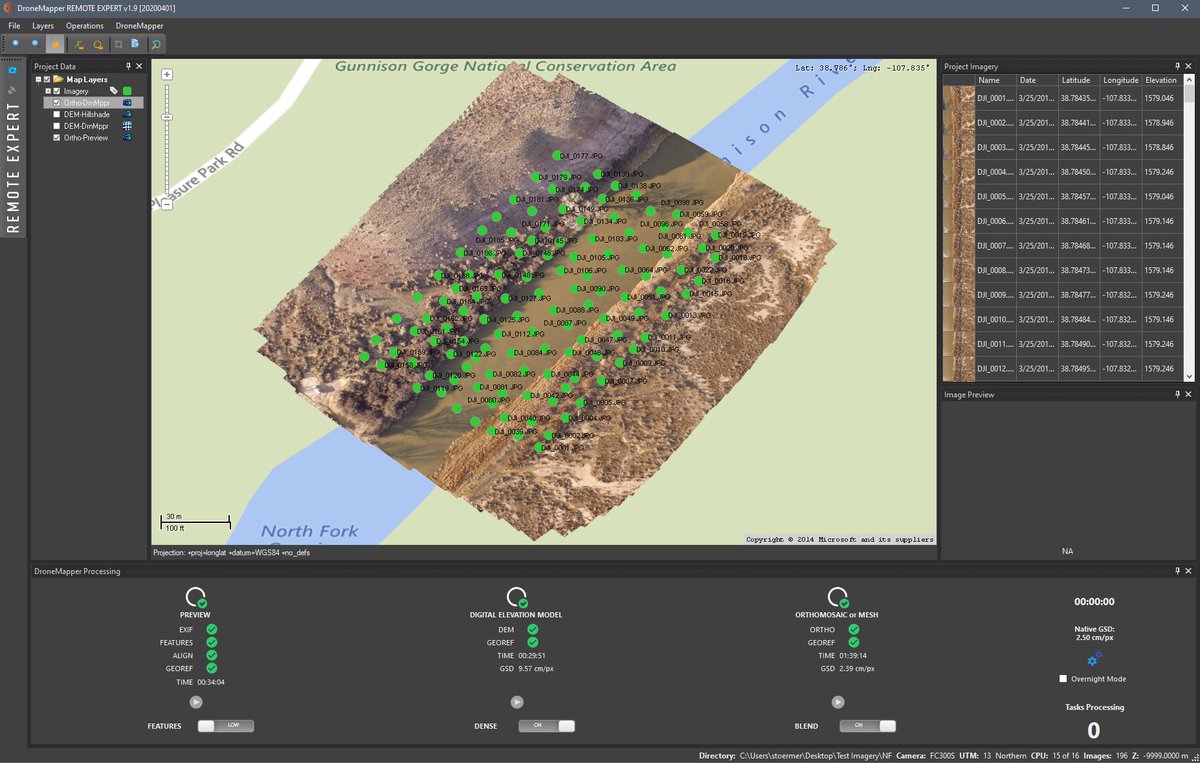
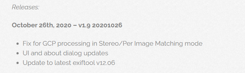
New release of DroneMapper Rapid/Remote Expert. https://t.co/Gtwb2PpCMk v1.9 20201026
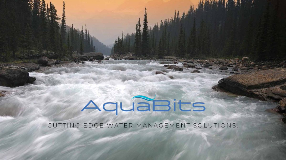
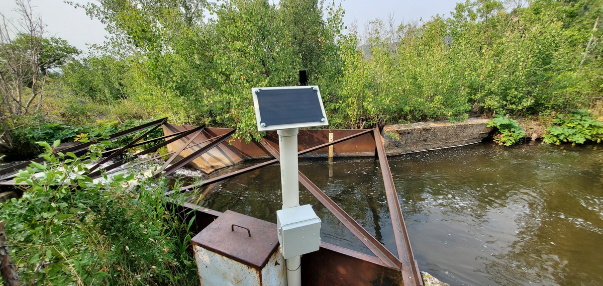
Also, please check out our new #IOT offering https://t.co/8Kzu2gDSFK
https://t.co/b3PkRoYBFZ
#gis#drones#dji#dronemapper#photogrammetry
DroneMapper was one of five selected finalists in the challenge offering an approach using a 3D sensor for continuous remote sensing of the water surface and the use of UAS for stream channel characterization to improve hydrological modeling and simulation.
New release 1.8 20200121 with updated EPSG for Polish projections and new imagery subset selection tool. Provides the ability to create a polygon AOI of images from a large collection for settings testing or subset processing. #dji#photogrammetry#drones
https://t.co/Gtwb2PpCMk
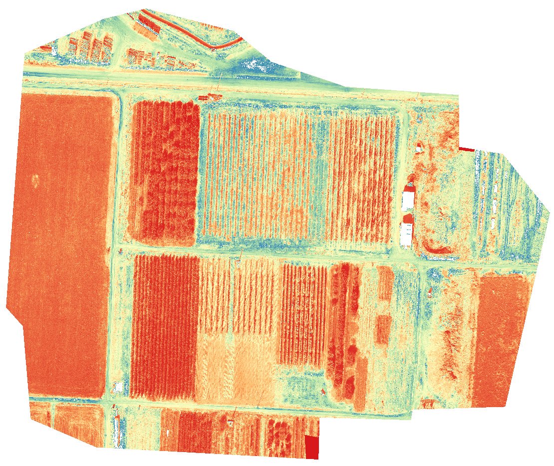
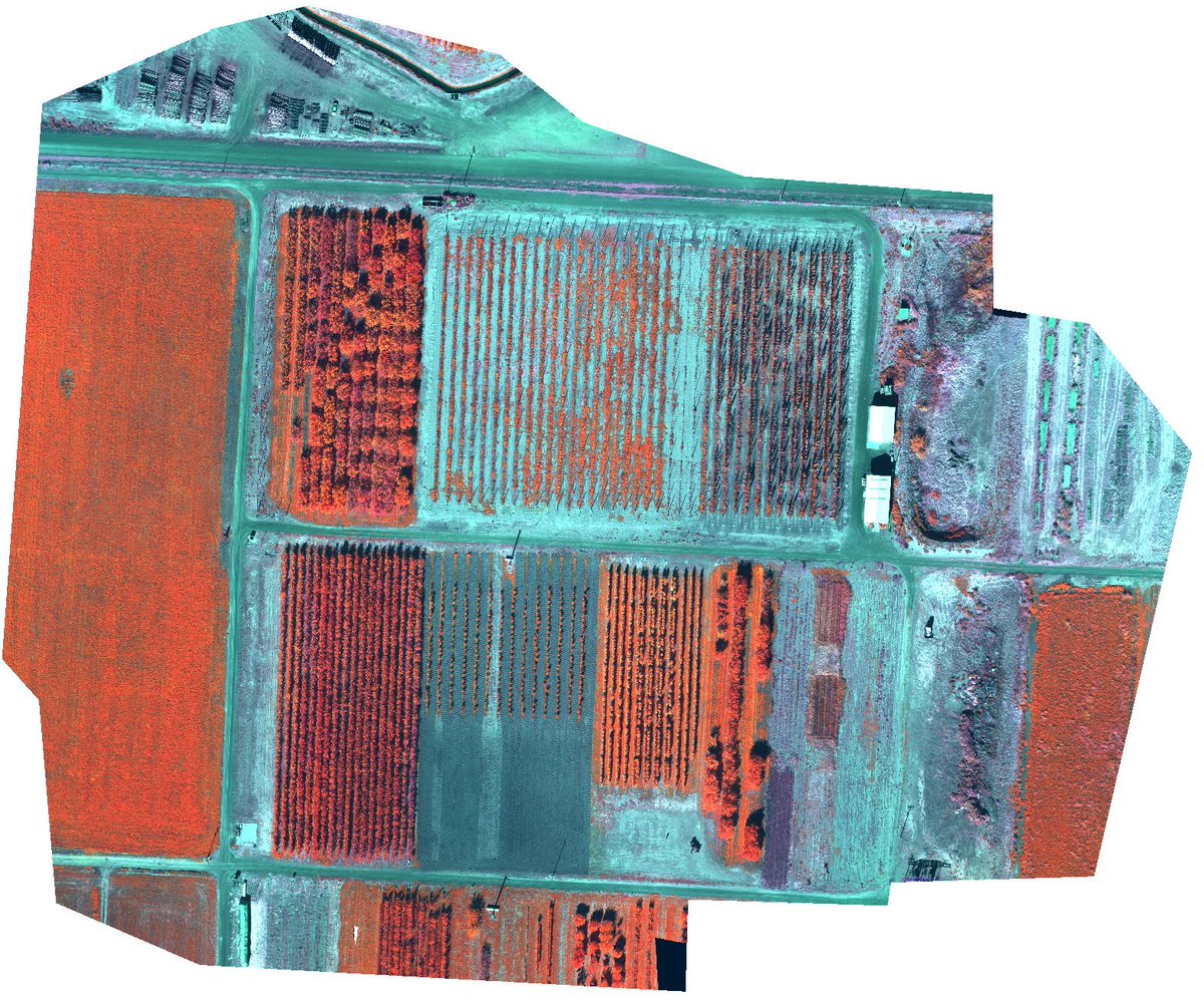
@BertRijk@MicaSense The thermal band (6) in the processed orthomosaic shows stitching artifacts which could likely be improved using more accurate pre-processing alignment and de-distortion algorithms. You can find more information about these functions in the MicaSense imageprocessing github repo.
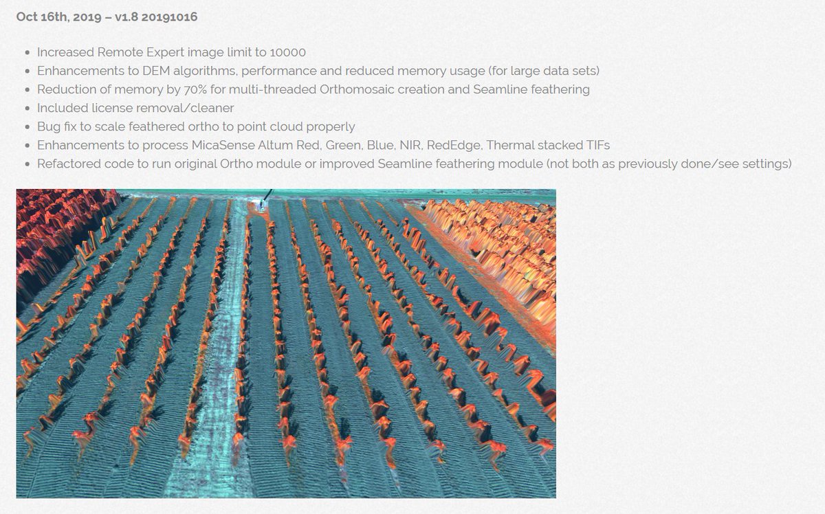
New release of RAPID and Remote Expert. https://t.co/Gtwb2PpCMk v1.8 20191016 major improvements to DEM performance, memory consumption and seamline feathering/multi-thread orthomosaic modules. #drones#mapping#photogrammetry#gis
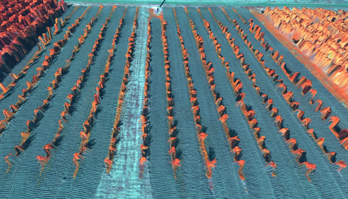
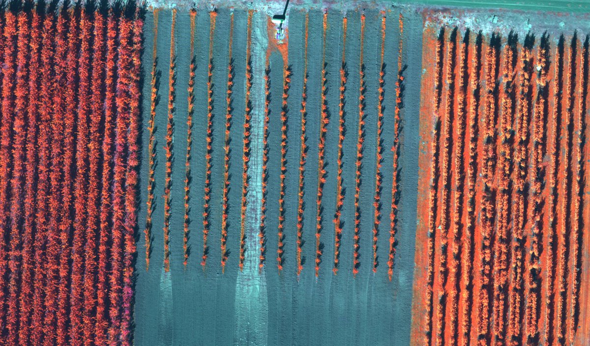
@MicaSense provides a great data set from the #MicaSenseAltum camera for plant analysis, #biomass, and other metrics! Red, Green, Blue, NIR, Rededge and Thermal.. plus a digital elevation model. We'll post the processed data soon on our examples page. https://t.co/Gtwb2PpCMk #gis
Processed @MicaSense Altum imgs w/ DroneMapper RAPID & Remote Expert https://t.co/Gtwb2PpCMk available soon on our examples page. We forked the MicaSense 'imageryprocessing' repository w/ small enhancements for DM processing. DEM + R,G,B,RedEdge,Thermal orthomosaic output. #GIS