Personal news - I stepped away from academia on May 1 to work full time on Instagrain - our field camera that uses ML to instantly determine sed. grain size. If you are interested in talking about the Instagrain camera (or about edge ML for envt. monitoring), please reach out!
Come join the Coastal Hazards Lab at NCSU!
Multi-year research associate for two coastal monitoring programs: https://t.co/nzNdyqrQdf
One-year (possibility of extension) postdoc related to modeling of chronic coastal flooding: https://t.co/8AePTBQ3Xl
New OA Paper: Temporal Variability of Fluvial Sand Composition: An Annual Time Series From Four Rivers in SW Germany
@stutenbecker et al.,
https://t.co/ZgcMY80KjY
I love sensor build days!!! Students from NCSU and UNCW built new V2 pressure sensors this week. Super slick. V2 solar powered + cellular cams coming soon (size of the blue polycase in the photos). Wiki to build your own should be done by Aug. All open source!
Authors who use AI tools in the writing of a manuscript, making graphics, or in data collection and analysis must disclose details of use, including which AI tool was used and how it was used, in the Materials and Methods (or similar section) of the paper.
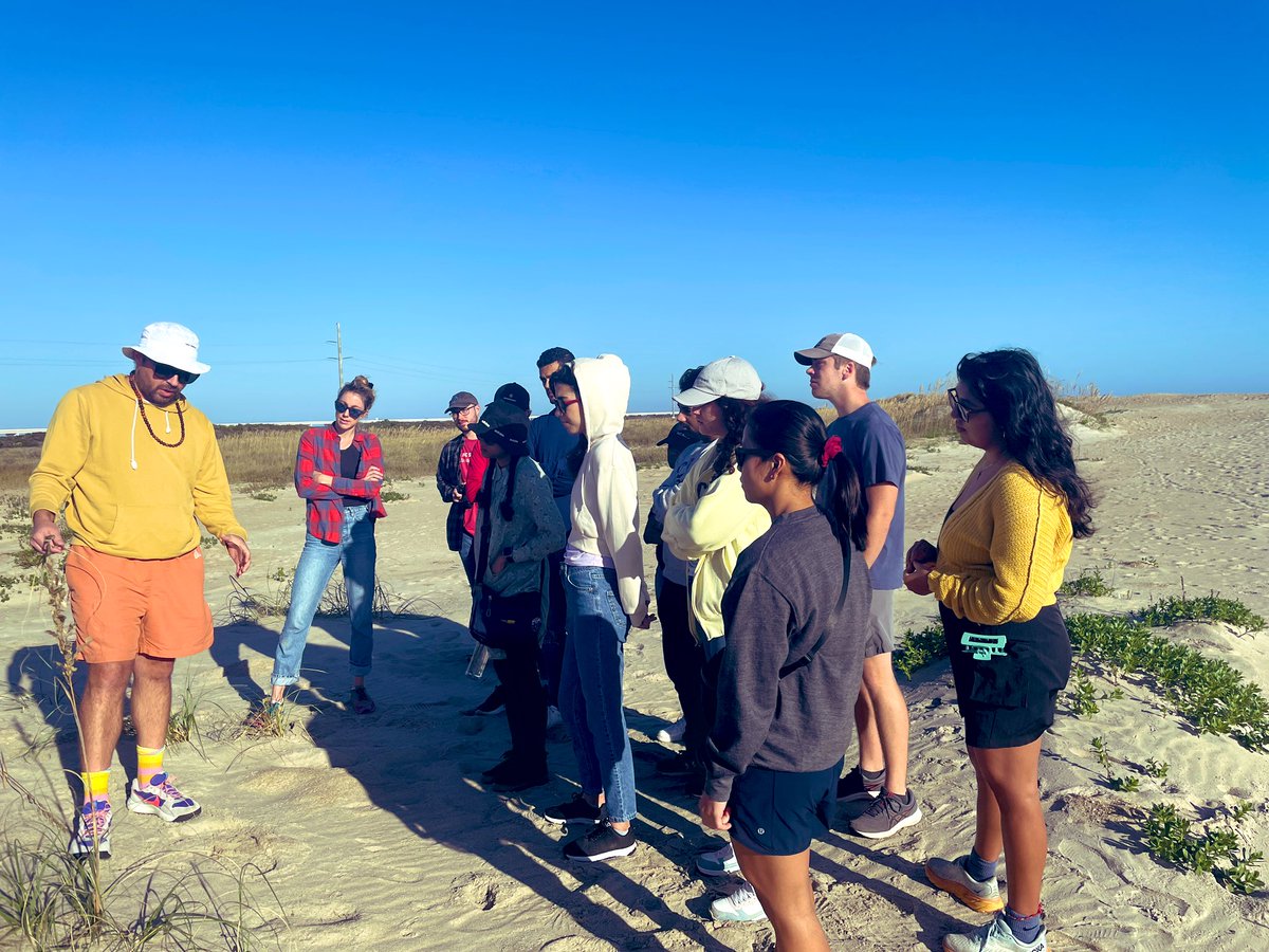
#Instagrain as demonstrated by @ebgoldstein. This custom-built prototype was able to perform image-based grain size distribution analysis within seconds. I'm stoked on the potential applications to increase knowledge about sediment transport dynamics 🌊⛱️
#geomorphology#obx
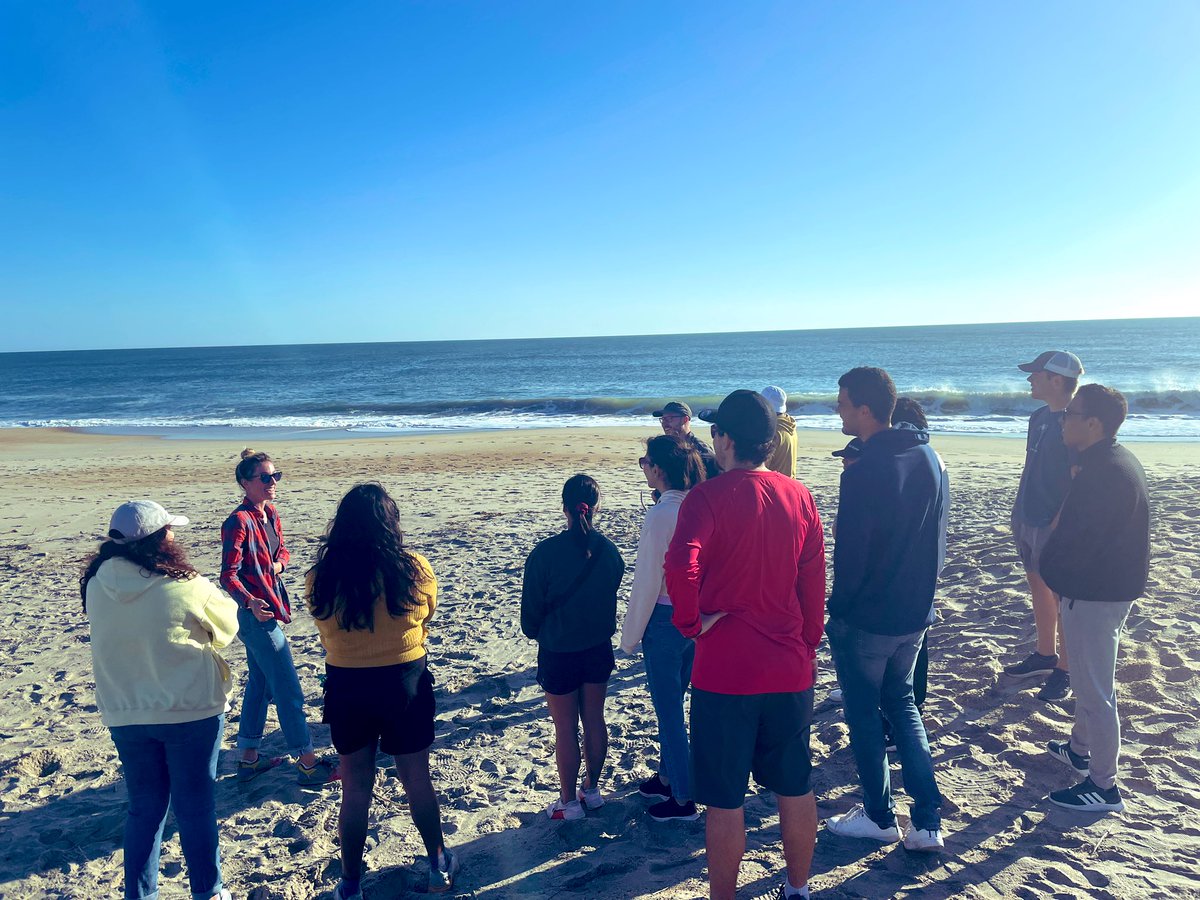
#Instagrain as demonstrated by @ebgoldstein. This custom-built prototype was able to perform image-based grain size distribution analysis within seconds. I'm stoked on the potential applications to increase knowledge about sediment transport dynamics 🌊⛱️
#geomorphology#obx
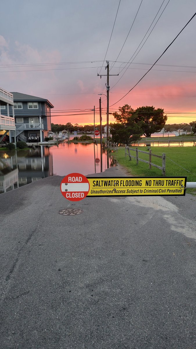
We’re measuring coastal floods, on land, where people live.
In coastal NC, storm drains are filled by tides on a daily basis, which can lead to roadway flooding during even small rainstorms.
https://t.co/C2JyYbbS2i
New pub from the @sunny_day_flood team! Our new sensors detected water on the road 24x in 5 months in coastal NC - flooding is happening more often than common proxies (e.g., NOAA HTF counts) suggest b/c we capture the impacts of rain (1/4 of our events were rain + tide).
Honored to have been able to participate in this great article on local/regional sea level rise, along with scientists and engineers at the bleeding edge of this field.
https://t.co/Fq2LWjzs7C
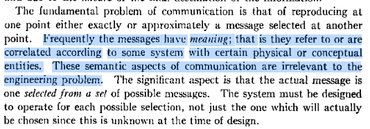
this, from a 1948 paper by Claude Shannon, still holds for current LLMs, given they are systems that predict next word/string of words out of a given list, not the meaning of the words
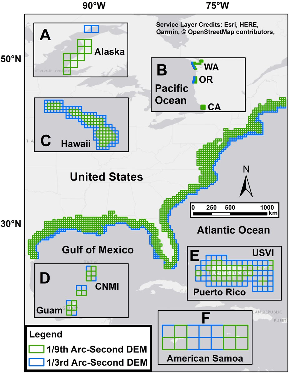
This publication encompasses a decade’s worth of DEM development that was made possible with the support from many at @NOAANCEI and from external storm surge and tsunami inundation modeling partners.