@JimCantore@catnipp8@dpshow Thanks. 🙏
Stop filming these sensational media reports in life threatening winds. Bad safety message. Debris can be deadly. Thank-you for all you do otherwise.
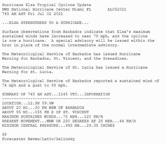
#Elsa has strengthened into a hurricane. A sustained wind of 74 mph with a gust to 86 mph was recently reported at Barbados. A special advisory is being issued shortly. More info: https://t.co/tW4KeFW0gB
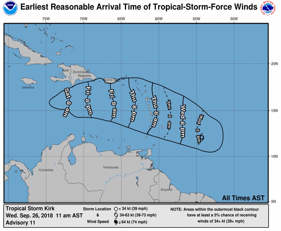
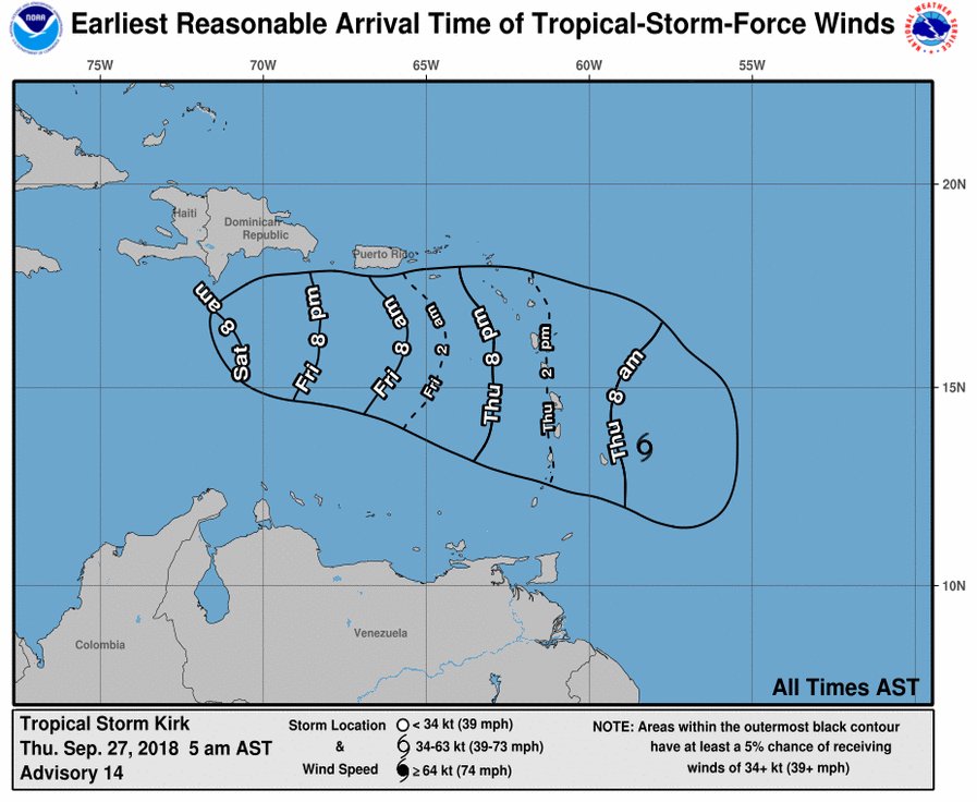
#TSKirk Slowly moves WNW and is expected to edge the north of #Barbados
Weather Forecast in #Barbados: Generally cloudy to overcast with moderate to heavy showers, periods of rain, gusty winds and isolated thunderstorms.
#TSKirk for #Barbados at 5PM
Wind speeds increase across #Barbados later tonight, sustained surface winds of 25-35 mph with gusts to storm force expected to spread across the island tomorrow.
Expect: pockets of moderate to heavy showers Some flash flooding likely.
#TSKirk should pass just north of #Barbados.
Outer bands will bring heavy rains and winds to the Windward Islands starting from Thursday around noon.
#Barbados
Seas: Rough to very rough in open water with swells from to 3.5m to 4.5m.
A Small craft/high surf warning in effect.
Wed 5PM Update: #Kirk
Location: 280MI EAST of Barbados
Winds: 60MPH max
Moving: West North West 18MPH
Pressure: 998MB
Maximum sustained winds are near 60 mph (95 km/h) with higher gusts. Little change in strength is forecast until Kirk crosses the Lesser Antilles.
2PM
#KIRK STRENGTHENS SOME MORE BUT LITTLE ADDITIONAL CHANGE IN STRENGTH EXPECTED THROUGH THURSDAY
Location: 305MI EAST of Barbados
Winds: 60MPH max
Moving: West 18MPH
Pressure: 998MB
Tropical storm conditions are expected to first reach the warning area by Thursday afternoon.
Update: Tropical Storm #Kirk
Located: 360 MI ESE OF BARBADOS
Max Winds: 50MPH
Moving: WEST 18MPH
#Kirk is expected to produce total rainfall of 4 to 6 inches across the northern Windward and southern Leeward Islands.
#Barbados heavy rains expected tomorrow as afternoon >1pm
#Isaac dissipated @NHC_Atlantic
NOAA HURRICANE HUNTER PLANE INDICATES ISAAC HAS DISSIPATED THIS IS THE LAST ADVISORY
Max Winds: 35MPH
#Isaac potential rainfall totals of 2-4 inches across the south-central portion of the Dominican Republic, southern #Haiti, and most of #Jamaica
#Isaac Update
Currently heavy rainfall in St. Croix from the outer bands of #Isaac.
Over the next 3 days we will watch if #Isaac can regroup, but for now Isaac is forecast to gradually weaken over the next few days, and could degenerate into a tropical wave at any time.
#Jamaica
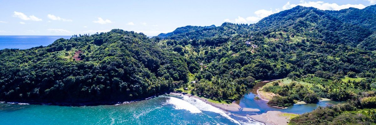
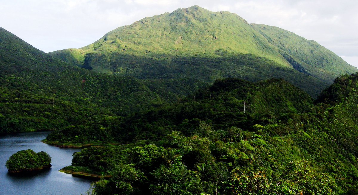
Morne Trois Pitons National Park on #Dominica - a UNESCO World Heritage Site. Its scenic beauty is complemented by numerous natural lakes, including Boeri Lake and Freshwater Lake, the country’s largest lakes. #CaribbeanFacts Photo @Nature_Island
ISAAC BECOMING LESS ORGANIZED OVER THE EASTERN CARIBBEAN SEA.
LOCATION: 80 MI WSW OF DOMINICA
Center of #Isaac is now West South West of #Dominica
Satellite imagery indicates that Isaac remains a poorly organized!
#Isaac weakens but is expected to produce tropical-storm-force winds across portions of the Lesser Antilles
Wind measurements from the weather plane suggested that #Isaac is close to opening up into a tropical wave - no longer a tropical storm as it passes the Lesser Antilles
#ISAAC UPDATE 8AM from @NHC_Atlantic
TROPICAL-STORM-FORCE WINDS EXPECTED SOON IN THE LEEWARD ISLANDS
LOCATION: 25 MI EAST OF DOMINICA
MAX WINDS: 45 MPH
MOVEMENT: WEST AT 21 MPH
PRESSURE: 1006 MB
Maximum sustained winds remain near 45 mph.
Rainfall: 2 to 4 inches expected
UPDATE 2PM: from @NHC_Atlantic
ISAAC MOVING RAPIDLY WESTWARD
LOCATION: 420 East of MARTINIQUE 345 MI and East OF GUADELOUPE
MAX WINDS: 60 MPH
MOVEMENT: West AT 21 MPH.
PRESSURE: 1002 MB
It is *possible* that #Isaac will degrade into a tropical wave in the next couple days