Earlier this week, IMO specialists installed two DOAS remote sensing instruments on Húsafell. One of the DOAS instruments detected SO2 yesterday and today at the newly formed graben, located between Sundhnúkagígar and Grindavík. https://t.co/9vYBBjNcX9
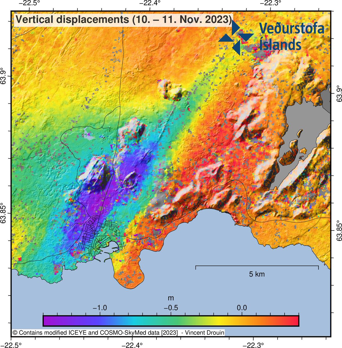
Estimate of the vertical displacements caused by the dike during its initial propagation from 10-11 November. The imagery shows over 1-m of ground displacement in the western part of Grindavík, caused by the propagation of the magma intrusion. https://t.co/9vYBBjNcX9
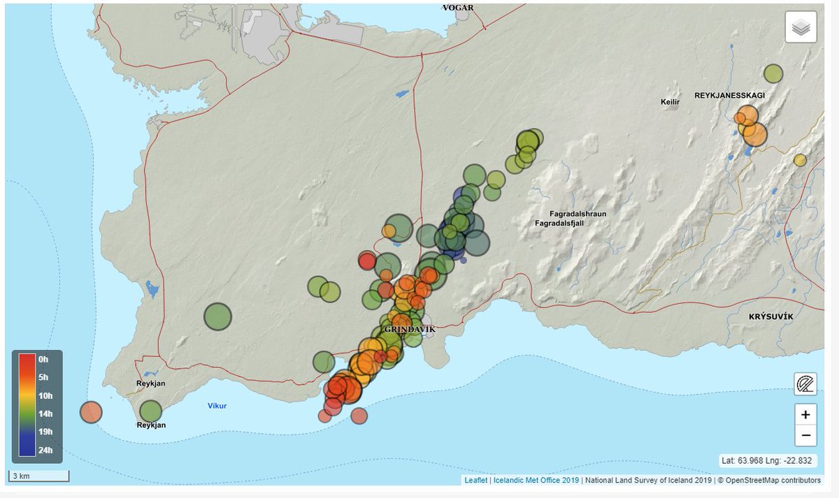
We've added two new, updated maps to our post, tracking the latest seismic data in Iceland. Here's one; head to our blog to find the other one! (Link in my bio.)
Seismicity is decaying; the likelihood of a eruption in the coming days is "significant": https://t.co/LIcBMhJt6j
Visualizing the dike intrusion on Reykjanes Peninsula. The seismicity illuminates the dike's growth, starting NNW of Grindavik, and its rapid propagation in both directions.
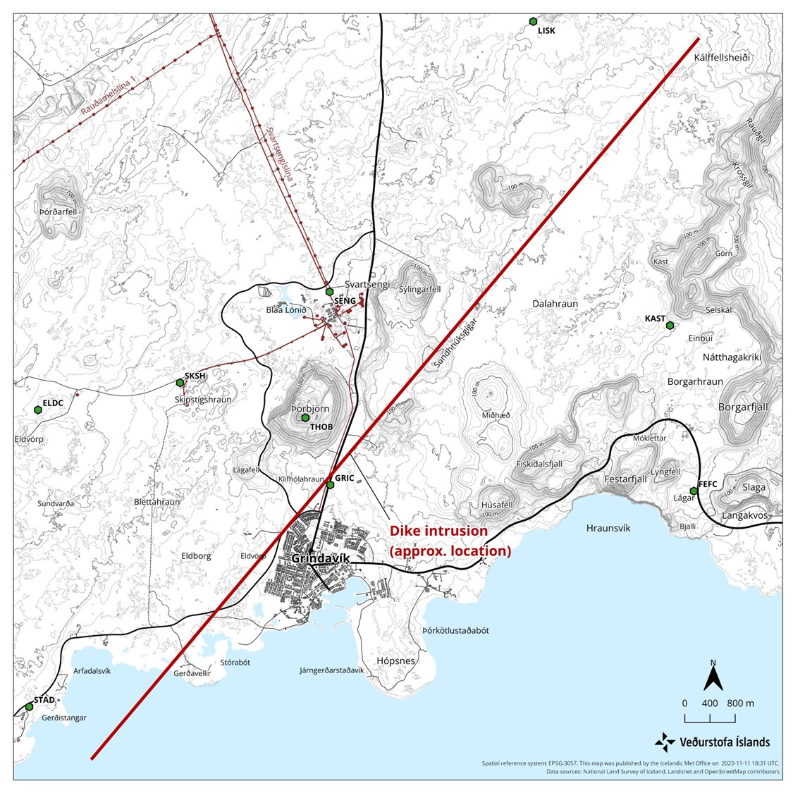
Significant likelihood of a volcanic eruption in the coming days. Models show a 15-km long magma intrusion, located just northwest of Grindavík. A hazard area has been defined based on the location of the dike, as shown in the map. https://t.co/9vYBBjNcX9
The rate of ground deformation is much higher than has been measured previously on the Reykjanes Peninsula. Around 800 earthquakes have been detected since midnight. The likelihood of a volcanic eruption occurring in the near future is deemed considerable. https://t.co/9vYBBjNcX9
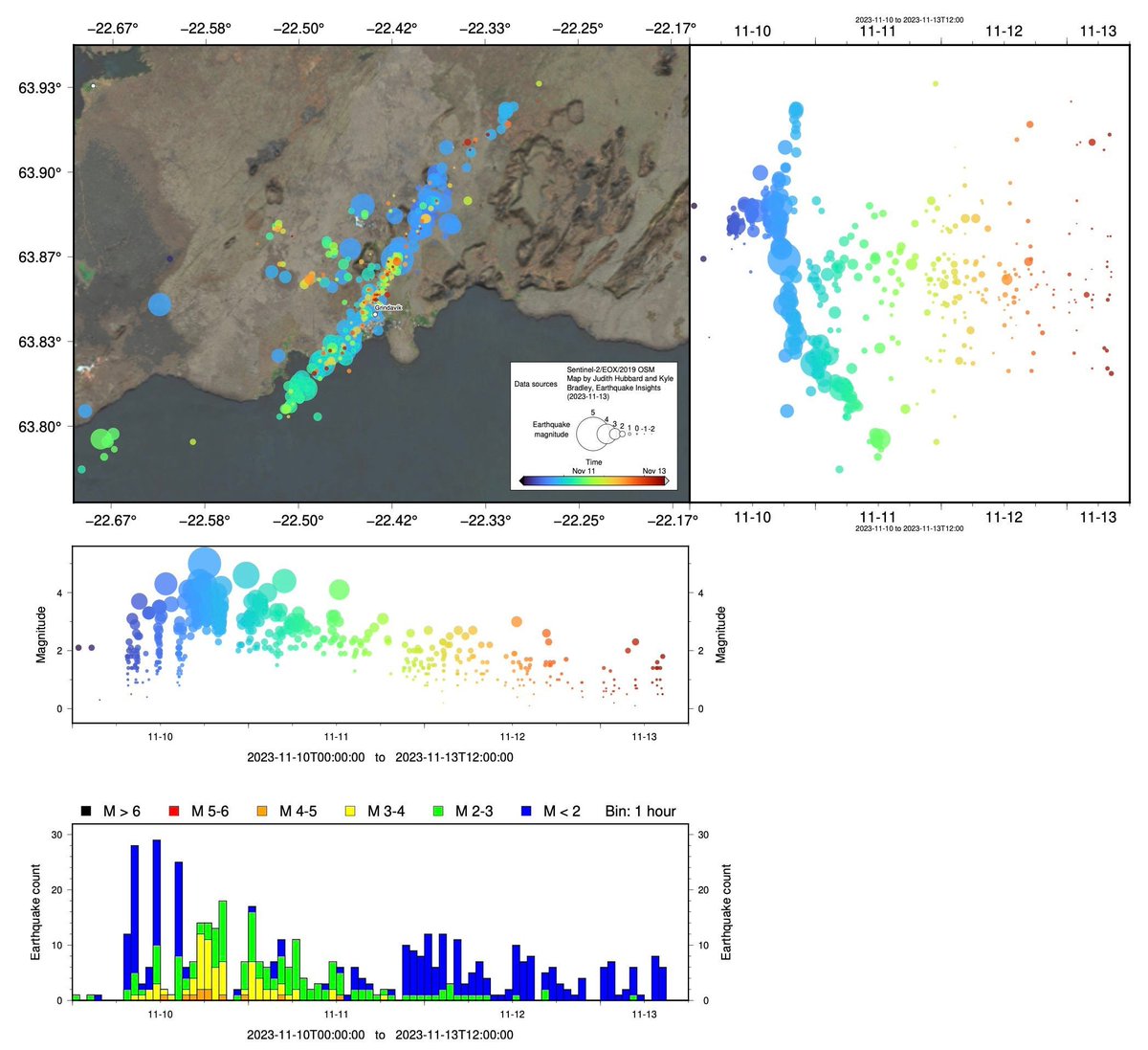
32 hours of earthquakes on Reykjanes Peninsula. The propagation of seismicity from NE towards Grindavik in the SW can be seen. The gap between the high-intensity clusters corresponds with a mantle upwelling beneath Reykjanes.
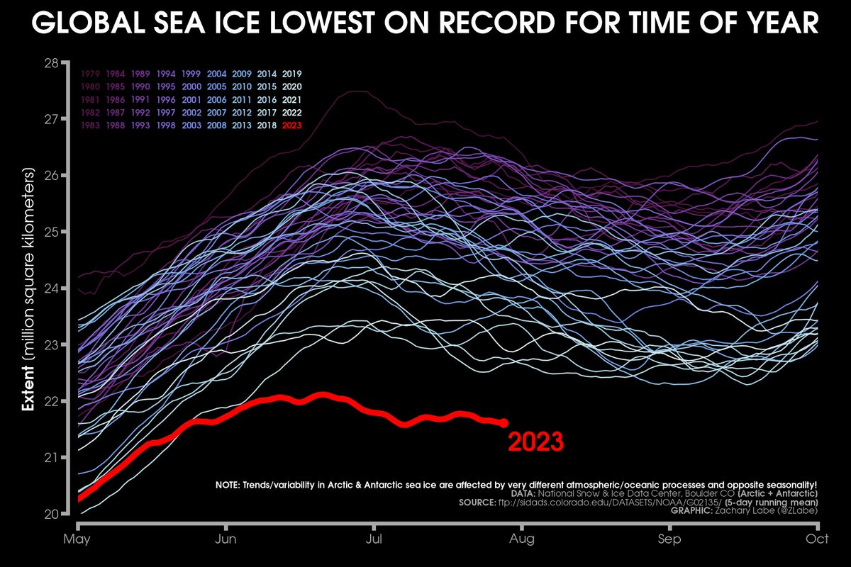
The extent of global sea ice cover remains record small for this time of year. Both poles are unusually low, but the largest departure is currently coming from the extreme event in the Antarctic.
More global visuals at https://t.co/ecHYax1cql
We are searching for #drone videos during some specific hours in July-August 2021, to know how the activity was in the #Fagradalsfjall crater at specific hours. Each video, even few secs would be interesting! Thanks in advance 🙏
#Crowdsourcing#ISTREMOR#CitizenScience#Volcano
🌎 To help capture the 30 tonnes of CO2 that were emitted throughout the organization of the SPHERE Festival in September, the first seedlings will be planted this year in the NACO ''Smart Forest'', in New Brunswick, Canada.