The best defense is a good offense!
Before you leave for an outdoor event, check the forecast at https://t.co/UhFgw9iswF. Hazardous weather can change your plans in an instant, so stay informed and be ready to pivot. #dfwwx#txwx
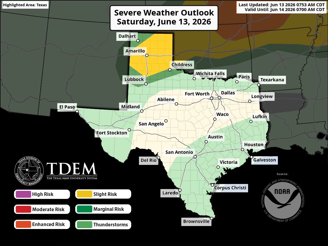
Weekend weather reminder: severe storms can create dangerous conditions.⚡
Main threat area includes the Texas Panhandle today, shifting further south and east over the weekend.
Severe Weather Safety Tips: https://t.co/IW30y8HSvR
Showers and storms will decrease in coverage and shift further into CTX during the day on Monday. Scattered showers and storms will remain possible across portions of CTX into Tuesday. Locally heavy rain, frequent lightning, and gusty winds will be the main threats. #dfwwx#ctxwx
Severe Thunderstorm Warning continues for Ponca City OK, Blackwell OK and Tonkawa OK until 8:30 PM CDT. This storm will contain wind gusts to 70 MPH and golf ball sized hail!
A cluster of thunderstorms with slow storm motion continues to reform over the same area near Glazier in Hemphill County. A Flash Flood Warning is in effect until 10:15 PM. Stay on high ground and avoid driving through flooded roadways! #phwx#txwx
Rain chances return on Sunday as scattered showers and storms are expected to form along a passing cold front. Strong wind gusts, as well as occasional lightning and heavy rain have a chance to derail any outdoor plans, so remain weather aware! #dfwwx#ctxwx
12:30pm CDT #SPC Day2 Outlook Enhanced Risk: Saturday afternoon into Saturday night across eastern Kansas adjacent portions of southeastern Nebraska and northeastern Oklahoma and much of western through central Missouri... https://t.co/Y1WiOd8m1i
At Gov. Abbott’s direction, TDEM has activated state emergency response resources ahead of heavy rainfall and potential flooding across TX heading into the weekend.
Details: https://t.co/ojWAjeQU0W
Monitor local forecast information and follow instructions from local officials.