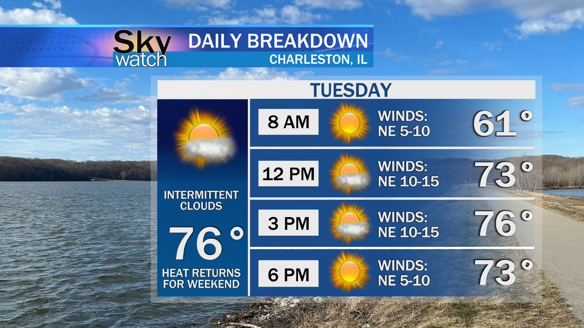
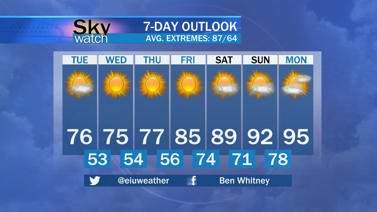
Below average temperatures persist for the remainder of this week, but summer-like, above average heat returns for the weekend. A look at your forecast for Tuesday, August 20th and beyond from SkyWatch Local Forecaster Ben Whitney.
Hot and sunny tomorrow with temperatures nearing the mid 80s. A look at May 2nd's forecast for Charleston, IL and surrounding areas by Sky Watch Local Forecaster Ben Whitney.
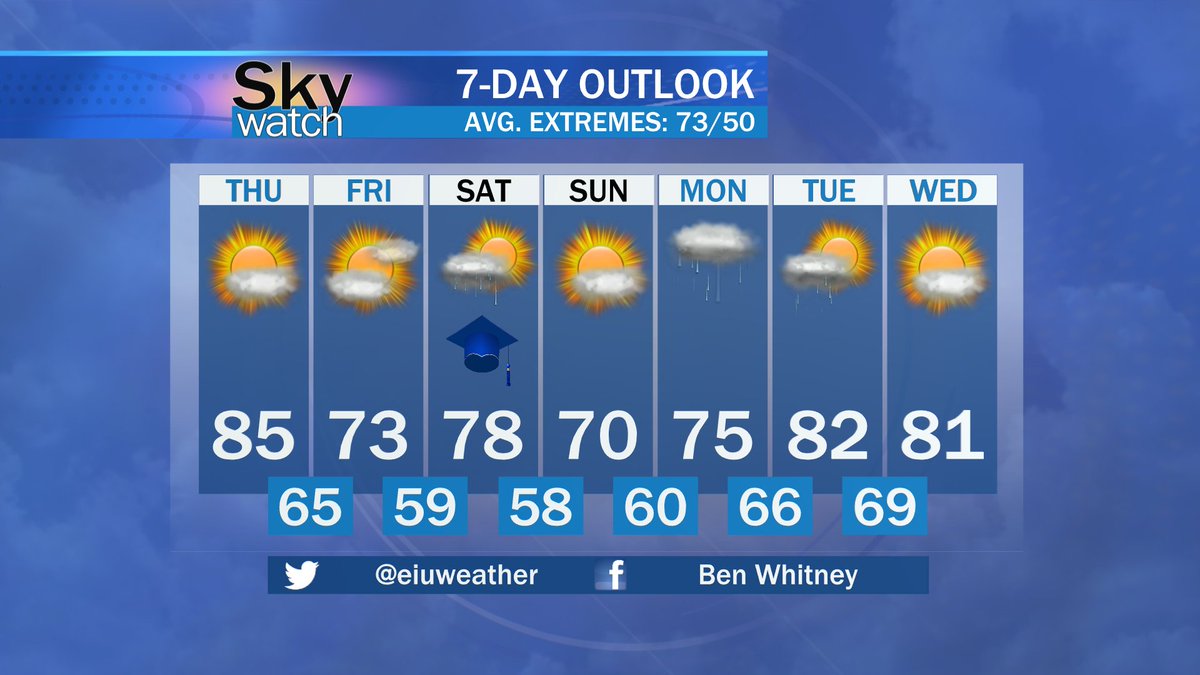
You might need a jacket if you have any plans for your Veteran's Day Weekend. Although the temperatures are low the sun will be shining all weekend giving us great conditions to honor our Veterans.
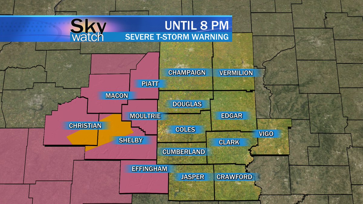
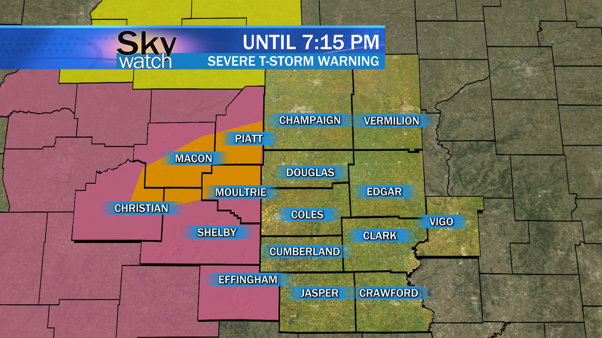
SEVERE THUNDERSTORM WARNING for parts of Piatt, Macon, Christian, Moultrie, and Shelby counties until 7:15 PM. We will continue to bring you updates from the Weather Center.
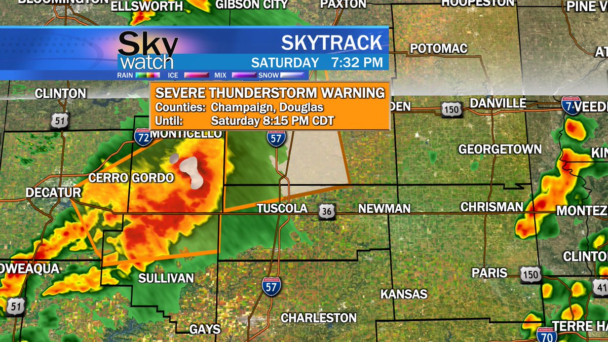
NWS: SPECIAL WEATHER STATEMENT...Thunderstorms continue with wind gusts of 50 to 55 mph and nickel size hail...for Champaign, Douglas, Macon, Piatt, Moultrie, and Coles counties.
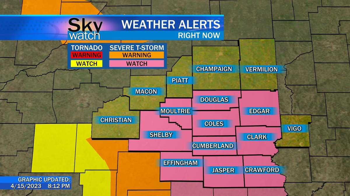
National Weather Service (NWS) has issued a SEVERE THUNDERSTORM WATCH for Moultire, Douglas, Shelby, Coles, Effingham, Cumberland, Edgar, Jasper, Clark, and Crawford counties until 1:00 AM CDT.
Continue to monitor the possibility of severe weather via our social media.
KEEPING YOU AWARE
Severe weather is possible this evening through the overnight. We will continue to monitor the situation when National Weather Service sends out updates.
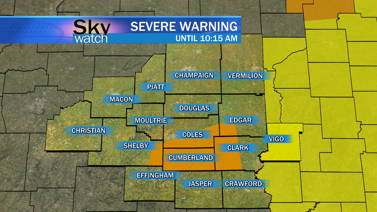
SEVERE THUNDERSTORM WARNING in effect for parts of Coles, Shelby, Cumberland, Clark, and Edgar counties UNTIL 10:15 AM. We also have a TORNADO WATCH in Vigo county UNTIL 5 PM.
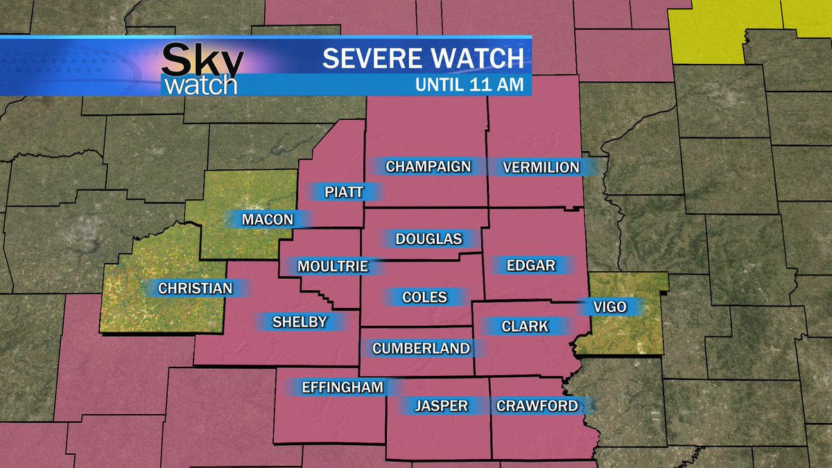
SEVERE THUNDERSTORM WATCH is in effect for the majority of the #WEIU viewing area until 11 AM. @WillRedden71 will continue to bring you updates from the Weather Center.
SEVERE THUNDERSTORM WARNING in parts of Jasper, Shelby, Cumberland, Effingham, Christian, and Moultrie Counties. 60 MPH winds are possible as well as hail up to .75 inches. Scott Ealy will have your full forecast at 5:30 and we will continue to keep you updated.
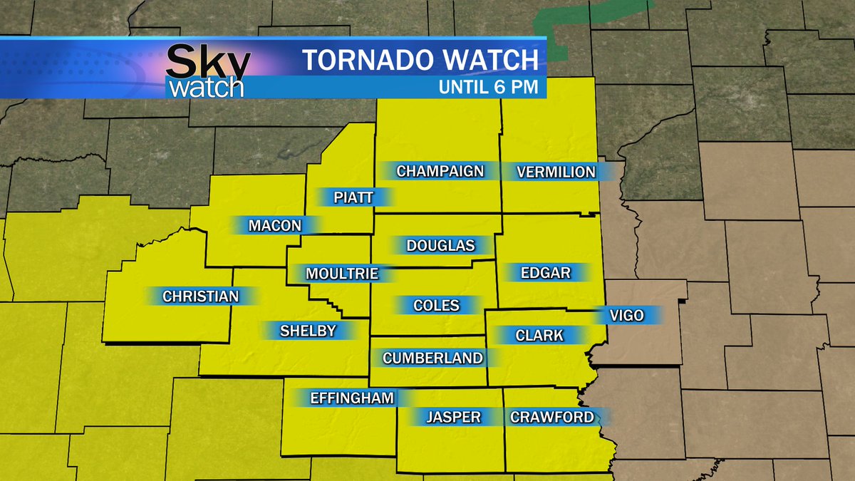
TORNADO WATCH in effect until 6 PM for all Illinois portions of the #WEIU viewing area. We also have a WIND ADVISORY in effect until 10 PM for Clark, Jasper, Crawford, and Vigo Counties.
We will keep you updated from @eiuweather with any changes.
A Severe Thunderstorm Warning has been issued for Douglas, Moultrie, Macon, and Piatt Counties until 7:45 p.m. including 60 mph wind gusts and quarter-size hail.