Don't forget to set those clocks back one hour tonight before going to bed! It's also a good time to check the batteries in your smoke detectors and weather radios. Daylight saving time will return March 10, 2024.
TODAY: There will be a nationwide emergency alert test on cell phones, wireless devices, radios, and TVs.
2:20 p.m. ET
1:20 p.m. CT
12:20 p.m. MT
11:20 a.m. PT
10:20 a.m. AKT
8:20 a.m. HT
Information from @FEMA_Deanne ⤵️
Our first Skywarn Spotter Training of the spring season is happening THIS EVENING in Powell County!!! 6pm-8pm. Check out https://t.co/O70yWWHu2G for more information and a list of other classes! No need to register + it's a free class!
Tornadoes can form in minutes, day or night. Stay #WeatherReady by having a way to receive weather alerts any time of day. If you receive a Tornado Warning, get to shelter immediately. https://t.co/3HzjIicJzI
Surface high pressure will keep eastern Kentucky dry through Wednesday morning. A strong system takes aim at the Ohio Valley and Great Lakes and will bring a shot of arctic air to eastern Kentucky to end the week. #ekywx
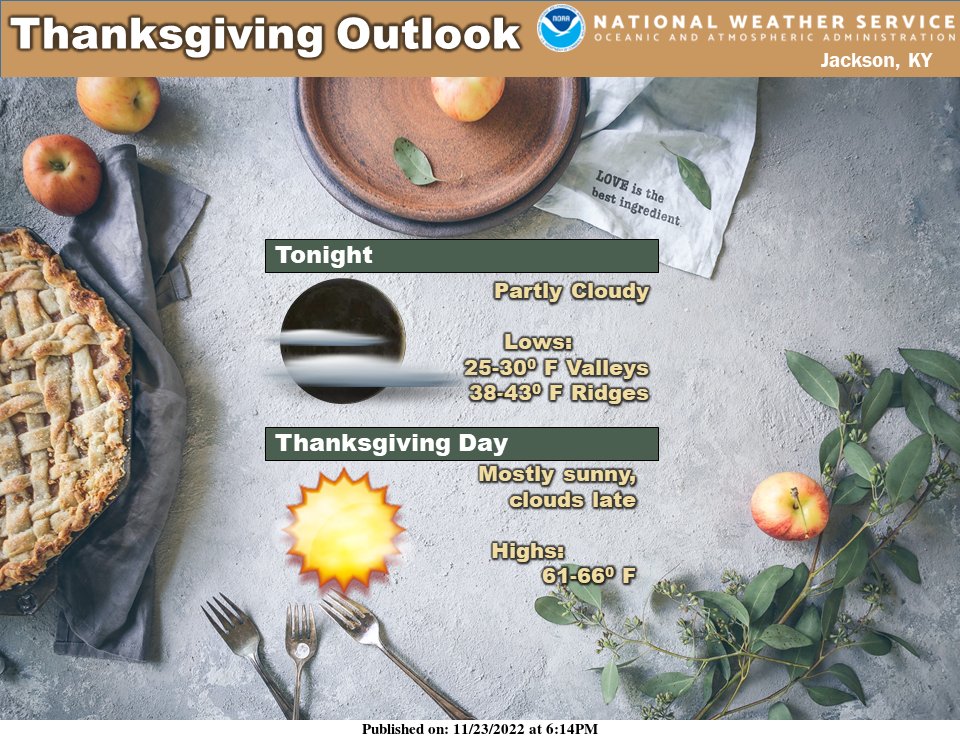
You'll gobble up the temperatures for Thanksgiving Day as highs climb into the lower to mid 60s across eastern Kentucky. Clouds will be on the increase late in the day, but the threat of rain will hold off until tomorrow night. #kywx#ekywx
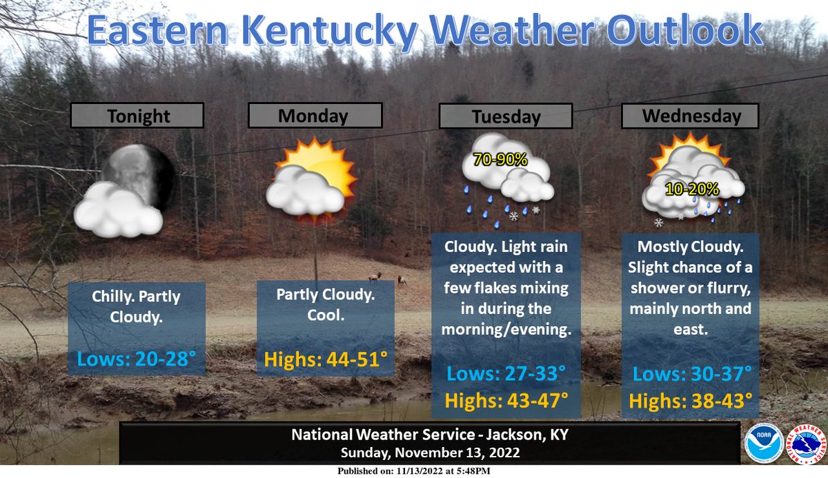
Cool high pressure will remain in control through Monday before a surface low and associated cold front move toward the Commonwealth late Monday night. A mix of rain and snow will be possible early before transitioning to all rain Tuesday. Temps will remain well below normal.
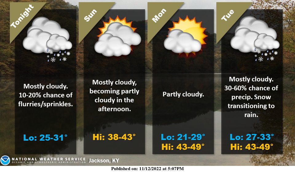
Residual moisture from Hurricane Nicole will combine with much colder air to support the chance for flurries/sprinkles overnight. High pressures moves into the area Sunday and Monday. A cold front approaches the area mid-week and will support snow showers transitioning to rain.
Have a degree in meteorology and looking for a good NWS office to start out working in? NWS Jackson, KY has 2 vacancies posted on USAJobs, currently! The post doesn’t close until November 14, so there’s still time! #kywx#ekywx
Attention #Meteorologists! Interested in joining the @nws team? Come join us @nwsjacksonky. If interested please reach out to me. https://t.co/AdtAWqXyYh
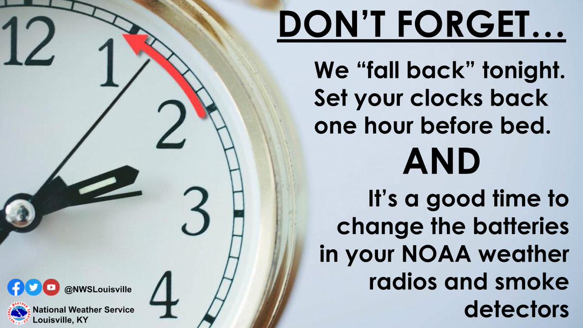
DON'T FORGET! We "Fall Back" tonight... Before bed, set your clocks back 1 hour. This is also a good reminder to check/change the batteries in NOAA weather radios & smoke detectors.
Stay safe after a flood by staying out of floodwater. Floodwater may contain hazardous waste, fallen power lines, or debris. For more flood safety tips, visit https://t.co/R3HUfZGoGL #PrepYourHealth
@TeamW700 @EastKYWARN @nwsjacksonky Yep, except like 5 Flatgaps happened in one night this time, plus the additional flooded areas. Hopefully the death toll doesn’t rise any further…
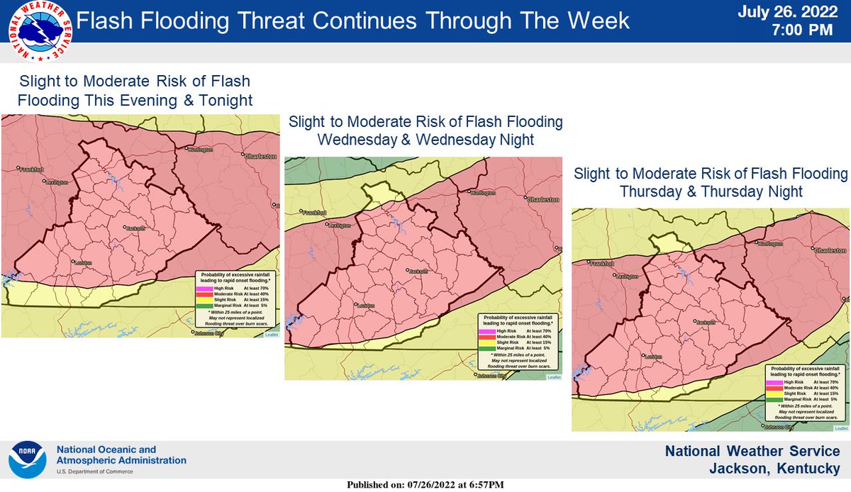
Over 5 inches of rain reported at the Jackson mesonet site, much of that in the past few hours. Significant flash flooding is occurring in multiple counties across Eastern KY. Please don't venture out if you don't have to. #ekywx#kywx