It's that time again.... our 3rd Geospatial Tech Radar is LIVE!!
Each time we develop a new tech radar, we're on a mission to capture the latest community and industry developments from the past year while also staying true to our E84 perspective.
https://t.co/5ChylS4W7L (1/4)
New on the blog: strategies for organizations in the financial sector & other highly regulated industries thinking about risk associated with AI.
Check it out: https://t.co/NGuZ4hvyaB
Some of our favorite conversations included:
⚖️ Advancements and challenges related to benchmarking
🤖 The most impactful ways to build & implement trustworthy, reliable agents into a variety of science-focused use cases
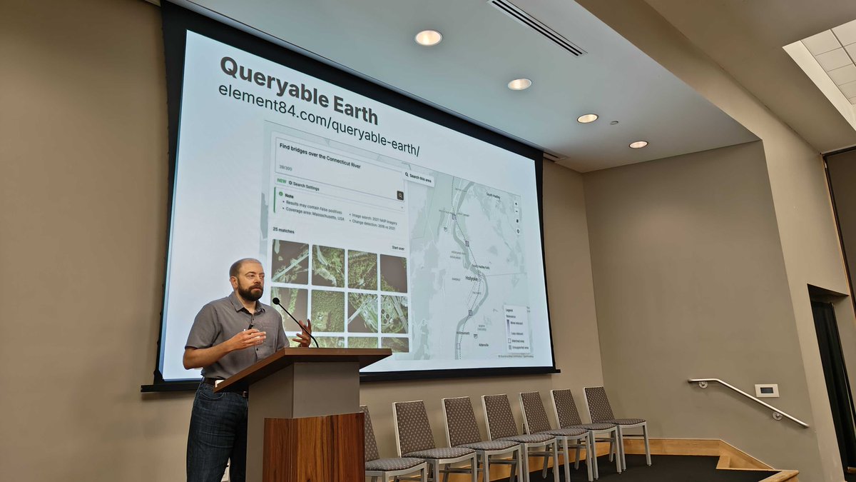
Check out Queryable Earth: https://t.co/UzfaeBmZGX
Last week, Adeel & Jason represented E84 at the 2nd @esa-@NASA Workshop on AI Foundation Model for Earth Observation.
It was great to share the latest updates from our work on Queryable Earth, and we always appreciate discussing new ways that the project can be implemented.
One #NationalAdaptationForum2026 takeaway: preparing & being proactive is easier & cheaper than responding once a crisis has occurred.
Gaining insights from organizations directly interfacing w/ communities on the ground helps us build tools that solve real world problems.
Only a few days left before the @AWRAHQ#GeospatialWaterTechnologyConference, and we're all ready to go!
If you'll also be in Niagara Falls, NY next week, be sure to say hi to @rajadain to learn about the latest at E84.
We're gearing up for a big week in Colorado at @USGIF#GEOINT2026!
At GEOINT this year we're excited to connect with partners, learn from others, and share more about our work with #KSAT.
If you'll be there too, keep an eye out for our team -- they'd love to connect!
If you'd like to chat about this more, send us a message! We'd love to learn more about the challenges you're facing with your data (federal or otherwise).
(3/3)
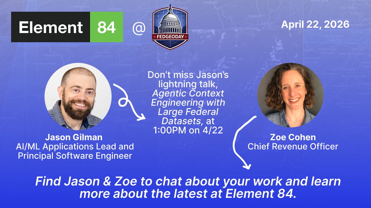
And just like that, @FedGeoDay_US 2026 is a wrap! We're a little biased, but Jason Gilman's lightning talk: Agentic Context Engineering with Large Federal Datasets was definitely a highlight for us.
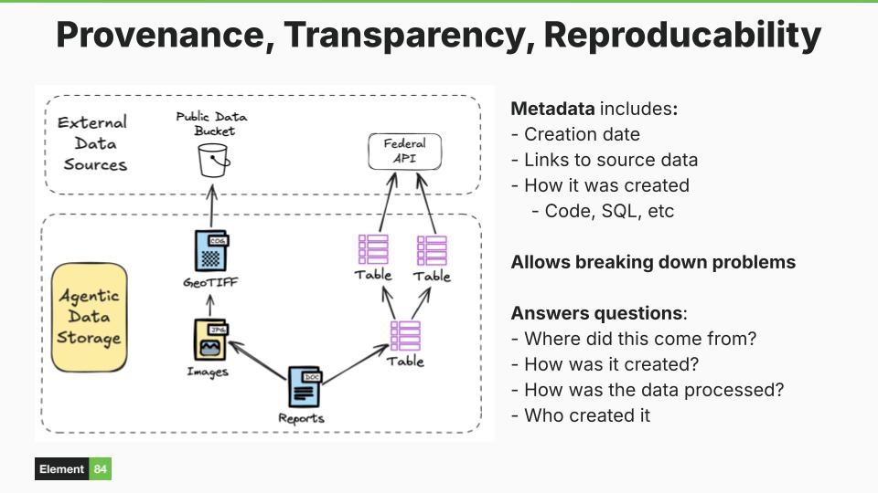
It's no small feat to work with enormous federal datasets to begin with...
(1/3)
...and Jason shared insight regarding how we can help agents to cooperate with those large amounts of data.
One crucial element: data provenance. Understanding the metadata & origins of a dataset can hold the key to interpreting & making the best use of that data. (2/3)
It's almost time for @FedGeoDay_US!
Jason Gilman will be presenting his lightning talk: Agentic Context Engineering with Large Federal Datasets and we're looking forward to connecting with folks across disciplines who are tackling similar problems in their work.
This week we attended our first #GoodTechSummit, and it was an awesome opportunity to connect with other mission-oriented organizations! 🌐🌟
During sessions we were excited to hear people looking to open source and data standards to solve complex challenges in their work.
Our latest blog details our work helping NASA build and scale a chat-based AI tool called ChatGSFC.
In the blog, we discuss how ChatGSFC is made up of composable parts that function as building blocks for users to control and assemble to fit their needs.
https://t.co/ckwBq7MCKS
It's the first day of #GoodTechSummit26! We're so excited to be in DC learning about impactful and inspiring work from a variety of sectors.
If you're here too, let us know and say hi to Catherine Oldershaw!
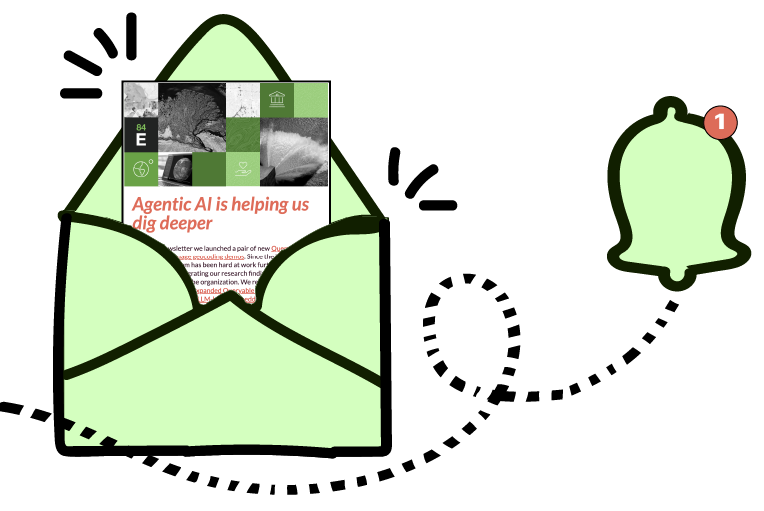
It's Friday and our latest quarterly newsletter is out in the world!! 📬
We share more about:
🌎 Updates to our Queryable Earth demos
🔮 The future of agentic AI & the open source ecosystem
🗓️ Our Spring conference calendar!
🤝 Open roles on our team
https://t.co/uEQ5D8w2pH
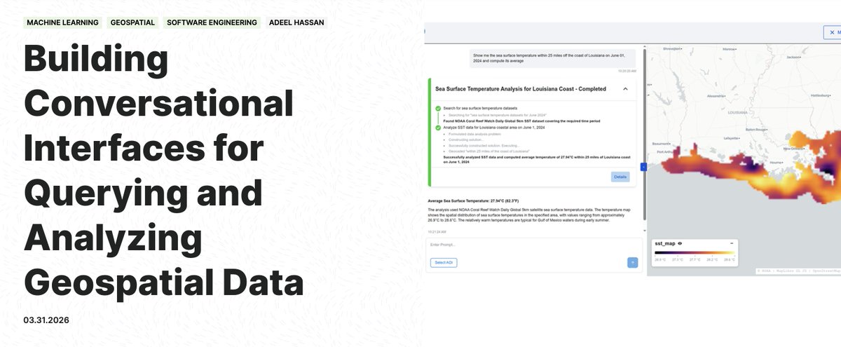
As geospatial data becomes increasingly accessible, how can we also make it trivial to query & analyze the same data using modern LLMs?
In this blog, Adeel Hassan details our ongoing open-source work to answer this question as part of a NOAA-funded study: https://t.co/wunZBTMnJC
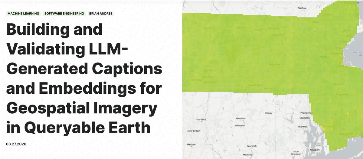
In our latest blog we kick off a technical deep-dive into Queryable Earth. We discuss our process captioning Queryable Earth tiles, validating our results, and comparing the embeddings generated by SkyCLIP, Claude Haiku, & Claude Opus.
Check it out: https://t.co/QMnJknE3cV
It's always the highlight of our week when we see a creative new way our work is being used in the wild!
Biologist Stephen Klosterman developed an experimental forecast of flower blooms in California's Antelope Valley using Sentinel-2 satellite imagery from Earthsearch. 🪻🌷
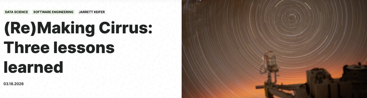
It's time for (Re)Making Cirrus: Part 2!! Jarrett Keifer is back on the blog picking up where he left off in the last installment of this retrospective discussion about Cirrus, the data orchestration framework we develop and use here at E84.
Check it out: https://t.co/epUmcqZEA5
Our Director of AI Applications, @JasonGilman, just returned from the 1st Geospatial Vector Embeddings Standards Sprint!
Attendees worked to define common standards, best practices, and documentation for geospatial vector embeddings.
His takeaways: https://t.co/qdRYSM8vU3