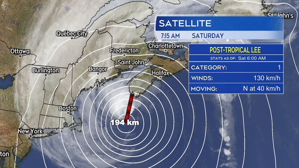
Lee is now post-tropical. Post-tropical is a change in the structure of the storm not necessarily meaning a lessening of impacts expected.
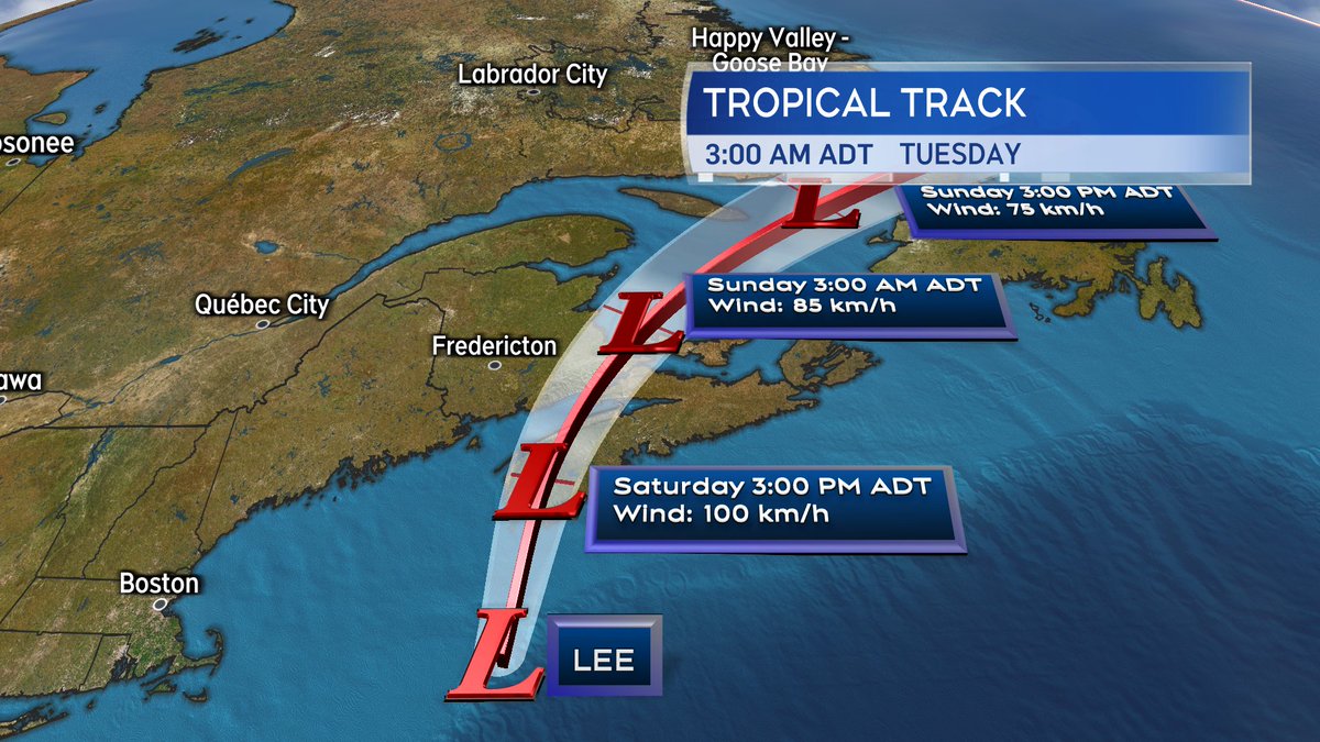
The centre within 200 km/h of southwest NS. Landfall looks likely this afternoon near the border of Yarmouth/Shelburne Co.
=Friday Evening Update=
First rain bands of Lee have arrived.
Rain & wind ramp up tonight.
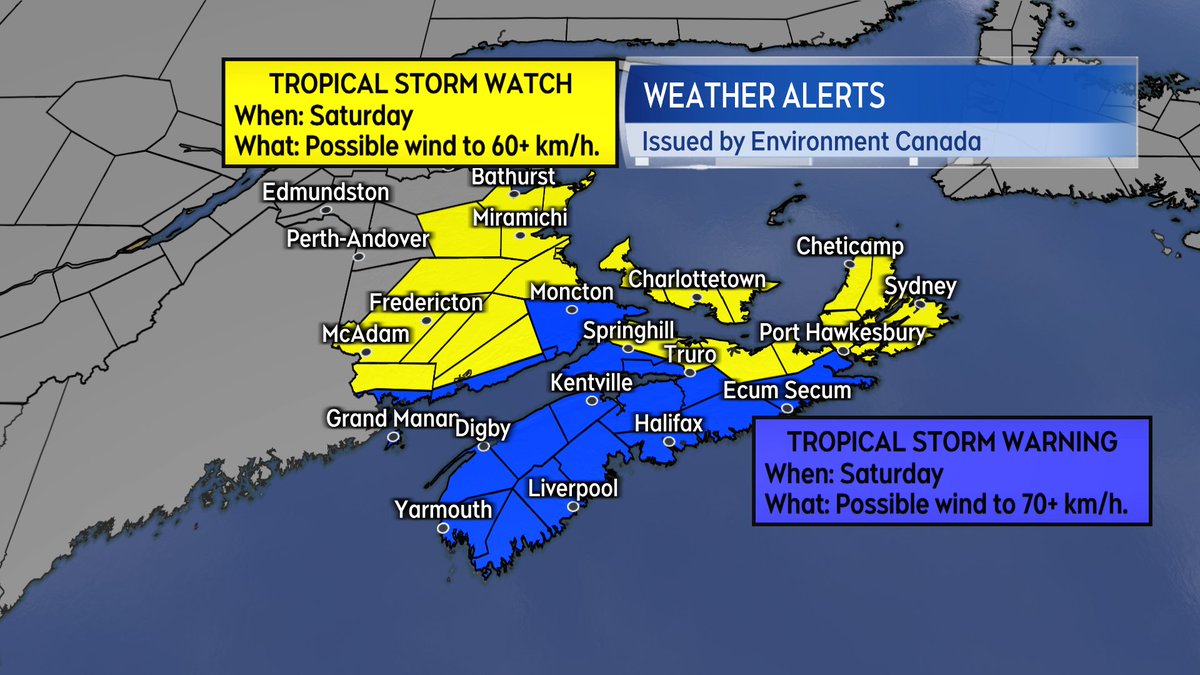
Stormy Saturday in the Maritimes.
CHC now warning of water levels up to 1.5 metres above high tide along the Atlantic coast:
Timeline & details:
https://t.co/Of2Yfa6WKQ
#nsstorm#nbstorm
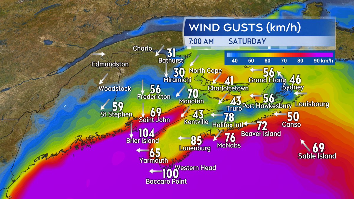
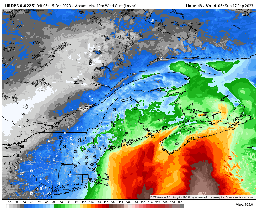
HRDPS model suggests parts of Nova Scotia, from near Shelburne to Canso, including Halifax/Dartmouth, will gusts exceeding 100 km/h and in some areas approaching hurricane force (120 km/h). This will occur during the afternoon and evening hours on Saturday. Parts of PEI may also see gusts nearing 100 km/h.
A storm surge warning (and hurricane watch) in effect for the Atlantic coast of Mainland NS... higher water levels with large waves breaking onshore could cause catastrophic damage to exposed infrastructure.
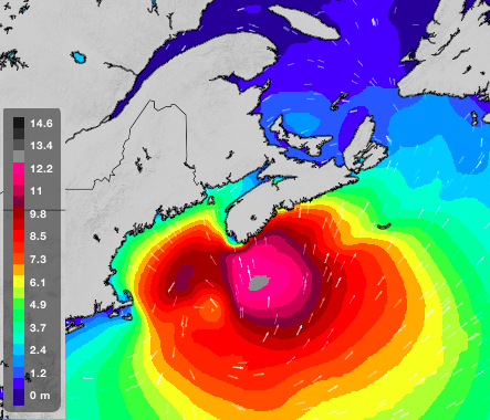
The wave chart for tomorrow morning is threatening...
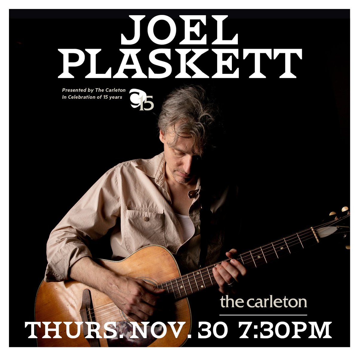
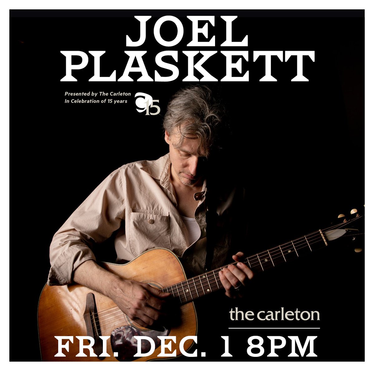
Just Announced! We are thrilled to have the first artist to ever appear on The Carleton stage back for our 15 Anniversary celebrations. Don't miss Joel Plaskett, Nov. 30 & Dec 1. Tickets on sale now: https://t.co/70ddxtNv9W #joelplaskett#liveatthecarleton#celebrating15years
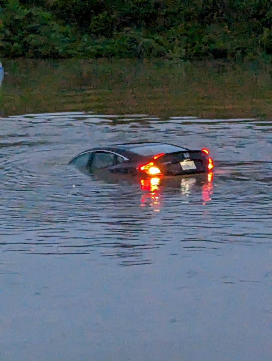
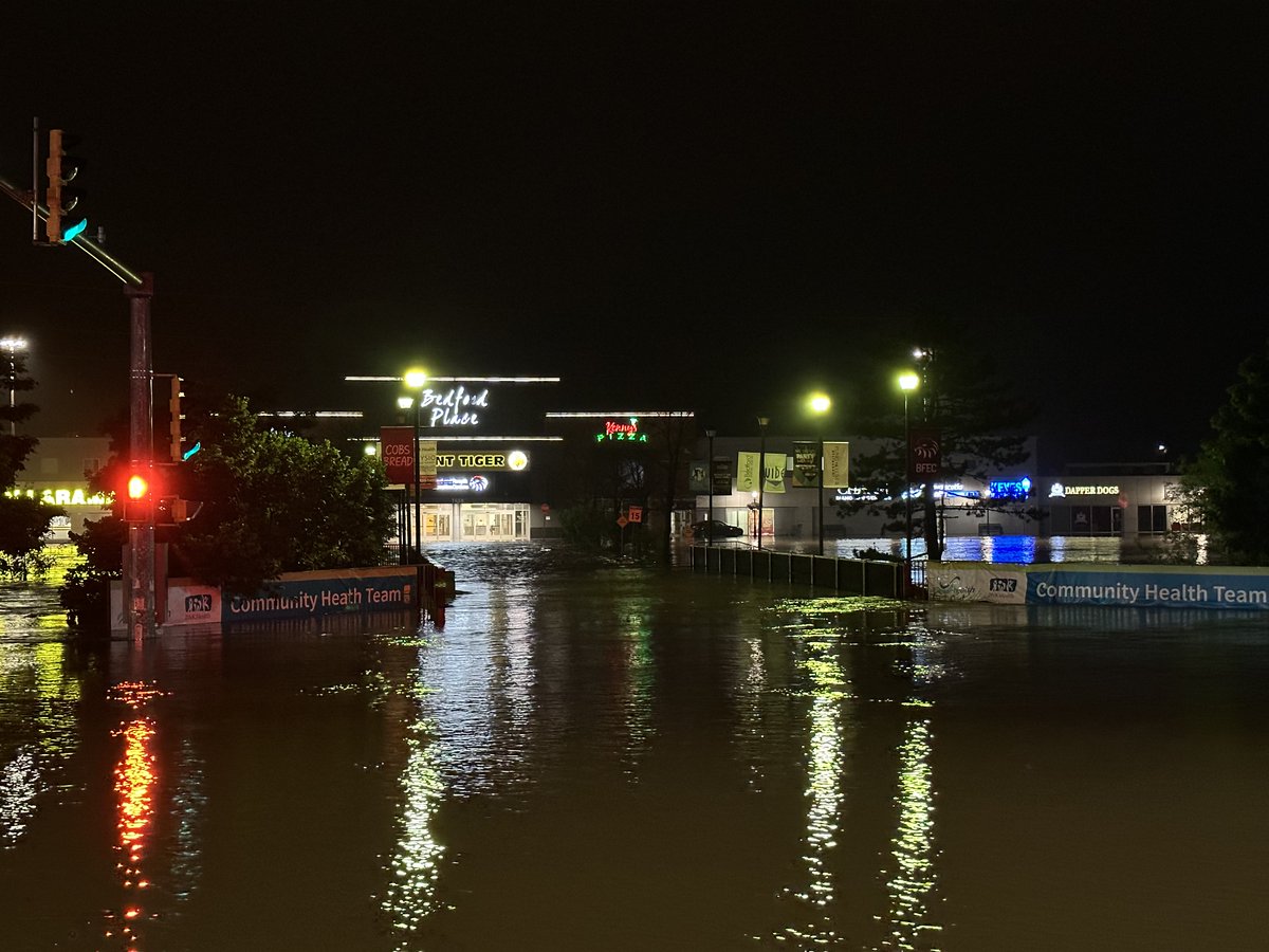
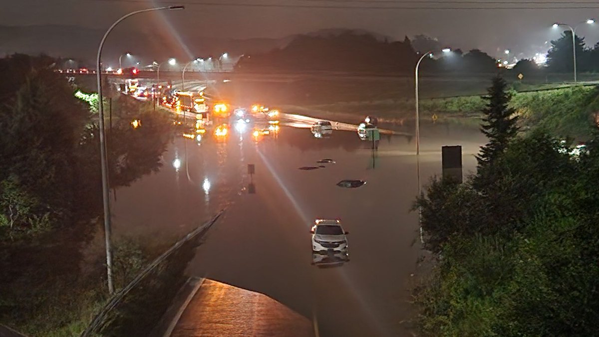
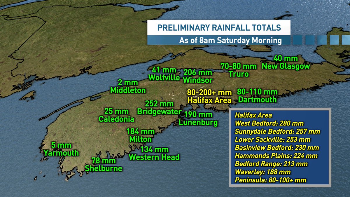
A historic flooding event for Nova Scotia.
This appears to be the heaviest rain event for the #Halifax area, since Hurricane Beth hit in 1971.
#NSStorm
https://t.co/Iw2Uvqjc5f
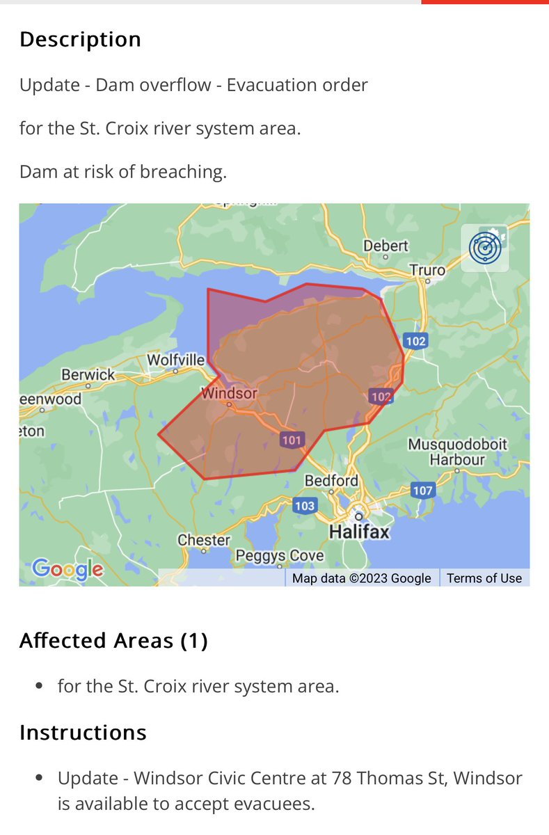
Emergency Alert issued for the St. Croix river system area.
=Evacuation order= for the St. Croix river system area.
Dam at risk of breaching.
#nsstorm#nswx
4am Radar
After a break, the heavy rain, thunder and lightning have now returned to Halifax area, as this line of training storms expands eastward.
CASGO - Super-Res Reflectivity 1 3:53 AM #NSStorm
Please stay home due to the current flooding conditions. Never attempt to cross a flooded area.
If you must drive, do not drive through flood water. Drive carefully with headlights on. Make way for pedestrians and emergency vehicles.
Update from our geomatics researchers. The satellite image on the left shows the wildfires in Shelburne on May 28, the image on the right shows how much it's grown in only a few days, pretty scary. The rain can't come soon enough.
#ShelburneFire#ShelburneCounty#AGRG
Gordon Lightfoot has left us. There’s something about Canada and Gordons.. This is a photo of him alongside fellow Gords Downie and Pinsent. Pinsent then painted the image. All gone now. To quote Mr. Lightfoot, “If you plan to face tomorrow, do it soon.” #GordanLightfoot
We are seeking feedback to support the development of a Marine Module on https://t.co/EymGlo0mUI, to help the marine and coastal sectors adapt. Help us assess data and information needs of the marine sector by filling this survey by March 14: https://t.co/fjMftqYgsp
Save the date! CONFERENCE: Advancing Adaptation Action in Atlantic Canada
WHEN: Wed. May 24, 2023, 9am-5pm AST
WHO: This conference is for those interested in and working on climate adaptation in the Atlantic
Learn more & show your interest here: https://t.co/Vt6BNugmRj.