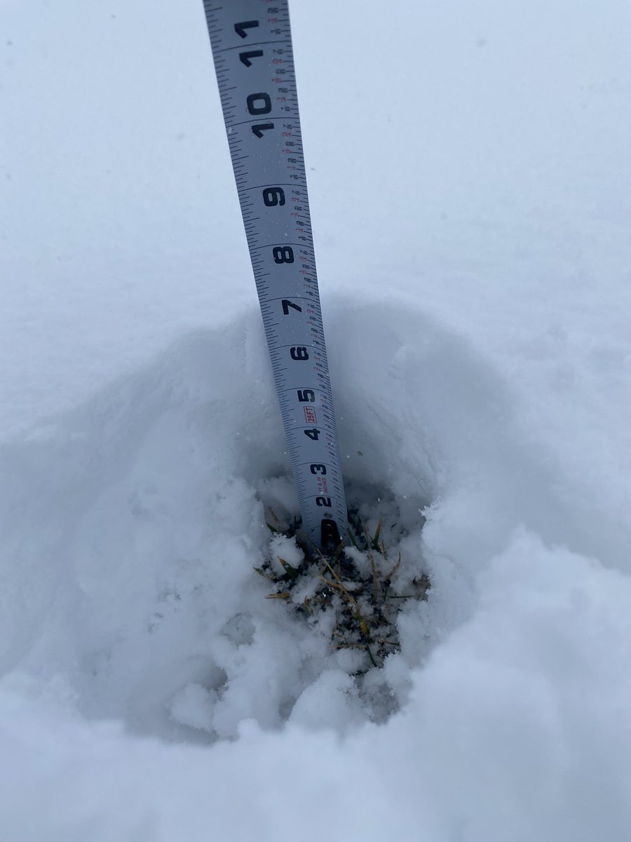
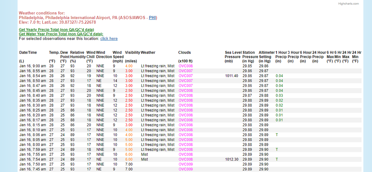
And here is the snow squall I’ve been waiting for! I also stitched in a small part of the radar loop (tried to get the timing correct) and i was very happy with how it turned out @NWSStateCollege@weatherchannel@accuweather
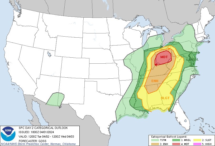
1:02pm CDT #SPC Day2 Outlook Moderate Risk: across a large portion of Ohio, and including adjacent parts of southeastern Indiana, northern Kentucky, and western West Virginia https://t.co/Y1WiOd8TQQ
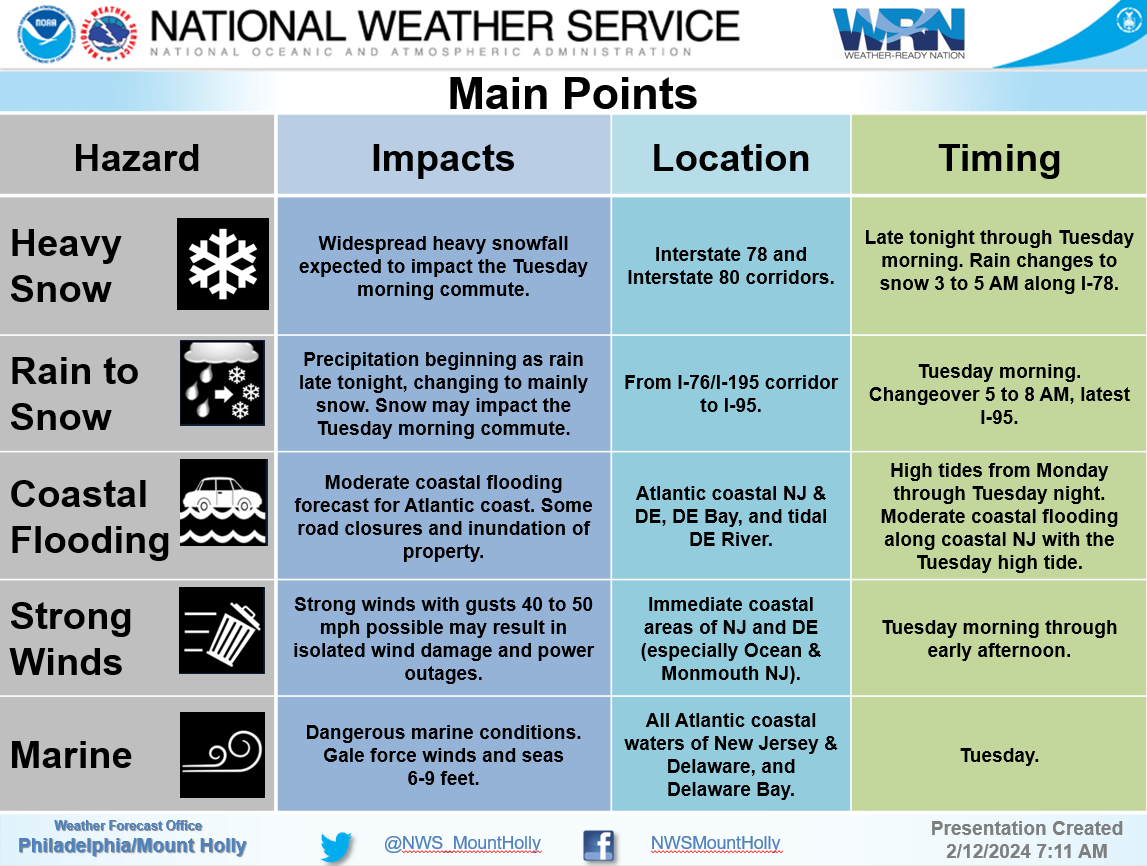
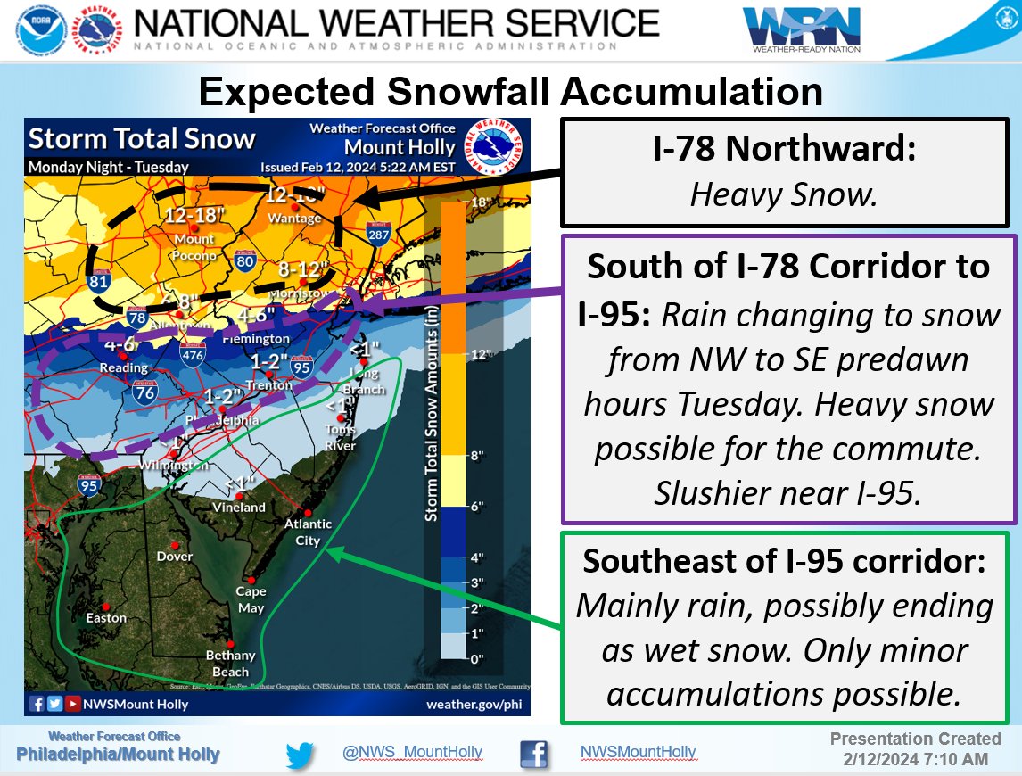
Significant changes to the forecast from the overnight package, particularly with respect to increasing snowfall amounts. The Tuesday morning commute is looking *rough*, particularly I-78 & I-80 corridors, but I-95 northwest will need to be cautious. https://t.co/mMnIx09PUq
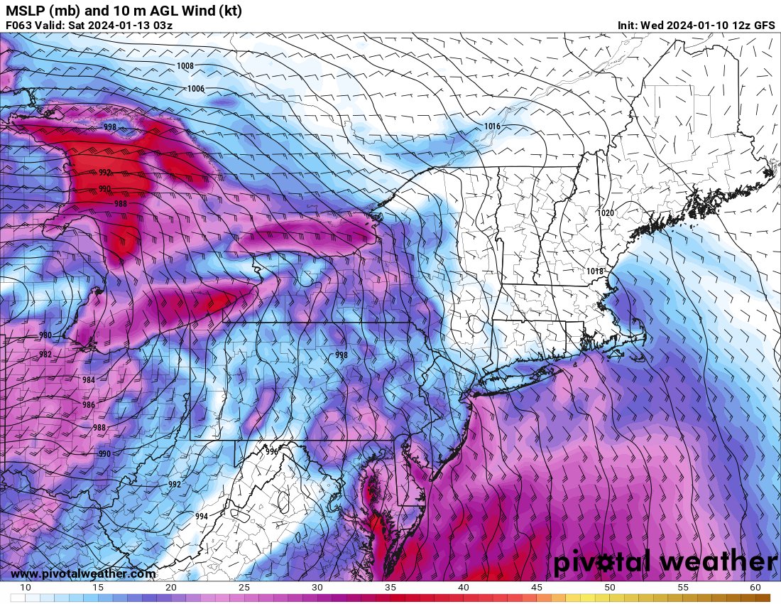
There is a notable trend in the operational GFS for Tuesday afternoon if you love snow. I don't necessarily buy this yet, I'm leaning more towards the EURO output. Euro shows more warm air advection to I-95, resulting in less snow.
Excited to see how this progresses next.
The threat of snow is lingering as we see the GFS ensembles trending stronger for Sunday into Monday.
Situation on the EPS looks similar, showing a slower and stronger system around 00z Monday
Not much change from the overnight models. Snow is expected starting Friday morning into the night. Looks like it will be a very similar system to what we just had Mon/Tues.
I personally like a 2-4" range for southeast PA once again.
Eyes are on Friday's system for the northeast. GFS trough is starting to trend a bit more negative, good news if you like snow. I would like to see this trough dig a bit more.
Will be interesting to see how models play out.
Snow storm potential for Tuesday continues to quickly decrease for the Mid-Atlantic on global models. Looking a lot more likely that the Mid-Atlantic sees some flurries, maybe an inch of snow.
GFS (first) vs ECMWF (second) at 18z Tuesday
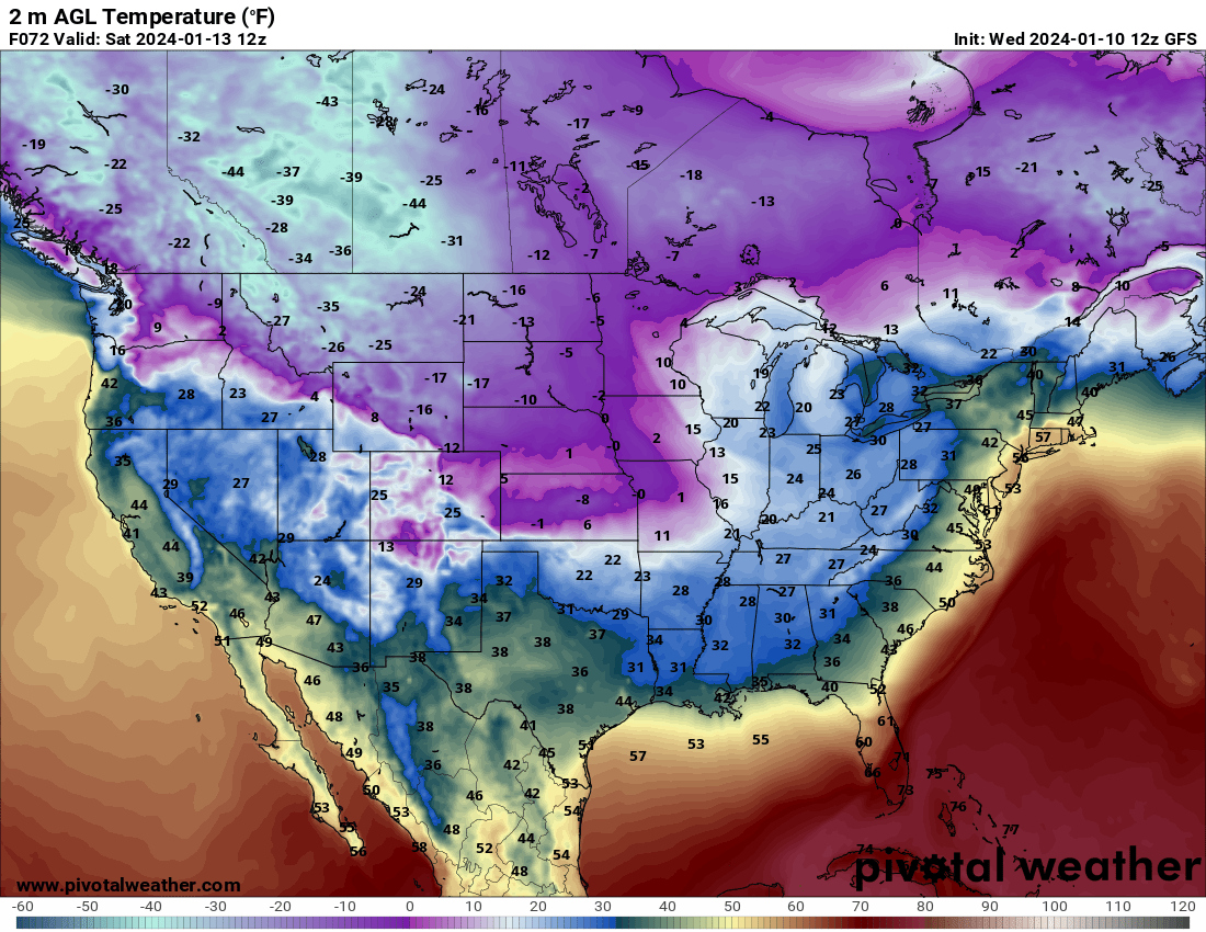
In addition, arctic air is being pulled down from Canada, resulting in frigid temperatures for majority of the US this weekend into next week.
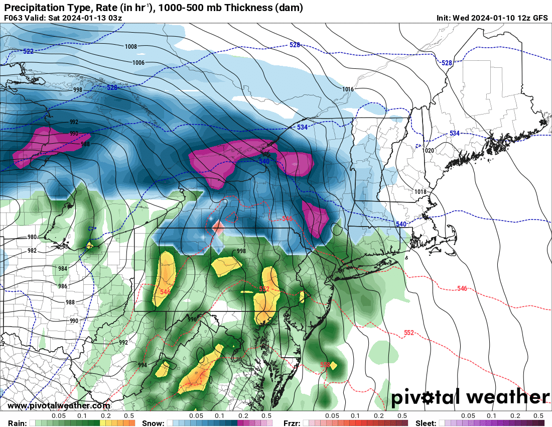
Not to mention...possible Monday snow for the Mid-Atlantic...👀
Wind, rain, and flooding returns Friday night. River flooding will occur easily because of yesterday's storm.
Key differences w this system for SE PA: slightly less rain and wind. However, still could see gusts up to 45mph similar to last night. Have a plan if power goes out.
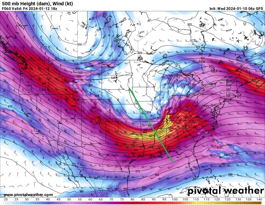
Eyes on Friday as a very similar system moves in. Wind & rain in the Mid-Atlantic, blizzard like conditions in the Midwest, and severe storms in the Deep South
A key difference in this system compared to yesterday is the negatively tilted trough, aiding severe weather growth
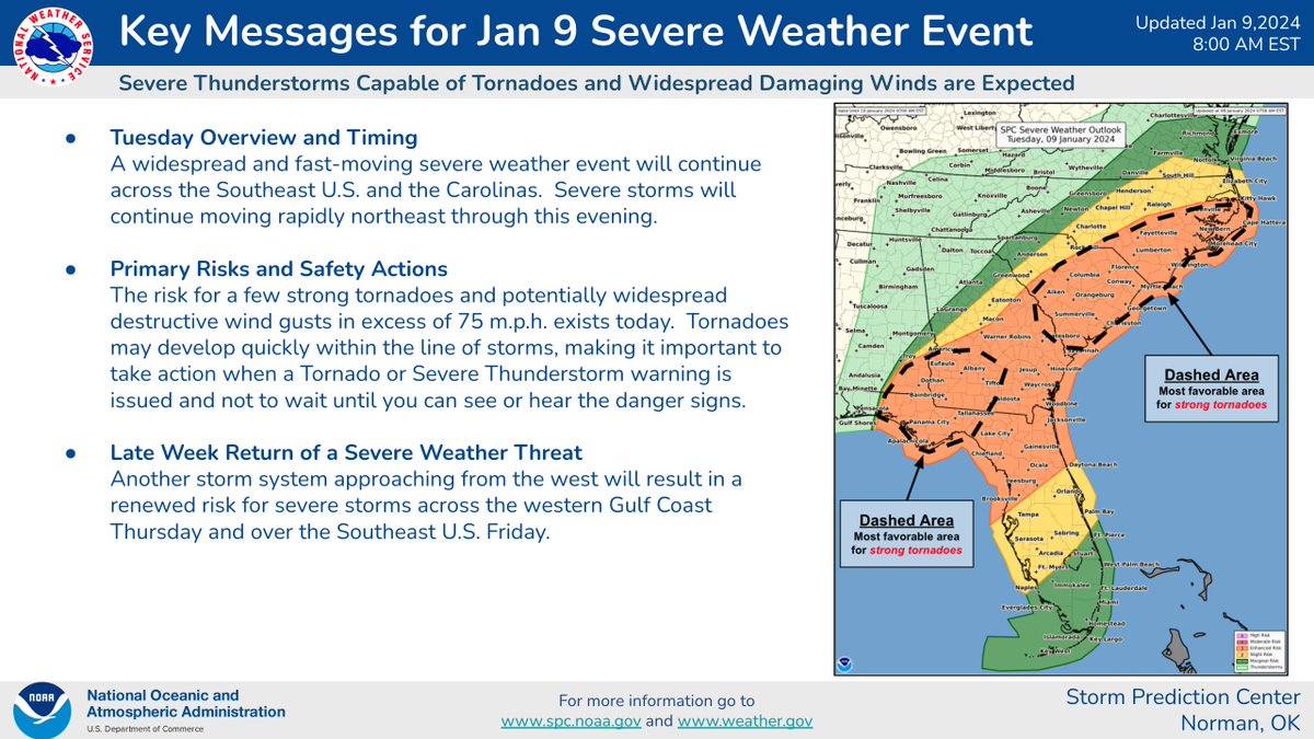
A line of strong/severe thunderstorms is expected to move across the Southeast today bringing damaging wind gusts and tornadoes. Strong tornadoes will be most likely this morning across southwest GA and the FL Panhandle and then this afternoon/evening in the eastern Carolinas.
Power storm system to move through Tuesday that will certainly bring strong winds and significant amounts of rain. Coastal flooding is a major concern.
If you lose electricity easily or live somewhere that floods often, have a plan prepared.