Tracking this renegade supercell moving toward North Dallas with hail maybe larger than quarters! This storm had a mesocyclone, which can increase hail size due to the enhanced updraft speeds. Get those rental cars to a safe place @Avis@Hertz OMG!
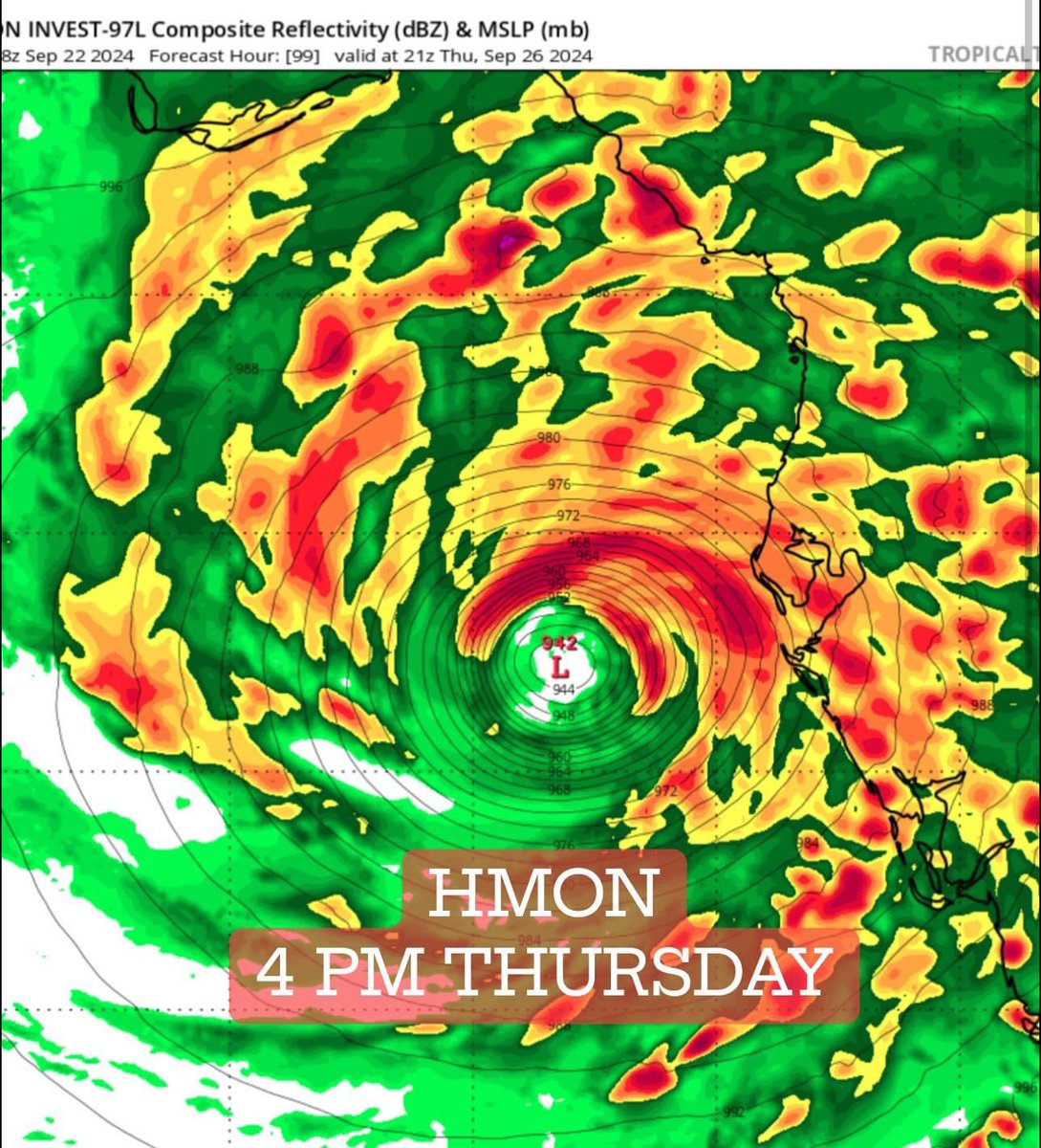
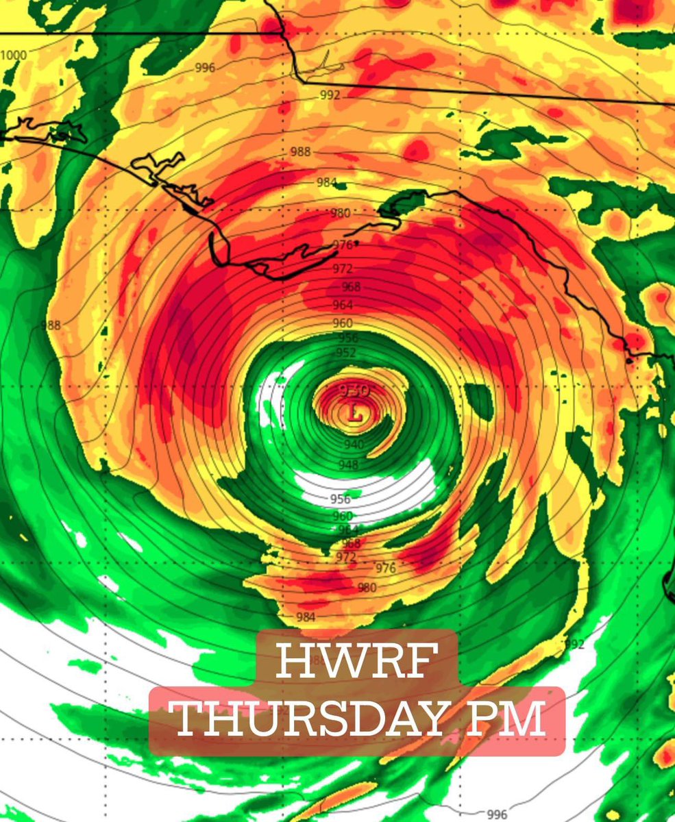
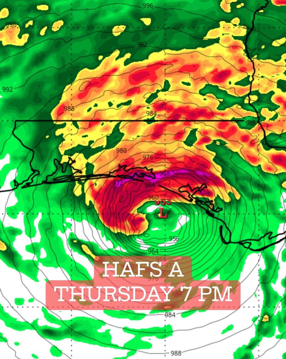
NEW HURRICANE MODELS show a range of intensifies from a category 4+ Hurricane Helene approaching northwest Florida Thursday afternoon to a weaker storm in the FL Panhandle (HAFS-A) to a ripper just north of Tampa Bay as a major outlier (HMON). The exact track depends on where the center forms and also the speed of the upstream upper-level trough. Live briefings begin tomorrow morning! Stay tuned!
#invest95L is heading towards the Caribbean likely setting its sights on the northeastern part or open waters to the north. Most guidance has it a hurricane by day4 ramping it up as it moves through the MDR. This could be a big deal if it stays low and goes through the northeastern Caribbean. Otherwise many members (not all) start turning it north likely as a powerful hurricane at this point. As to how much turn, and if this will be the third storm to threaten Bermuda remains to be seen.
The rain and wind is picking up in Cedar Key, Florida ahead of Hurricane Idalia. Considering a reposition north. Dangerous storm surge expected here Wednesday morning. Live stream begins at 330 am
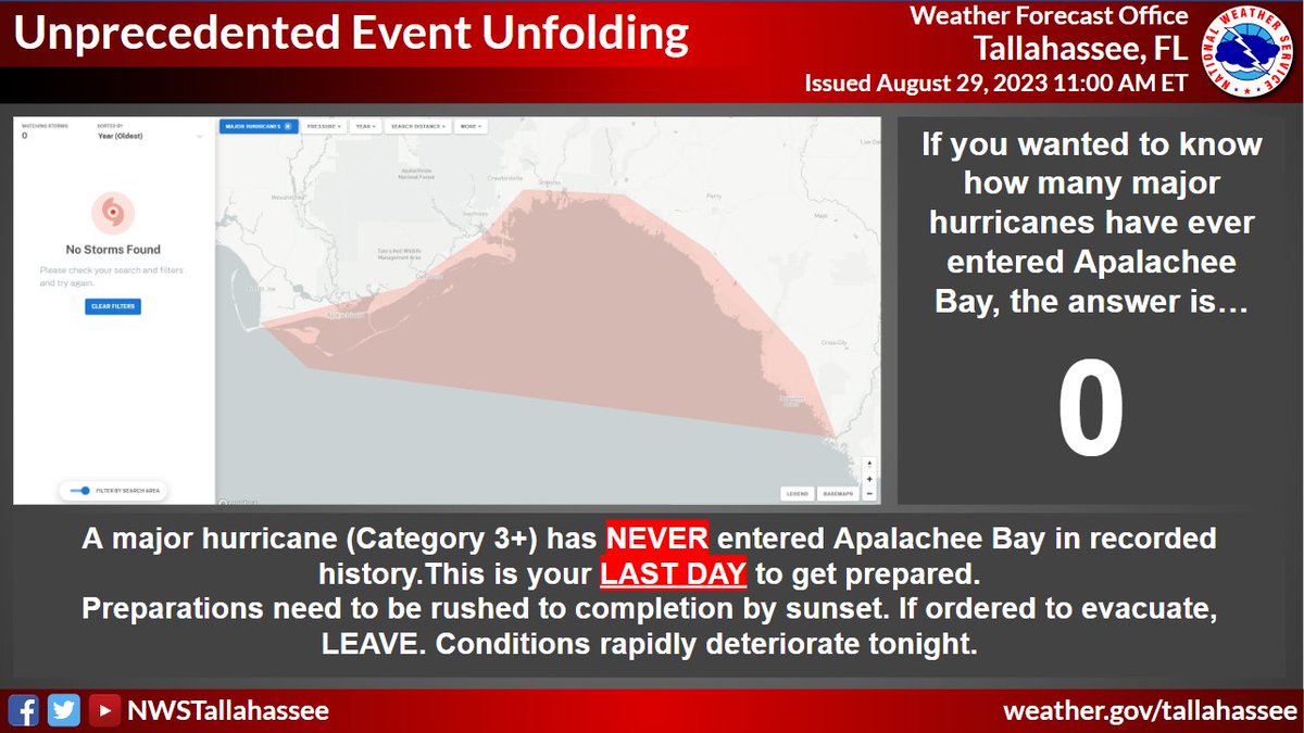
Hurricane #Idalia will likely be an unprecedented event for many locations in the Florida Big Bend. Looking back through recorded history, NO major hurricanes have ever moved through the Apalachee Bay. When you try to compare this storm to others, DON'T. No one has seen this.
UPDATE on Tropical Storm #Idalia that has formed off the Yucatan Peninsula! Models trending a bit east with the forecast track. Some show landfall as a cat 2 near the Citrus Coast. Tampa still in the cone!
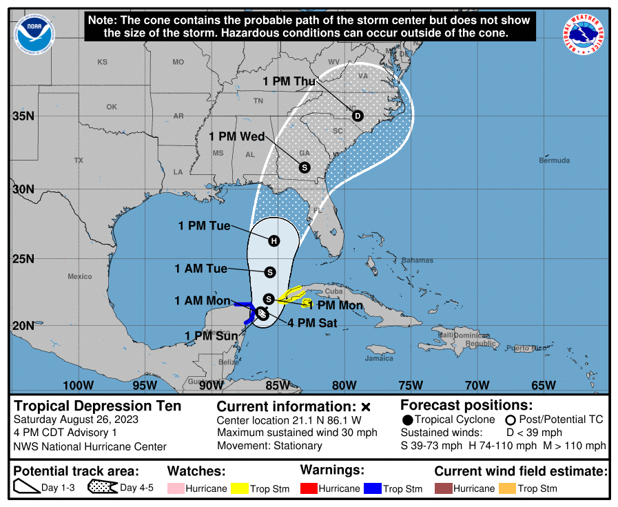
Tropical Depression #10 has formed off the Yucatan Peninsula. It'll sit there for a day but start moving north into the Gulf of Mexico on Tuesday as an intensifying cyclone. Potential for an impactful hurricane in Florida on Wednesday. We'll be there to document & livestream.
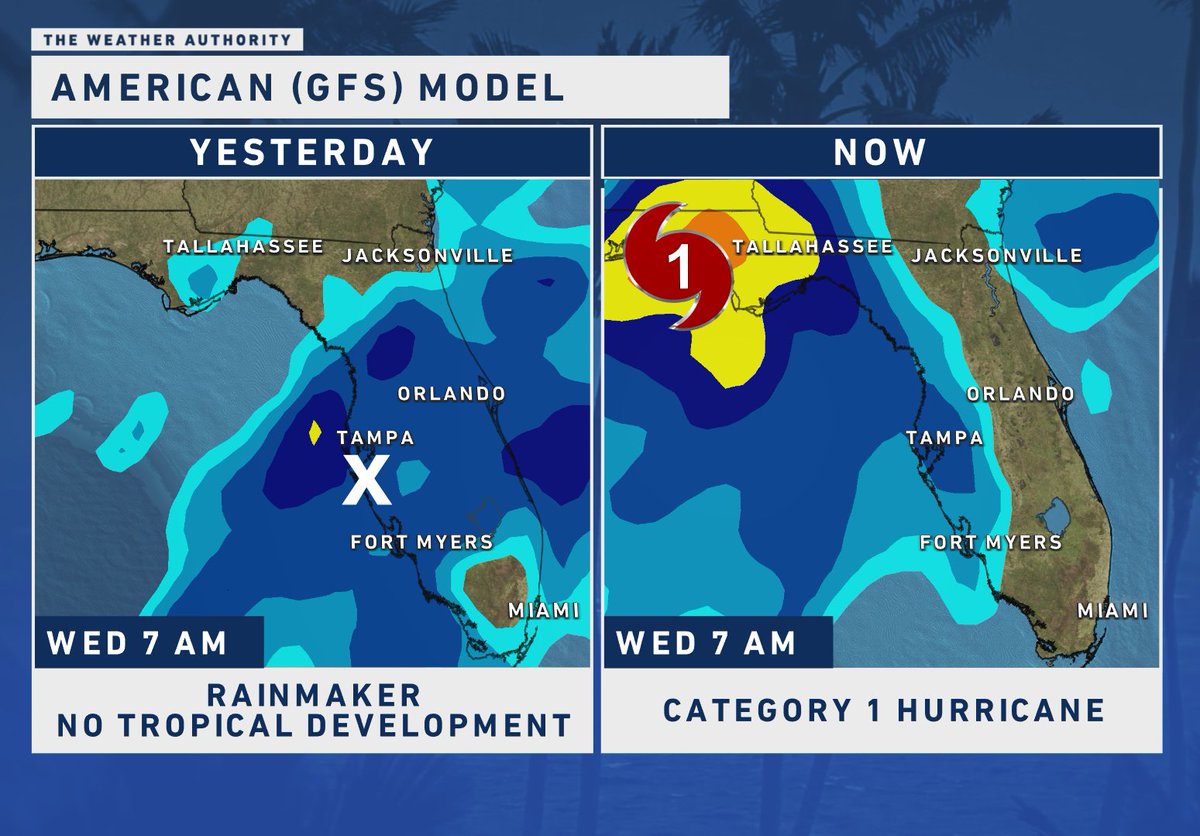
TROPICAL UPDATE 🌀 The American Model 24 hours ago had a weak rainmaker across Florida. Now they've flipped and joined the other models showing tropical development. Current run puts a Category 1 Hurricane in the Florida Panhandle, but considering the model's inconsistency, observe with caution. Could easily change. Consider ALL models + ensembles and look for consistency. New European model will be coming out shortly, I'll keep you posted. @WINKNews
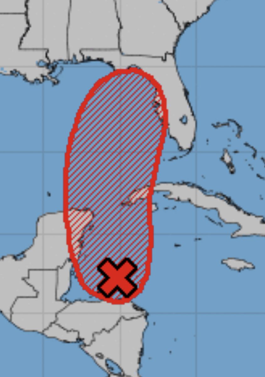
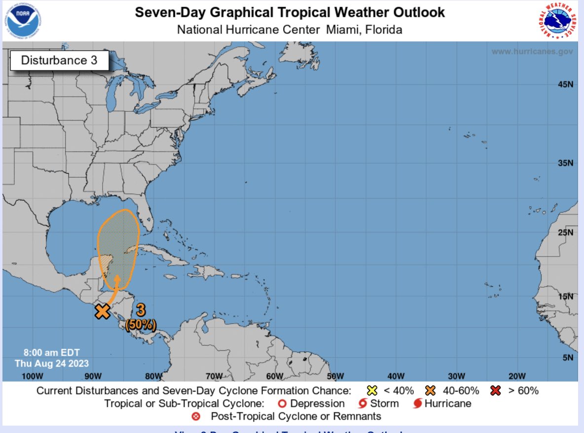
The National Hurricane Center has increased probability of tropical cyclone formation from the western Caribbean to eastern Gulf of Mexico over the next 7 days. We will need to activate storm chase mode for this storm. Anywhere along eastern Gulf of Mexico coastline and even ATL upstream from this need to pay attention!
JUST IN: NOAA boosts Atlantic hurricane season forecast, is now leaning toward above average season, with 14 to 21 named storms (5 have occurred already).
https://t.co/1oT6PKNbJy