The world's latest mapping and imagery technology in a simple web-based tool to allow Australia’s rangelands to be managed more profitably and sustainably
New land means a steep learning curve. FarmMap4D helps you get familiar quickly, from fence lines to water points and paddock layouts. Good decisions start with knowing your land.
📍 Make the transition smoother: https://t.co/DlKe23dapz
Nothing slows you down like chasing a broken fence. With FarmMap4D, map and monitor your fence lines to spot weak spots before they become a problem. Less driving, more fixing.
🚜 Save hours: https://t.co/DlKe23dapz
Running out of water isn’t an option. With FarmMap4D, track all water points—bores, tanks, troughs, and dams—to always know where your stock can drink. No second-guessing.
💧 Plan ahead and keep your herd moving: https://t.co/zEEXPNvhPf
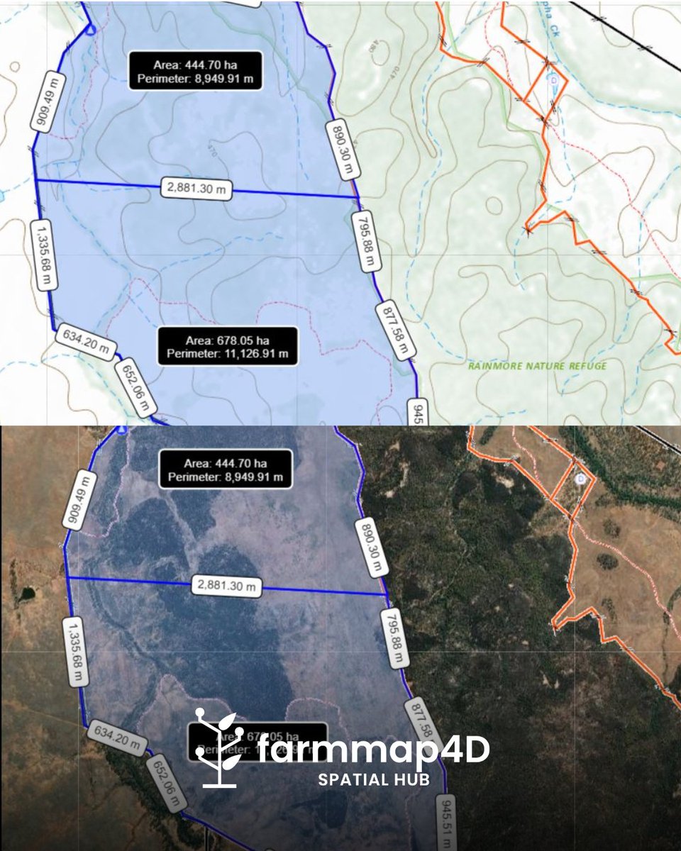
Overgrazed in one spot, underutilised in another? It happens. FarmMap4D gives you a clear picture of your land so you can plan rotations, improve pasture, and get the best out of every acre.
🌱 Better grazing, better results—see how here: https://t.co/DlKe23dapz
Are your paddocks running at the right stocking rate? FarmMap4D helps you track and balance grazing so you can get the best out of your land, season after season.
🐄 Smarter decisions, better results. See how it works: https://t.co/DlKe23dapz
When you’re running a large-scale operation, every minute counts. FarmMap4D helps you manage infrastructure, stock movements, and grazing rotations without endless hours in the ute or on the bike.
🚜 Want to make management easier? See how here: https://t.co/DlKe23dapz
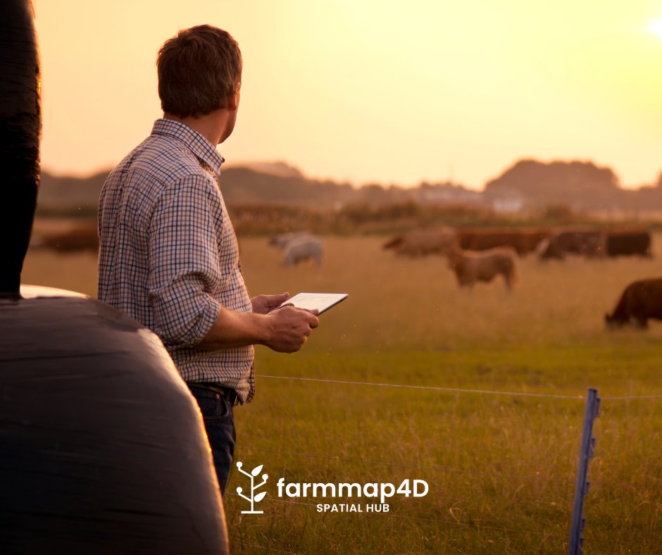
Paper maps fade, get lost, and go out of date. FarmMap4D keeps a live, interactive map of your property right on your phone or computer so you can check paddocks, water points, and fences from anywhere.
📍 No more guessing. Take a look at what’s possible: https://t.co/DlKe23dapz
If your farm records are scattered, you’re not alone. FarmMap4D keeps everything in one spot—maps, grazing history, infrastructure plans—so the right info is always at your fingertips.
🖥️ Make farm management simpler: https://t.co/DlKe23dapz
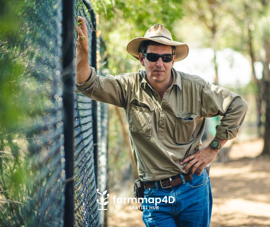
When Mike took on new land, he knew water points and fencing would be key. With FarmMap4D, he mapped infrastructure, tracked grazing, and made smarter decisions—no guesswork.
🔗 See how Mike put it to work: https://t.co/3CPzxl1cxE
Some paddocks are overstocked, others underused. FarmMap4D helps you track stocking rates, plan rotations, and keep pastures healthy. 👉 Graze smarter: https://t.co/DlKe23dapz
Smarter decisions start with better maps. 🌏 FarmMap4D gives you satellite imagery, elevation data, and tools to plan fencing, water, and infrastructure—all in one place. See what's possible: https://t.co/DlKe23dapz
We’re heading to Primex 2025! 🚜
Explore how our AgTech solutions simplify farm management—from mapping your property to optimising water points. Let’s chat about how we can help you make smarter decisions.
👉 https://t.co/uyI1PWttQZ
#FarmMap4D#Primex2025#AgTech
You can’t control the weather, but you can plan for it. FarmMap4D helps you track water, manage fencing, and plan grazing rotations—so you’re always a step ahead, no matter what the seasons throw your way.
🌦️ Planning makes a difference: https://t.co/DlKe23dapz
Whether you’re working alongside family or preparing to hand over the reins, FarmMap4D keeps records, paddock history, and infrastructure details. No more relying on memory or digging through old notebooks.
Future-proof your farm management: https://t.co/DlKe23dapz
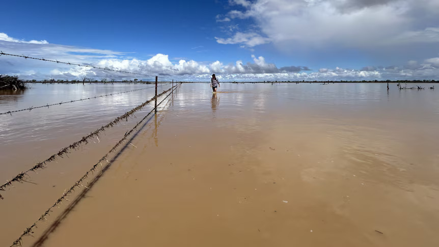
The floods in western Queensland are hitting farmers hard, with devastating losses to livestock and infrastructure. Thinking of all the graziers and families facing these tough times.
Full article here: https://t.co/jD0BLMcuJV
📸 ABC News
Built for farms of all sizes—whether managing a few paddocks or hundreds of hectares, FarmMap4D’s tools for mapping, grazing, and infrastructure help you make data-driven decisions to improve efficiency. 🔗 Explore the options 🔗 Explore your options here https://t.co/Kp8q3T4hgm
🚜 Spend less time worrying, and more time getting things done.
FarmMap4D gives you a simple way to track water points, plan infrastructure, and see your entire property in one place. Built for farmers who need practical tools to save time and money https://t.co/DlKe23dapz
Heavy rain and wild weather from Cyclone Alfred are putting pressure on ag supply lines. Events like this highlight the importance of preparation and mapping key infrastructure for recovery.
Stay safe and take care. https://t.co/ZAieOsoGEH
#CycloneAlfred
🐂 “It used to take weeks on a motorbike with a GPS in your hand to work out the grazeable areas" - Russell
💡 Find out how FarmMap4D works for farmers like you: https://t.co/DlKe23dapz
#FarmMap4D#FarmingMadeSimple#FarmTech
⏱️ FarmMap4D helps you stay organised, plan ahead, and cut out unnecessary trips. Manage your land with ease—whether it’s mapping fences, checking water points, or planning improvements.
📲 Simplify farm management today: https://t.co/DlKe23dapz
#FarmMap4D#FarmSmarter#AgTech