The Muskoka Fire Danger Rating has been elevated to HIGH due to increasingly dry conditions and several recent wildland fires in the region. With warm weather and low humidity, the risk of wildfire is serious.
When the fire danger rating is HIGH, extreme caution must be taken with all open flames. Forest fuels are very dry, meaning new fires can start easily, burn aggressively, and challenge fire suppression efforts. Extreme caution must also be used in any forest activities.
Aviation, Forest Fires and Emergency Services are responding with air attack on Timmins 1 (TIM001) which is a 2.5 hectare fire located around 3.5 kilometres north of Gogama. Please stay clear of the area and allow ample room for fire crews and aircraft to work safely.
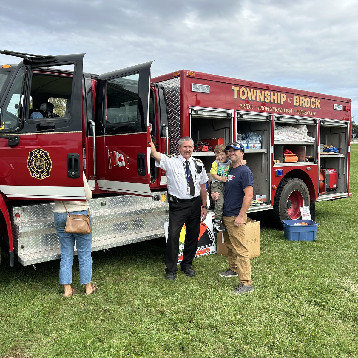
The past 12 hours have been very busy for the Brock Township Fire Department. We have responded to 24 incidents, dealing with hydro lines down, trees on hydro lines and trees blocking several roads throughout the area. Thank you to all the firefighters, job well done.
💧 Flooding Preparedness - Safeguard your Livestock 💧
Set up a plan for your livestock before flooding begins!
For more flooding preparedness information visit our website: https://t.co/HxYaLrTHv1
Over the last 3 days Ramara Fire was out on Lake Simcoe & Lake Couchiching responding to ice rescue incidents. Thankfully no one was injured.
This serves as an important reminder that no ice is safe ice. Ice conditions are unpredictable, inconsistent and potentially hazardous.
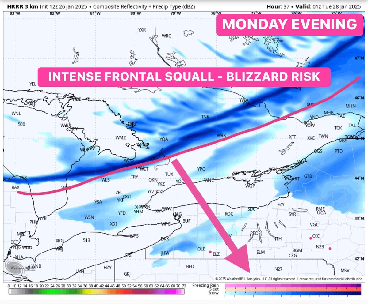
#ONStorm#ONwx ⚠️ DAMAGING WIND EVENT AND BLIZZARD POTENTIAL FOR MONDAY
The latest model data this morning has increased our concern about Monday’s wind event, which, when combined with heavy snow expected late Monday afternoon into the evening, could lead to widespread blizzard conditions across parts of Southern Ontario.
Wind gusts are forecasted to reach 90-100 km/h across much of Southwestern Ontario and the Golden Horseshoe. These gusts are expected to peak during the afternoon hours, creating hazardous conditions in many areas.
Certain regions are at even greater risk for stronger gusts, including the Lake Erie shoreline, Prince Edward County, and the Dundalk Highlands. Model data consistently highlights Collingwood as a hotspot for the most intense winds, with gusts ranging from 100 to 120 km/h depending on the model.
Such strong winds are capable of causing power outages and blowing away unsecured objects. If you have outdoor items that could be carried off by the wind, take action today to bring them inside or secure them properly.
To make matters worse, light to moderate snowfall will move into Southern Ontario during the afternoon. Paired with these intense winds, the snow will likely lead to widespread blowing snow and significantly reduced visibility. Blizzard-like conditions are most likely in Southwestern Ontario, where the strongest winds and snow overlap.
Adding to the danger is the potential for a narrow but powerful front squall to form along a sharp cold front sweeping through the region late Monday. This squall could bring a sudden, heavy burst of snow lasting a few hours. If this occurs, travel could become nearly impossible during the evening hours as the squall moves through.
The silver lining? Once the squall passes, the winds should begin to calm. However, this same system will usher in much colder air, causing temperatures to plummet by 15 to 20 degrees within a matter of hours late Monday night.
We are currently working on a detailed forecast that will be released later today, focusing on the blizzard potential and what to expect across different regions. Additionally, we’ll provide a snow day forecast, although the timing of this event might limit school bus cancellations compared to what you might expect.
Don’t miss our live stream this evening! Adam will be breaking down the latest model data and answering your questions. We’re planning to go live around 8 PM, but that timing may change slightly. Stay tuned for updates!
- Brennen
Image source: WeatherBell
Pictured, L to R, Fire Chief Rick Harrison, Councillor Peter Frank, Councillor Cria Pettingill, Councillor Lynn Campbell,
Fire Prevention Officer Madison Bath, Regional Councillor Mike Jubb.
This week the Brock Township Fire Department took ownership of a new 2024 Spartan FC-94 pumper fire truck.
This Canadian built fire truck was purchased from Dependable Emergency Vehicles as a replacement of a 20-year-old truck.
The truck is scheduled to be in service February.
Today, at approximately 3:50 a.m., BFD was dispatched to a private waste mgmt facility at 1232 Rosewarne Dr. Upon arrival, crews found smoke and flames coming from a large outdoor pile of refuse approximately 10,000 sq ft in size.
Crews remain on scene.
https://t.co/qKINWNT7mD
As of December 10, 2024, Blackwater Bridge on Con. 4 in Sunderland is closed due to safety concerns.
The bridge will remain closed until rehabilitation construction is complete.
For more information please visit our website https://t.co/gRqxYh4jHu
Ramare Fire & Rescue Services would like to congratulate Laura Karabin on her recent promotion to District Chief of Station 3, Washago.
We look forward to Laura’s contributions in this role as she is the first female chief officer in Ramara Fire and Rescue Service’s history.