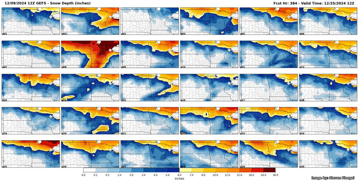
While still a long ways out, here’s the 12/9 12Z GEFS probability of 1” of snow depth for Christmas morning (and the individual members). Overall, low chances (<30%) for most of SD.
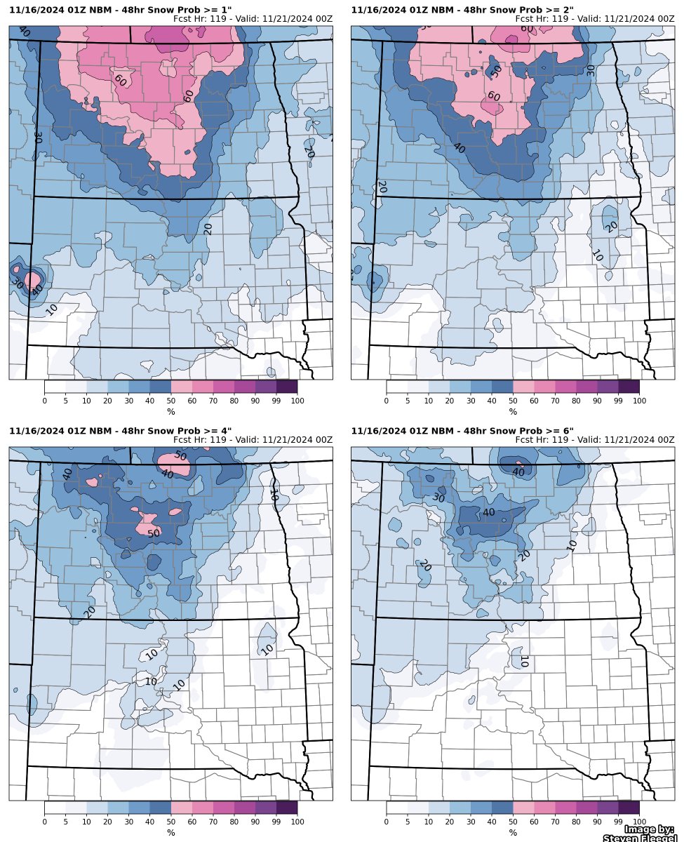
This evening’s NBM snowfall probabilities for the Dakotas on Monday evening through Wednesday afternoon. Not a lot of change over the last 12 hours, but still a lot of uncertainty on where/if snow occurs.
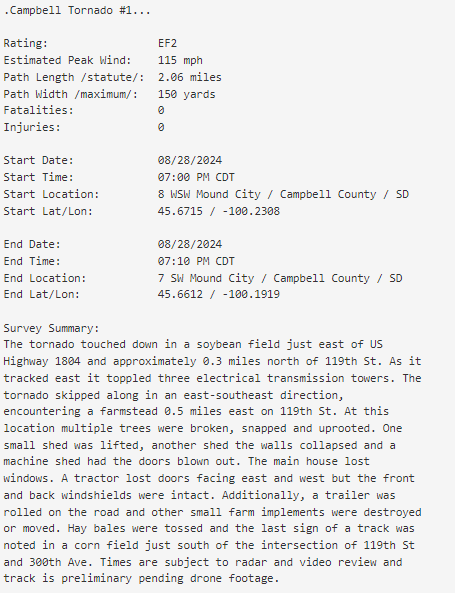
We are continuing to gather information on the August 28th tornadoes in Campbell County and will continue to update as necessary. Here is a summary of everything we have collected so far: https://t.co/bgiKT3tqkN
#SDwx
Here are the preliminary results from our survey of last night's tornado event. We have confirmed three tornadoes at this time, including an EF2, an EF1, and an EFU. For more information, see the attached images or visit the link below:
https://t.co/CLkiM0DSTj
Concert 2 of 3 this weekend in the books. Another great show and company. Green Day played Dookie and American Idiot in full, along with a good opener from Smashing Pumpkins.
Concert 1 of 3 this weekend and it didn’t disappoint. First time in the Snake Pit and it was amazing. Here’s a few pics while waiting in the parking garage.
@NWSGrandForks Second was at 46.761, -96.393, with tree knocked over and numerous 3-4” diameter branches down. Finally, at 46.761, -96.311 there was a tree down. 2/2
@NWSGrandForks Saw 3 different areas of tree damage on Clay County road 10 between Downer and Rollag from last evenings storm. First was around 46.761, -96.451 with numerous small branches (1” diameter) down in the ditch and on the road. 1/2
Dust is being lofted by the gusty winds and is being detected by the Dust RGB band on GOES satellite! This is seen as a pink diagonal streak from ND all the way into IA! For those driving in or near this area may experience brief reductions in visibility. #sdwx#mnwx
NWS Omaha's warning product generation this afternoon was nothing short of heroic. As of 7:45 PM
164 SVS (followup to TOR,SVR warnings)
102 LSR (Local Storm Reports)
42 Tornado Warnings
25 Severe Thunderstorm Warnings
Those SVS and LSR counts take extreme levels of effort.