FliteGrid: Q&A Thread
Q: What is FliteGrid?
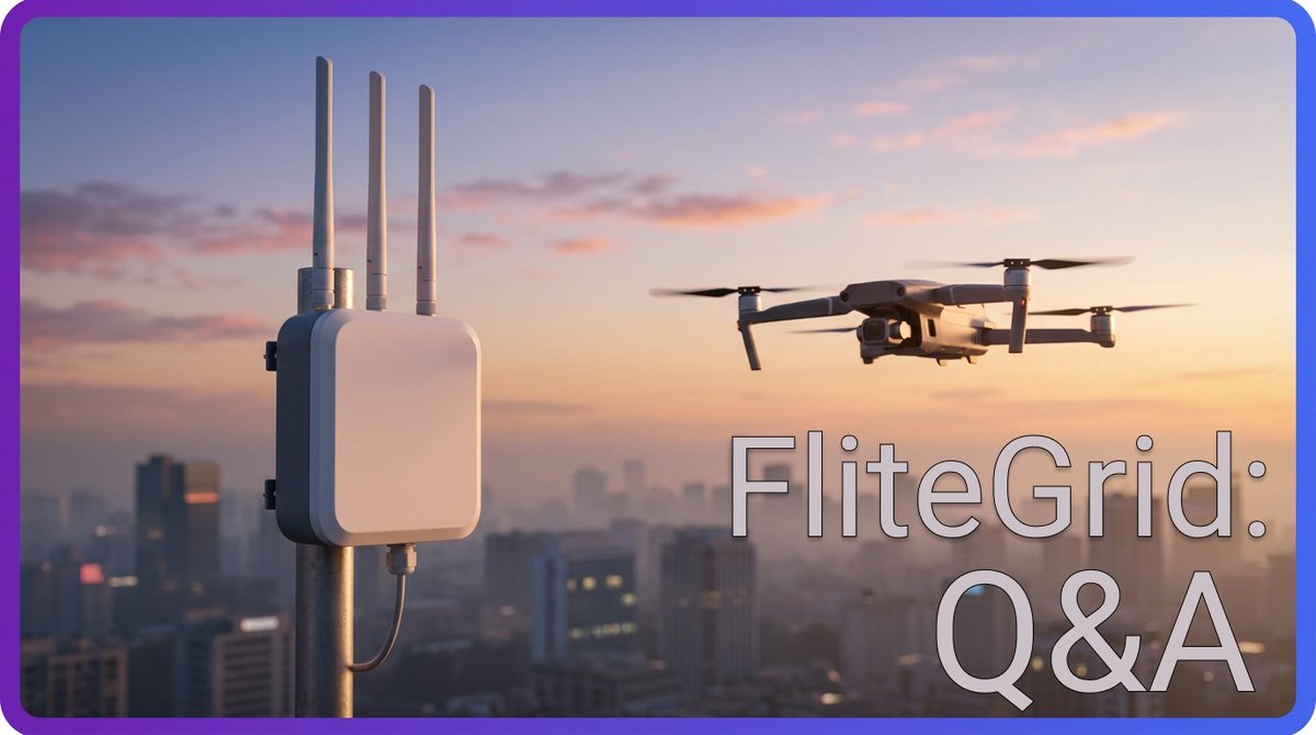
FliteGrid is a decentralized physical infrastructure network (DePIN) that detects, tracks, and identifies unmanned aerial vehicles. Its sensors monitor airways and read Remote ID data from passing drones, documenting their flight paths and capturing key identifying information. This data is then compiled on a platform for monitoring American drone traffic, which government and commercial entities pay to access.
Two days left to submit questions for the FliteGrid AMA!
Our CEO @gjordan will speak on:
- Which locations are most valuable
- How to earn USDC for referring customers
- How non-deployers can participate
Any questions you have, submit them on Discord. Now is your chance!
Join us on Discord for the first FliteGrid AMA!
CEO @gjordan will be answering your questions next Thursday, June 4th at 1:00pm EST.
Any questions you have can be posted in the # ama-questions channel, just let us know if you need an invite 👇
A new week, a new drone story!
In this case, California firefighters used Remote ID to catch drones entering unauthorized airspace.
These are the types of customers you serve when you deploy for FliteGrid. Today in America, tomorrow the world.
Join us on Discord for the first FliteGrid AMA!
CEO @gjordan will be answering your questions next Thursday, June 4th at 1:00pm EST.
Any questions you have can be posted in the # ama-questions channel, just let us know if you need an invite 👇
This is a perfect opportunity to learn anything you want to know about FliteGrid.
- Which locations will earn the most
- What kind of customers are already paying into the network
- How drones will be used in the future
Don't miss it!
A drone's flight path can tell you a lot about what it's doing.
This kind of orbit in a residential area is often real estate photography - perhaps an agent taking photos for an upcoming Zillow listing.
@gjordan@DePINConnection This was a great space. Give the whole thing a listen for more info about FliteGrid's past, present, and future:
https://t.co/1FZSHM37nG
When drones become automated, FliteGrid becomes critical.
CEO @GJordan opens up to @DePINConnection about why companies can't function without airspace awareness:
Before this FBI counter-drone force can stop UAVs at the World Cup, they'll use Remote ID sensors to detect and identify them.
So when we say stadiums pay for FliteGrid, this is why:
Detection is the first stage of drone security, and that's what FliteGrid does.
FliteGrid hardware doesn’t just earn money – it gives you a window into your own airspace.
You can view flight paths, Remote IDs, and even travel histories for every drone you see.
Also, it earns money.
If your drone isn't broadcasting Remote ID, you're liable.
Right now, you just have to trust the manufacturer that it is.
@gjordan and @FliteGrid found most drones don't broadcast properly, whether due to bugs or zeros.
They're building the infrastructure to fix it.
With nearly $60M raised, DoD as an early customer, 1M+ flights tracked, FAA validation, and a CEO who helped write the rules the industry operates under, @skysafe/@FliteGrid is positioning itself to be the backbone of the country's entire UAS Traffic Management infrastructure!
CEO @gjordan will be joining the space next Tuesday to cover it all!
Set your reminders!
https://t.co/WY4NdLYukv
The stars are aligning for @FliteGrid!
- federal regulatory mandate (Remote ID)
- two presidential executive orders demanding airspace sovereignty,
- $500M+ in government grant funding flowing to drone detection buyers
- strategic investment and partnership from Motorola Solutions
CEO @gjordan will be joining the space next Tuesday to cover it all!
https://t.co/WY4NdLXWuX
No single agency has both the visibility and the authority to respond to drone threats. That’s the problem.
@SkySafe CRO Melissa Swisher breaks it down on Federal News Network:
https://t.co/5sEIAYYFmV