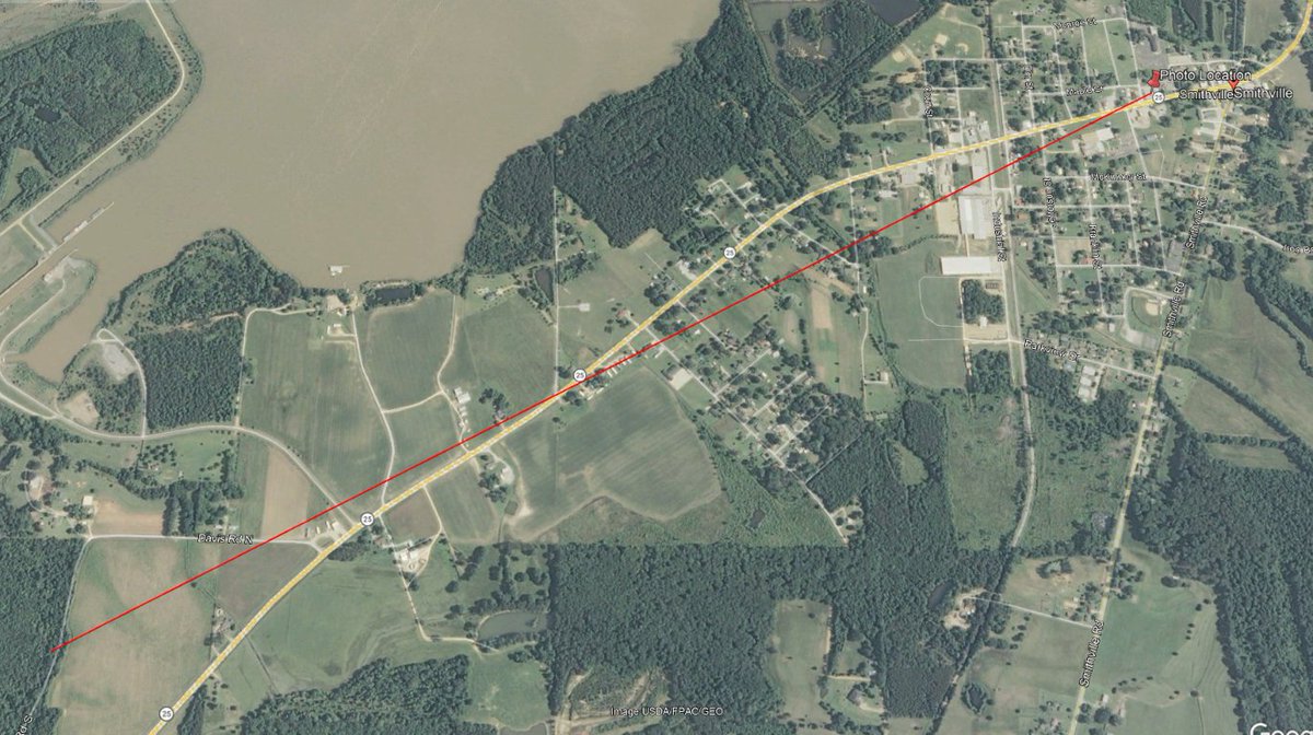
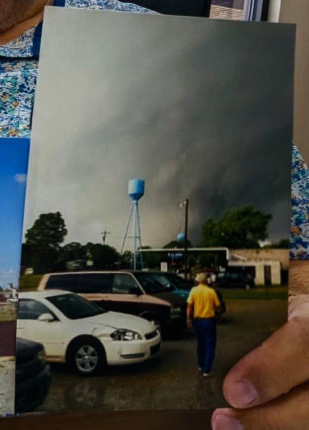
Here's a new, rare photo of the Smithville, MS EF5 early in it's life, taken by the current mayor in his restaurant's parking lot.
This is before it hit the town.
Based on geolocation, it was in between the RV park and the home of Jesse Cox (foundation dislodged) at the time.
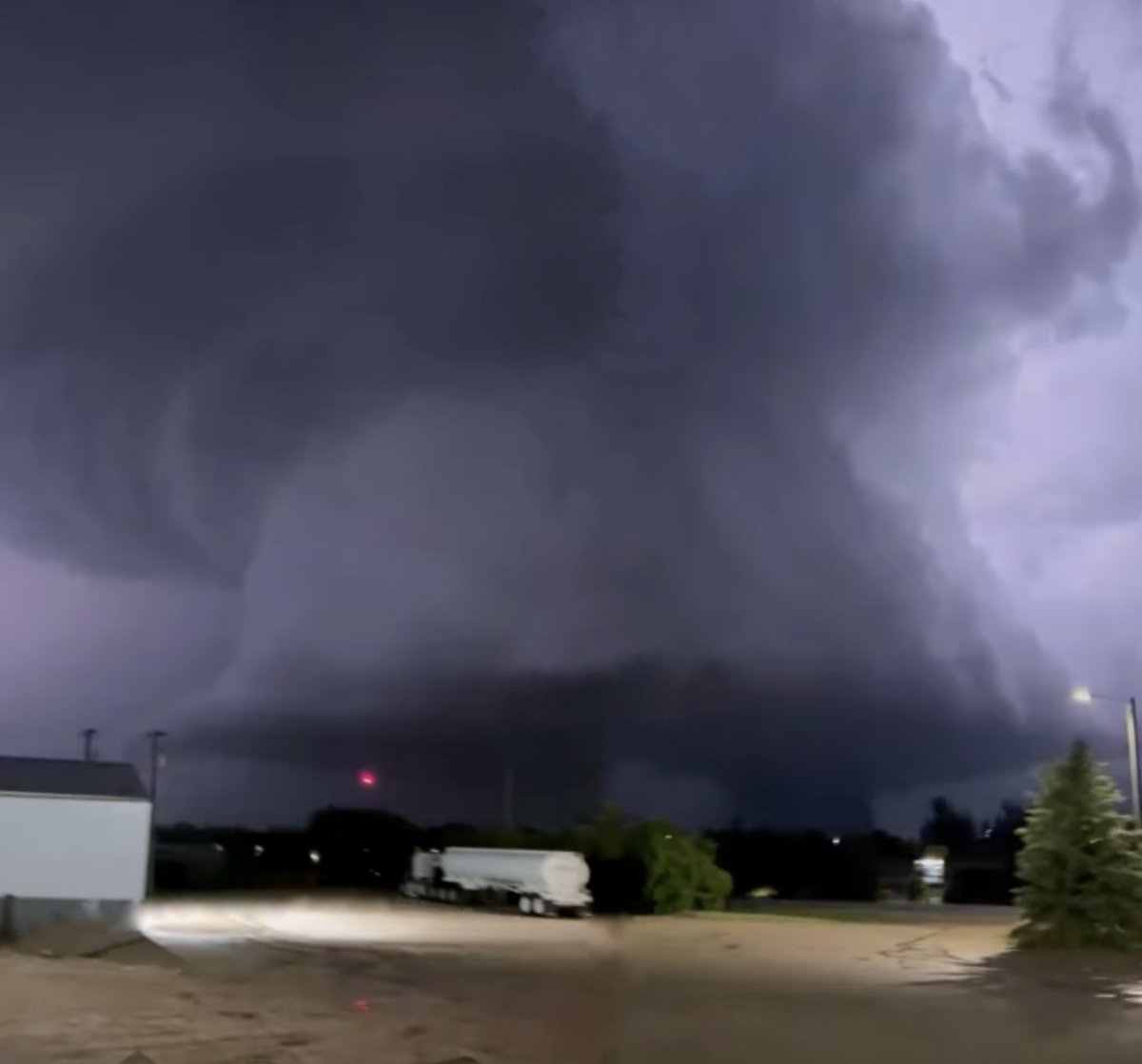
Another view of the Enderlin EF5 tornado from the TikTok account "avafernow".
This video is taken from over 6 miles west of the tornado, and shows the tornado as it was nearing peak width and intensity.
Original video: https://t.co/gI4SwjAtOy
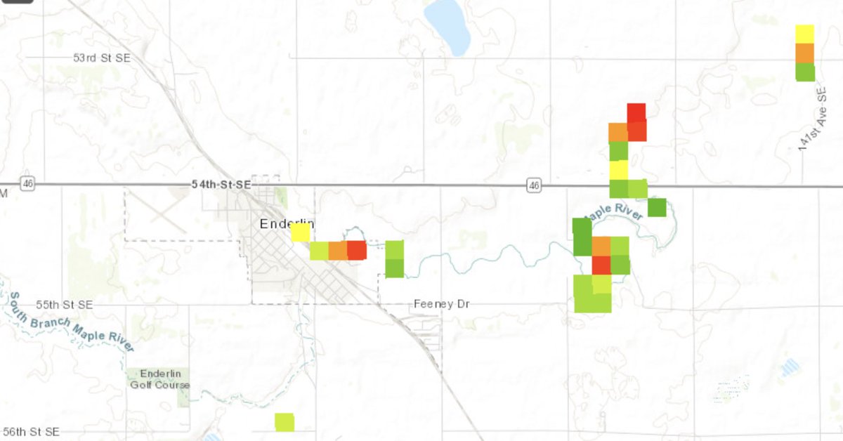
@plasticmattyy The Outlaw Chasers got within about 2 miles of the tornado when it was near Highway 46, but their footage isn't public right now.
At the moment the only thing they've released is a few screenshots on their facebook.
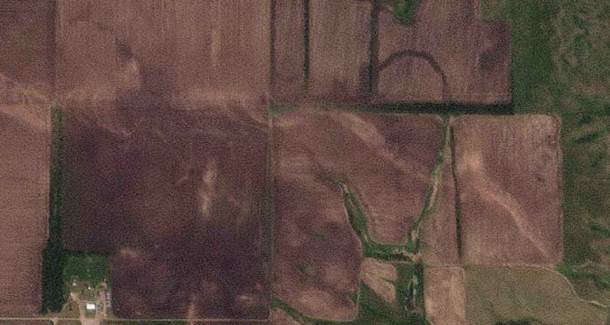
The Enderlin EF5 tornado near peak width as seen by Annie Johnson from Maple River Farms on the east side of town.
This is the 2nd closest piece of media showing the tornado during its mature stage.
Original video: https://t.co/yGtN4kRV9F
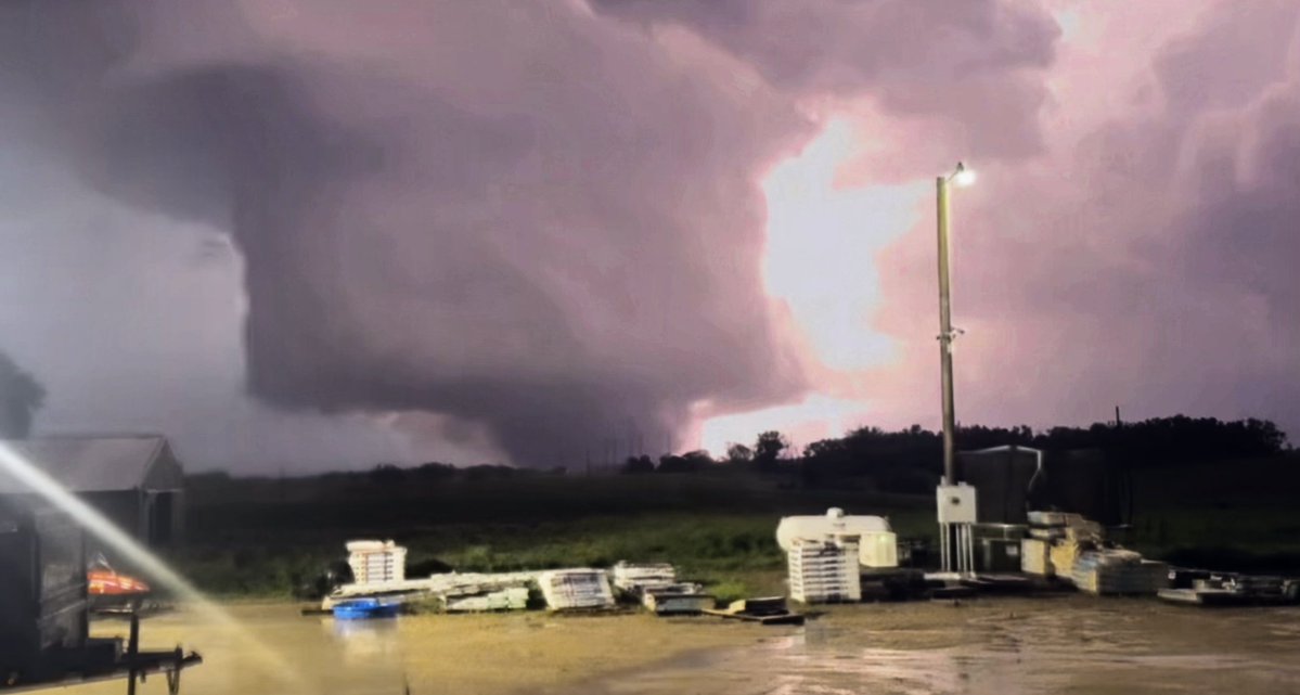
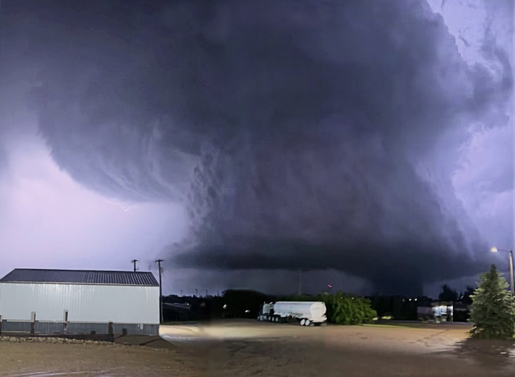
A view of the Enderlin EF5 and its parent storm looking SSE from the City View Fuel gas station located in the northwest part of town.
This is actually two (poorly) stitched together screenshots from a video by John Lux, which can be viewed here: https://t.co/drstvA5v0O
@WeMetWx Haha, thank you so much for the kind words!! I'd take luckiest chaser of the year but the COTY nominations definitely belong to all the chasers who grinded the whole year, and probs not the random Brit met student who got stupid lucky when chasing with friends for a month lmao.
@ATWChasing@tornadotrx I'm super interested to see what you get with your method, I have a 2300 feet is a bit too high so I'd love to see what you get in the end!!
@MetJam_ The 8 day stretch from June 20th - 28th was utterly ridiculous. I basically peaked at chasing before I ever really started. All downhill from here lol.
@NotChilledOut Ight, after looking at that USDA site more I think you're probably correct in assuming Green Ash, with maybe some American Elm in there too. Both sturdy hardwoods regardless!
Thank you for leading me down this interesting rabbit hole!!
@NotChilledOut Ight I totally just realised that there's both green ash and american elm listed on the Maple River east of Enderlin, so idk if that means there's a mix of species or something haha. I've definitely got confused at some point when looking at this.
@NotChilledOut Do let know why you think that! Afaik green ash is the only ash that has any major coverage in ND, and seems to be limited away from Enderlin. The USDA notes Elm as the primary riparian species in SE ND, specifying it to be the species that populates the river east of Enderlin.
@NotChilledOut Yes of course! It's super useful for this sort of stuff. You'll have to expand each species to find individual sub-species in the layer tab. And I'd use frequency instead of basal area, it makes locating the locations of species a fair bit easier: https://t.co/1hzpV9TfMh