Not many people will see this, but if you're ever feeling down, just remember that you tried and you're still here today. You're still here after all your worst days, stronger than ever.
If you ever need someone to talk to, I'm here for you (^-^)/
I love you <3
This is not a Category 3 #hurricane.
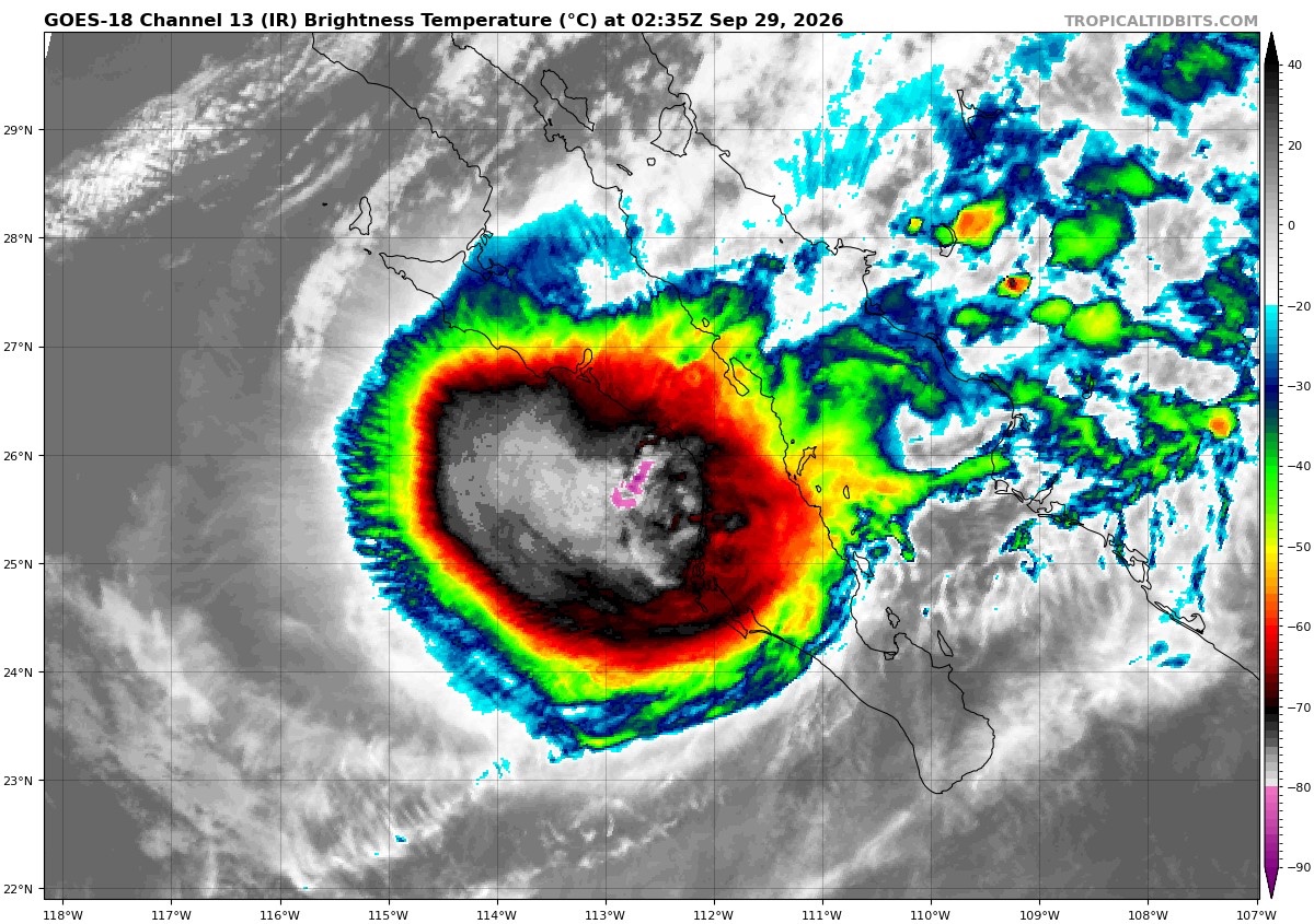
#Polo has weakened over the past few hours since recon departed, when it was only barely holding onto 100 kt.
Current intensity is likely 85-95 kt, with a best estimate of 90 kt.
Regardless, it is still an historic and potentially destructive landfall for that part of Baja California Sur.
Hatsune Miku Voice Notifications Now Available For Purchase in Japanese and English on Amazon Music!
Add a little cuteness to your daily notifications with Hatsune Miku's adorable voice! 📷
▼Available on iTunes Store and Amazon Music!
iTunes Store:
https://t.co/EC1inpLRoV
Amazon Music:
https://t.co/DoPrkqnXza
We are about to see one of the largest rain events that’s ever been triggered in the continental United States by a Pacific Hurricane.
After making landfall in Baja California, the saturated remnants of former-Category 5 Hurricane Polo are going to inject a massive conveyor belt of deep, tropical moisture up through NW Mexico and into the U.S.
South-Central Texas could be at the epicenter of the event, with isolated rain totals potentially reaching up to a FOOT this week.
Here’s #Hurricane#POLO’s track and position up to the brand-new 8 pm MST advisory. The new position is just 33 km (~21 mi) from me. Conditions here: 997 mb & falling slowly, light rain, breezy. Wtf. Either this thing vaporized or it’s a crazy-ass microcane with a tiny, violent core.
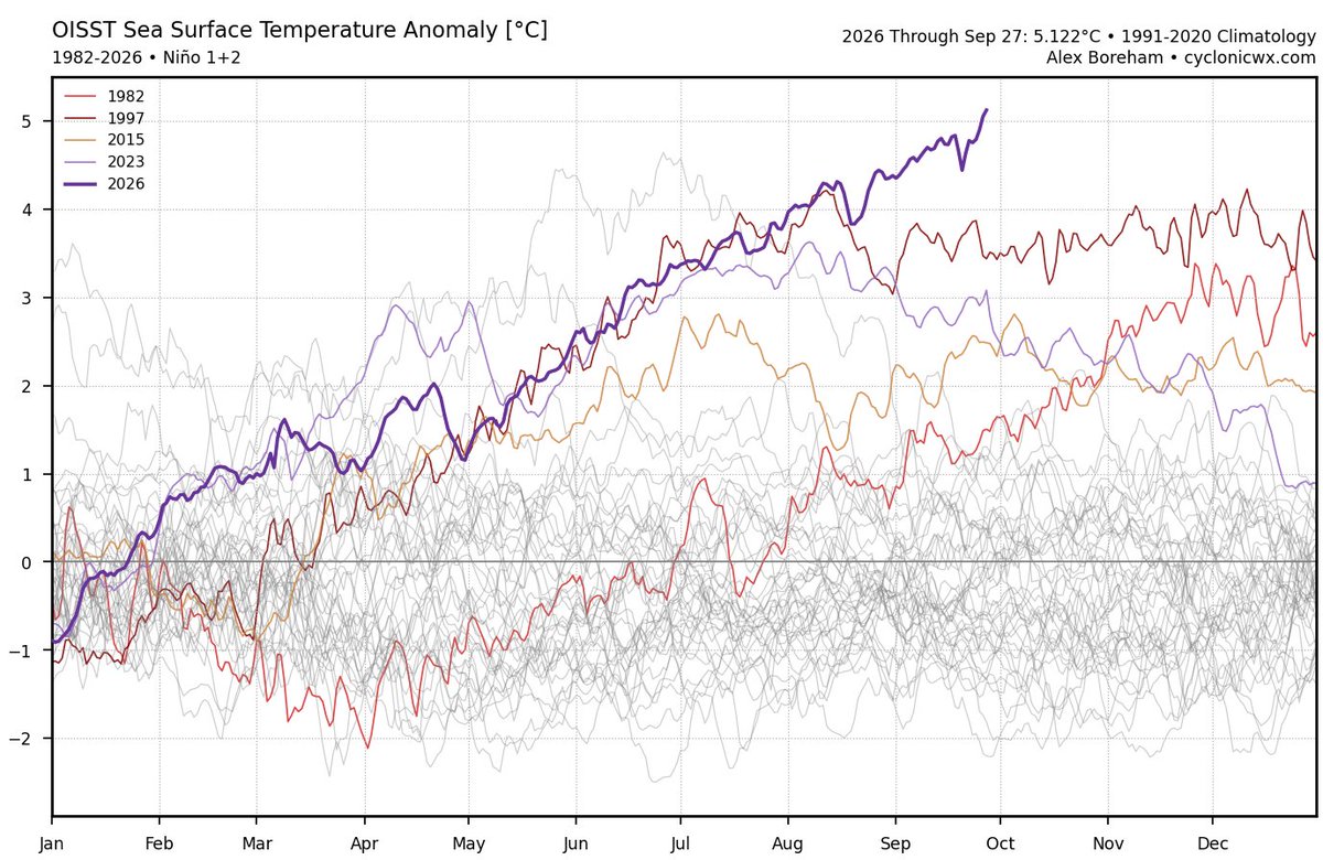
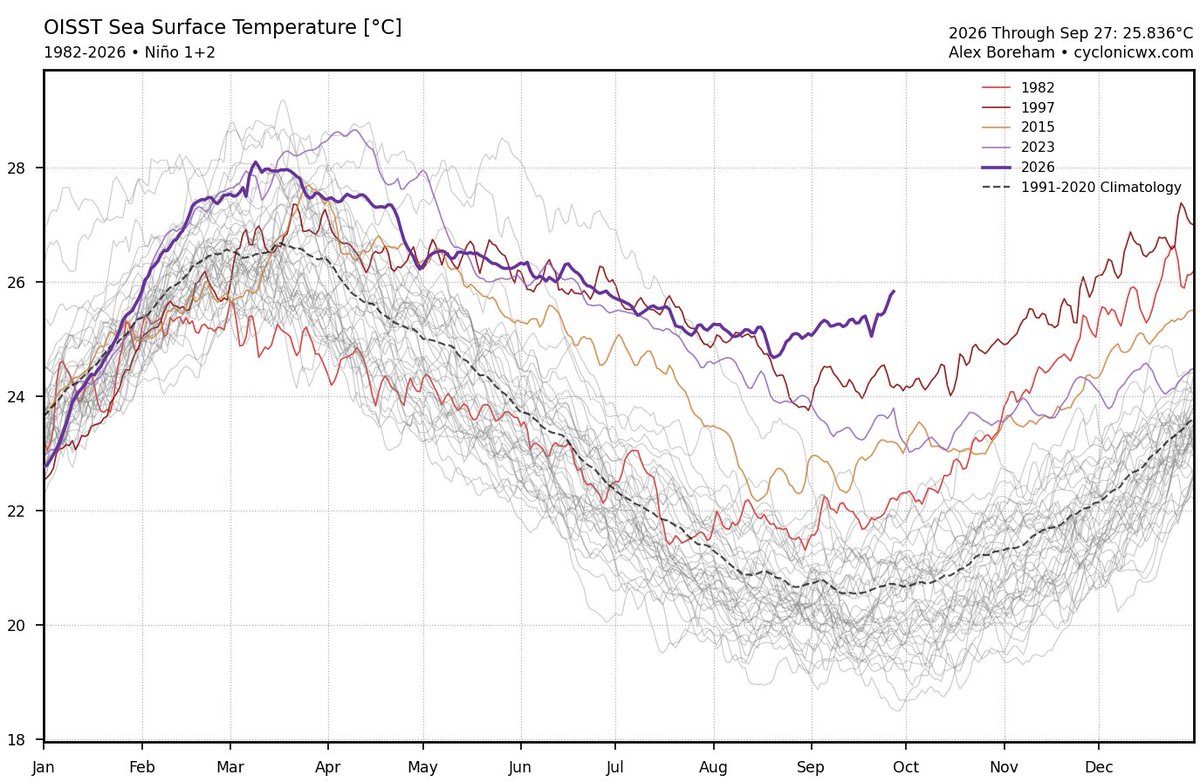
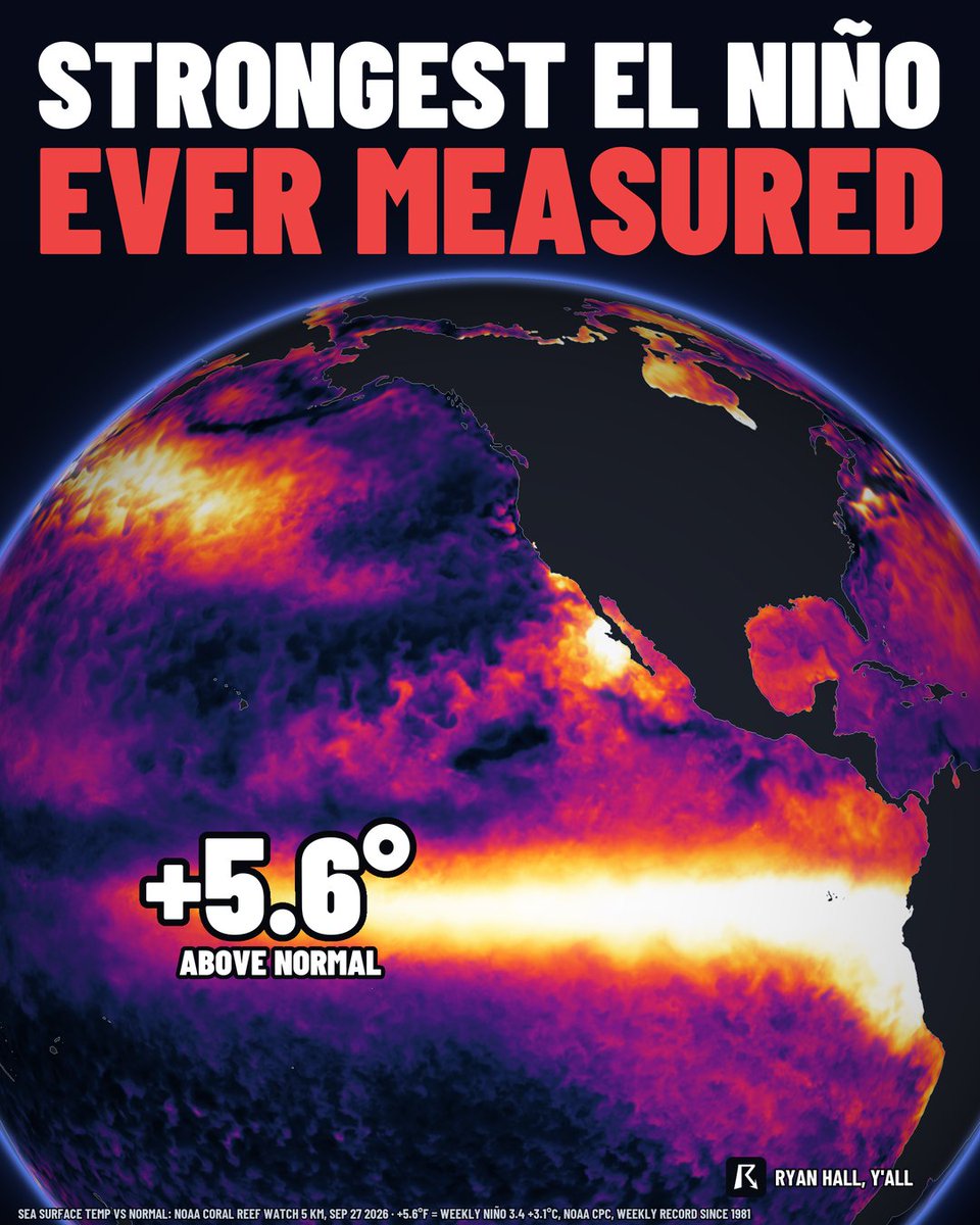
This is now the strongest El Niño reading ever measured.
And it's only September. The big ones usually peak in November or December, so this one will likely keep getting stronger.
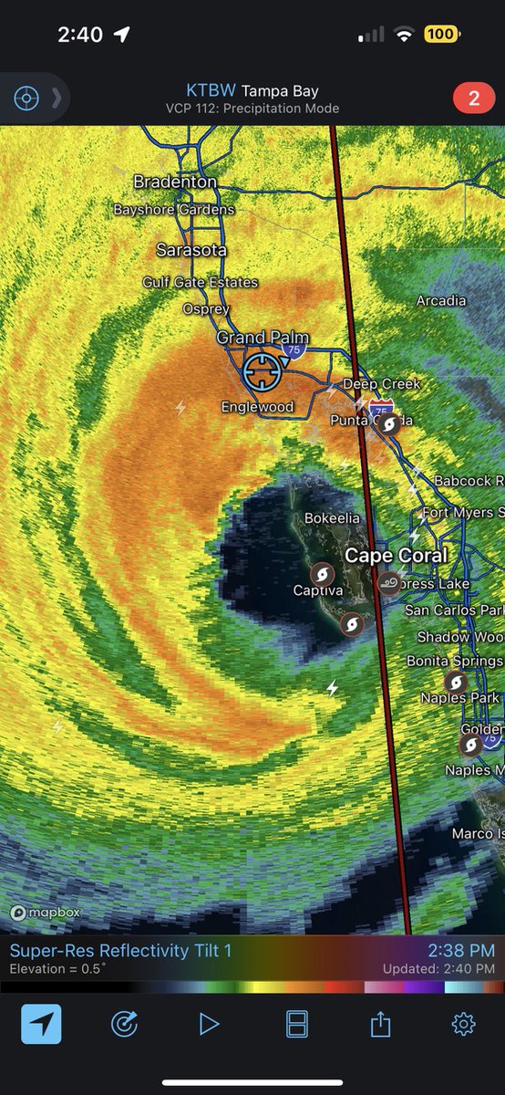
🧵 4 years ago this afternoon, Florida was brought to its knees by the most devastating storm to strike the state since 1935.
This is the story of CATEGORY 5 Hurricane Ian, as it happened in late September of 2022.
Polo, by all indications right now, is about to make a powerful landfall in a rare location for Major Hurricanes in Mexico.
As he gets closer to this dust-swept desert peninsula and swims through even warmer waters, an icy thunderstorm updraft has started to erupt in the N eyewall quadrant, spiking to temps of -126 F (-88 C).
This persistence of very cold and uniform convection is not only increasingly the likelihood of Major Hurricane-force winds translating to the surface, but it’s also likely to exacerbate rainfall rates.
Since records began, only one Major Hurricane has hit Mexico’s Pacific coast at a more northerly latitude than where Polo is set to land. That was Hurricane Olivia in 1967, and she hit Baja California Sur from the Sea of Cortez (rather than from the open ocean like this).
Through the weekend, Hurricane Polo moved northward along the southwestern coast of Mexico.
The storm is expected to make landfall on the west coast of the Baja California Peninsula this evening.
4 Years ago, I woke up to what, honestly, remains one of the most terrifying radar images I've ever seen. Little did I know, one hurricane was about to change my my outlook on tropical meteorology, and my passion for this gorgeous stretch of coastline I call home, forever. #HurricaneIan
@iJailbreak10@LuftkoppTim Image 1 is a typo, grow a pair of balls and admit you’re bitching just to bitch.
Image 2-4 were leaks, so obviously nothing was 100% confirmed. Quit embarrassing yourself 🥀
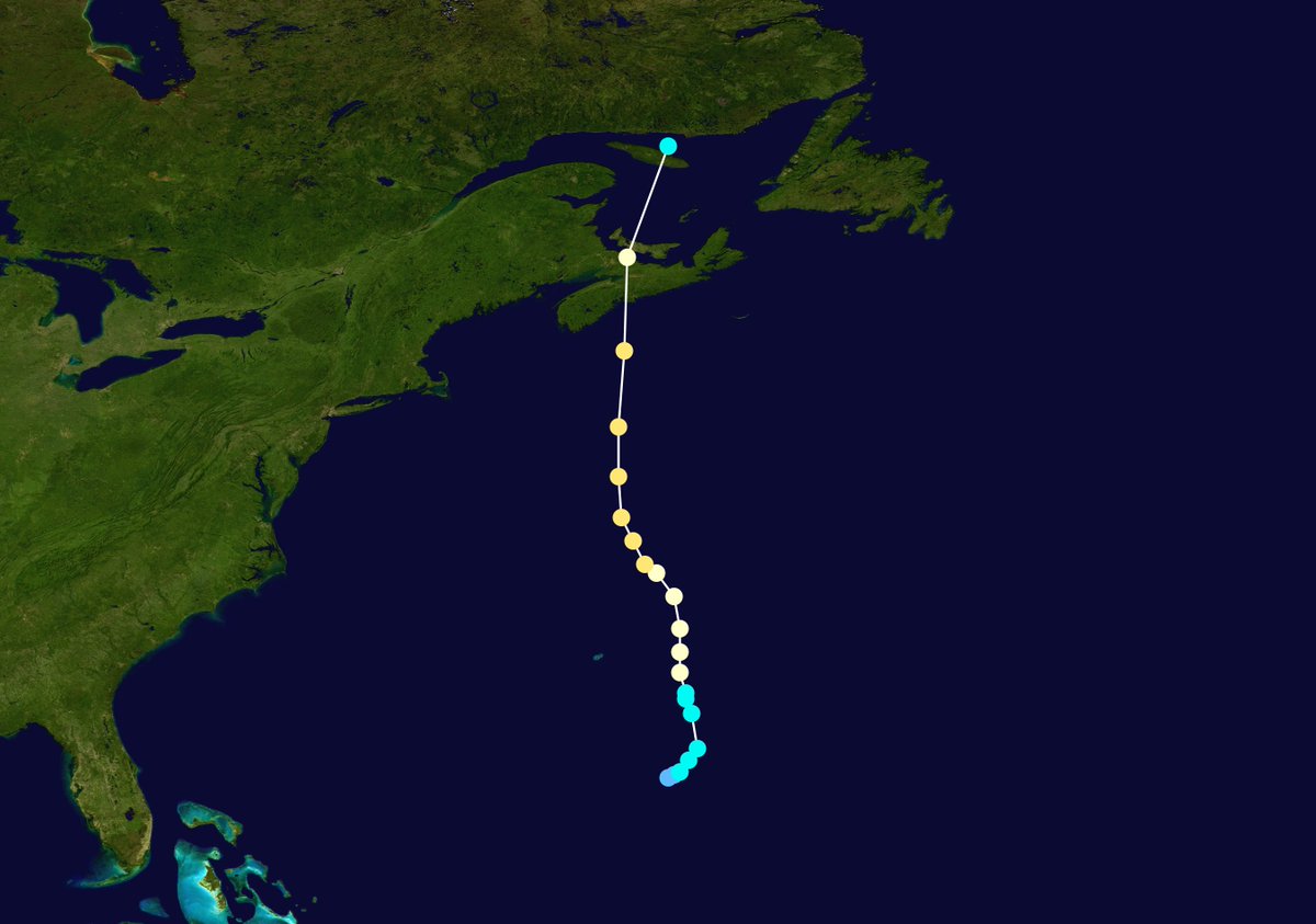
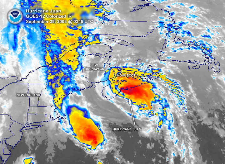
September 28, 2003:
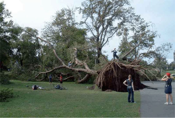
Hurricane Juan made landfall in Nova Scotia as a Category 2. The storm was the worst tropical cyclone to impact Atlantic Canada in over a century. Juan knocked out power to 300,00 residents, caused $200 million in damage, and killed eight people.
#wxhistory