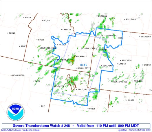
🚿 An anomalously moist atmosphere for this time of year is moving into the region. Expect showers and storms each day through Thursday. Storms could produce locally heavy rainfall and flash flooding, so a Flash Flood Watch has been issued. @idwx
Looking at satellite, you may notice a milky white color across Idaho. This is wildfire smoke from multiple wildfires burning within the state. This smoke is expected to expand south throughout the day and bring hazy skies, and even reduced visibilities.
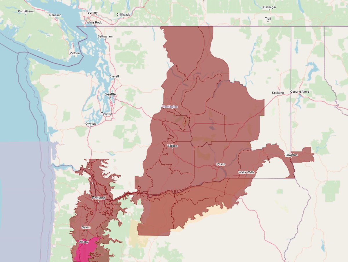
EXTREME HEAT WATCH FOR CENTRAL WASHINGTON INTO NORTH CENTRAL OREGON UNTIL TUESDAY EVENING‼️
WHAT TO EXPECT: Dangerously hot conditions with high temperatures of 95 to 105 degrees possible. This will pose a major to extreme risk of heat-related illness.
#wawx#orwx
Isolated showers and thunderstorms have formed this afternoon and were moving NE around 20 mph. And because a picture is worth a thousand words, and a loop even more...here ya go. 😉
📡 Radar 5:20PM MDT: Storm activity has increased over the last two hours, with radar estimated hail sizes up to half an inch in SE Oregon. We are continuing to monitor for thunderstorm outflow gusts, which could be as high as 55-65 mph. #idwx
🌩️Showers and weak thunderstorms are moving across the area this morning. Check out the latest precipitation totals from this morning (About 0.35" in Burns, OR!) and the latest radar. We expect showers with stronger thunderstorms early this afternoon into the evening!
Flash Flood Warning issued for Pocatello area. Between a quarter to three quarters of an inch of rain have fallen per @NWSPocatello.
If you see flooded roads, turn around, don’t drown.
#wx#idwx#flood