Watching a storm undergo explosive cyclogenesis is truly one of the most spectacular meteorological processes to witness. Éowyn has just proven this once again.
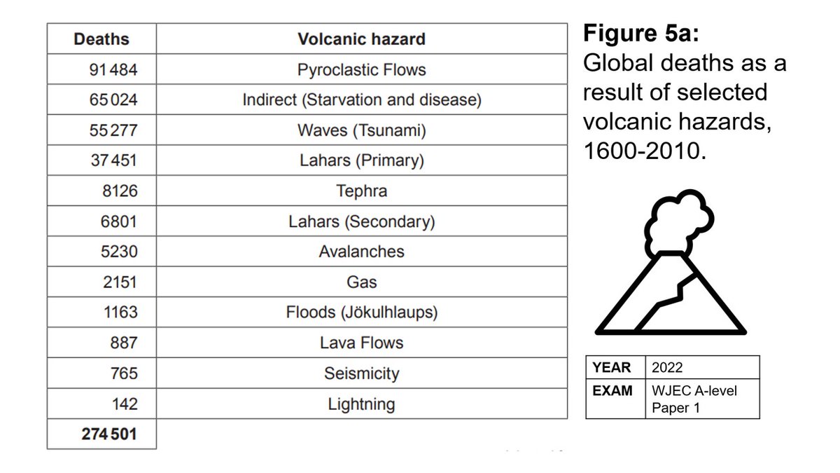
Volcano dangers: This data table helps address the misconception that lava flows are the key risk. As shown here in a past A-level exam, pyroclastic flows are far more significant. In shared exam figures folder - link above. Credit: WJEC. #teachers#geography#geographyteacher
Discover the functions of drainage basins with this great segment from "The drainage basin system" on
@timeforgeog with @esriuk@RssHydro@UWE_GEM
https://t.co/RLcuTtaCrJ
Check out our geography trips: https://t.co/o10h84Sdw0
#Geographyteacher
#HowIUsedGISToday
Check out this excellent GIS app that allows you to explore in 3D the Wadati-Benioff zone & other seismic patterns in the mantle. Could be used either as teach from the front by pupils. Hour of endless fun with this GIS app!
https://t.co/t1t3TpjblT
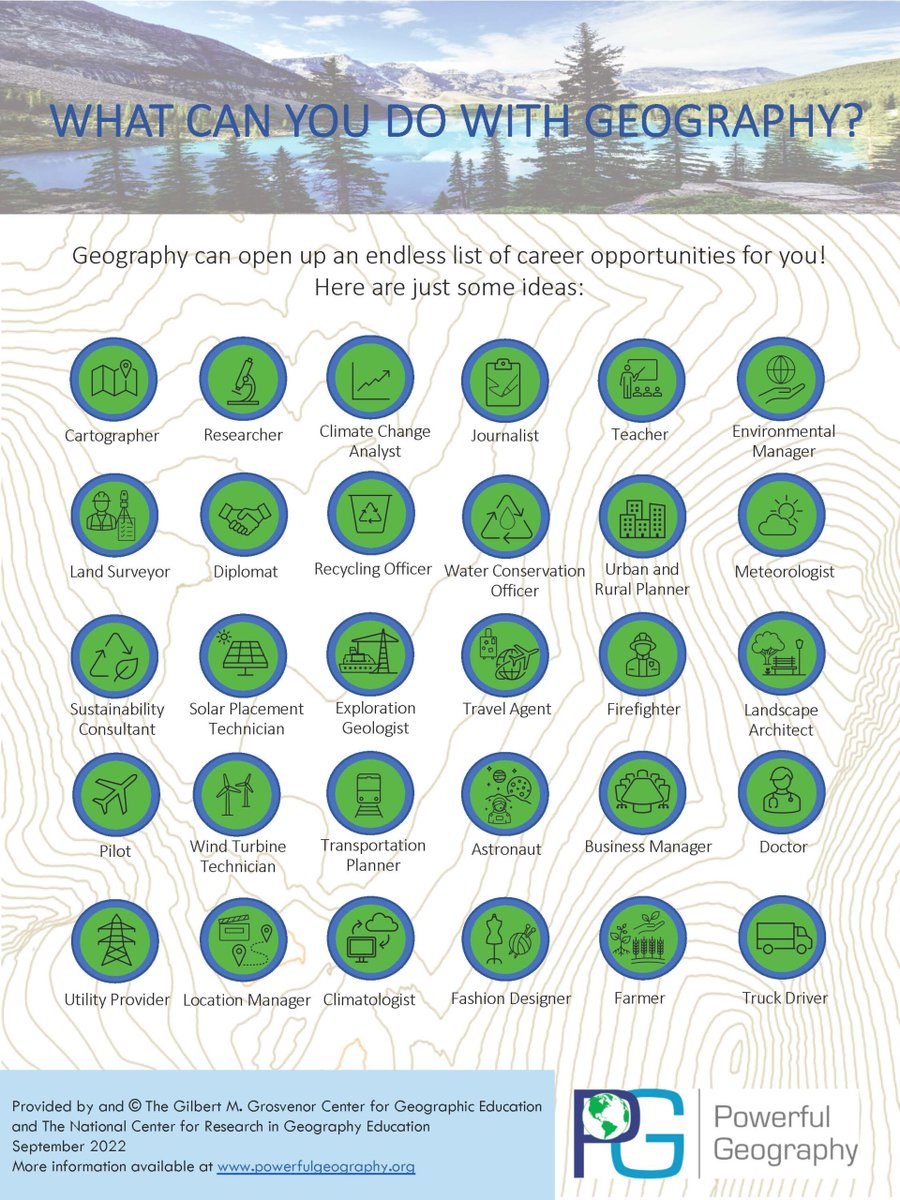
Studying geography can open up an incredible range of careers to your students. Check out this infographic from @PowerfulGeoUSA to inspire your students' career options. You can find out more on their website: https://t.co/86zyB0wgEX #geography#geographyteacher
A little bit of geo-art tonight. If you fancy a 3D sliced view of a depression, coloured to reflect the Pm and Tm air masses, then this is what you're looking for!
⭐️ lesson with YR8 exploring tropical diseases, locations at risk of malaria & factors which contribute to its spread
We kicked off the lesson which a ‘think outside the box’ challenge Q - if disease was an animal, what animal would it be and why? #geographyteacher@greenbankhs
Infrared satellite imagery from Himawari-9 shows the powerful explosive eruption of Indonesia's Ruang volcano this evening.
Ash plume reached +60,000 feet high.
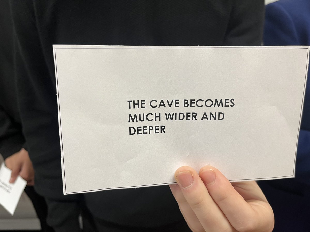
Well done to 5C Higher Geography who were able to chronologically organise them to explain how a stump is formed in the headland! Even better- achieved in 1 minute 40 seconds! @DalzielHigh@DLSocialSubs
How does width of a river channel change downstream?
Data from 6 sites retro-fitted into @ArcGISSurvey123. Great for the non-attendees and a brilliant basis for further inquiry and discussion.
No devices needed. Teach from the front resource 👍
#geographyteacher
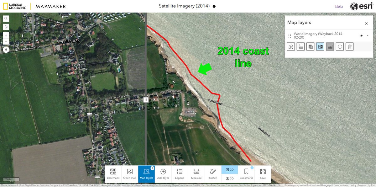
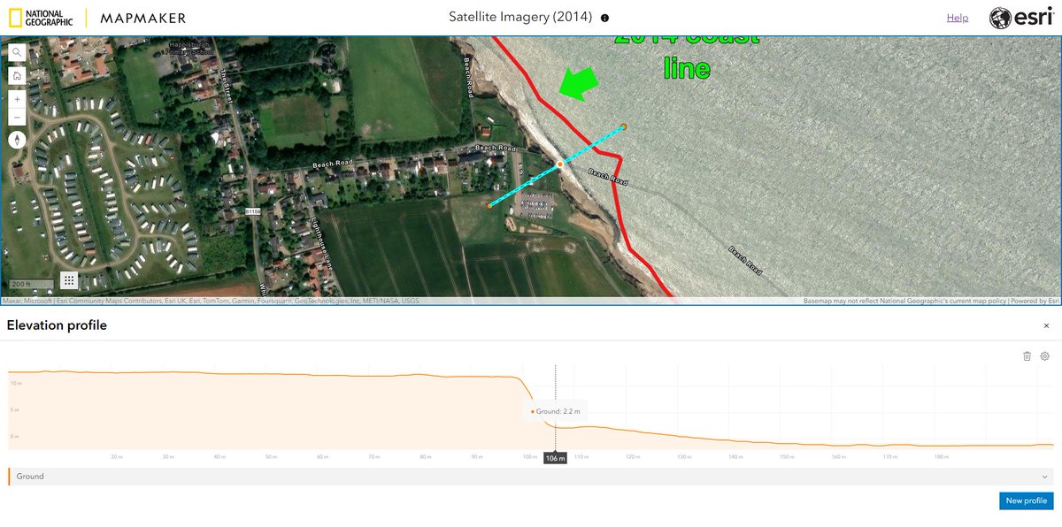
Understanding how landscapes change can be a difficult task. National Geographic MapMaker has simple tools to help with this.
Historic imagery, Sketch + Measure tools to quantify the change and elevation profile tools for visualisation #geographyteacher https://t.co/GfWUFcJNnC