Your trusted knowledge source for all things geospatial. We delve into tech convergence and pivot to Industry 4.0 via Digital Transformation and Sustainability
There are speculations of a possible merger between @SpaceX and @Tesla, which @ElonMusk has tentatively termed 'a good idea'.
The reason being cited is Superintelligence and AI Singularity. In 2005, futurist Ray Kurzweil predicted a singularity where humans merge with machines.
Today’s scramble is about machines that improve themselves via a consistent feedback loop.
Satellite imagery, real-time actionable insights and the broader Earth intelligence stack powered by the geospatial ecosystem will be crucial for this decisive shift.
Watch the video:
IN-SPACe has selected six Indian space startups and MSEs under the AI INSPIRED Seed Fund Scheme. Each will receive up to ₹1 crore in grant-in-aid, from a total of ₹6 crore.
AgniKul Cosmos, Digantara, Eon Space Labs, OrbitAID Aerospace, Omnipresent Robot Tech and TakeMe2Space will build AI for precision landing, space object evaluation, debris detection, on-orbit servicing, target recognition and spacecraft autonomy. Foucault and Akashaveda Technologies receive mentorship and access to IN-SPACe and ISRO facilities.
Geospatial World congratulates all eight enterprises. Swipe through to see what each one is building.
#INSPACe #SpaceTech #AIinSpace #IndianSpaceSector
The 2026 Nobel Prize in Economic Sciences has been awarded to Robert E. Hall and Michael Woodford for 'Microeconomic Foundations of Macroeconomic Stabilization.'
Their models help central banks respond to supply and demand shocks. As per the @NobelPrize, on the basis of these models, well-timed fiscal and monetary policy measures can reduce the economy’s peaks and troughs.
Geospatial data turn theory into practice, mapping shipping bottlenecks, factory idleness, and retail foot traffic as shocks unfold.
Combining macroeconomic stabilization policy with Geographic Information Systems (GIS) allows governments to observe the highly uneven geographical distribution of economic distress.
Geospatial mapping is a real-time proxy for consumer demand, giving policymakers immediate insight into whether a localized shock is altering household spending behavior.
@Stanford@Columbia@riksbanken
#NobelPrize #Geospatial #Economics #GIS
#GSI2026#Announcement | We're delighted to welcome @suhoratech back to GeoSmart India 2026 as an exhibitor!
Amit Kumar, COO & Co-Founder, Suhora shares his thoughts ahead of the event:
India's geospatial future demands more than data - it demands intelligence that's actionable, scalable, and built for the ground. Suhora is shaping that future with multi-intelligence solutions designed to create real-world impact, and the team is looking forward to meaningful conversations with those building what comes next.
Join us at GeoSmart India Conference & Expo, 16-18 December 2026, Bharat Mandapam, New Delhi, and explore what Suhora Technologies brings to India's geospatial ecosystem.
📅 16-18 December 2026
📍 Bharat Mandapam, New Delhi
Register Now: https://t.co/PhRaC6CqCa
#GeoSmartIndia2026 #GeoSmartIndia #Geospatial #EarthObservation #SpaceTech #Exhibitor #Suhora
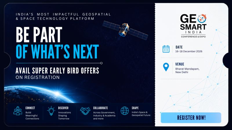
Be among the first to secure your place at GeoSmart India 2026 - India's most impactful geospatial and space technology platform.
Join industry leaders, government representatives, innovators, startups, academia, and technology providers for three days of insightful discussions, breakthrough innovations, and unparalleled networking opportunities.
📅 16–18 December 2026
📍 Bharat Mandapam, New Delhi
#GeoSmartIndia2026 #Geospatial #SpaceTechnology #GIS #DigitalTwins #EarthObservation #Innovation #GeoAI #Networking #Conference #NewDelhi
[Presentation]
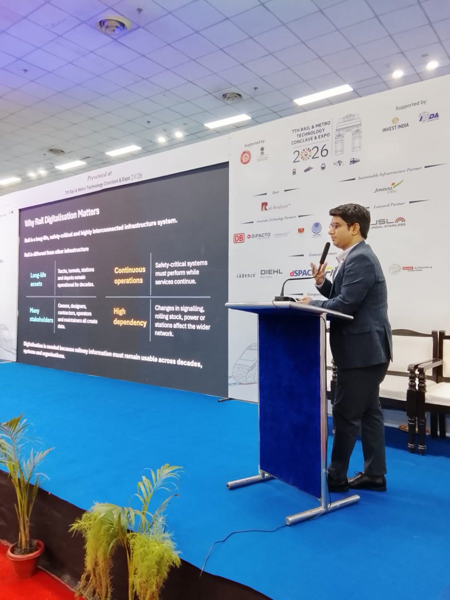
Shri Ankur Vyas, Associate Director, Infrastructure and AEC, Geospatial World, to speak on Digital Railways for a Connected India - Global Practices, India’s Progress and the Path to Lifecycle digitisation at #RMT2026, New Delhi
#RailAnalysis#Expo#Rail#Metro
We're excited to announce that VibeGeo Technologies Pvt. Ltd. will be exhibiting at #GeoSmartIndia2026!
VibeGeo delivers advanced solutions in LiDAR, Photogrammetry, Satellite Imagery, GIS & 3D Infrastructure Design to enable smarter planning and decision-making.
📍 Booth B54
📅 16–18 Dec | Bharat Mandapam, New Delhi
#Geospatial #GIS #LiDAR
#GSI26 | Welcome Geomaticx Scientific Technology Services Pvt. Ltd. to #GeoSmartIndia2026!
We're pleased to have Geomaticx join us as an exhibitor. Visit Booth B26 to explore their expertise in GIS, Remote Sensing, LiDAR, Drone Mapping, Web GIS, and AI/ML solutions, and connect with the team.
📍 Booth B26
#Geomaticx #GIS #Geospatial #LiDAR #DroneMapping #AI
#ExhibitorAnnouncement | Spry Technocon Pvt. Ltd.
We're delighted to welcome Spry Technocon Pvt. Ltd. as an exhibitor at GeoSmart India 2026!
SPRY India empowers heavy and highway contractors, infrastructure developers, and marine technology users with innovative solutions that improve accuracy, optimize workflows, and reduce project costs. Its portfolio includes advanced machine control systems, Site Positioning Systems, and Construction Asset Management Services, enabling greater efficiency across construction and infrastructure projects.
In the marine sector, SPRY delivers cutting-edge technologies for precise ocean wave measurements, even in deep-water and remote environments. With a strong presence across Western and Southern India, the company continues to drive smarter, technology-led solutions for critical infrastructure and marine applications.
📍 Visit Booth B25 to discover how SPRY India is helping industries Speed Up, Scale Up—with Precision and Knowledge.
📅 16–18 December 2026 | Bharat Mandapam, New Delhi
#GeoSmartIndia2026 #SPRYIndia #ConstructionTechnology #MachineControl #SitePositioning #MarineTechnology #Infrastructure #Geospatial #Innovation #SmartConstruction
#ExhibitorAnnouncement | @giskernel
We're excited to welcome @giskernel as an exhibitor at GeoSmart India 2026!
GISKernel is driving global geospatial innovation with cutting-edge GIS and GeoAI solutions deployed across 25+ countries. Its flagship no-code GeoAI platform, SpatioSynth, is transforming disaster recovery by enabling automated debris mapping, compliance-ready documentation, and AI-powered decision-making using aerial and drone imagery—helping organizations reduce time, effort, and costs by over 70%.
With 150+ successful projects, a growing patent portfolio, and global recognition—including the National Startup Awards 2025 and the Geospatial World Rising Star 2025—GISKernel continues to redefine spatial intelligence for disaster management, utilities, and urban development.
📍 Visit Booth #B19 to explore how GISKernel's AI-powered geospatial solutions are shaping the future of smarter, faster, and more sustainable decision-making.
📅 16–18 December 2026 | Bharat Mandapam, New Delhi
#GeoSmartIndia2026 #GISKernel #GeoAI #SpatioSynth #GIS #Geospatial #ArtificialIntelligence #DisasterManagement #UrbanDevelopment #Innovation #SpatialIntelligence
#ExhibitorAnnouncement | @GeoCentroid Pvt. Ltd at GeoSmart India 2026
We're excited to welcome @GeoCentroid as an exhibitor at GeoSmart India 2026!
GeoCentroid is driving digital transformation across the AEC, GIS, and urban and rural planning sectors with innovative geospatial and reality capture solutions. Its expertise spans BIM, Digital Twins, Scan-to-BIM, 3D laser scanning, drone mapping, immersive AR/VR, and geospatial technologies, helping organizations improve planning, design, and asset management with greater accuracy and efficiency.
Serving industries such as infrastructure, utilities, geomatics, and oil & gas, GeoCentroid continues to enable smarter, data-driven decision-making through cutting-edge digital solutions
📍 Visit Booth B18 to explore their latest innovations and connect with the team at GeoSmart India 2026.
📅 16–18 December 2026 | Bharat Mandapam, New Delhi
#GeoSmartIndia2026 #GeoCentroid #DigitalTwin #BIM #GIS #RealityCapture #LaserScanning #DroneMapping #AEC #Geospatial #Innovation
#ExhibitorAnnouncement | @EsriIndia at #GeoSmartIndia2026
We are delighted to welcome @EsriIndia as an exhibitor at GeoSmart India 2026!
For nearly three decades, Esri India has been at the forefront of advancing Geographic Information Systems (GIS) and location intelligence in India. As a leading provider of end-to-end geospatial solutions, the company has empowered more than 6,000 organizations with ArcGIS-powered technologies that enable smarter planning, informed decision-making, and sustainable development.
Esri India's innovative solutions are driving transformation across a wide range of sectors, including land management, utilities, water resources, infrastructure, telecommunications, urban development, smart cities, forestry, disaster management, and natural resource management. With a strong focus on innovation, the company has also developed Indo ArcGIS, a unique solution tailored specifically to meet the needs of Indian users.
📍 Visit Booth #A1 to connect with the Esri India team, experience their latest GIS innovations, and discover how geospatial intelligence is shaping the future of governance, business, and society.
Join us from 16–18 December 2026 at Bharat Mandapam, New Delhi, and explore the technologies and partnerships driving India's geospatial future.
#GeoSmartIndia2026 #EsriIndia #GIS #ArcGIS #LocationIntelligence #Geospatial #DigitalTransformation #SmartCities #Infrastructure #UrbanDevelopment #DisasterManagement #Innovation #GeoTech
#GSI26#Announcement | We are pleased to welcome @garudalytics as a Co Sponsor of GeoSmart India 2026.
The future of geospatial innovation lies in technologies that do more than collect data- technologies that can interpret, predict, and create intelligence that drives real-world decisions.
At the forefront of this transformation, Garudalytics is building next-generation geospatial solutions by combining the power of artificial intelligence, IoT, blockchain, and advanced spatial analytics to solve complex challenges across industries and governments worldwide.
With deep expertise in location intelligence, cloud-based solutions, and advanced geospatial data systems, Garudalytics continues to redefine how organizations transform data into meaningful action.
#GeoSmartIndia2026 #GeospatialTechnology #ArtificialIntelligence #LocationIntelligence #SpatialIntelligence #DigitalTransformation #IoT #Blockchain #FutureTech #InnovationLeadership
#GSI26#Announcement | We are pleased to announce #Aetosky as Co- Sponsor at GeoSmart India 2026.
Aetosky builds intelligence systems that integrate data from multiple sources, including satellite imagery, sensors, and operational systems, and turn it into actionable outcomes using advanced AI.
The company enables governments and organizations to deploy AI models, fuse intelligence across systems, and support real-time decision-making. This enhances situational awareness and closes the loop between data, insight, and action across headquarters and field operations.
Built for mission-critical environments, Aetosky delivers end-to-end, sovereign systems deployable on-premise or within national infrastructure.
#GeoSmartIndia2026 #ArtificialIntelligence #SpatialIntelligence #FutureTech
#GSI26#Announcement | A trusted leader in geospatial technology and location intelligence, Esri India has empowered 6,000+ customers with cutting-edge GIS solutions across infrastructure, utilities, urban development, disaster management, and more.
Proud to welcome @EsriIndia as the Strategic Sponsor for GeoSmart India 2026.
#GeoSmartIndia2026 #GIS #SpatialIntelligence #GeospatialInnovation
#GeoSmartIndia2026 | 𝐌𝐀𝐑𝐊 𝐘𝐎𝐔𝐑 𝐂𝐀𝐋𝐄𝐍𝐃𝐀𝐑. The Geospatial & Space Community Returns to New Delhi.
After another remarkable edition, GeoSmart India returns to New Delhi, bringing together the space and geospatial community once again at Bharat Mandapam for three days of dialogue, collaboration, and technology showcases.
Geospatial intelligence coupled with space infrastructure is reforming the way we perceive and interact with the world. This has made the convergence of both technologies central to the conversations of sovereignty and global development.
As India’s biggest platform for space and geospatial technologies, GeoSmart India 2026 will convene government leaders, policymakers, industry experts, technology innovators, academia, startups, and users from across the ecosystem to explore the future of the sector and the business models redefining it.
16–18 December 2026
Bharat Mandapam, New Delhi
𝐂𝐚𝐥𝐥 𝐟𝐨𝐫 𝐀𝐛𝐬𝐭𝐫𝐚𝐜𝐭𝐬 𝐢𝐬 𝐍𝐨𝐰 𝐎𝐩𝐞𝐧
Interested in sharing your project, research, case study, or success story with the community? Submit your abstract and be part of the conversations driving the future of the geospatial and space industry.
Deadline: 10 September 2026
Click here to Submit: https://t.co/3LIWsNP6qi
𝘙𝘦𝘨𝘪𝘴𝘵𝘳𝘢𝘵𝘪𝘰𝘯 𝘸𝘪𝘭𝘭 𝘰𝘱𝘦𝘯 𝘧𝘳𝘰𝘮 15 𝘑𝘶𝘭𝘺 2026.
#GeoSmartIndia2026 #Geospatial #SpaceTechnology #GIS #EarthObservation #DigitalIndia #Innovation #SpaceEconomy