FIRST drone images of Rota after the devastating impact of Super Typhoon Bavi.
No, this isn’t Guam, this is the small island to the north. Most people don’t know this place even exists and they could really use your help.
@AaronRigsbyOSC@NWSGuam#wxtwitter#typhoon#bavi #marianasislands
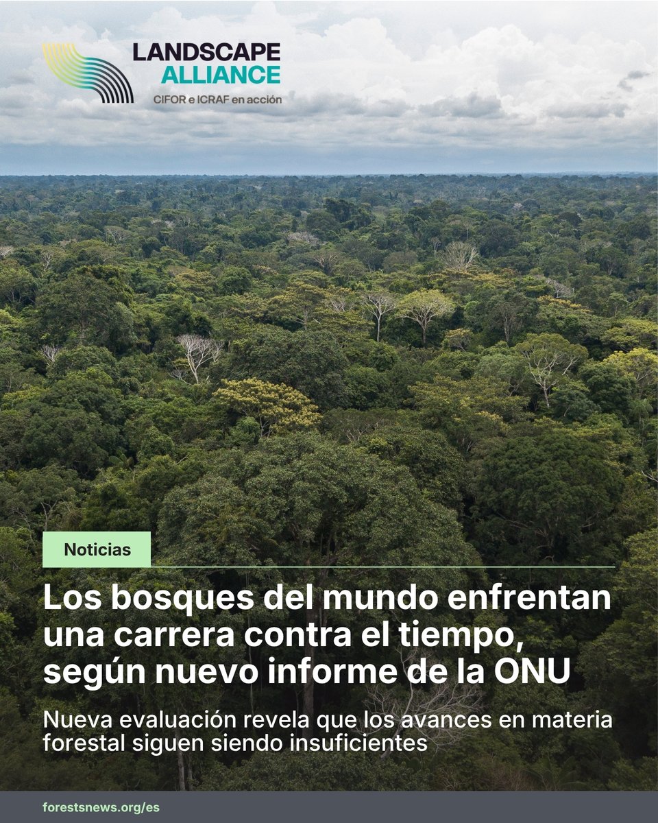
🌳🌎 Los bosques del mundo enfrentan una carrera contra el tiempo.
Entre 2015 y 2025 se perdieron más de 40 millones de hectáreas de bosque.
"Sabemos qué hacer. Pero, ¿tenemos la voluntad para hacerlo?", plantea Éliane Ubalijoro.
🔗 https://t.co/Uilucvr6i4
#LandscapeAlliance
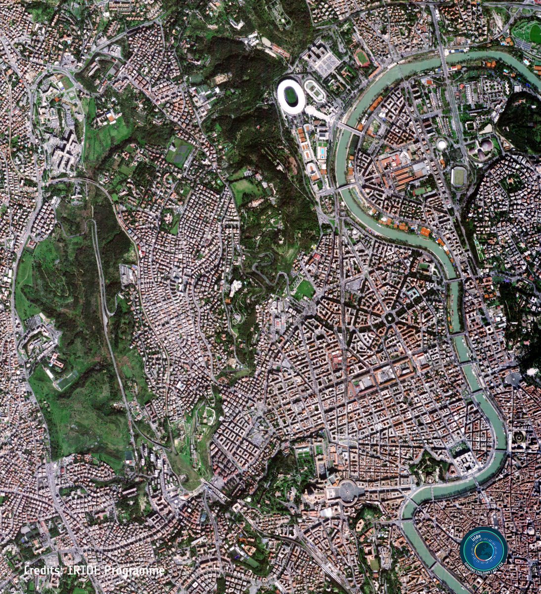
Italy's IRIDE Earth observation constellation just hit 31 satellites in orbit after a successful Falcon-9 launch on May 3. 🛰️🇮🇹
Read more: https://t.co/chxGUMmLAi
Image: ESA/IRIDE - Rome
#Geoawesome#ESA#EarthObservation#IRIDE
GeoLibre v1.10 is now on the Microsoft Store!
Windows users can install GeoLibre with a single click: signed, sandboxed, and auto-updating, straight from the Microsoft Store. No SmartScreen warnings, no manual installer downloads, no hunting for updates.
https://t.co/c2dsROEJ9g
GeoLibre is a free and open-source, cloud-native GIS platform for visualizing, exploring, and analyzing geospatial data, and it runs everywhere you do: in the browser, on the desktop, on mobile, and inside Jupyter notebooks. Your data stays local and private.
GeoLibre works across platforms:
- Windows: Microsoft Store / winget
- macOS: Homebrew
- Linux: AUR, COPR, Flatpak (FlatPark), .deb / .rpm / AppImage
Try it today and let us know what you build. Star the repo: https://t.co/VXq8c1o2Nd
#GIS #OpenSource #Geospatial #MapLibre #GeoLibre #DataScience #Mapping #MicrosoftStore
🟢 Adicción a las redes: demandan a Meta por casi todo su valor en Bolsa
Meta enfrenta un reclamo de 1,4 billones de dólares por presuntamente diseñar Facebook e Instagram para generar adicción entre los usuarios jóvenes y engañar al público sobre la seguridad de sus plataformas. La suma, exigida por los estados de California, Colorado, Kentucky y Nueva Jersey, equivale casi por completo al valor bursátil de la compañía, estimado en unos 1,5 billones de dólares. La cifra, hasta ahora desconocida, surge de documentos judiciales presentados antes del juicio previsto para agosto en California. Meta sostiene que la "adicción a las redes" no es un diagnóstico psiquiátrico establecido.
Por qué cayeron las casas del chavismo tras los terremotos en La Guaira, Venezuela
Escombros es lo que queda de los edificios que eran bandera del plan habitacional impulsado por el entonces presidente Hugo Chávez.Una veintena de complejos fueron construidos por el propio Estado venezolano, y otros por países aliados como China, Rusia e Irán. Hoy, de ellos no queda sino una montaña de escombros. El doble terremoto los derrumbó en segundos. ¿Por qué? DW pregunta a expertos en urbanismo en Venezuela.
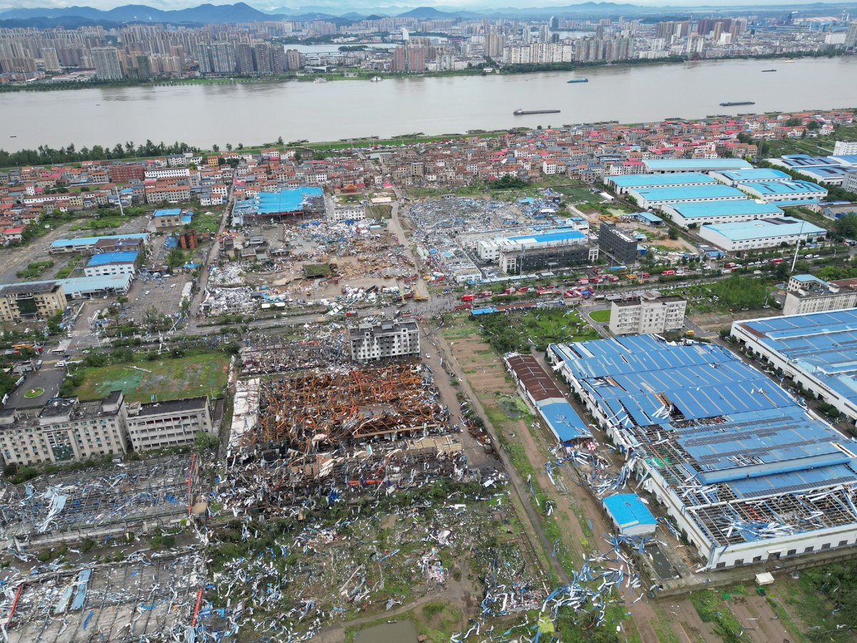
Daylight reveals the horrific aftermath of the intense tor in Huanggang, Hubei Province last night. The tor picked the deadliest path directly thru the city center, entire rows of bricks homes severely damaged or destroyed, cars tossed. Local authorities confirmed 9 fatalities.
Cómo 11 millones de teléfonos se convirtieron en un sistema de alerta sísmica
Cuando dos fuertes terremotos sacudieron #Venezuela, la tecnología basada en colaboración masiva hizo lo que la infraestructura nacional no pudo. Esta es la historia.
#DWDigital#DWMagacines
Another high-quality home vid shot during the Huanggang tor. Cameraman shot the whole meso from the beginning, and watched tor closing in step by step. Notice the strange light orbiting around tor around 00:05, as I've mentioned earlier in previous post, I think that was a car...
👩🏻💻 Un rastro digital vincula a un diputado con la creación de una universidad de cartón.
⚠️ La universidad no tiene aulas ni estudiantes, pero sí puede tener voz y voto en decisiones políticas importantes del país.
@jeanellydvg te cuenta más. 🔍
🌪️ Çin’den yeni görüntüler
Hollywood filmi değil, gerçek.
-Dünyamız bize 🆘 veriyor.
6 milyonluk bir metropolün ortasında bu büyüklükte bir tornado oluşması gerçekten çok nadir. Yüzlerce tornado görmüş olabiliriz ama bu başka seviyede…
Şu ana kadar en az 5-8 kişi hayatını kaybetti, yüzlerce yaralı var. Hasar da oldukça büyük.
Küresel denge bozuluyor gibi görünüyor.
İleride Paris’te, Madrid’de, Ankara’da ya da Berlin’de benzer sahneler görecek miyiz?
bu tür olaylar artacak mı?🤔
#hortum #tornado #GlobalWarming #ClimateChange #龙卷风
La final de la Copa Mundial de la FIFA (19 de julio de 2026) Estadio MetLife.
Fotografía tomada el 17 de abril de 2022 con una cámara digital Nikon D5 y una distancia focal de 1150 milímetros / Programa de la Estación Espacial Internacional.
Access Free High-Resolution Disaster Satellite Imagery in Your Browser
Explore high-resolution disaster satellite imagery directly in your web browser with GeoLibre, an open source web GIS application. In this tutorial, you'll learn how to install the Vantor Open Data plugin, search disaster events, visualize pre and post event imagery, and download original imagery for further analysis.
The plugin provides seamless access to Vantor's cloud-hosted disaster imagery on AWS without requiring any GIS software installation or manual data downloads. New disaster events become available automatically as they are published through the STAC catalog.
In this video tutorial (https://t.co/Mm8ZvVvUN3) , you'll learn how to:
- Install the Vantor Open Data plugin in GeoLibre
- Browse available disaster events
- Search pre and post event satellite imagery
- Visualize high-resolution imagery instantly
- Identify disaster impacts
- Download original Cloud Optimized GeoTIFFs (COGs)
- Share interactive GeoLibre maps with others
Resources
- Launch GeoLibre Web: https://t.co/8gMtkVtfnm
- GeoLibre GitHub:https://t.co/VXq8c1o2Nd
- Vantor Open Data Plugin: https://t.co/kpUPpY9IBt
- Vantor Open Data Program: https://t.co/KJhhiwkCcf
#GeoLibre #GIS #RemoteSensing #SatelliteImagery #DisasterResponse #MapLibre #OpenSource #Geospatial
Christchurch lost 14.5% of its urban tree cover in 5 years. A new study mapped exactly where - down to individual properties - using LiDAR, imagery, and AI. 🌳🛰️
Read more: https://t.co/e1oVQNJqFw
#Geoawesome#UrbanForestry#LiDAR#GeoAI
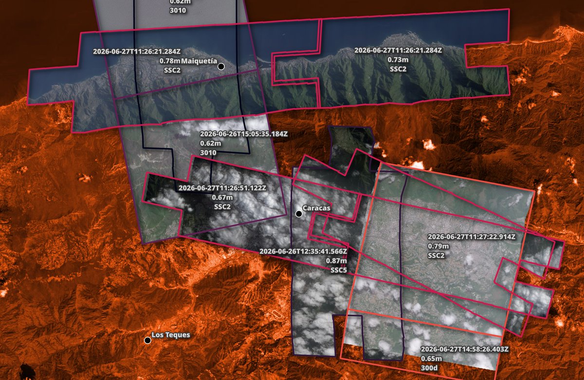
Planet Labs has published 62-87cm imagery from eight of their satellites of the aftermath of the Venezuela earthquake. The imagery was captured between the 26th and the 28th. There is historic imagery as well.
Details: https://t.co/qvyd1lAkhC
La comunidad de @hotosm está trabajando en el mapeo de edificios destruidos por el reciente terremoto en Venezuela: https://t.co/uQOfyxPJCJ
Más sobre HOTOSM aquí 👉 https://t.co/ZJB8DioFSo