Generic prepping (food, guns, solar) is incomplete. Your county has a unique fingerprint.
We scored every county in America for real preparedness using public data.
Most people are prepping for the wrong threats.
Here’s what actually matters where you live 🧵
Arizona's first tornado watch in 16 years — and the tornado isn't the main risk. 🌩️
Wednesday: golf-ball hail and a 72 mph gust in Flagstaff, a likely tornado in Heber-Overgaard, a record flood on Moenkopi Wash (33.5 ft — flood stage is 27). More rain today; Flood Watch til 11pm MST.
The ground truth for Flagstaff, from the Get Ready local intelligence platform:
💧 #1 hazard in Coconino County is inland flooding — $86M/yr in FEMA-modeled losses. Downtown itself sits in Flood Zone AE.
🔥 #2 is wildfire ($29M/yr) — and rain on burn ground becomes the flood path.
🚗 Flagstaff's outflow runs west — Bullhead City, Lake Havasu, rural land. Not south into Phoenix: same Flood Watch. Median fuel stall, 80 mi.
Know your ground before it's on the news.
Sources: NWS Flagstaff · Fox Weather · azcentral · AP. Data: Get Ready Area Study, Flagstaff AZ (FEMA · USFS · USGS).
Your county next? Drop it in the comments 👇
#Arizona #Flagstaff #flashflood #preparedness #weatheraware
@sdut Flock gets the headlines, but most of the plate readers in San Diego aren't Flock. Public mapping data counts 596 within 10 miles of downtown, the bulk from other makers. Worth knowing what this vote does and doesn't change.
@ZackGianino@MayorToddGloria Dropping Flock is one contract. Within 10 miles of downtown San Diego, public mapping data shows 596 license plate readers, and most are made by other companies. Those stay up after this vote.
@mattvanswol Flock is taking the heat, but it isn't the only company watching Richmond. Public mapping data shows 307 license plate readers within 10 miles of downtown, and only about half match Flock's hardware. Here's where they all sit.
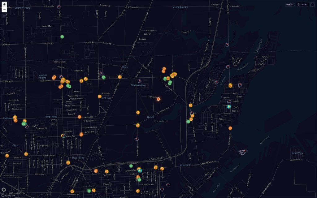
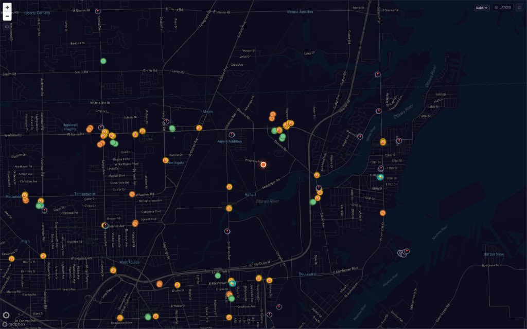
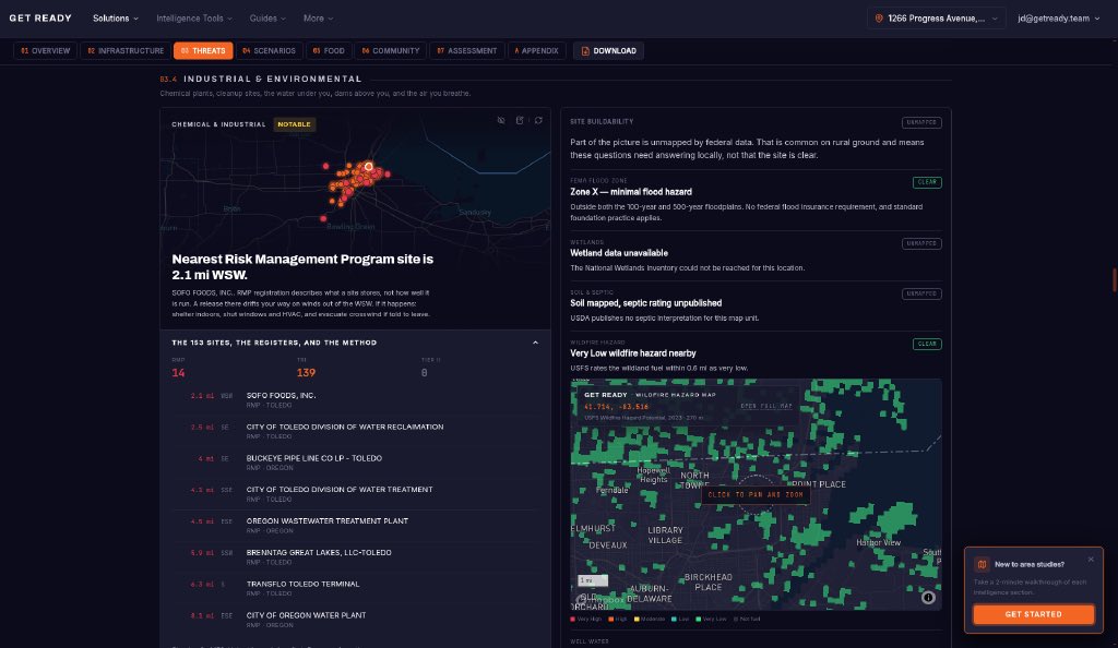
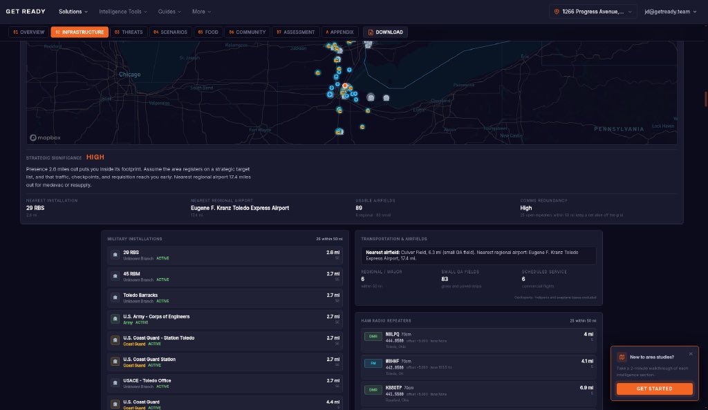
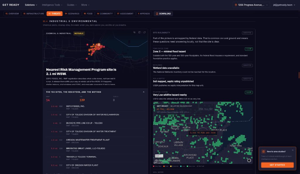
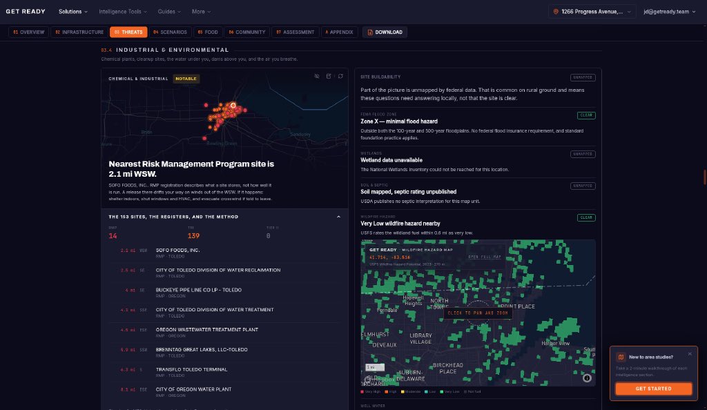
What sits within a few miles of the Progress Ave tank, per federal data: Toledo's water reclamation plant (2.5 mi), water treatment plant (4.1 mi), Buckeye Pipe Line (4 mi), Oregon's wastewater plant (4.5 mi). 153 chemical-reporting sites in the wider area. Check yours.
Toledo's 3-mile shelter-in-place is lifted, but the next one may not give warning. What it means: stay inside, close windows and doors, turn off fans and HVAC that pull in outside air, keep pets in. Fog and a plume look the same, so don't judge by the sky.
@NewsHour Update: Toledo has reduced the evacuation to a half mile and lifted the 3-mile shelter order. Nearby, federal data maps the city's water reclamation plant 2.5 mi and water treatment plant 4.1 mi from the site, both under EPA's Risk Management Program.
@BabyD1111229 Different scale from East Palestine: this was one ~5,500-gallon tank (EPA). Evacuation is now a half mile, shelter order lifted. The irritant causes eye, nose and skin burning and headache or nausea; anyone with symptoms should rinse and call a doctor.
@honeyybomb On the water question: per EPA facility data, Toledo's water treatment plant is 4.1 mi SSE of the Progress Ave site, and the reclamation plant 2.5 mi SE. No water impact has been announced. Health questions: Toledo-Lucas County Health Dept, 419-213-4100.
@Brushbeater Check out our local intel platform to assist with your Fifty Mile plan. You can plan get home routes, map your cache locations and see what infrastructure + choke points exist on the way out https://t.co/RzhU54w5FS
@ZachBitango For anyone mapping exposure: the nearest EPA risk-program sites to the Progress Ave spill are SOFO Foods (2.1 mi WSW) and Toledo's water reclamation plant (2.5 mi SE). Oregon's wastewater plant is 4.5 mi ESE.
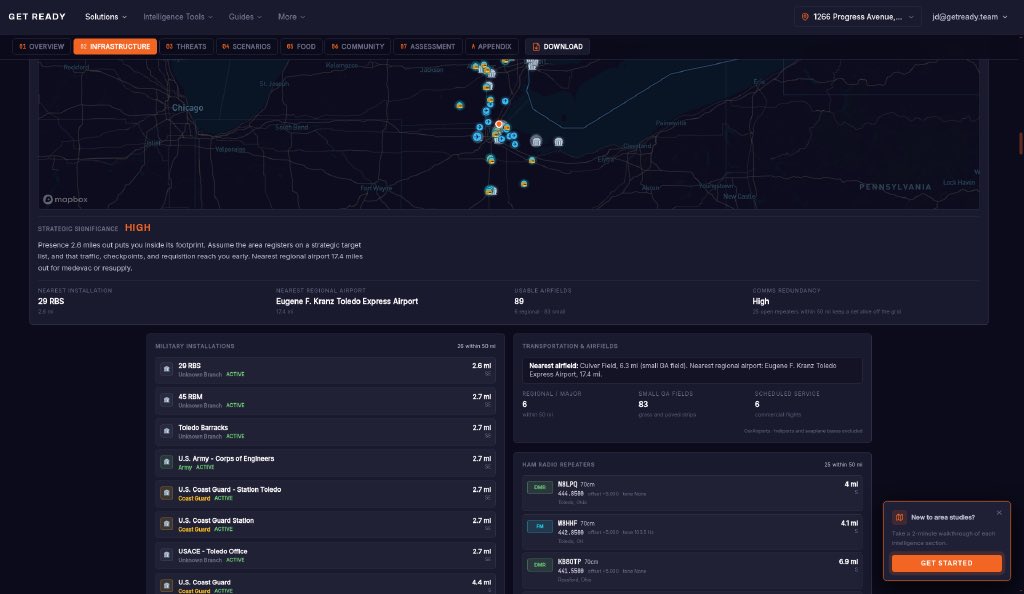
@ElectionWiz Some local context: the spill site sits in an industrial corridor. 153 chemical-reporting sites are mapped in the wider area, and Coast Guard Station Toledo and the Army Corps' Toledo office are about 2.7 miles SE.
@toledonews For North Toledo residents: the nearest Superfund site to the Progress Ave spill is a closed cleanup 8.2 miles NW. The closer neighbors are EPA risk-program facilities, including the city's water reclamation plant 2.5 miles SE.
@WTOL11Toledo Mapped what sits around the Progress Ave site: Toledo's water reclamation plant (2.5 mi SE) and water treatment plant (4.1 mi SSE) are both EPA Risk Management Program facilities. The site itself is in FEMA flood zone X.
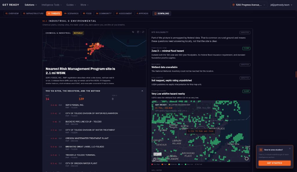
@ZachBitango What's inside a few miles of the spill site, per federal data: Toledo's water reclamation plant (2.5 mi SE), Buckeye Pipe Line's Toledo facility (4 mi SE), and the city water treatment plant (4.1 mi SSE).
@Local12 What's inside a few miles of the spill site, per federal data: Toledo's water reclamation plant (2.5 mi SE), Buckeye Pipe Line's Toledo facility (4 mi SE), and the city water treatment plant (4.1 mi SSE).
@CBSMornings Context on the area around the Progress Ave site: 153 chemical-reporting facilities are mapped in the wider area, 14 of them under EPA's Risk Management Program. Two are Toledo's own water plants, 2.5 and 4.1 miles away.
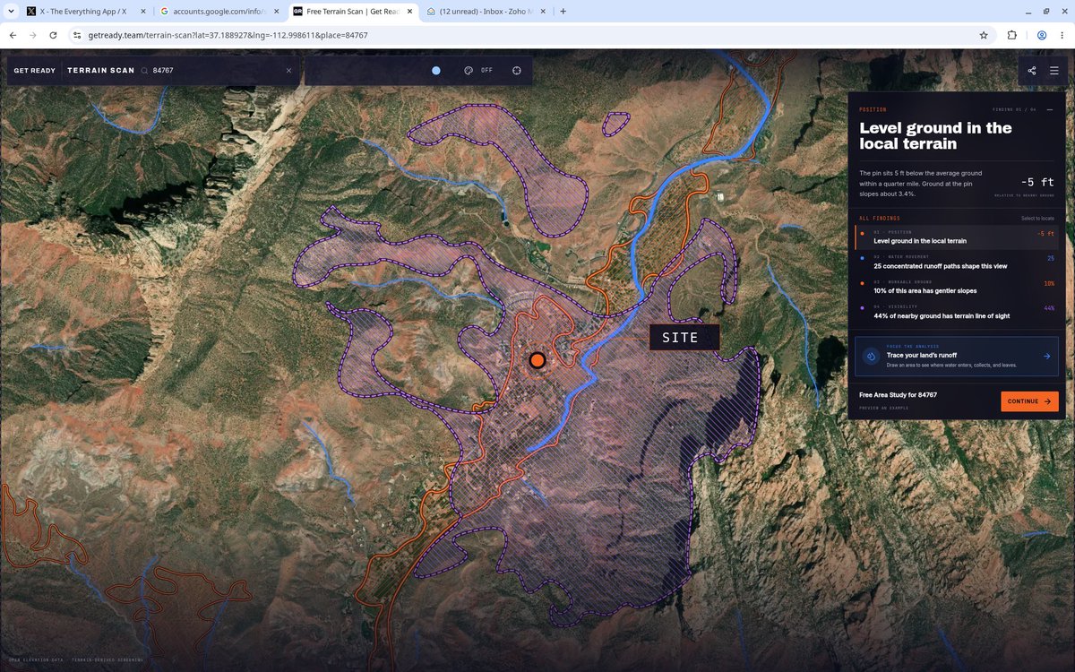
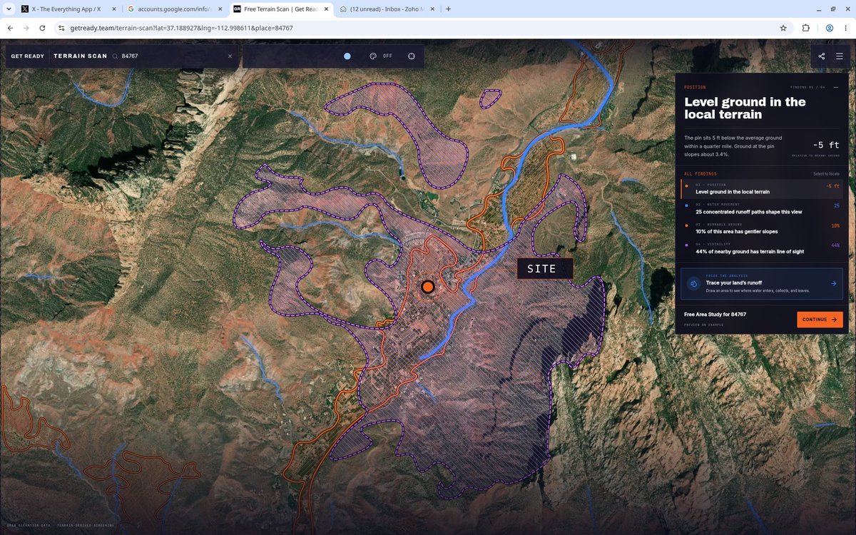
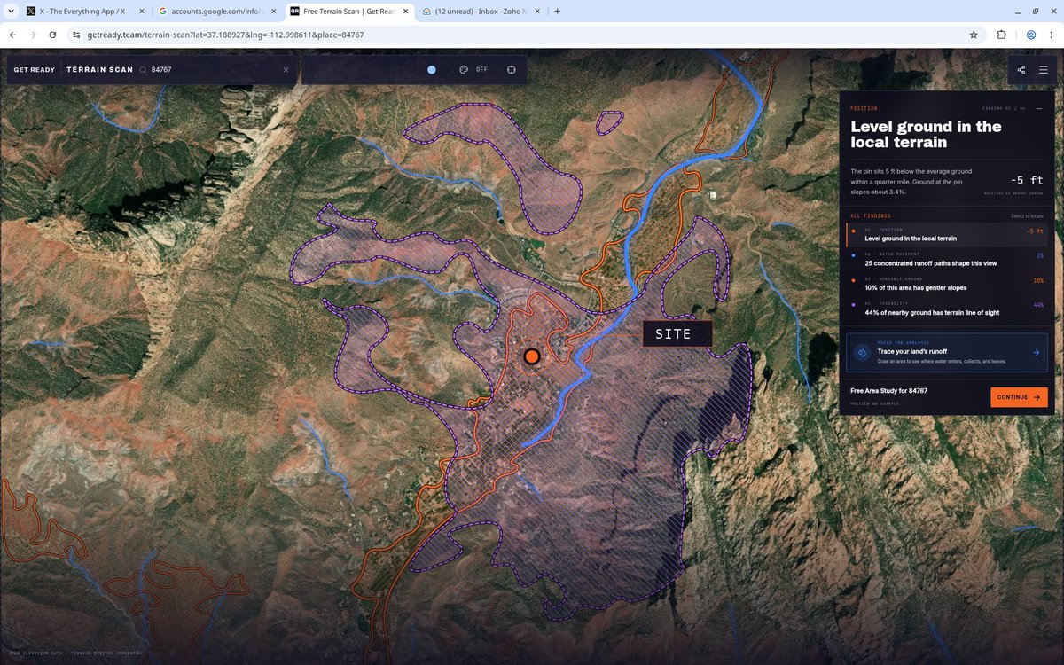
@NWSSaltLakeCity Why Springdale floods fast: elevation data shows 25 concentrated runoff paths feeding the area within 5 miles of town, in a narrow canyon where only about 10% of the ground is gently sloped. Water has few places to spread out.
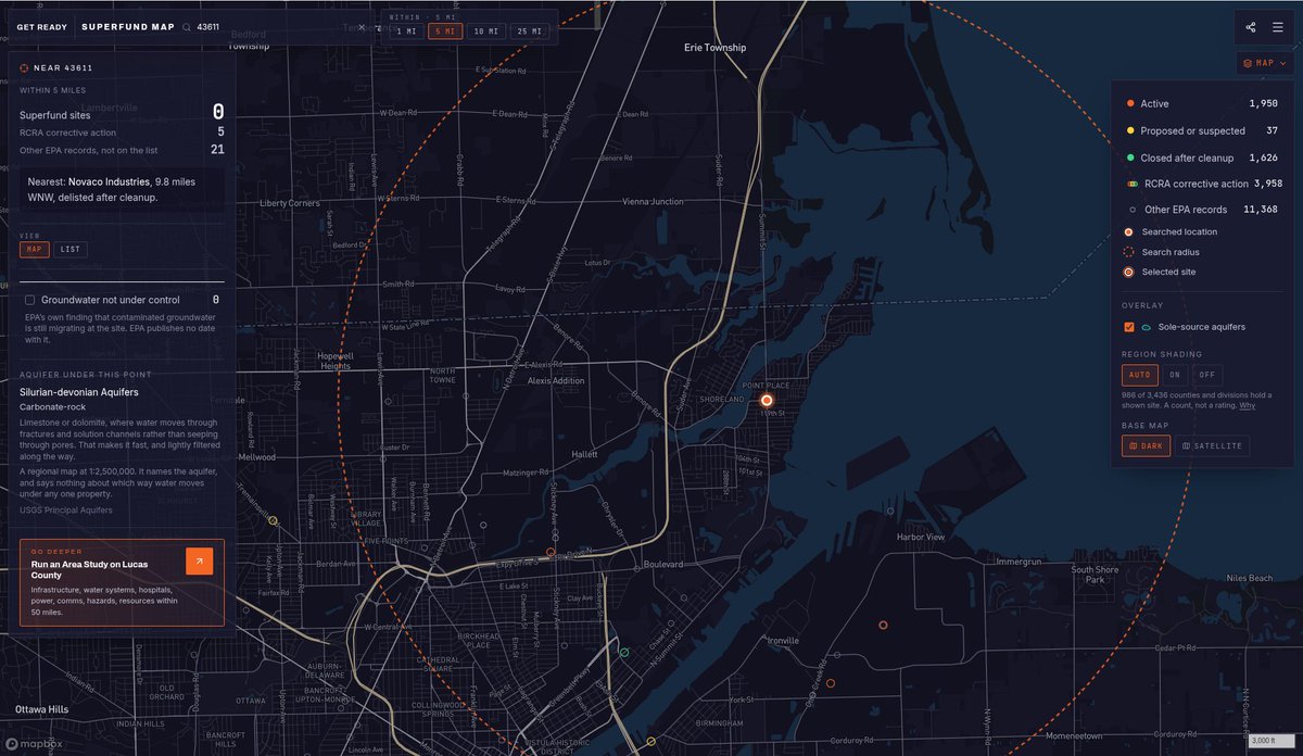
@CitizenApp For residents checking their address: here's what EPA tracks within 5 miles of ZIP 43611. 5 RCRA corrective-action sites, 21 other EPA-tracked facilities, 0 Superfund. Public data, mapped.
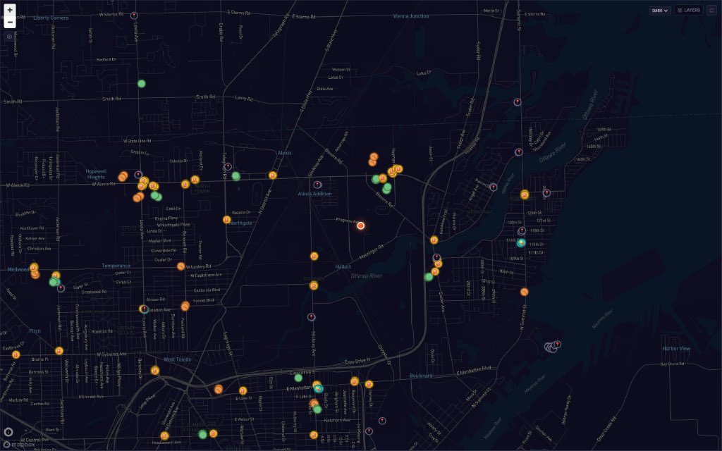
@KaceeRAllen Good summary. For anyone nearby wondering what else is around: within 5 miles of ZIP 43611, EPA records 5 RCRA corrective-action sites and 21 other EPA-tracked facilities (0 Superfund). Map attached.