CCTV footage shows the serious crash on Scott Road in Surrey, where a motorcycle was left hanging from a traffic light pole. The rider survived with serious but non-life-threatening injuries.
A wildfire burning in the Everglades near the Broward/Miami-Dade County line has grown to 4,800 acres and remains 0% contained as it approaches US-27.
🎥: @FLStormChasers_
🔥🚨BREAKING: What appears to be yet another fireball was spotted in the skies of Los Angeles California, this would be the 6th ‘meteor’ sighting this week.
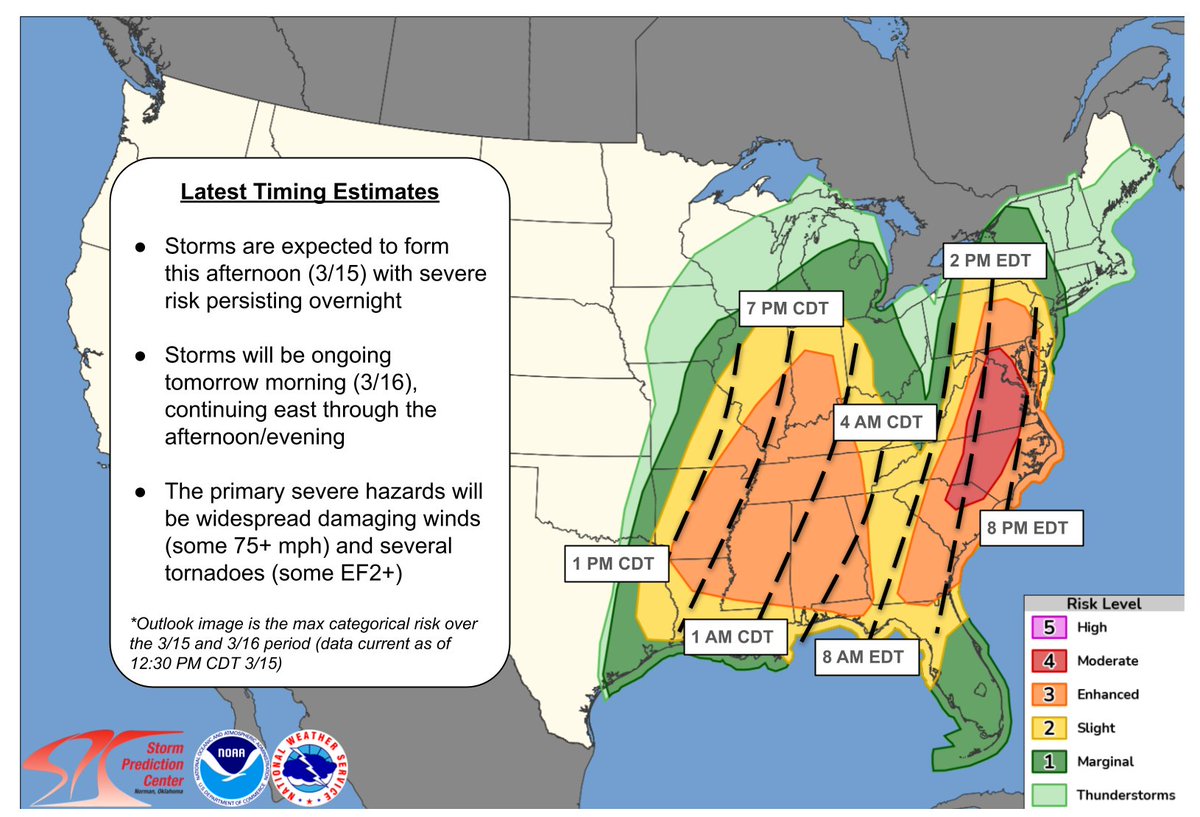
With updated forecast information, here are our timing estimates. We continue to monitor the mid-Mississippi Valley into the Mid-South for storm development this afternoon. See https://t.co/cpnLqiKdeW and https://t.co/YX4AE4omzj for the latest information.
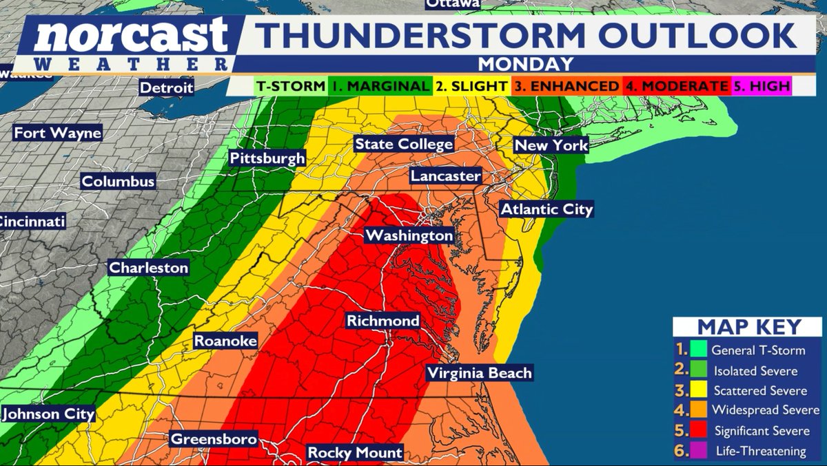
SPC is all in with a moderate risk now in place along the i-95 from SC to Baltimore. I'll have my full update this evening on timing, expectations & impacts. A bumpy weather day is expected on Monday. Stay tuned. @Norcastweather#MdWx
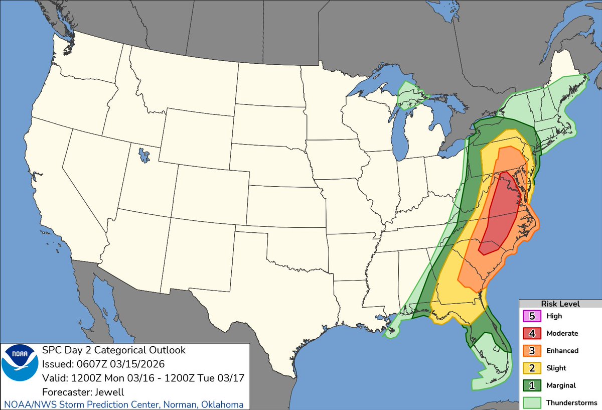
SERIOUS SEVERE WEATHER: The Storm Prediction Center has UPGRADED to a rare Level 4 out of 5 severe weather risk for Monday in the Mid-Atlantic. This includes Washington D.C., Richmond, Raleigh, Charlotte and part of South Carolina!
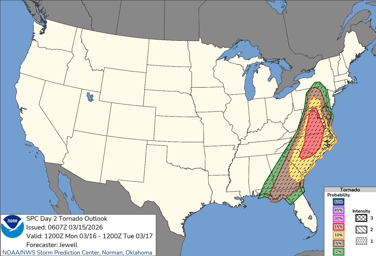
In the red zone, there is an increasing concern for a couple supercells that could produce an isolated EF2+ tornado, and given fast storm motions, we can't rule out a longer-track tornado as well.
This risk tier happens 3 times per decade on average in our area; the last times in D.C. were August 7, 2023 and April 19, 2019. These risk tiers are reserved for only the most substantial, higher-impact severe weather events that are somewhat reminiscent of what I chase out west.
Dangerous storms, some of which may produce 60-75 mph wind gusts, are likely. A few rotating supercells with tornado potential could crop up, and we'll also likely see a few brief spin-up tornadoes within the main squall line that should come through during the evening hours.
School districts – use Sunday to plan. Multiple rounds of potentially dangerous storms, including with some tornado risk, are likely in some spots.