Ain Eddban VI
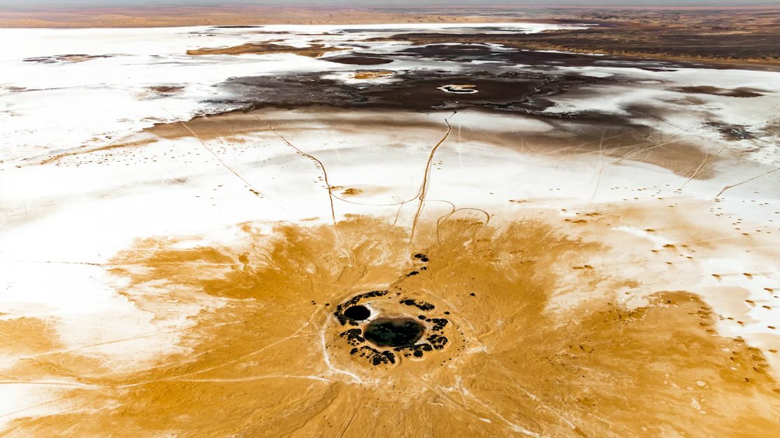
Right on the border with Tunisia, about 50 km from Ghadames, there is a salt flat called Sabkhat Mujazzam, where Ain Eddban lies. The name derives from Arabic and refers to the two adjacent lakes which, when seen from above, resemble the eyes of a fly. This area, considered a depression, was most likely a salt lake that has now dried up, revealing two small lakes, one freshwater and one saltwater. An extremely mysterious place that remains poorly documented to this day.
available on SR
0.5 ETH
Freedom to Roam 🐪
Keys and Gates Museum Project
For millennia, the Sahara was one of the largest interconnected territories on Earth, where trans-Saharan routes linked kingdoms, cultures, and communities from the Atlantic coast to the Mediterranean and the Sahel. Caravans moved salt, gold, manuscripts, and knowledge across vast distances through systems sustained by memory, oral navigation, tribal alliances, seasonal wells, and mutual dependence rather than centralized authority.
It was one of the last continental spaces where tribal and commercial movement remained largely free, a fluid geography that endured for centuries before being fragmented in the late 19th and early 20th centuries, when colonial partitions imposed borders on a landscape that had long resisted fixed containment. Even though some nomadic communities still move freely beyond the Sahara imposed borders, this once open landscape is now increasingly fragmented by checkpoints, surveillance, visas, and restricted zones.
This contrast raises a deeper question about progress itself: whether contemporary systems expanded human freedom or replaced decentralized autonomy with mediated structures of control, permission, and visibility.