Droni / UAS + analisi avanzata dei dati per monitorare il territorio e le emergenze ambientali. Una soluzione integrata di Planetek e Sky Eye Systems.
Dove saremo:
🚀 Sea Future (28/9 - 1/10)
🚀 Earth Technology Expo (13-16 ottobre)
https://t.co/2opv2nvYWT
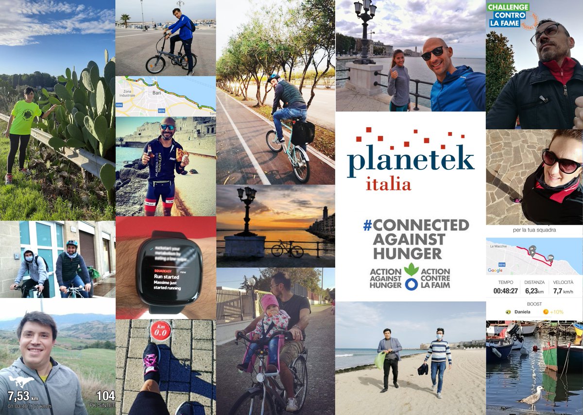
Il team #Planetek vince la #ChallengecontrolaFame!🏆
Una sfida sportiva di solidarietà tra 60 team aziendali di tutto il mondo, tutti #ConnectedAgainstHunger per rispondere all’emergenza alimentare aggravata dal Covid19 a sostegno delle comunità più fragili del mondo
Can space technologies offer protection to our ecosystems?
Today @SteliosBollanos Director of @PlanetekHellas joins at @economistevents 4th Sustainability Summit to explain how Space can help us protecting our planet. #EconSustainability
➡️Watch Live: https://t.co/prwsPV0EMz
2 important facts that go hand in hand:
1⃣ @CopernicusEU launches the #EGMS service with this #CIW2020 workshop
2⃣ A webinar of @HexGeospatial tells how #GroundMotion data enable solutions that go beyond information and provide real knowledge to users
https://t.co/khtuGNJady
#Rheticus includes all the capability to ingest and process #satellite data, to extract information and manage it in user-friendly dashboards.
It processes, every month, hundreds of new #Sentinel1 images from #Copernicus, to monitor #groundmotion over large areas in the world.
Spaceborne time series Synthetic Aperture Radar Interferometry (#InSAR) supports #groundmotion monitoring.
To simplify the control of landslide risk areas on a regional scale we developed our cloud platform #Rheticus.
Full article on https://t.co/ayLVZcGSiu
Find out how utility companies enhance their water and sewer network inspection efficiency of more than 30% using satellite-based #groundmotion measures, thanks to a collaboration going on for 500 years:
#Copernicus 🤝 #Rheticus
➡️https://t.co/sRPHzEeXp4
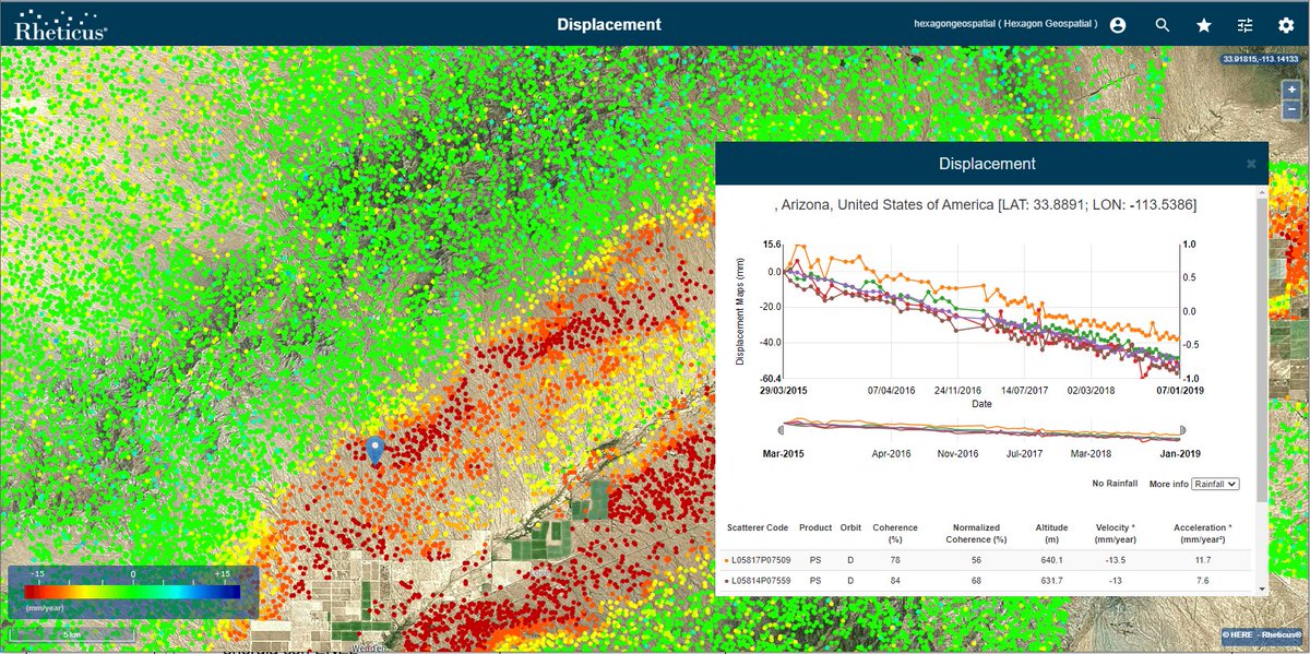
The #McMullen Basin is an agricultural area located about 150 km west of Phoenix, in #Arizona, and covers almost 1,700 square km. The site undergoes significant changes in land elevation, in floodplain and drainage slopes caused by the use of #groundwater.
#3D reality meshes with billions of targets measuring terrain #displacement are generally massive in size.
With #Rheticus and #LUCIADconnect we publish #groundmotion data of entire regions on the web as #OGC 3D Tiles-compliant datasets.
➡️Read more: https://t.co/fYseCFGcEY
We are partnering with @planetek and offering Rheticus Network Alert to improve the efficiency of #wastewater pipeline inspection and maintenance activities. https://t.co/KoNBVJy2KP
Working with the #IMPRESSIVE team @Planetek is developing an innovative pollution risk monitoring service for #European ports and coasts. In few months the release of the service fueled by @CopernicusEU#Sentinel and powered by Planetek's #Rheticus
🛰 #Webinar Il satellite per la progettazione, realizzazione e gestione di opere ed #infrastrutture 🌍
Il 26 Maggio faremo una panoramica degli usi del satellite e avremo ospite @enelgreenpower per una use case nel campo energetico.
Iscriviti è gratuito: https://t.co/HPZLkig3t1
Come è cambiata l'orografia o la copertura del suolo? E il nuovo edificato che devi servire con le tue #infrastrutture?
Un nuovo #videotutorial per capire come i satelliti ci rivelano in modo dettagliato ed economico le dinamiche del territorio.
https://t.co/KE5MNwLd7T
Per i nostri clienti che operano da casa in questo periodo di emergenza legata al #coronavirus, abbiamo deciso di offrire licenze temporanee dei nostri #software per dati geografici e da #satellite.
#SolidarietaDigitale https://t.co/oivXVyIoKT
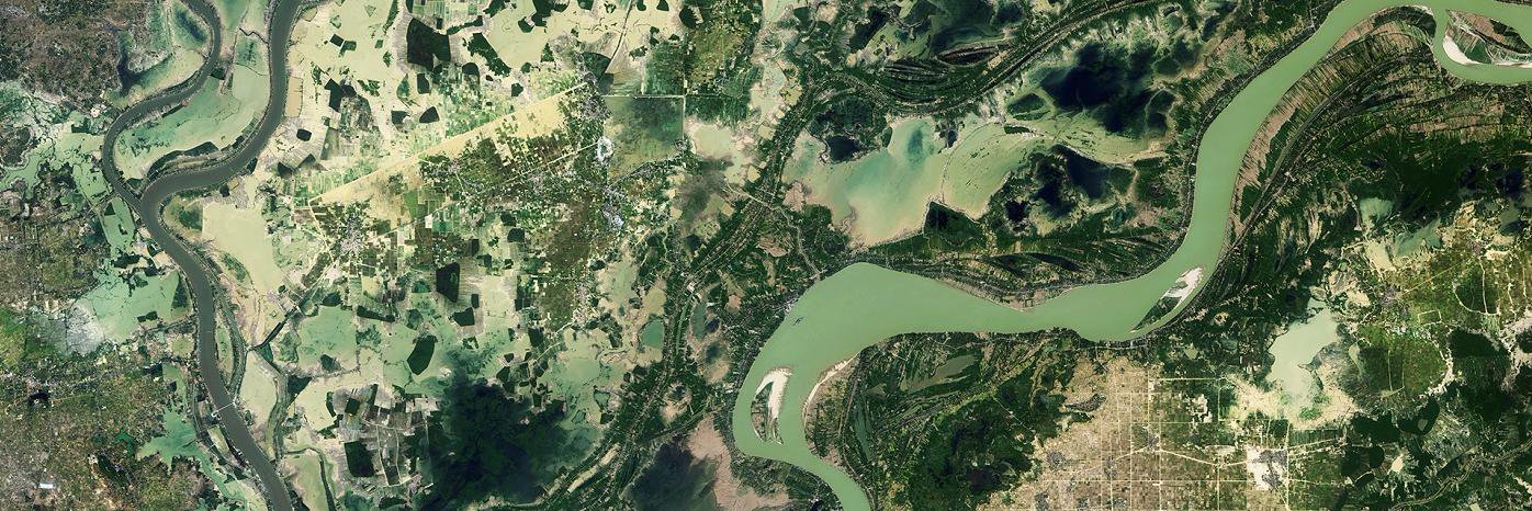
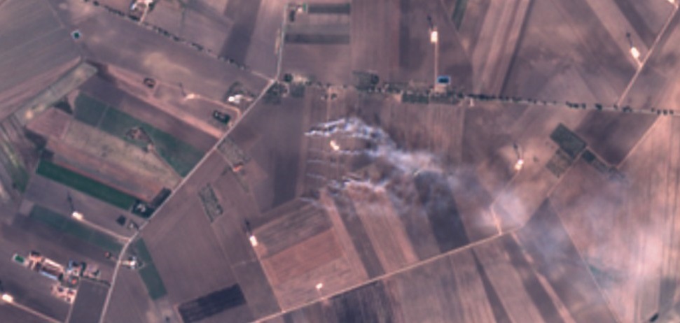
Bruciatura delle stoppie in un campo di San Marco in Lamis (Foggia), vista dal satellite Sentinel-2 lo scorso 30 settembre. Le immagini satellitari sono un valido strumento per il controllo del territorio. #ESA#copernicus#data processed by @planetek