Washington DC Area’s Guide to where you want to go! Providing superior front desk concierge service & lobby management to commercial & residential properties
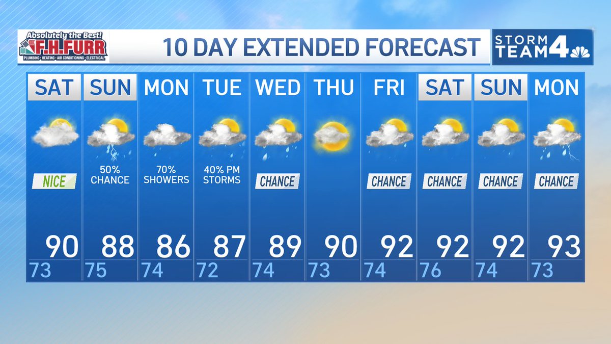
A great day tomorrow, but a bit more humid with clouds. Showers and storms move in on Sunday. I'm not expecting widespread severe storms, but a few could be strong. Then a chance of showers and storms most of next week. Have a great weekend!!
🎡 See the Fairfax County Carnival and Fair from a whole new perspective! The 7News Drone captured stunning aerial views of the fair at Frying Pan Park. 🎪🎠
It's dry and sunny now, but expect clouds and humidity to increase throughout the day and storms to arrive tomorrow. Here's your forecast: https://t.co/skVYUeMOEp
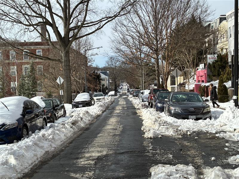
It was a long, harsh winter in D.C. We can finally call it over.
After a long and often harsh season — punctuated by persistent cold, stubborn snow and ice, and a late-season chill this week — the pattern ahead has shifted. Milder air is taking hold, and there are no meaningful signs of a return to sustained cold or accumulating snow.
That means we can officially declare the winter of 2025-2026 behind us.
We’ve made it a tradition to mark the onset of spring once the threat of prolonged cold and lasting snow has passed. The forecast now clearly favors warmer days, budding trees and a steady march toward spring — even if a few bumps remain along the way.
The forecast ahead is promising for flowers — and for fans of warmer weather.
Highs surge into the 60s on Friday and reach the 70s by Sunday. But a warning: Springlike weather doesn’t mean sustained warmth.
Next week, for example, daily highs bounce between the low 50s and mid-60s — a reminder that spring is a season of swings.
Still, there is little sign of any return to sustained wintry weather.
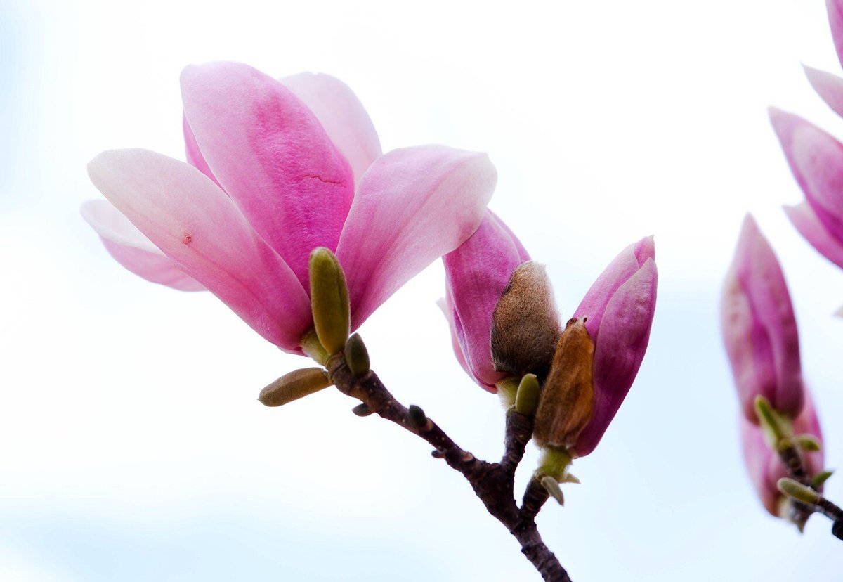
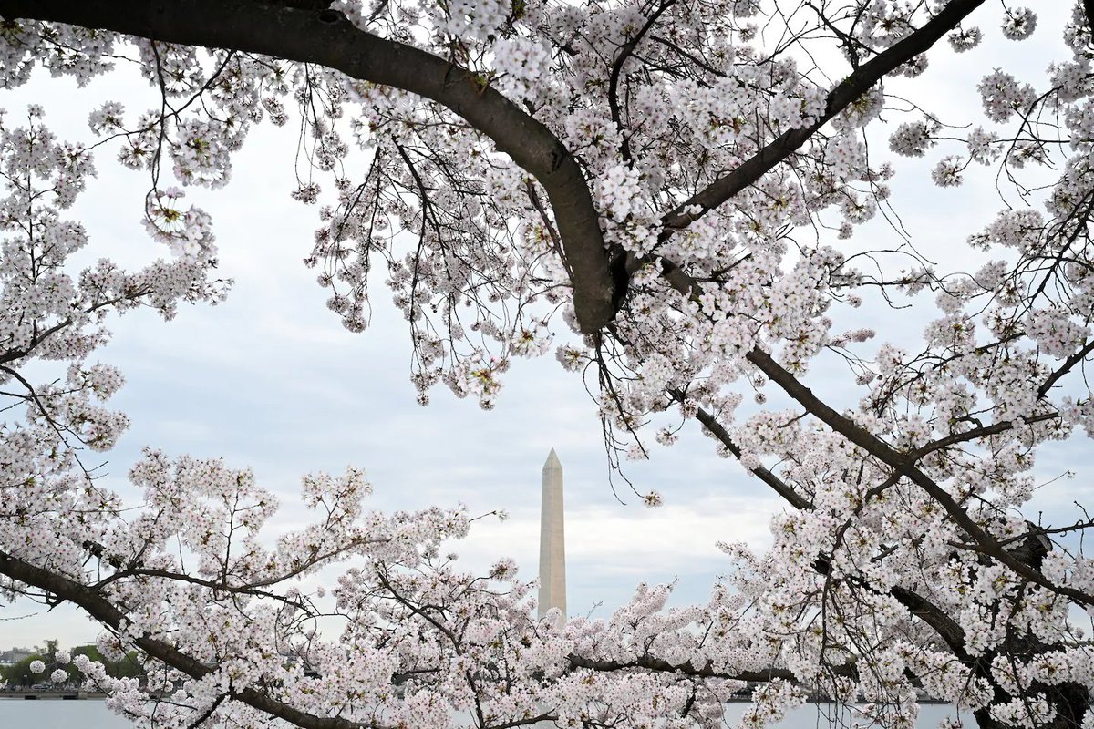
🌸 D.C.’s cherry blossoms may take their time this year.
After the chilliest winter in more than two decades, the trees are just beginning to wake up. Warm weather this week should kick-start development, but cooler conditions later in March may slow the progression toward peak bloom.
📅 Our forecast: April 3–7 for peak bloom at the Tidal Basin.
That would be the latest since 2018 and notably later than last year’s March 28 peak.
Over the past century, peak bloom has shifted about a week earlier on average because of climate warming — but this year looks like a throwback to a later bloom.
After 144 years of construction, the Sagrada Família in Barcelona has reached its full height with the placement of the final piece atop its central tower.
📹davidcantor
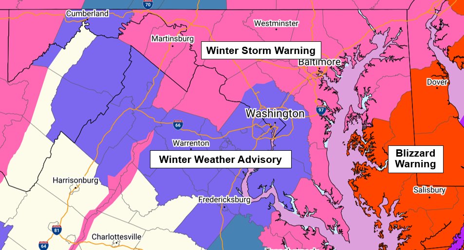
The National Weather Service has updated their alerts for the storm. These are in effect late Sunday afternoon into Monday morning:
* The Beltway area is now under a Winter Weather Advisory.
* A more significant Winter Storm Warning has been issued for areas west, north, east, and southeast of the Beltway area, where NWS expects heavier snow that could reach or exceed 5 inches.
* Blizzard Warning on the Eastern Shore (yikes!!)
Sunset over the icy Chesapeake Bay today (Tuesday) from near Kent Narrows.
This is SOUTH of The Bay Bridge and the channel is getting more narrow.
I stand by my call to have ice across the full spread by the bridge this week.
📷 Walter George
This winter storm was complex, and our response tactics have had to evolve.
Ice, sleet, and snow—combined with persistent, below-freezing temperatures—have made clearing efforts particularly difficult.
Most main roads in DC are now passable. Side and residential roads are our focus.
DC, we appreciate your patience—our teams will be out until the work is done.
❄️So… what are the chances we really get hammered?
This map comes from the European modeling system, which runs the storm scenario 50 different ways. Here’s what it shows right now:
* In the D.C. area, about 30–40% of the simulations produce at least 12 inches of snow
* The odds of a foot or more are even higher just south of D.C.
That’s a meaningful signal for something potentially pretty memorable between Saturday night and Monday morning.
⚠️ Important caveat:
These are just probabilities and, with the storm still several days away, these numbers can and will change as the storm track and timing become clearer.
But this gives you a sense of why we’re taking this setup seriously as of Tuesday night.
Today we honor Dr. Martin Luther King Jr.’s legacy of service, his commitment to justice, and his belief that every one of us has the power to make a difference, because as he reminded us, “everybody can be great, because everybody can serve.”
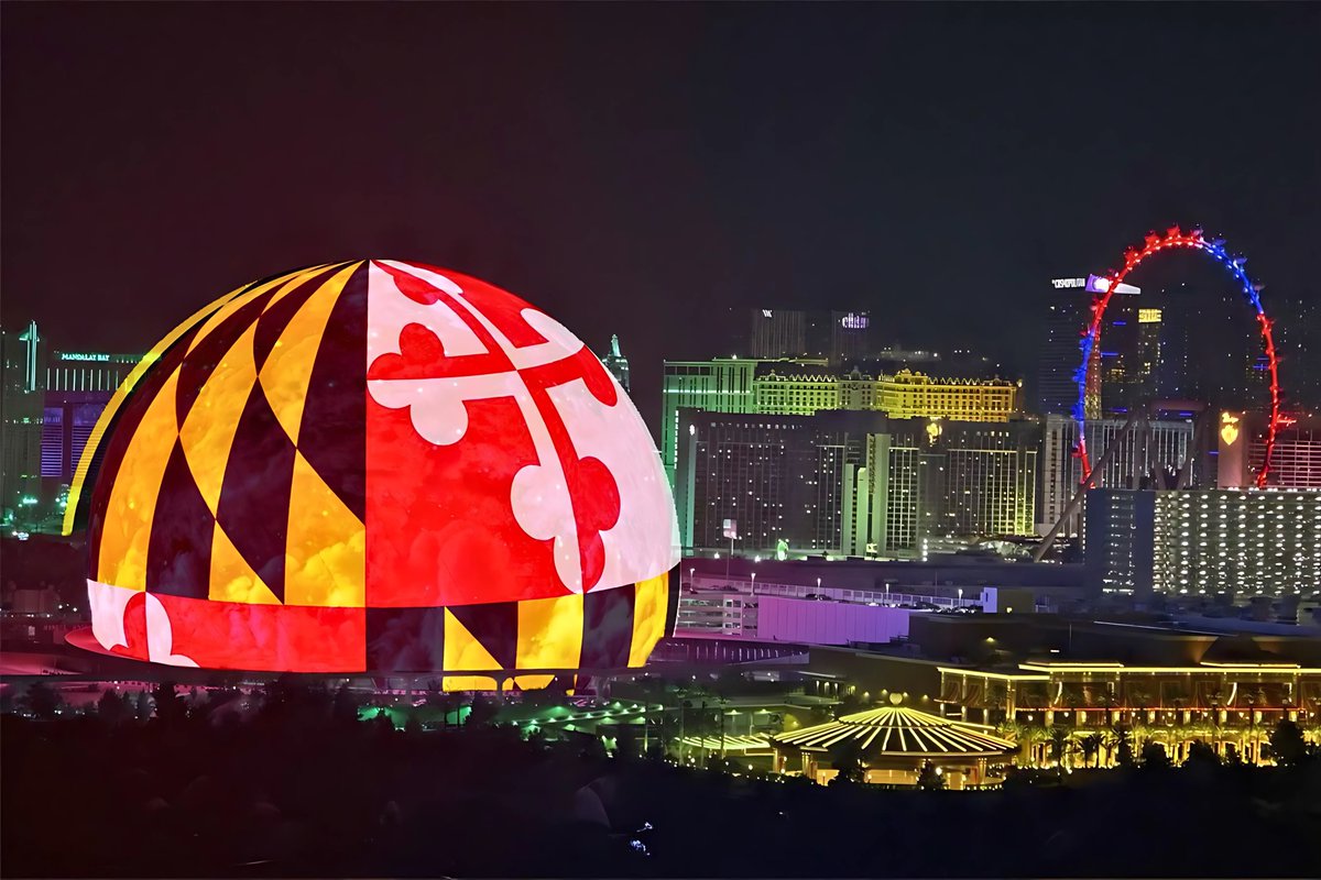
Breaking: Sphere Entertainment has announced Maryland will be home to a Sphere venue at the National Harbor, near Washington, D.C.
It will be the second Sphere Entertainment project in the USA.
𝘛𝘩𝘦 𝘯𝘦𝘸 𝘷𝘦𝘯𝘶𝘦 𝘸𝘪𝘭𝘭 𝘩𝘢𝘷𝘦 𝘢 6,000 𝘴𝘦𝘢𝘵 𝘤𝘢𝘱𝘢𝘤𝘪𝘵𝘺 𝘢𝘯𝘥 𝘧𝘦𝘢𝘵𝘶𝘳𝘦 𝘢𝘯 𝘌𝘹𝘰𝘴𝘱𝘩𝘦𝘳𝘦 – 𝘵𝘩𝘦 𝘦𝘹𝘵𝘦𝘳𝘪𝘰𝘳 𝘓𝘌𝘋 𝘥𝘪𝘴𝘱𝘭𝘢𝘺 𝘰𝘧 𝘚𝘱𝘩𝘦𝘳𝘦, 𝘢𝘴 𝘸𝘦𝘭𝘭 𝘢𝘴 𝘢 16𝘒𝘹16𝘒 𝘪𝘯𝘵𝘦𝘳𝘪𝘰𝘳 𝘥𝘪𝘴𝘱𝘭𝘢𝘺 𝘱𝘭𝘢𝘯𝘦 – 𝘵𝘩𝘦 𝘸𝘰𝘳𝘭𝘥'𝘴 𝘩𝘪𝘨𝘩𝘦𝘴𝘵-𝘳𝘦𝘴𝘰𝘭𝘶𝘵𝘪𝘰𝘯 𝘓𝘌𝘋 𝘴𝘤𝘳𝘦𝘦𝘯. 𝘐𝘵 𝘸𝘪𝘭𝘭 𝘣𝘦 𝘰𝘯𝘦 𝘰𝘧 𝘵𝘩𝘦 𝘭𝘢𝘳𝘨𝘦𝘴𝘵 𝘦𝘤𝘰𝘯𝘰𝘮𝘪𝘤 𝘥𝘦𝘷𝘦𝘭𝘰𝘱𝘮𝘦𝘯𝘵 𝘱𝘳𝘰𝘫𝘦𝘤𝘵𝘴 𝘪𝘯 𝘗𝘳𝘪𝘯𝘤𝘦 𝘎𝘦𝘰𝘳𝘨𝘦'𝘴 𝘊𝘰𝘶𝘯𝘵𝘺 𝘩𝘪𝘴𝘵𝘰𝘳𝘺 𝘸𝘪𝘵𝘩 𝘢 𝘨𝘰𝘢𝘭 𝘵𝘰 𝘦𝘭𝘦𝘷𝘢𝘵𝘦 𝘕𝘢𝘵𝘪𝘰𝘯𝘢𝘭 𝘏𝘢𝘳𝘣𝘰𝘳, 𝘢𝘯𝘥 𝘔𝘢𝘳𝘺𝘭𝘢𝘯𝘥, 𝘢𝘴 𝘰𝘯𝘦 𝘰𝘧 𝘵𝘩𝘦 𝘤𝘰𝘶𝘯𝘵𝘳𝘺'𝘴 𝘱𝘳𝘦𝘦𝘮𝘪𝘯𝘦𝘯𝘵 𝘵𝘰𝘶𝘳𝘪𝘴𝘮 𝘢𝘯𝘥 𝘦𝘯𝘵𝘦𝘳𝘵𝘢𝘪𝘯𝘮𝘦𝘯𝘵 𝘩𝘶𝘣𝘴.
@SphereVegas #MarylandPride @NationalHarbor@StateMaryland