

Top Tweets for #APAYAO

This is your sign to explore APAYAO 🇵🇭
Sidetrip: Ilocos Norte and Ilocos Sur
🗓️Aug 21-23
🗓️Oct 31-Nov 2
PM us for details
#galaph #taragalatayo #apayao #philippines #ph82


Maging alerto mga lalawigan ng #Apayao at #Cagayan!
NDRRMC(5:22AM,27Nov25) Red Rainfall Warning sa Cagayan at Apayao. Asahan ang matinding pag-ulan, pagbaha at pagguho ng lupa.
#NDRRMC
#BawatSegundoMahalaga
#VerbenaPH

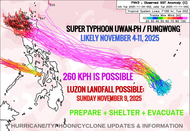
Maging alerto, mga lalawigan ng #Cagayan, #Apayao, #Abra, #Kalinga at #IlocosNorte!
NDRRMC(11:36PM,9Nov25)Signal #4 sa Cagayan, Apayao, Abra, Kalinga at Ilocos Norte. Malakas na hangin ang inaasahan sa loob ng 12 oras. Lahat ay pinag-iingat.
#NDRRMC
#BawatSegundoMahalaga
#UwanPH


* #PHILIPPINES #90W #32W #Uwan #UwanPH #FungWong #Luzon #Visayas #Mindanao #Cagayan #Isabela #Aurora #Quezon #Calabarzon #Apayao #Batanes #Babuyan #Kalinga #Ifugao #MtProvince #NuevaVizcaya #Abra #IlicosNorte #IlicosSur #Benguet #LaUnion #TyphoonUwan #TyphoonUwanPH #SuperTyphoonUwanPH #SuperTyphoonUwan #TyphoonFungwong #SuperTyphoonFungwong #Tropics #TropicsUpdate
BLOG/MAPS/SATELLITE:
https://t.co/IHDjiokcBN
Maging Alerto, mga lalawigan ng #Cagayan, #IlocosNorte , at #Apayao !
NDRRMC(5:08AM, 23Sep25) Signal # 3 sa Cagayan, Apayao, at Ilocos Norte. Malakas na hangin ang inaasahan sa loob ng 18 na oras. Lahat ay pinag-iingat.
#NDRRMC
#BawatSegundoMahalaga
#NandoPH

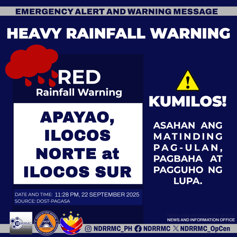
Maging Alerto, mga lalawigan ng #Apayao , #IlocosNorte at #IlocosSur!
NDRRMC(11:28PM,22Sep25) Red Rainfall Warning sa Apayao, Ilocos Norte at Ilocos Sur. Asahan ang matinding pag-ulan, pagbaha at pagguho ng lupa.
#NDRRMC
#BawatSegundoMahalaga
#NandoPH
#HeavyRainfall
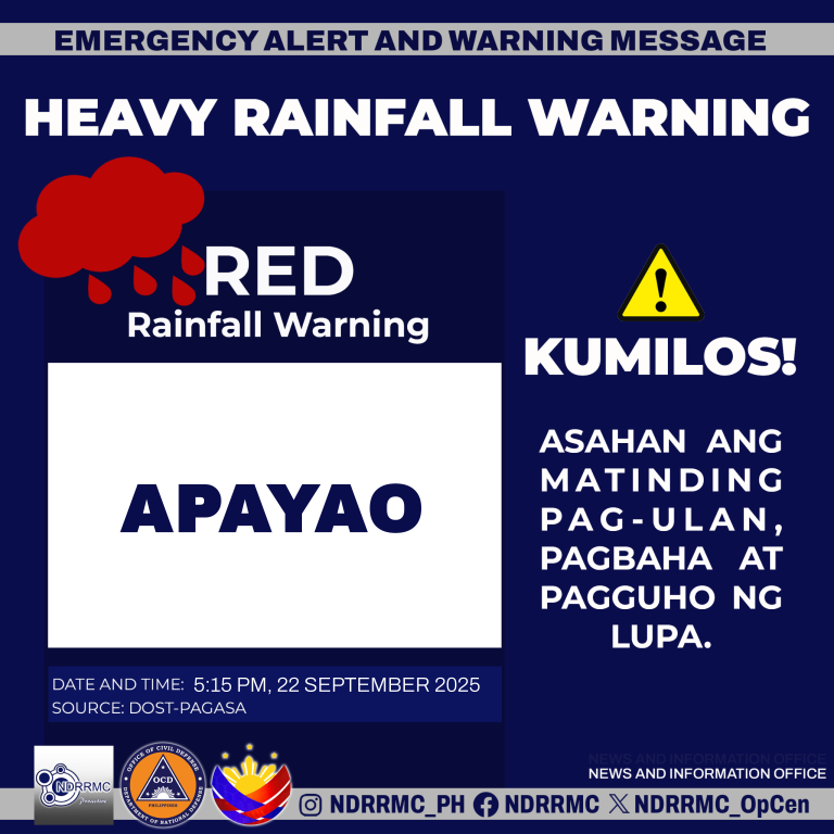
Maging Alerto, lalawigan ng #Apayao!
NDRRMC(5:15PM,22Sep25)Red Rainfall Warning sa Apayao. Asahan ang matinding pag-ulan, pagbaha at pagguho ng lupa.
#NDRRMC
#BawatSegundoMahalaga
#NandoPH
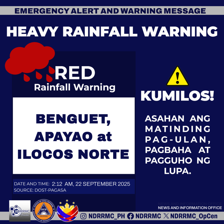
Maging Alerto, mga lalawigan ng #Benguet, #Apayao at #IlocosNorte !
NDRRMC(2:12PM,22Sep25)Red Rainfall Warning sa Benguet, Apayao at Ilocos Norte. Asahan ang matinding pag-ulan, pagbaha at pagguho ng lupa.
#NDRRMC
#BawatSegundoMahalaga
#NandoPH

[Note: Info on future #24W or #NandoPH, a MUCH STRONGER TC, will be posted after this update]
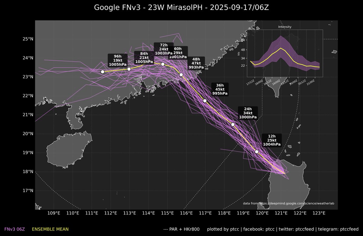
TD #23W (#MirasolPH) is located near #Apayao-#IlocosRegion... Its low-level structure has been impacted by the mountainous terrain and deep convection near the center has largely weakened...
MirasolPH is expected to intensify again soon after it reemerges over the sea... Although traditional NWP models do not indicate significant strengthening... The hot waters and probable presence of point-source divergence may bring its intensity to STS category on Friday...
The cyclone will exit the PAR tomorrow morning and will continue moving NW towards eastern #Guangdong... Landfall is anticipated Friday afternoon or evening between #Hongkong and #Shanwei District...
A turn to the west is expected when it approaches the coast... but it is uncertain whether this turn will occur before or after landfall... The track will also depend on the cyclone's intensity...
Friends in #Hongkong and #Macau are advised to stay alert... Gales may be possible late Friday to early Saturday...
[PS, You may follow our Telegram (https://t.co/ThUI7XDr3C) for updates on new posts, as well as notifications about JMA upgrades/downgrades and changes to TC signals in the region]


The above conditions are expected over the rest of #Pangasinan, rest of #Abra, portions of #Benguet, portions of #LaUnion, portions of #IlocosSur, portions of #IlocosNorte, portions of #Apayao and portions of #Cagayan within the next 1 to 2 hours.
Source: PAGASA
Moderate to occasionally heavy rain showers with lightning and strong winds are expected over the rest of #IlocosNorte, the rest of #Apayao, #Abra(Malibcong, Daguioman, Bucloc, Boliney, Tubo, Tineg, Lacub, Lagayan, Danglas, LicuanBaay),
Thunderstorm Advisory No. 2 #NLPRSD
Issued at 01:45 PM 18 August 2025
Moderate to heavy rain showers with lightning and strong winds are being experienced in #IlocosNorte(Carasi, Dingras, NuevaEra, Solsona), #Apayao(Calanasan, Kabugao, Luna, Pudtol),

and may affect nearby areas.
Moderate to occasionally heavy rain showers with lightning and strong winds are expected over #IlocosNorte, #Apayao(Conner, Flora, Kabugao, Pudtol, SantaMarcela), #Abra(Malibcong, Daguioman, Bucloc, Boliney, Tubo, Tineg, Lacub, Lagayan, Danglas),
Northern Luzon Thunderstorm Advisory No. 1
Issued at 12:55 PM 18 August 2025
Moderate to heavy rain showers with lightning and strong winds are being experienced in #Apayao(Calanasan, Luna), #MountainProvince(Sadanga, Bontoc, Sabangan, Barlig), #Kalinga(Tinglayan and Pasil)

Gonzaga, LalLo, Pamplona, SanchezMira, SantaAna, SantaPraxedes, SantaTeresita), #Apayao, and #IlocosNorte while Light to moderate rains affecting the rest of #Cagayan #Abra, #IlocosSur, #LaUnion, and #Benguet(Bakun, Kibungan and Mankayan)


Last Seen Hashtags on Sotwe
freaks
Seen from United States
ejaculation #cum
Seen from Malaysia
daddyash
Seen from Malaysia
xxlpickup
Seen from United States
sex
Seen from United Arab Emirates
季雨
Seen from United States
탁란
Seen from Poland
Aigay
Seen from Vietnam
thedigitalentreprenuer
Seen from United States
야동계
Seen from Korea
Most Popular Users

Elon Musk 
@elonmusk
241.5M followers

Barack Obama
@barackobama
118.8M followers

Cristiano Ronaldo
@cristiano
114.6M followers

Donald J. Trump
@realdonaldtrump
111.8M followers

Narendra Modi
@narendramodi
107.1M followers

Rihanna
@rihanna
98.7M followers

NASA
@nasa
92.3M followers

Justin Bieber
@justinbieber
91.8M followers

KATY PERRY
@katyperry
90.1M followers

Taylor Swift
@taylorswift13
84M followers

Lady Gaga
@ladygaga
75.5M followers

Virat Kohli
@imvkohli
73.5M followers

Kim Kardashian
@kimkardashian
70.9M followers

YouTube
@youtube
68.8M followers

Neymar Jr
@neymarjr
66.5M followers

Bill Gates
@billgates
65.3M followers

Selena Gomez
@selenagomez
63.1M followers

The Ellen Show
@theellenshow
62.2M followers

CNN
@cnn
61.7M followers

X
@x
60.7M followers