

Top Tweets for #Camppendleton

Thank you to the brave firefighters who responded to the #CampPendleton fires. They have completed the arduous work and did so with incredible bravery. Awesome work!

🔥Update: #PipelineFire/#CampPendleton
There is currently no threat to personnel or structures, per Camp Pendleton on Facebook. Camp Pendleton Fire and Emergency Services personnel remain on scene and continue suppression and monitoring efforts.
Brush 🔥 #PipelineFire/#CampPendleton
The fire has exploded in size and has been mapped at 919 acres.
(Statement issued by Camp Pendleton via FB)
UPDATE (5:04 pm): Paige Field House will serve as the Evacuation Control Center for personnel impacted by the mandatory evacuation order.
UPDATE: EVACUATION ORDERED FOR 33 AREA
UPDATE: Camp Pendleton Fire and Emergency Services continues to respond to the vegetation fire that began in the vicinity of Range 501 near Edson Range.
Firefighting aircraft are actively working to protect critical infrastructure and structures in the area.
Multiple mutual-aid resources, including CAL FIRE personnel and equipment, are arriving and being integrated into suppression operations. CAL FIRE personnel are also supporting the Incident Command staff.
The evacuation of personnel from the 32 Area remains in effect as a precautionary measure. The Camp Pendleton Regional Defense Operations Center remains activated to coordinate installation support to the Incident Commander and emergency response operations.
Personnel and members of the public should continue to avoid the affected area and follow directions from emergency personnel. Additional updates will be provided as conditions change.

🚨 FIRE UPDATE: The Pipeline Fire at Camp Pendleton is at 180 acres. Mandatory evacs active for Areas 32 & 33 on base. South OC: Expect smoke drifting into our area today. 💨 Stay safe. 📍 Camp Pendleton #CampPendleton #OCNews

Last night we assisted #CampPendleton Animal Shelter by evacuating their pets due to the #Pipelinefire. 7 dogs and 8 cats spent the night at our Oceanside and Escondido Campuses.

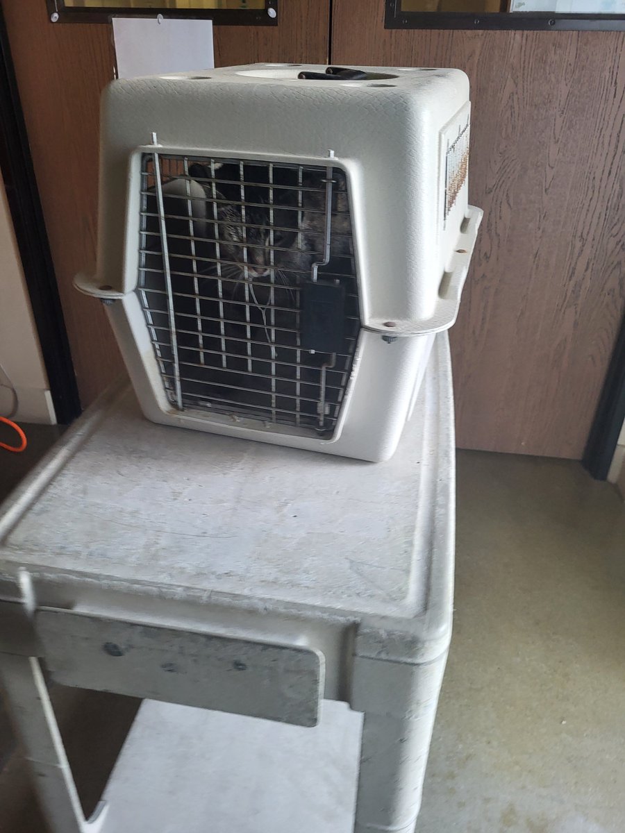
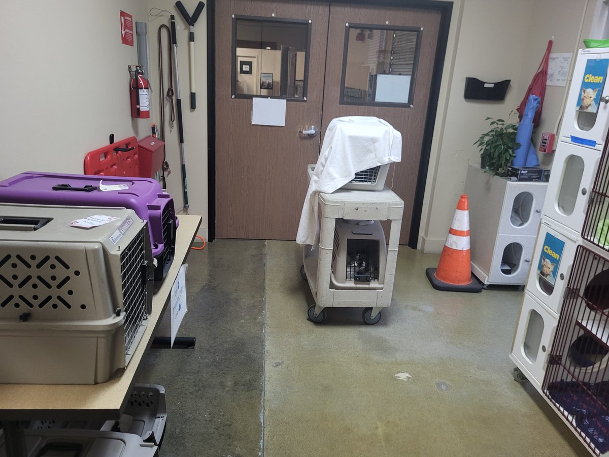
🔥Update: #PipelineFire/#CampPendleton
All tankers have been released, per air attack. Retardant has been dropped around most of the spot across the MASS-3 fuel break. 2 night-flying helicopters and 1 night-flying helicopter coordinator (HLCO) are now overhead/responding.
A smoke advisory has been issued for Northern San Diego County by the San Diego County Air Pollution Control District.

🚨 #BREAKING: A new wildfire at Camp Pendleton has rapidly expanded to more than 1,000 acres.
Evacuation orders have been issued for certain areas of the base as firefighters work to contain the fast-moving blaze.
#Breaking #CampPendleton #California #Wildfire #Evacuations
🔥 #BREAKING: Catalonia wildfire burns through hundreds of hectares
A wildfire near the municipality of Carme has scorched an estimated 400 hectares, according to preliminary figures released on July 6.
Aerial footage shows thick smoke and fast-moving flames sweeping across the landscape as firefighters continue battling the blaze.
#Catalonia #Spain #Wildfire #BreakingNews #Firefighters

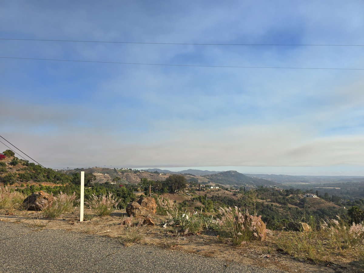
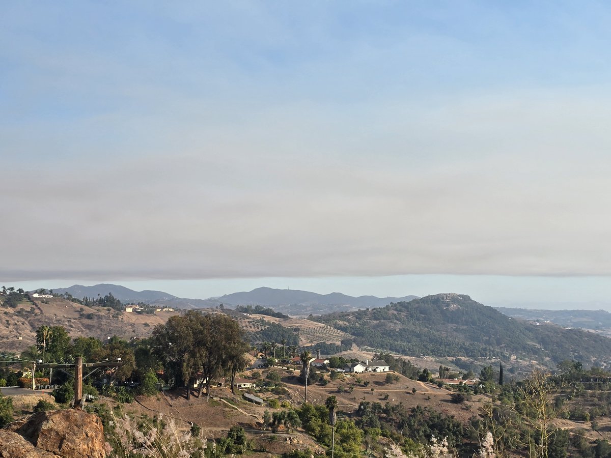
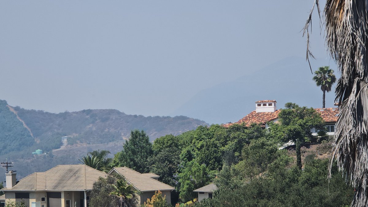
Views of #PipelineFire's smoke from #MarineCorpsBase #CampPendleton looking Southeast from two locations in #Fallbrook, #SanDiegoCounty, California, 92028. By Michael Jonathan Buell of the #DemocracyWatchNews Service, @dwatchnews nam, https://t.co/KX7PVnGTPZ on July 6th. 2026, from 5:50 PM to 6 PM. cc: @NorthCountyFire

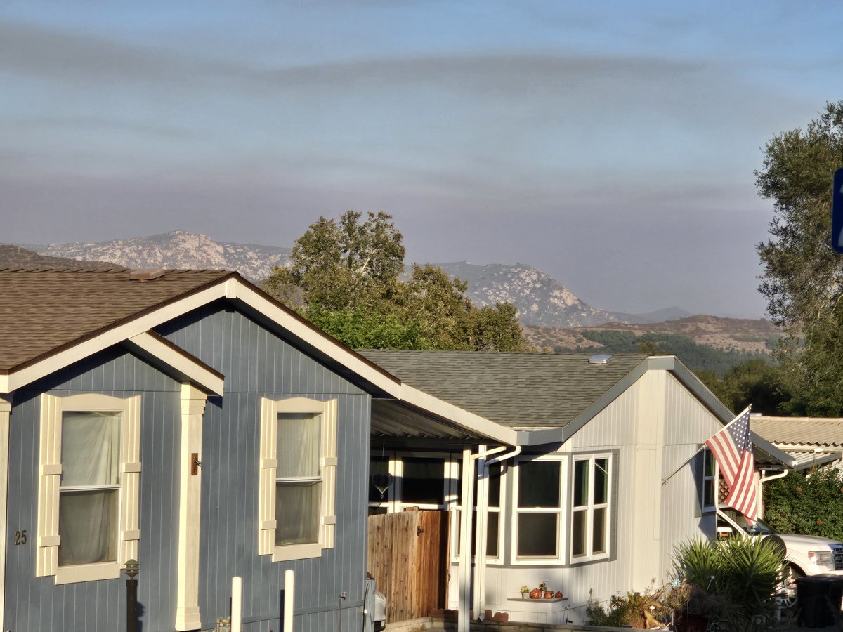
Views of the #PipelineFire on #MarineCorpsBase ##CampPendleton from two locations in Southeast #Fallbrook, California, 92028. By Michael Jonathan Buell of the #DemocracyWatchNews Service, @dwatchnews_nam, https://t.co/KX7PVnGTPZ on July 6th, 2026 via 5:50 PM to 6 PM. cc: @NorthCountyFire
Mandatory Evacuation of #CampPendleton's 32 Area and 33 Area. Evacuate immediately to the Paige Field House (Evacuation Control Center) 1110 13th Street, Camp Pendleton, CA 92058
Created by #WatchDuty · Jul 6 at 5:16 PM link of shelter site for #PipelineFire: https://t.co/R0EVDxcsuQ

Brush 🔥 #PipelineFire/#CampPendleton
The fire has exploded in size and has been mapped at 919 acres.
(Statement issued by Camp Pendleton via FB)
UPDATE (5:04 pm): Paige Field House will serve as the Evacuation Control Center for personnel impacted by the mandatory evacuation order.
UPDATE: EVACUATION ORDERED FOR 33 AREA
UPDATE: Camp Pendleton Fire and Emergency Services continues to respond to the vegetation fire that began in the vicinity of Range 501 near Edson Range.
Firefighting aircraft are actively working to protect critical infrastructure and structures in the area.
Multiple mutual-aid resources, including CAL FIRE personnel and equipment, are arriving and being integrated into suppression operations. CAL FIRE personnel are also supporting the Incident Command staff.
The evacuation of personnel from the 32 Area remains in effect as a precautionary measure. The Camp Pendleton Regional Defense Operations Center remains activated to coordinate installation support to the Incident Commander and emergency response operations.
Personnel and members of the public should continue to avoid the affected area and follow directions from emergency personnel. Additional updates will be provided as conditions change.
@SanDiegoCounty @NWSSanDiego @watchdutyapp @KPBSnews @10News @KUSINews @UTNorth @WrittenOffUSA @HuffPost @LisaHalverstadt @voiceofsandiego #EvacuationOrders for ##CampPendleton Areas 32 and 33 due to the #PipelineFire, #Wildfire. Level 3 Evacuation Notice. Leave now. #NorthSanDiegoCounty as of 5:15 PM on Monday, July 6, 2026 via @watchdutyapp. cc: @dwatchnews_nam
At 5:02 PM: Liam Winstead • Manager of Operational Intelligence & Mapping • 1 minute ago • Jul 6 at 5:02 PM: An #EvacuationOrder has been ordered for the 33 Area, per #CampPendleton on fb. https://t.co/v8Iu6p7clI
Via Liam Winstead • Manager of Operational Intelligence & Mapping • 1 minute ago • Jul 6 at 4:57 PM via @watch@watchdutyapp:
"The fire has been mapped at 919.3 acres by FIRIS OES Intel 24. Their perimeter is visible on the #WatchDutyMap under the Active Fire Perimeters map layer.
Winds are approximately 10 knots, with gusts up to 20 knots, pushing the fire to the southeast, per #CampPendleton on Facebook. Firefighting aircraft are actively working to protect critical infrastructure and structures in the area.
Personnel and members of the public should continue to avoid the affected area and follow directions from emergency personnel."
Attached photograph of #PipelineFire smoke in central Temecula, South Riverside County, California. On #WatchDuty https://t.co/zwfjIf7VBA visual at https://t.co/cr0JocYyW8.


Winds are blowing from the west to southwest inland, carrying smoke from the #PipelineFire on #MarineCorpsBase #CampPendleton toward #Fallbrook, #Bonsall, and the #Temecula Valley.
The fire has grown to approximately 180 acres and is reported at 0% containment per @watchdutyapp and the Fallbrook Village News.
Heavy smoke has been reported in Fallbrook and Bonsall, although officials say the fire is not currently threatening the town of Fallbrook via #CALFIRE. In Fallbrook, CA to Temecula, CA, expect periods of moderate to heavy smoke this afternoon and evening. Keeping windows and doors closed and limiting outdoor activity is recommended while the smoke persists via Michael Jonathan Buell of #DemocracyWatchNews, @dwatchnews_nam, https://t.co/KX7PVnGTPZ cc: @NorthCountyFire


The latest available reports indicate the fire on #CampPendleton is being pushed by onshore winds, meaning the wind is blowing from the west/southwest toward the east and northeast.
Thus, the smoke is drifting inland, primarily toward #Fallbrook, #Bonsall, and #Temecula. Air quality in Fallbrook and Temecula appears to be degraded. The fire's primary spread has been east to northeast, away from the coast. cc: #ClimateCrisis #ClimateChaos MJB
#PipelineFire #CampPendleton: The fire is now 150 acres with a moderate to critical rate of spread and an immediate structure threat, per air attack. Level 3 Evacuation Order (Leave now - Go) for Area 32. July 6, 2026 at 3:48 pm.

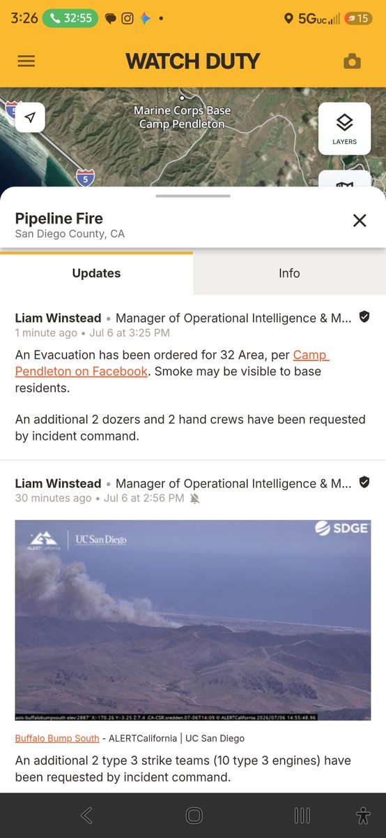
#CampPendleton #PipelineFire: via Liam Winstead • Manager of Operational Intelligence & Mapping • 1 minute ago • Jul 6 at 3:25 PM.
An #Evacuation has been ordered for 32 Area, per #CampPendleton on Facebook. Smoke may be visible to base residents. An additional 2 dozers and 2 hand crews have been requested by incident command. Camp Pendleton fb link: https://t.co/v8Iu6p7clI, website
Liam Winstead • Manager of Operational Intelligence & Mapping on Jul 6 at 2:42 PM noted via @watchdutyapp that evacuations of MASS-3 have been requested by incident command. Additional aircraft from #CALFIRE have been requested.
The fire is now 30-plus acres with a moderate rate of spread and a potential for 100 acres, per incident command. An additional 2 Type 1 engines have been requested for structure protection on Macs Road. 1 copter has also been requested: https://t.co/cr0JocYyW8 cc: @NorthCountyFire


Review of the photographs (not the entire video) via #ChatGPT suggests they depict a classic example of a twilight #Falcon9LaunchIllusion. The rocket was almost certainly launched from Space Launch Complex 4E at #Vandenberg #SpaceForceBase, not from #CampPendleton. @SpaceX had a Starlink Falcon 9 mission scheduled for the evening of June 24, 2026, from Vandenberg.
• ¿Why does it look like it launched from Camp Pendleton?
• Several factors create this illusion:
• Line-of-sight compression • From Fallbrook, you are viewing a distant object against the horizon.
• Human depth perception is poor at distances greater than a few miles.
• A launch 180+ miles away can appear to originate from a point much closer if it aligns with local terrain.
• The rocket quickly climbs above the horizon and within seconds, a #Falcon9 is several miles high.
Once it rises above the mountains and marine haze, your brain tends to associate it with the nearest visible landmass—in this case #CampPendleton and the coastal region northwest of #Fallbrook, #California.
• Perspective from the launch azimuth: #Vandenberg launches to polar and sun-synchronous orbits generally head south or southeast down the California coast. Thus From Fallbrook, that trajectory can visually align with the Camp Pendleton coastline, making the rocket appear much closer than it actually is.
• How far is Vandenberg from Ridge Road, Fallbrook? The straight-line distance from the Fallbrook area (92028) to Vandenberg Space Force Base is approximately: 170–190 miles (275–305 km) depending on the exact points used. A reasonable estimate from Ridge Road is about 180 miles (290 km).
• Why was the "fire" so bright and red? What you saw was not just the flame itself. At sunset, the geometry is unusual: ☀️ The Sun has already set for observers on the ground.
• 🚀 The rocket is rapidly climbing into sunlight above Earth's shadow. The exhaust plume becomes illuminated by direct sunlight while the ground is dark. The plume can therefore appear:
• Bright white, Orange, Pink, Red, Golden depending on the Sun's angle.
• This is the same phenomenon responsible for the famous " #SpaceXjellyfish" launches seen across California. The exhaust plume is acting like a giant cloud high in the atmosphere, reflecting sunlight long after sunset.
• Why the plume appears enormous: the twisting section of the plume is likely the result of:
• Upper-atmosphere winds, Stage separation effects, Expansion of exhaust in near-vacuum conditions. At altitudes of 50–100+ miles, the exhaust expands dramatically because atmospheric pressure is extremely low. The illuminated plume can become hundreds of times wider than the rocket itself.
• Looking at your images specifically: The bright powered-flight segment near the horizon. A long illuminated exhaust trail extending westward.
• Excellent sunset contrast that enhances the apparent brightness.
• Wind-sheared exhaust at a higher altitude. A plume that has expanded and curled.
• The images are consistent with a Falcon 9 launch viewed from #NorthSanDiegoCounty during evening twilight.
• For comparison, although the launch pad was roughly 180 miles away, the rocket may already have been 50–100+ miles above Earth when it became most visible from Fallbrook. At that altitude, it can be seen from hundreds of miles away, which is why Southern Californians often report that Vandenberg launches seem much closer than they really are. Video by Michael Jonathan Buell of the #DemocracyWatchNews Service. Facing the launch off Ridge Road, looking towards the rocket heading South. cc: @ChatGPTapp, @RisePDX, on June 24, 2026.

Chase & Drug Seizure at #CampPendleton
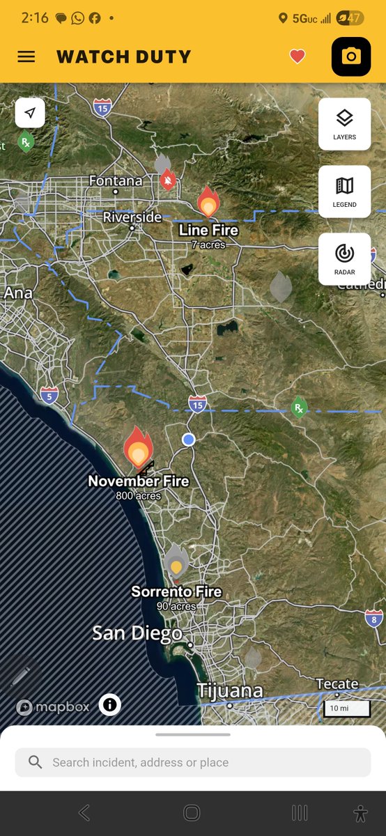
#CampPendleton-Oceanside #NovemberFire 6.10.26 - #EvacuationWarning #Level 2 via @watchdutyapp. Shelter at https://t.co/yaKSlQ1X89. #CalFire air tankers over Fallbrook. Little x sent post to drafts. Uploading video now of chopper refueling - Hwy 395 & 76. https://t.co/eYkl6qRkGA

Last Seen Hashtags on Sotwe
SexySaturday
Seen from Saudi Arabia
Teenagegirls https
Seen from Netherlands
tenseishitaraslimedattaken
Seen from United Kingdom
sleeping #gay
Seen from Japan
nsfwskz
Seen from Philippines
teeN #monkeyapp
Seen from United States
omegle
Seen from Argentina
Momson() +filter:native_video
Seen from Switzerland
reshmarechu
Seen from United States
นัดเย็ดภูเก็ต
Seen from Thailand
Most Popular Users

Elon Musk 
@elonmusk
240.8M followers

Barack Obama
@barackobama
119.2M followers

Donald J. Trump
@realdonaldtrump
111.7M followers

Cristiano Ronaldo
@cristiano
111.2M followers

Narendra Modi
@narendramodi
107M followers

Rihanna
@rihanna
97.8M followers

NASA
@nasa
92.2M followers

Justin Bieber
@justinbieber
91M followers

KATY PERRY
@katyperry
87.9M followers

Taylor Swift
@taylorswift13
81.8M followers

Lady Gaga
@ladygaga
73.3M followers

Virat Kohli
@imvkohli
70.4M followers

Kim Kardashian
@kimkardashian
69.9M followers

YouTube
@youtube
68.7M followers

Bill Gates
@billgates
64.1M followers

Neymar Jr
@neymarjr
63.2M followers

The Ellen Show
@theellenshow
62.4M followers

CNN
@cnn
61.9M followers

Selena Gomez
@selenagomez
61M followers

X
@x
60.8M followers