Top Tweets for #DisasterMapping

Behind every climate statistic is a family. This tool turns numbers back into human stories. Insights: https://t.co/OsmyG0PKoZ
.
.
#ClimateJustice #LossAndDamage #ClimateDebt #FloodedFutures #DataForGood #ClimateReparations #DisasterMapping #BangladeshClimate #ClimateEvidence


📢 Calling UN Mappers 📢
We are supporting the response activation to map buildings in DRC.
🗺 Features to map: buildings 🏘
🌐 Open to all
📍 Map: https://t.co/QEoxe9Z6Dr
More info: https://t.co/SFK0VbOhDV
#UNMaps #UNMappers #OpenStreetMap #disastermapping #volunteering


🌪️ DISASTER MAPPING: SPEED
Copernicus EMS:
post-disaster maps in 12 hours. 💡
600+ activations since 2012. 💥
Turkey earthquake 2023:
36,000 sq km damage mapped. 😬
[Src: ESA Copernicus EMS]
#DisasterMapping
(20/24)

I used satellite imagery over #Nashville from before (1/22) and after (1/27) the recent #WinterStorm to estimate #PowerOutage at a finer spatial scale, based on changes in nighttime radiance. 🛰️❄️🪫🗺️
#WinterStormFern #DisasterMapping #DataVisualization

I made a map visualizing the customer count and percentage of #PowerOutage as of 6 AM CT on Jan 26, following the severe #WinterStorm over the weekend. #Nashville stands out as the hardest hit area in terms of outage numbers. #WinterStormFern #DisasterMapping #DataVisualization


🚨 The latest imagery of Typhoon Kalmaegi captured on the 9th of Nov.
Interactive map 👉: https://t.co/nI9H0T5QBW
Major flooding is visible across the coastal region, with a distinct brown plume stretching from river to ocean.
#TyphoonKalmaegi #DisasterMapping #RemoteSensing

AI challenge advances satellite-based disaster mapping @esa #satellitedata #earthobservation #artificialintelligence #disastermapping
https://t.co/Rq76PPQ5aM
🗺 Features to map: buildings 🏘 and roads 🛣
🌐Open to experienced mappers
📍https://t.co/HSnHKoaxx4
More details: https://t.co/YMfybWOKDG
#UNMaps #UNMappers #OpenStreetMap #disastermapping #volunteering #UNvolunteering #UNvolunteers


🇳🇵GIC organised training on "Glacial Lake Outburst Flood (GLOF) Mapping using Earth Observation Satellite Data" alongwith DHM in Kathmandu, Nepal on 29-31 July 2025 under the @asiasentinel Project. #Disastermapping #Sentinelasia #JAXA
🔗https://t.co/SrUCDTWPpJ

Emergency-mapping platforms fuse high-resolution disaster images with GIS layers to guide relief agencies in identifying impassable roads and damaged bridges. #DisasterMapping #GIS

Through the use of satellite imagery and geographic information systems (GIS), the Cook Islands is improving its disaster mapping and planning, ensuring more accurate and informed decision-making. #DisasterMapping #GIS
🇮🇩 GIC attends training on "SAR Data Analysis for Disaster Mapping and Damage Assessment" organised by @science_BRIN in Jakarta, Indonesia on 16-18 June 2025 under the @asiasentinel Project. #Disastermapping #Sentinelasia #JAXA
🔗https://t.co/MVoBMHqlGd


Honduras is working with international organizations to improve disaster risk mapping and develop strategies for minimizing the impact of hurricanes and floods. #DisasterMapping #GlobalPartnerships

The government is promoting the use of technology, including drones and satellite imagery, to better predict and assess disaster risks and monitor the effectiveness of responses. #TechInDisasterResponse #DisasterMapping

Guinea-Bissau is working on mapping disaster risks and creating geographic information systems (GIS) to better assess and monitor areas at risk. #DisasterMapping #GIS

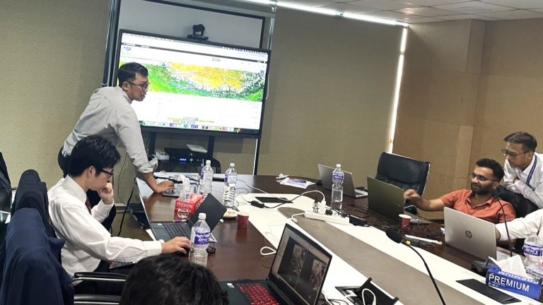
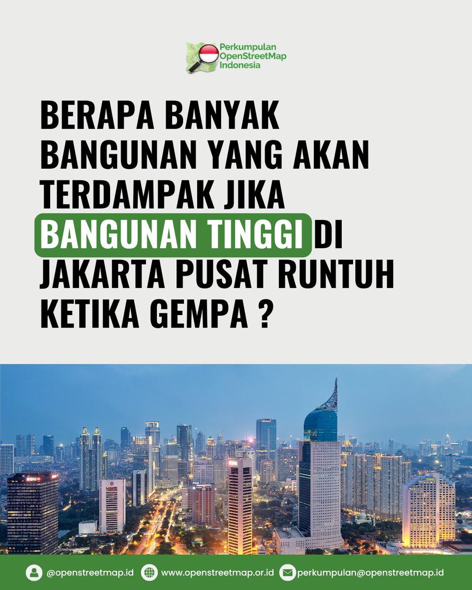
🏙️ What happens if high-rise buildings in Central Jakarta collapse in a major quake?
Using OpenStreetMap data, we mapped how many surrounding buildings could be directly or indirectly affected.
#DisasterMapping #OSMIndonesia #EarthquakeScenario
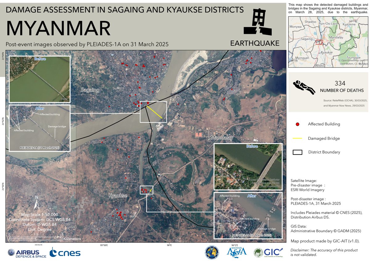
🚨M7.7 earthquake hit near Mandalay, Myanmar on Mar 28, 2025. Tremors reached as far as Bangkok.
📍GIC released satellite-based damage maps for Sagaing & Kyaukse using ESRI & PLEIADES-1A imagery to assess impact.
#MyanmarEarthquake #Disastermapping
🔗https://t.co/SGN6AtShYi

1/ **Real-Time Disaster Mapping Tools 🗺️🚨**
Innovations in mapping technology allow for real-time monitoring and visualization of disaster scenarios, helping agencies coordinate response efforts more effectively! #DisasterMapping #CrisisManagement

Charting the Devastation: A Comprehensive Map of the Eaton and Palisades Fire Damage
#EatonFire #PalisadesFire #FireDamage #DisasterMapping #LosAngeles https://t.co/KWzK4MJxVf
Most Popular Users

Elon Musk 
@elonmusk
240.1M followers

Barack Obama
@barackobama
119.3M followers

Donald J. Trump
@realdonaldtrump
111.6M followers

Cristiano Ronaldo
@cristiano
108.8M followers

Narendra Modi
@narendramodi
107M followers

Rihanna
@rihanna
97.2M followers

NASA
@nasa
92.1M followers

Justin Bieber
@justinbieber
90.5M followers

KATY PERRY
@katyperry
86.8M followers

Taylor Swift
@taylorswift13
80.6M followers

Lady Gaga
@ladygaga
72.1M followers

Kim Kardashian
@kimkardashian
69.4M followers

YouTube
@youtube
68.6M followers

Virat Kohli
@imvkohli
68.5M followers

Bill Gates
@billgates
63.4M followers

The Ellen Show
@theellenshow
62.5M followers

CNN
@cnn
61.9M followers

Neymar Jr
@neymarjr
61M followers

X
@x
60.9M followers

CNN Breaking News
@cnnbrk
59.9M followers