

Top Tweets for #ONstorms


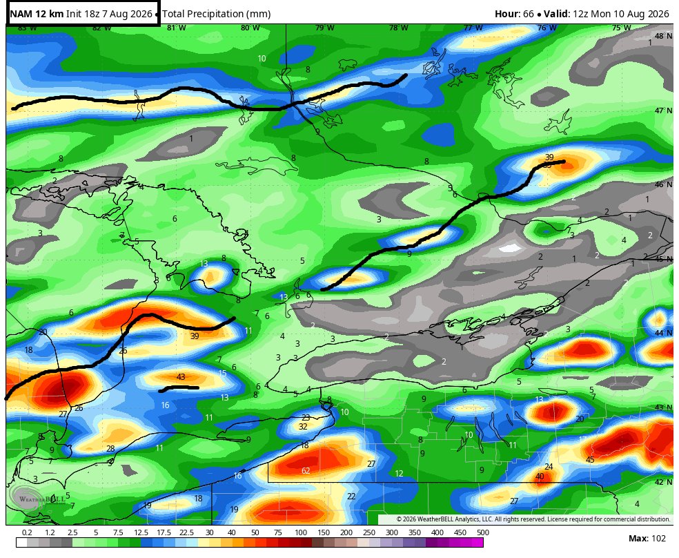


@MagneticTurtle9 @KrisStellick @KLgfeld1 @GreatNthRoad @iambilljeffery @kathypom54 @JanM7356064604 @kelly15197728 @SophieShipton_ @stephtweetsx @ForCanucksSake @LJ9111011 @bluejaysfankim @CathieBargenda @BillsMafiaLouie @robert12jones @lisamarieLML @bluejayspeteguy @filmgatereviews @tampeters1215 @Kaceyla73 @shipton_sophie @DylanCease Keep an eye out for #OnStorms today
https://t.co/kmqt2uRq0d

⚡ Potential Severe Storm Risk in Southern Ontario on Monday
We’re monitoring the potential for severe thunderstorms on Monday across parts of Southern Ontario. Right now, there is still some disagreement between forecast models on exactly where the greatest severe weather threat will develop.
Some models also suggest storms may not form until later in the evening, which could make this a nocturnal severe weather event. However, the atmosphere may become less favourable after sunset, which could limit the intensity of any storms that develop.
Because of that uncertainty, we’re waiting until tomorrow morning or early afternoon to release our detailed forecast. We want to review the latest morning data to get the clearest picture of the risk and determine where the strongest storms are most likely to develop.
At this point, we’re watching two main areas of concern, Deep Southwestern Ontario and regions around Lake Simcoe.
Storm development appears most likely in these areas during the afternoon and evening, although some storms could continue into the overnight hours.
All severe weather hazards remain on the table, including a slight tornado risk. The timing of storm development will be especially important. Storms that form during the afternoon and early evening, when daytime heating is at its peak, would have the greatest potential to produce tornadoes.
Large hail and damaging wind gusts are also possible with any stronger storms.
For now, we’re standing by the preliminary forecast we included in last night’s outlook, as it still generally reflects our current thinking.
Stay tuned tomorrow for our final forecast. We’ll also be providing full live storm coverage on our YouTube channel. Subscribe and hit the bell icon to be notified when we go live: https://t.co/gTJilWUr1D
Stay ahead of the storm by downloading our free Instant Weather app. You’ll receive notifications when we go live and be among the first to know if severe weather is threatening your area. Learn more at https://t.co/MpdPi8XnZ1.
- Brennen
#ONStorm #ONwx


#Onstorms
Tornado warnings for Oakville and Mississauga


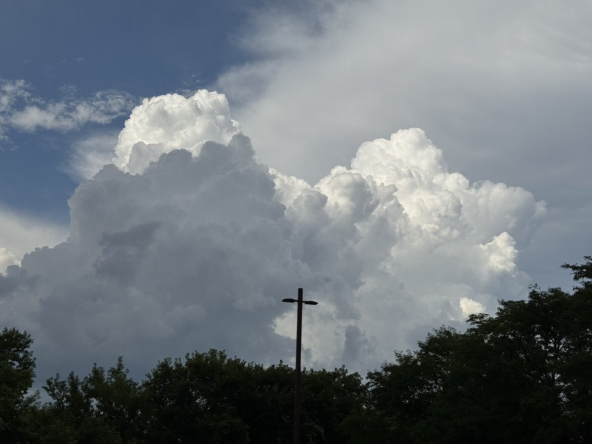
@weathernetwork @KMacTWN big thunder heads forming over Cambridge (Hespeler) Only a little burst of rain so far. Need more rain! So dry here. #OnStorms #Weather


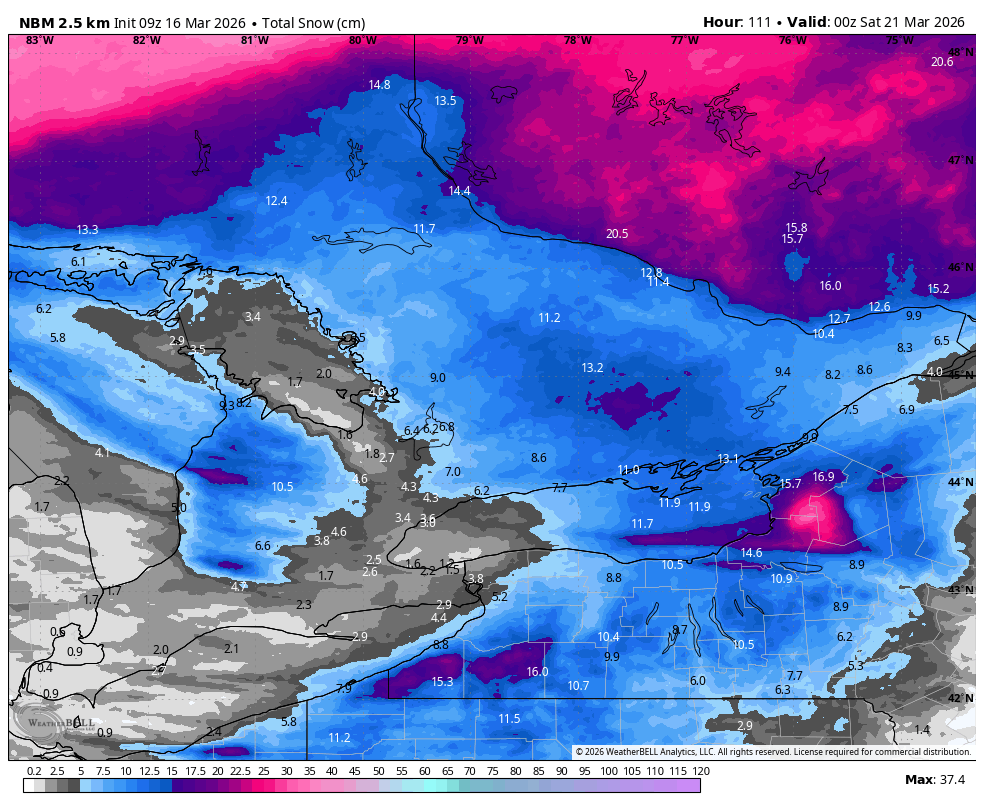
It’s unfortunate I am missing Winter #onstorms
Another pop up storm in the northwest of Kingston #popupstorms #rainfall #thunderstorms #ONStorms KTYX - Super-Res Reflectivity 1, 13:54

Gorgeous anvil over #GrandValley seen from #Georgetown area. What beautiful structure! #ONstorm #ONstorms #OntarioStorm


Heavy storms rolling through downtown Windsor and Detroit around 345pm Wednesday. #onstorms #shareyourweather @weathernetwork


Last Seen Hashtags on Sotwe
Most Popular Users

Elon Musk 
@elonmusk
241.5M followers

Barack Obama
@barackobama
119.1M followers

Cristiano Ronaldo
@cristiano
113.6M followers

Donald J. Trump
@realdonaldtrump
111.8M followers

Narendra Modi
@narendramodi
107.2M followers

Rihanna
@rihanna
98.5M followers

NASA
@nasa
92.4M followers

Justin Bieber
@justinbieber
91.7M followers

KATY PERRY
@katyperry
89.5M followers

Taylor Swift
@taylorswift13
83.4M followers

Lady Gaga
@ladygaga
74.9M followers

Virat Kohli
@imvkohli
72.6M followers

Kim Kardashian
@kimkardashian
70.7M followers

YouTube
@youtube
68.8M followers

Neymar Jr
@neymarjr
65.6M followers

Bill Gates
@billgates
64.9M followers

Selena Gomez
@selenagomez
62.6M followers

The Ellen Show
@theellenshow
62.3M followers

CNN
@cnn
61.8M followers

X
@x
60.8M followers