

Top Tweets for #StokeLevel

Coop Cooper
#StokeLevel is solid at Camp Richardson Marina - Happy 250th weekend, my friends...
Stay'nThirsty
Coop
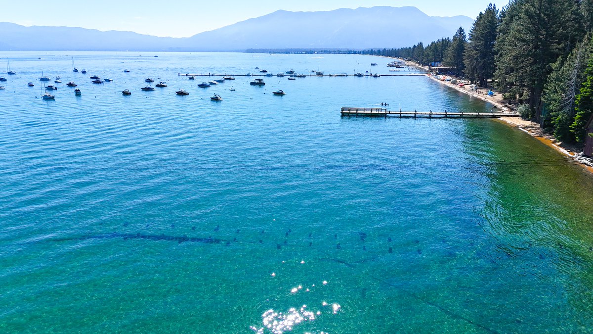
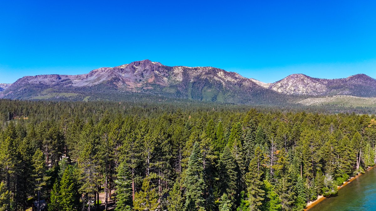
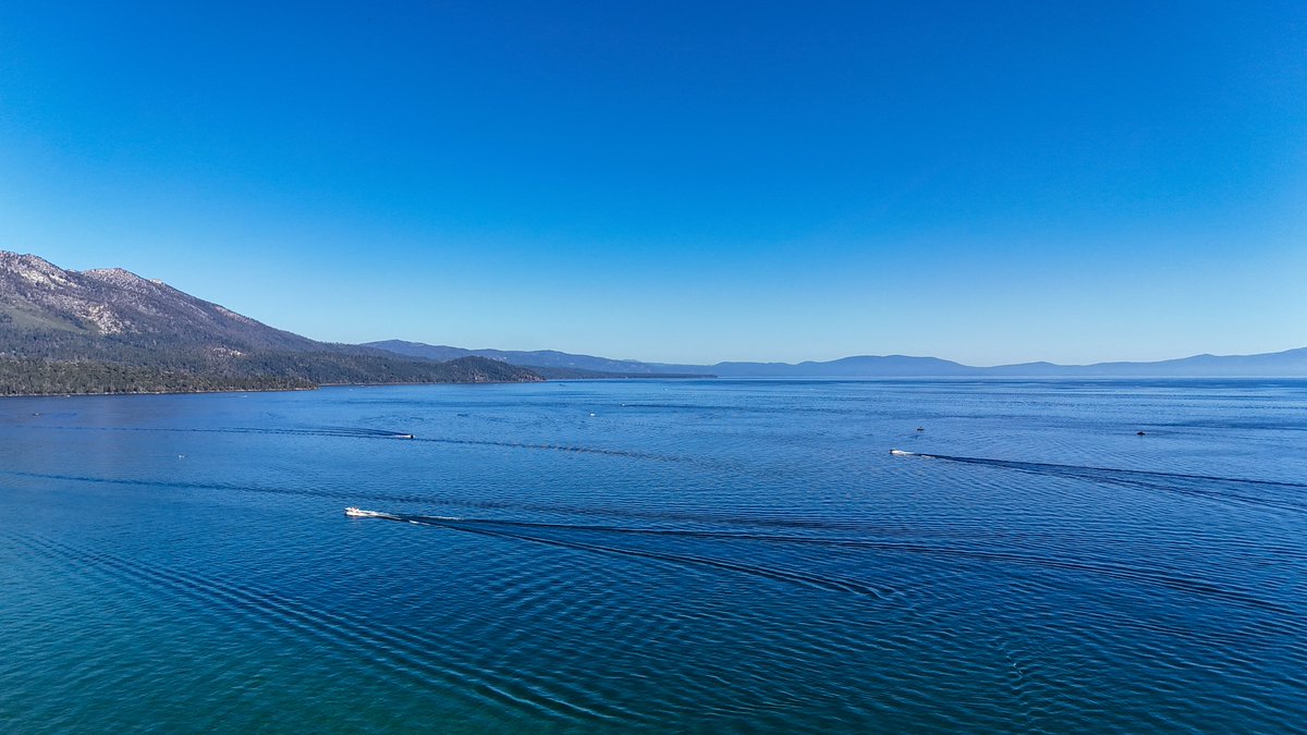
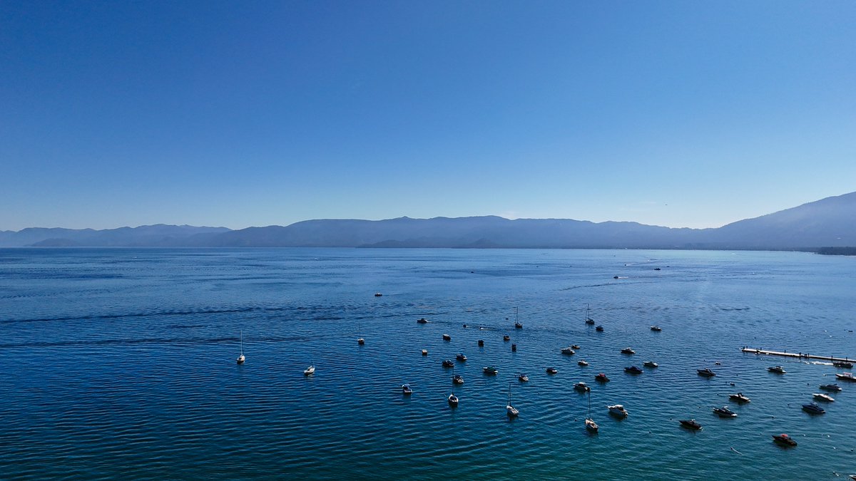
#NeverWasteADay
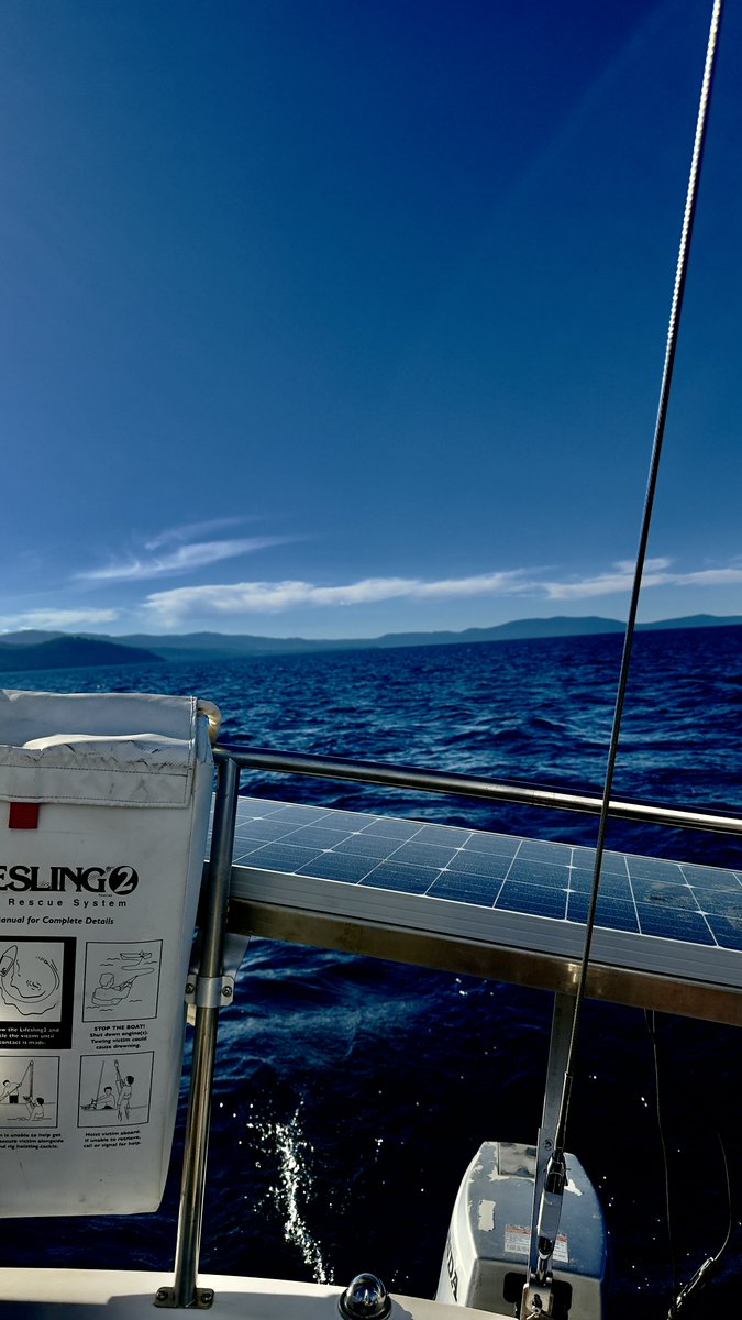
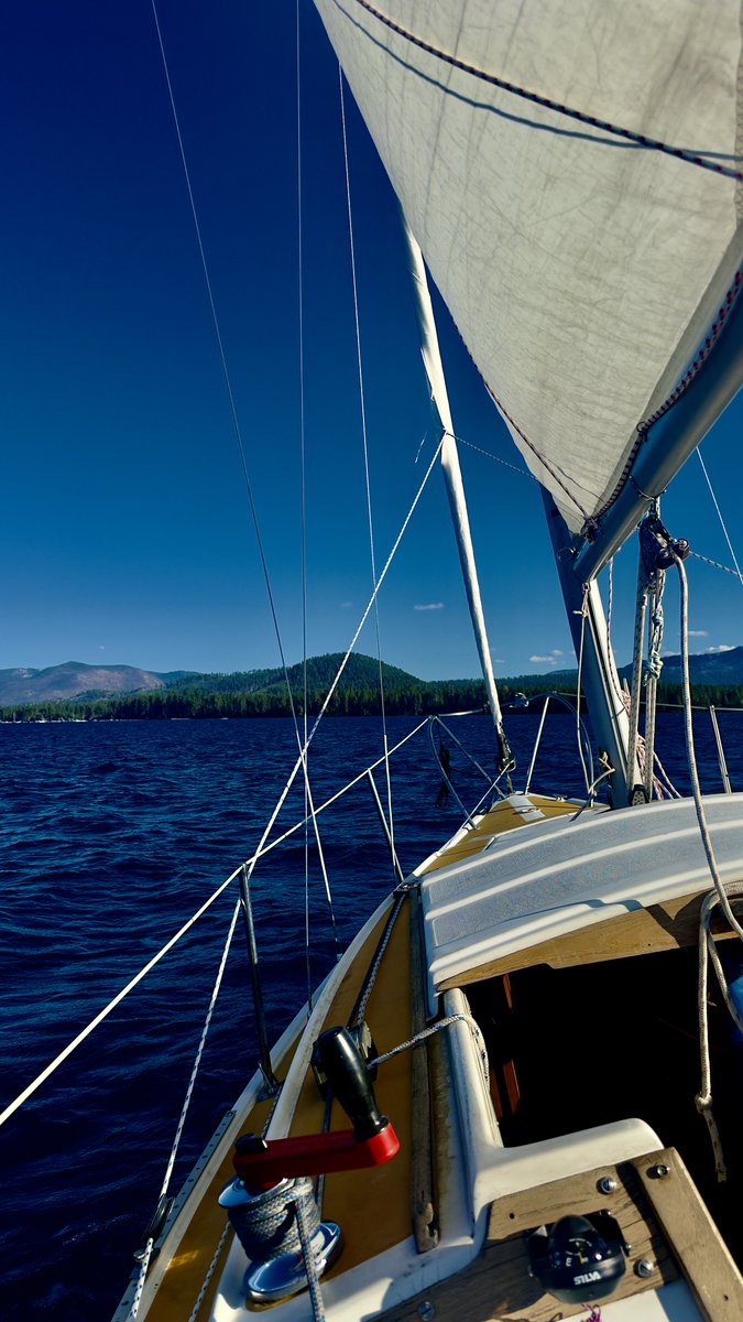
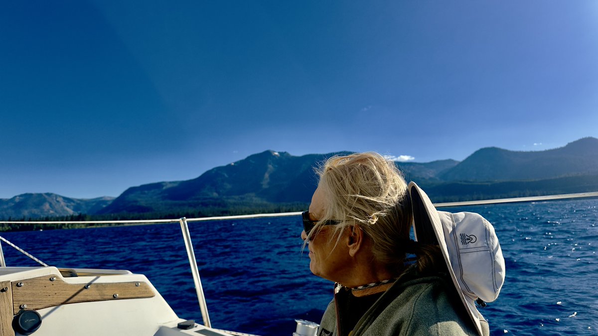
Out for an evening out on #SunshineDayDream, light SW winds, east sailing on #BigBlue. Never get enough of this, takes the #StokeLevel to a whole new level... The 250th is ahead my friends. Let's be celebratory and festive, be safe, and respect #BigBlue...
Stay'nThirsty, #StokedOnLife
Coop

¡Buenos días, my friends
Cup’☕️ ’Joe in hand on a #ThrasherMagThursday. The #StokeLevel begins to rise as a #FreshRound of #MaNatural is officially inbound for the Sierra. A Winter Storm Watch goes into effect tomorrow, April 10, at 0500 PDT. The models are in, and on the latest runs, we can clearly see the approaching bands of precipitation.
❄️ The Flex: This system is going to be a multi-stage event. We will see #Rain and #Snain through Thursday and Friday, with snow levels holding high at approximately 8,500 to 9,000 feet. However, the real shift happens on Saturday. Temperatures are forecasted to drop along with those snow levels. We are looking at potential accumulations of 1-2ft above 6,600ft and a massive 3-4' feet above 7,800ft.
🗓️ Timing and Impact: Significant mountain snow will affect travel throughout the weekend. Snow levels will remain above pass levels through Friday afternoon, dropping to around 6,000-7,000ft late Friday into Saturday, and eventually lowering to around 4,000-4,500ft by late Saturday into Sunday.
❄️ The Totals: Accumulations of 1-2ft are expected above 4,500ft, with up to 3-4ft over the highest peaks. Lighter accumulations are expected down to 4,000ft.
The Window: At this point, the heaviest snow is expected late Saturday morning through midday Sunday.
The Watch: A Winter Storm Watch is in effect for the southern Cascades and northern Sierra above 4,500 feet from 5 PM Friday through 11 PM Sunday.
🏔️ Mountain Ops and Travel: Travel will be significantly impacted this weekend. If you are planning to cross the passes, be prepared for winter conditions. Stay up to date with the latest forecast at https://t.co/sz5Bs6NlXF and check road conditions before you head out.
“Symptoms of chronic stress are feelings of fragmentation and of chasing after time, of not being able to be present. What we are looking for is a settled, joyful state of being, and we need to give this state space.” ― Dalai Lama XIV.
Full Tahoe Sector report 👉: https://t.co/0ZdePGLBF8
Stay'nThirsty for POW
Coop
¡Buenos dìas, my friends
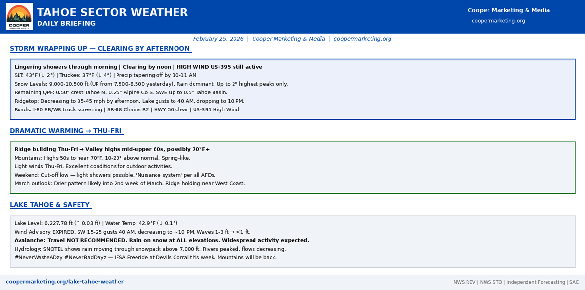
Cup’O’Joe in hand, #StokeLevel, well, it's soggy to be transparent, shit-howdy, tut-tut looks like more rain, well, at least until 10ish this morning... The recent snow is gone, and the mountains are back to Pre-Feb levels. We've just experienced 24 hours of Rain to approx. 10k across the region. #Sloopy, wet, and rotten, with a few passes with a CAT to clean up the rain runnels... PRECIP, taper off this morning around 10/11am - Temps high near 49º, Southwest wind 5 to 10 mph, with gusts as high as 20 mph.
Saturday, we do have another round approaching. ECMWF and GSPS show the system approaching; guidance shows snow levels at 8,600+, possibly lowering on Sunday... Long-range, well, that's a story for tomorrow. Off to the IFSA Freeride, with the Tahoe Freeride family, in Devils Corral today, through Sunday... Bring'yr rain-slickers, and muck'aluks...
#TahoeSector details 👉 : https://t.co/0ZdePGLBF8
“Choose to be optimistic, it feels better.” ― Dalai Lama XIV
Coop | RS#69
¡Buenos días my friends,
Cup’O’Joe in hand, #SweetSoulSalvationSaturday is here with a #StokeLevel of 11.9. The stars are out, it’s cold in the basin, but the winds are light, and the snow is sliding well. We have arrived at MLK weekend!
The MLK Weekend Playbook: We are in a “Rinse & Repeat” High Pressure cycle. Expect sunshine, spring-like temps, and light winds (E/ENE 5-10mph).
• The Inversion: It’s another “Upside Down” start. Truckee is a deep freeze at 14ºF, while Kirkwood Chair 6 is a balmy 45.4ºF.
• The Strategy: Layer up! It’s chilly early, but you’ll be shedding layers by noon.
• The Surface: #EarlyBird gets the #FreshCord. Off-piste is firming up—look for the wind-buff up high, but expect fast/corn-like snow as you descend. Watch for #LowTide obstacles off the groomed runs.
Tahoe Sector Report: https://t.co/0ZdePGLBF8
Tahoe Sector Data (Verified @ 0615 PST)
• Temps (Inverted): 16ºF (SLT) / 14ºF (Truckee) / 45.4ºF (Kirkwood Ridge).
• Winds: Light & Variable (finally!). Ridge gusts have calmed significantly.
• Roads: Clear & Open. No restrictions. Valley Commuters: Dense Fog Advisory until 10 AM.
• Advisories: None Active in the Sierra. Watch for Freezing Fog in Truckee/Martis Valley.
The Bottom Line: The weather gods have delivered a mixed bag of sunshine, inversions, and spring-like vibes. If you are hitting the resorts, enjoy the stability and the soft turns. If you are BC-bound, enjoy the conditions. Next scheduled #Refresh, to be determined, #MotherNature has a HP parked off the West Coast, and is not looking like she’s ready to let ole üllr and Neptune return for a winter's party for at least another week.
Stay’nThirsty for POW,
Coop | RS#69
¡Buenos días my friends,
Cup'O'Joe in hand, #StokeLevel back to 11 and back on the Weather desk, as chill to the morning air, light wind, with a few stars poking about. Today, there is a 20% chance of snow before 1600. Cloudy through mid-morning, then gradual clearing, with a high near 36º at lake level. Winds SW 5/15mph. Tonight, Snow likely, mainly between 1900 and 0400. Increasing clouds, with a low around 14º. Breezy, with a southwest 15/20mph, gusts around 30mph. Chance of precipitation is 60%. Possible lake-level snow accumulation of 1/2" possible.
The Sit-Rep: We have a fast-moving, moisture-starved system arriving late today into Thursday morning.
The "Haves vs. Have-nots": NWS Reno warns of a "banded snowfall scenario" where narrow bands could drop 1 inch per hour rates for a brief period overnight.
The Totals: High peaks (Western Tahoe Basin) could see up to 4 inches. Donner Pass has a 35-40% chance of hitting 3 inches.
The Winds: A 110kt jet stream is moving overhead. Expect westerly gusts of 70+ mph tonight over Tahoe peaks.
Be aware in the BC: No Kooks, Karens, Jimmies, Nancies, or Jerries. Check SAC before, have your gear (AND know how to use it), and make a plan!
We are in a quick-hit cycle. Today offers a window of calm before the wind ramps up and the "banded" snow moves in tonight. It won't be deep, but 1-4" of #MaNatural sets the stage for a #ColdSmoke #TheologianThursday #FreshCoat!
Tahoe Sector Weather: https://t.co/0ZdePGLBF8
"Every day, think as you wake up, today I am fortunate to be alive, I have a precious human life, I am not going to waste it… I am going to benefit others as much as I can."
― The Dalai Lama
Stay'nThirsty for POW
Coop | RS#69
¡Buenos días my friends,
Cup’O’Joe in hand, #TheologianThursday - #StokeLevel 13.7. Happy New Year to you all!
We are starting 2026 with rain at elevations < 8,500’ and “snain” above—can’t really call it snow even at 10k yet. The main band of precipitation is approaching from the south now, stretching from Fresno to Sacramento. Good news: Snow levels are forecast to drop to around 7,400 feet in the afternoon.
Tahoe Sector Data (Verified @ 0615 PST)
Temps: 34ºF (SLT) / 32ºF (Truckee) / 32ºF (Ridge - Wet Snow).
Winds: Light SW winds increasing to Breezy South later.
Roads: Slick in spots. Watch for Black Ice.
Advisories: Winter Weather Advisory (Until Noon). Winter Storm Watch (Fri PM - Sun AM).
Mtn Ops Note: Today will be wet, sloppy snow, but carveable where the Mtn Teams dropped tillers. Off-piste will be “funkity.” Be light on your feet. However, the Bull-Wheels are spinning at 0900, and a wet day on the mountain beats a dry day in the salt mines. Get’cha some.
The Bottom Line: We start 2026 with a wet kiss from #MotherNature. Keep the faith—the cold air and big totals (2-4 feet!) are lined up for the weekend. Respect the Mtn Teams working in the slush today; they are the real MVPs.
Tahoe Sector Sit-Rep: https://t.co/0ZdePGLBF8
Cal Trans Roads: https://t.co/l4Sso1i2dc
Stay’nThirsty for POW,
Coop | RS#69
¡Buenos días my friends,
Cup'O'Joe in hand, #StokeLevel 11.9 on a New Year's Eve morning! It is a chilly start here at the #HippieHaus (27ºF) with stars still above, but savor the calm. #MotherNature is marching a 1-2 punch up from the South that will define our holiday weekend.
Sit-Rep: We are looking at a "Rain-to-Snain-to-Snow" transition.
• Today (NYE): Starts calm, but precipitation arrives late afternoon.
• Tonight: Because of the cold, valley air trapped by inversions, Freezing Rain is a real threat. Roads could turn to sheets of glass.
• The Weekend: The storm turns colder on Friday. We are tracking a model signal for 24-31" of snow South of Hwy 50 by Sunday.
Rode KirkwoodMtn yesterday, Sentinel is riding well with mid-season, ripping, carvalicious snow. Be warned: it is still #LowTide off-piste. The Wall, challenges at the entry, lurkers, and a few spicy lil-sharky objects, now on the Wall, Butter, wind affected from the Easterly yesterday, seek and you shall find.
Today is the transition. Enjoy the morning calm, because the pattern flips this afternoon. We start wet and warm, however, #MotherNature has a #Refresh for the weekend. Keep the #StokeLevelHigh, # Slow'yrRoll on the ice, and get ready for a #KirkwoodDeep start to 2026.
New Year’s Forecast & Storm Timing: https://t.co/0ZdePGLBF8
Stay'nThirsty for POW
Coop | RS#69
¡Buenos días my friends,
Cup'O'Joe in hand, #StokeLevel feel'n solid at 11.9. Rode KirkwoodMtn yesterday, and the snow is in mid-winter shape, carvable on-piste and soft/variable off-piste #LowTideZones - be aware. Story this morning is the temperature. We are waking up to a chilly 12ºF here at the #HippieHaus; however, at 9,100’, it is 43.9ºF. That is a +31º delta...
The Bottom Line: It will feel warmer riding the upper mountain than standing in the parking lot. Enjoy the carvalicious cord today, because #MaNatural is serving up a "Snain" sandwich for the New Year.
The Forecast Shift:
• The Warmup (Wed-Thu): A warm system brings high snow levels (>8,500') and potential rain/snain to the Basin on New Year's Day.
• The Crash (Fri-Sat): Colder air arrives late Friday, crashing snow levels down to 6,000' with a potential return to heavy powder.
Tahoe Sector report: https://t.co/0ZdePGLBF8
Stay'nThirsty for POW,
Coop | RS#69
¡Buenos dìas! #SupercalifragilisticSaturday! #StokeLevel 10.9.
This is PEAK "bonus fall." Near-record highs ~69°F. #FlatAssCalm lake. Get out & get'cha'some!
Enjoy it, because the pattern is set to change. The "hint" is now a "notable pattern change" forecast for Wed.
0500 Report: -TODAY: Sun, ~69°F, light winds. Perfect. -NEXT WEEK: Ridge breaks. A real storm arrives Wed (wind, rain, & mtn snain, snow).
#HippieHaus Report: https://t.co/0ZdePGLBF8
#TahoeWeather #CAwx #PatternChange
Cup'O'Joe in hand, #StokeLevel fired up on a #SoulfulSunday down at Camp Rich, Temps 48º to kick off the day with a light 199º(SSW) wind that will gradually pick up throughout the day, Lake Tahoe West Buoy, winds 288º (SSW) at 1mph, temps 48º...
https://t.co/dGAmpOW23D
Cup'O'Joe in hand, Perfect start with a #RockSolid 11.1 #StokeLevel to kick off #HumpDay... Winds at Camp Rich currently SSW (198º) at .5mph, temp 57º, Lake Tahoe Buoy West, 52º with SSW (198º) at .5mph.
https://t.co/dGAmpOW23D
Buenos dìas, my friends
Cup'O'Joe in hand, #StokeLevel at 10.9. Today, Light SW wind at Camp Rich SW@2mph, temps 44º Lake Tahoe Bouy West, SE@2mph, and 43º
AkovaLife #LiveYourBestLife
https://t.co/dGAmpOVue5
Good morning, my friends
Cup'O'Joe in hand, #StokeLevel is solid at 10.0 on a Friday. Yesterday was a blustery day on the lake, with peak gusts in the 30-35mph range. Today - Kick'n it off with 46º at Camp Rich, Winds are currently SW at 3mph.
https://t.co/dGAmpOW23D
Buenos dìas my friends
Cup'O'Joe in hand, #StokeLevel solid at 10.0, beautiful day on-tap here in the Sierra temps forecasted to reach the low 70ºs around the lake.
Here is the link to: https://t.co/dGAmpOW23D
Buenos dìas my friends
Cup'O'Joe in hand, with the #StokeLevel solid @10, to start the day. How bout'that T-Storm light show last night... Today, the warming trend continues; trails will be #BrownPow, Lake flat, with a light wind into the mid-afternoon, T-showers forming after 2p - Check out the timing on the K-Index, be aware, and have a ripping day!
#AkovaLife #LiveYourBestLife
“Happiness is determined more by one’s state of mind than by external events.”
― Dalai Lama XIV
Stay'nThirsty
Coop
https://t.co/dbhoJngkx3
Buenos dìas, my friends
Cup'O'Joe in hand, #Stoked to see measurable precipitation across the Sierra and the State this morning. #StokeLevel holding firm at a 9.1 with little to no real snowpack accumulation regionally, 8" to 12" over the past 48 hours, with a wet and heavy start to the season. Mtn Teams across the region will be working the #MaNatural carefully, letting the moisture leech out so they can distribute the load across their currently open terrain. Groomers and snow-making teams are the saviors of the start to this season, give'm a hug, or buy'm a adult frosty the next time you see'm in the store, or at your favorite watering hole...
There's not much to report; however, it's #MaNatural, and we are #Stoked for every inch # MotherNature provides our local and regional resorts.
By the numbers:
• Sugar Bowl = 10"
• Bear Valley = 8"
• Palisades = 7"
• Mt Rose = 6"
• KirkwoodMtn = 4"
• Mammoth = 4"
Forecast models have us regionally looking at dry but cooler temps. It's a tough start, but it is a start, mìs amìgos...
NWS Summary - West Slope
Latest forecast accumulations are trending drier for the bulk of the area today, with much of the precipitation confined to areas along and west of the I-5 corridor. NBM is indicating a 60 to 80% chance of exceeding 0.25" of QPF for this area, with a 40 to 60% chance for areas further eastward. Furthermore, probabilities of mountain snowfall remain highest along the Sierra, south of the Highway 50 corridor, with a 60 to 80% chance of exceeding 1" of additional snowfall and a 30 to 60% chance of exceeding 4" of additional snowfall. Snow levels are expected to rise throughout the day from the 6,500 to 7,500 foot level to the 7,000 to 8,000 foot level.
Extended Forecast:
The end of the weekend into early next week looks to see transient upper-level ridging build into the region. This will result in a continuation of the mostly quiet weather ahead. High temperatures are expected to moderate in the low to mid-50s for the Valley and mid-40s to low 50s at higher elevations. Ensemble guidance indicates that an upper-level trough will begin to drop southward from the Gulf of Alaska, moving toward midweek. While increasing precipitation chances will be possible, the exact timing and eventual trajectory of this feature remain highly uncertain at this time.
SolidDaliWednesdayWisdom:
“Every day, think as you wake up: today, I am fortunate to be alive; I have a precious human life, and I am not going to waste it. I am going to use all my energies to develop myself, to expand my heart out to others, and to achieve enlightenment for the benefit of all beings. I am going to have kind thoughts towards others, and I am not going to get angry or think badly about others. I am going to benefit others as much as I can.”
― The Dalai Lama
Stay'nThirsty for POW
Coop

Cup'O'Joe is in hand with the #StokeLevel at a high for the season-to-date of 9.9 with just a little 3" to 15" spread of fresh #MaNatural across the region this morning. Huge props to #MotherNature, Ole King Neptune, and that lil rascal Ullr for the sunrise surprise of #GorillaSnot for our Mtn Ops team to work with today. But wait, there's more: Forecast cast models (GFS & NAM), as posted, are looking like another round of #MaNatural late today and overnight!
NWS Reno: Our first system exited the region overnight, with just some stringy bands of snow showers draping over the central and northern Sierra early this morning. Otherwise, we will see an overall lull in precipitation through late morning between systems. The second wave, accompanied by another band of precipitation, will arrive late morning, spreading into the northern and central Sierra through the afternoon. This wave will be much less dynamic in comparison to the system that passed through yesterday, so much lighter precipitation is expected. Snow levels will be much lower this round, with snow levels between 5,000-5,500 feet. As such, we could see a dusting of snow down to foothill locations around the Reno-Carson-Minden areas. However, the heaviest snowfall is expected in the northern and central Sierra, with an additional 4-10" inches possible along the crest.
As this system exits the region tonight, expect precipitation to quickly taper off this evening, with skies clearing overnight. Clearing skies and northerly flow prevailing behind the exiting system will lead to quite frigid temperatures for Friday morning. Lows are expected to bottom out in the low 20ºs for western Nevada valleys and single digits to teens for Sierra locations.
24hr totals:
• Dodge - 3”
• Bear - 5”
• HV - 5"
• Kirkwood - 7”
• Sugar Bowl - 14”
• Palisades - 15”
ThursdayDaliWisdom:
“We were wired for this complementarity, this togetherness, this being family. And even if you think it is sentimental, it isn’t sentimental. It’s for real.”
― Dalai Lama XIV
Stay'nThirsty for POW
Coop
Evening, my friends!
Glass'O'Red in hand and my #StokeLevel hitting a solid 9.7, I'm feeling deeply thankful tonight. Big cheers to #MotherNature, King Neptune, and Ole Man Ullr for gracing us with 3" of #GorillaSnot at the #HippieHaus and a sweet 6" to 8" blanket above 7,800ft. In just 4 hours, our mountains have been magically transformed by #MaNatural's touch.
Shoutout to the tireless souls prepping and maintaining our mountains. Your dedication gives us incredible terrain to conquer and enjoy. Snowmakers, groomers, lift operators, and all in mountain ops - you're the unsung heroes of our #POWHunt'n season...
As we dive into this festive season, let's hold a thought for the less fortunate. Channeling the Dalai Lama's spirit of mindfulness and compassion, let's be fully present. And from Plato and Aristotle, let's draw wisdom to understand the beauty and impact of our deeds.
In true Hunter S. Thompson fashion, let's remember, "Life's journey is not to arrive at the grave safely in a well-preserved body, but rather to skid in sideways, totally worn out, shouting 'Holy shit, what a ride!'". Let's embrace life with a pinch of George Carlin's humor, finding joy in the little things.
Wishing everyone a rippingly amazing holiday season. Let's make these moments count, support one another, and spread kindness and cheer far and wide.
Stay thirsty for POW & Happy Holidays!
Coop
Buenos días, my friends,
Cup'O'Joe in hand, with the #StokeLevel at a solid 9.7 this morning, as we see a shift in the forecast over the next 72hrs. It's not much, but #MotherNature has pivoted, and we look like a #Solid 4" in the Basin (Sarcasim), but what the heck? It is better than the 1" to 3" forecast just 48 hours ago. There are scenarios that have a 4" to 8" range along the Crest, with snow levels as far down as 5,5k, but they are the outlier models. The good news is the temps and the ability for the Mtn team to continue to make snow, build the base around the lodges, lift ramps, and potentially gain more acreage as #MotherNature delivers a blessing of #MaNatural...
This is the start we all hate; however, it is more the norm than the anomaly. For those who have lived the dream as #SnowFarmers over the past several decades, yep, it is not your first rodeo, and you, just like I am, are just looking at the trends and models. Now, If you need it and want it, get it; UT, PNW, Whistler, Revy, Kicking Horse, Big Sky, and Jackson all have a base and a good sliding surface. Use that pass, go get it, and when you come home to the Sierra, bring some back with you...
Just saying ;)
Main Point and Changes:
A series of upper-level waves are slated to bring unsettled weather to the region today through Thursday.
The first wave arrives today as a negatively tilted trough that is quite dynamic in nature, with recent guidance indicating a frontogenetic signature that has subsequently bumped up snowfall totals considerably for the central and northern Sierra crest Wednesday afternoon and evening. We will see a lull in precipitation on Thursday morning, but the snowfall doesn`t end there. A second wave arrives Thursday afternoon, with inside slider characteristics that will yield much lower snow levels. As such, a Winter Weather Advisory has been issued for areas above 6,000ft from US-50 northward into Lassen County. Trans-Sierra travel will be difficult during this period.
Colder air looks to infiltrate the region much quicker than previous guidance for this first system, with snow levels during heaviest snowfall between 6,500-7,000 ft. Shadowing will be quite strong with this first band, especially given the downsloping that is expected along the eastern slopes of the Sierra. As such, the heaviest snowfall will mainly remain confined to areas in the central and northern Sierra above 6,500 ft. The second wave brings another less dynamic band of precipitation to the region on Thursday. Snow levels will be much lower this round, between 5,000 and 5,500 ft. As such, steady snowfall will initiate in the Sierra and portions of NE CA late Thursday morning, continuing into the afternoon.
#HumpDayLamaWisdom:
“As a second step to familiarizing ourselves with the virtue of patience, it is also very helpful to think of adversity not so much as a threat to our peace of mind but rather as the very means by which patience is attained. From this perspective, we see that those who would harm us are, in a sense, teachers of patience.”
― Dalai Lama XIV
Stay'nThirsty for POW
Coop
Last Seen Hashtags on Sotwe
caught
Seen from Singapore
ハズニ塩湖
Seen from New Zealand
Candidate18
Seen from Ecuador
edremitliler
Seen from United States
Gachaheatcommuinty
Seen from United Kingdom
تويرك
Seen from Netherlands
StopChildAbuse
Seen from United States
kayseri bayan
Seen from Turkey
XXLWOOFIA
COS2026
Seen from United States
Trends for you
Most Popular Users

Elon Musk 
@elonmusk
240.8M followers

Barack Obama
@barackobama
119.2M followers

Donald J. Trump
@realdonaldtrump
111.7M followers

Cristiano Ronaldo
@cristiano
111.2M followers

Narendra Modi
@narendramodi
107M followers

Rihanna
@rihanna
97.8M followers

NASA
@nasa
92.2M followers

Justin Bieber
@justinbieber
91M followers

KATY PERRY
@katyperry
87.9M followers

Taylor Swift
@taylorswift13
81.8M followers

Lady Gaga
@ladygaga
73.3M followers

Virat Kohli
@imvkohli
70.4M followers

Kim Kardashian
@kimkardashian
69.9M followers

YouTube
@youtube
68.7M followers

Bill Gates
@billgates
64.1M followers

Neymar Jr
@neymarjr
63.2M followers

The Ellen Show
@theellenshow
62.4M followers

CNN
@cnn
61.9M followers

Selena Gomez
@selenagomez
61M followers

X
@x
60.8M followers