

Top Tweets for #WW1Map

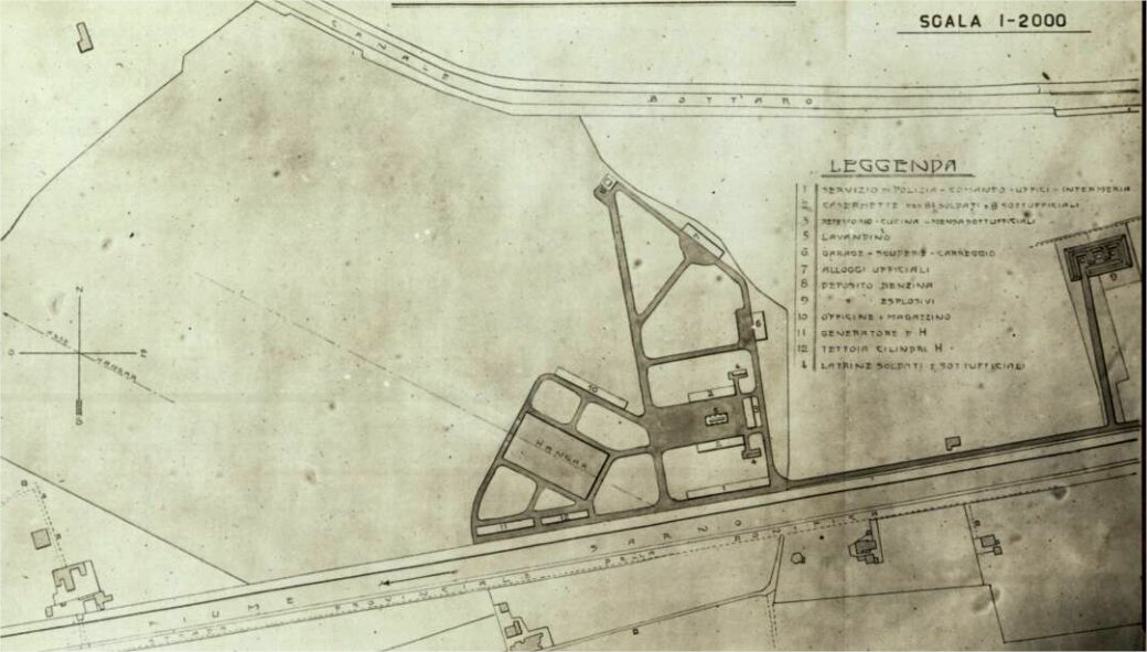
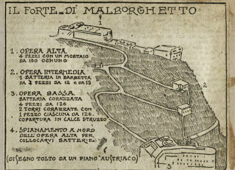
#ww1map with my modifications to highlight the Italian border in blue and the location of the mammoth Austro-Hungarian #FortHense, Malborghettol of the Napoleonic period, heavily bombed by the Italians. At its base is the monument from 1808 that is still there.
#ww1Fortresses



a fairly precise #ww1map of the Karst battlefield between south of Gorizia and Monfalcone area with the opposing lines from 1915 to 1917. The most famous locations are marked. Note the contour lines of the map also.
#ww1italianfront

#OTD, 1917, where all began:
#ww1map of the #Mrzli above Caporetto : it shows on the right the 3 Austro-German attack columns that broke through the Italian lines, opening the breach to descend into the valley.
#Caporetto
#ww1italianfront

#ww1map of Tonale pass, Adamello area, with indication of Italian and Austrian fortresses
#ww1italianfront

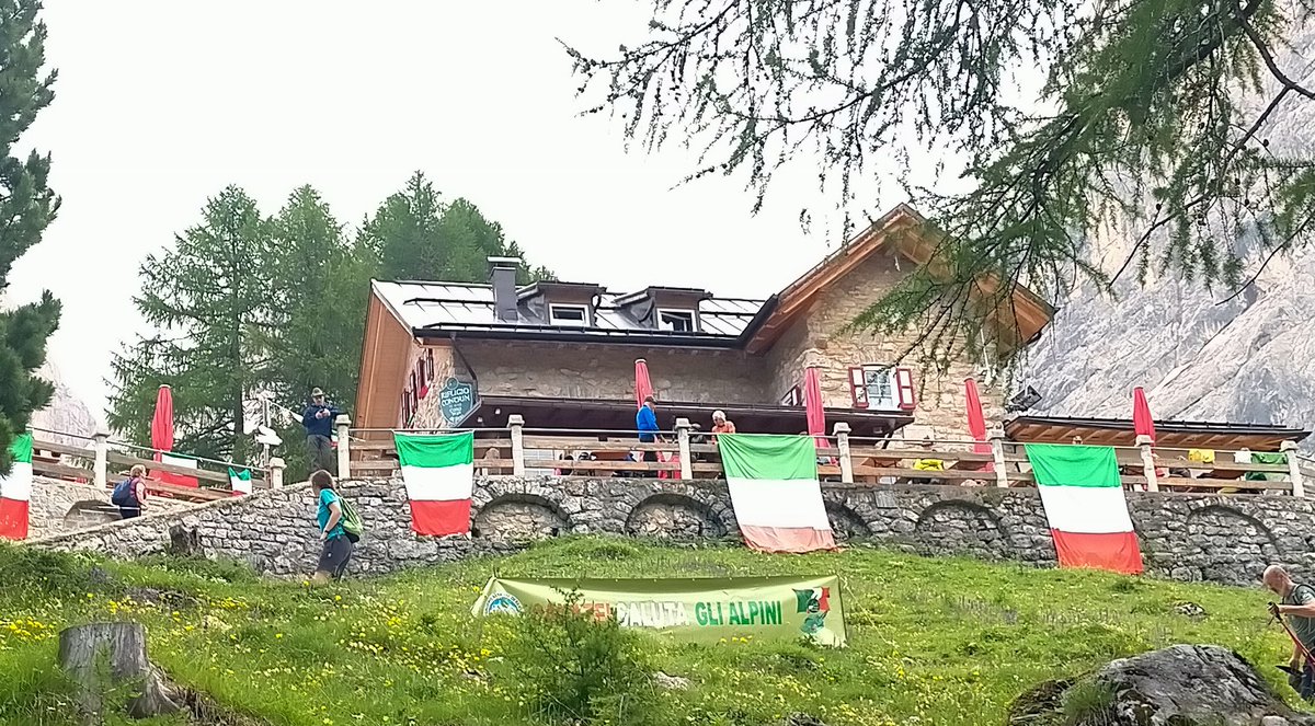
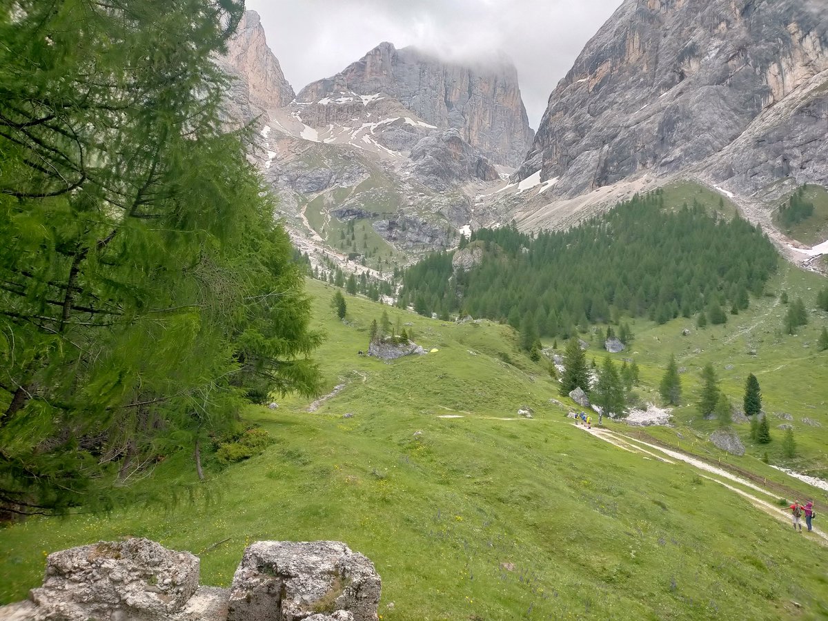
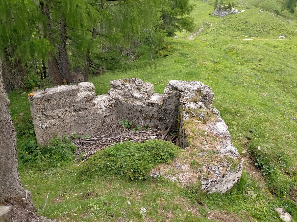
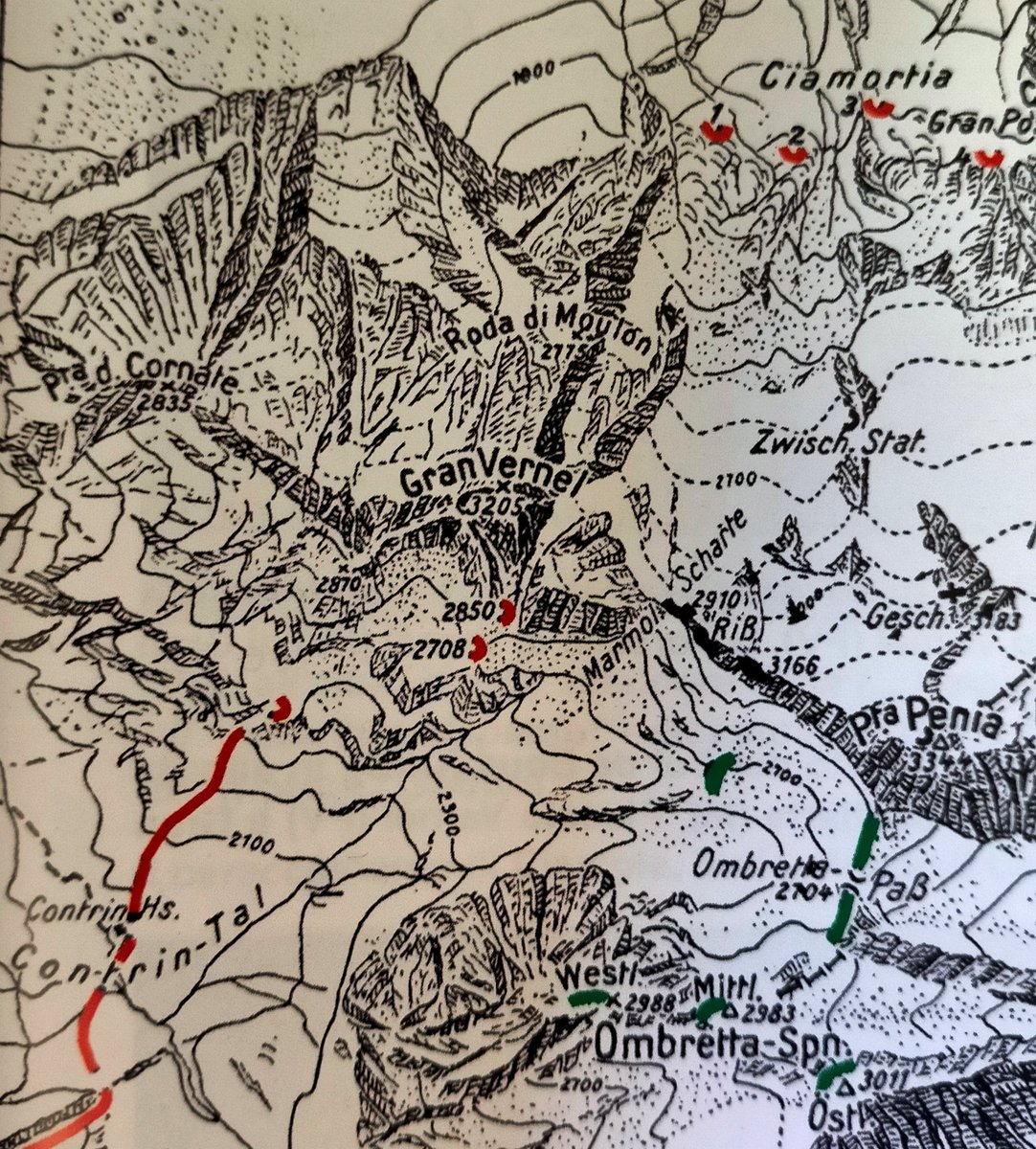
#ww1map of the Austro-Hungarian (red) and Italian (green) trenches in the Contrin-Ombretta area, southern #Marmolada sector. The fortified Austrian artillery bunker still stands today at the #Contrin Refuge
#ww1dolomitifront
#ww1map of the #MonteGrappa region with the maximum Austro-Hungarian advance on the red dot line. The maximum penetration took place at St Lorenzo bridge near Mt Raniero. Here is placed the Roman column that indicates the maximum point reached by the enemy.
#ww1Solstice


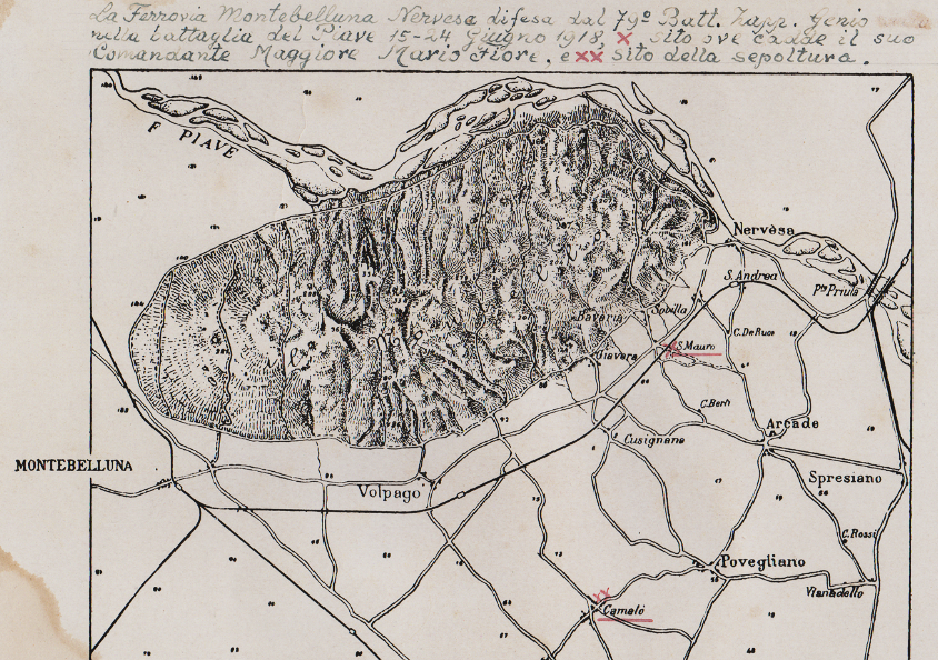
#ww1map of #Montello with the Montebelluna - Nervesa railway line that was defended by the italian 79th sapper battalion in the battle of the #ww1Solstice, #ww1Piavefront.
X where Commander Mario Fiore fell
XX place of his burial.
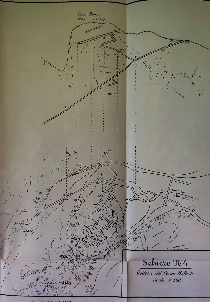
#ww1map of the Italian underground tunnels dug on the Corno Battisti, Monte #Pasubio area. Pictures of entrance number 8.
Find it on the map!
#ww1tunnel
#ww1italianfront


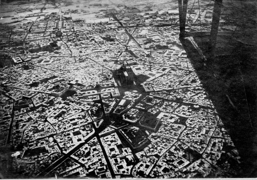
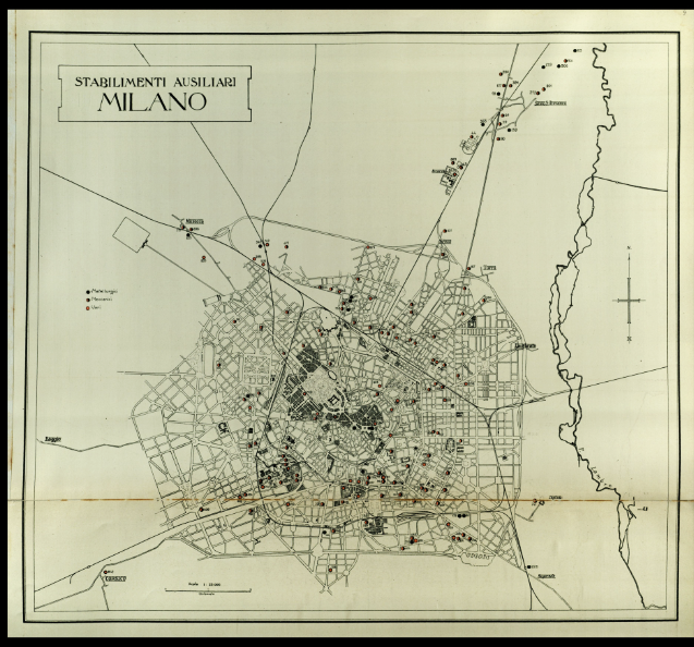
a #ww1map of Milan showing the auxiliary workshops for war production and an aerial view of the city in the winter of 1916
#Milano #ww1italianfront
#ww1map of the #Pasubio massif.
In white the Italian lines and in black the Austrian ones. Note how Pasubio (the "Denti" in particular) were the closest point of contact.
The struggle took place mostly in the rock with excavation of tunnels and mines.
#ww1minewarfare

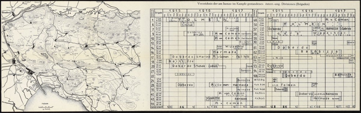
interesting Austrian #ww1map illustrating the dislocation of the various Austro-Hungarian departments on the Isonzo from 1915 to 1917
#ww1italianfront
#ww1map of the Colle di Santa Lucia in the Tolmino area, #Isonzofront, 1916. The Italian line in red and the "Fountain of the Dead" in the circle. It's the only point where water gushed and around it lay dozens of corpses shot by Austro-Hungarian snipers.


Received this in the post today. An Imperial War Museum Somme copy of a hand-drawn map of the East Surrey Regiments 1st of July objectives near Montauban. #Interesting #HandDrawnMap #WW1Map #TrenchMap @JBEcology

Last Seen Hashtags on Sotwe
Most Popular Users

Elon Musk 
@elonmusk
241.7M followers

Barack Obama
@barackobama
119M followers

Cristiano Ronaldo
@cristiano
114.4M followers

Donald J. Trump
@realdonaldtrump
111.9M followers

Narendra Modi
@narendramodi
107.2M followers

Rihanna
@rihanna
98.7M followers

NASA
@nasa
92.4M followers

Justin Bieber
@justinbieber
91.8M followers

KATY PERRY
@katyperry
90M followers

Taylor Swift
@taylorswift13
83.9M followers

Lady Gaga
@ladygaga
75.4M followers

Virat Kohli
@imvkohli
73.3M followers

Kim Kardashian
@kimkardashian
70.9M followers

YouTube
@youtube
68.8M followers

Neymar Jr
@neymarjr
66.3M followers

Bill Gates
@billgates
65.1M followers

Selena Gomez
@selenagomez
63M followers

The Ellen Show
@theellenshow
62.3M followers

CNN
@cnn
61.8M followers

X
@x
60.7M followers