Top Tweets for #elevationdata

GEBCO_2026 Grid: annual compilation of a continuous terrain model of the global oceans and land, released this week https://t.co/C96XCLKKar
Free to download but not quite #opendata unfortunately https://t.co/5mF5Nes3qq
#elevationdata #bathymetry

🎁Give yourself the gift of premium imagery from @vantortech, now available at SkyWatch-exclusive prices.
Limited-time offer ends Dec 31, 2025.
👉 https://t.co/ypd4ZL2Bpa
#satelliteimagery #satellitedata #basemaps #elevationdata #vantor


Empower your geospatial skills with GeoinfoAcademy!
🎥 Watch. Learn. Apply.
Part 1: https://t.co/pX66RYDLrO
Part 2: https://t.co/DegM1NNVA8
#GeoinfoAcademy #GIS #RainfallData #ElevationData #SpatialAnalysis #TutorialVideo #RemoteSensing #EnvironmentalData #GeospatialTraining

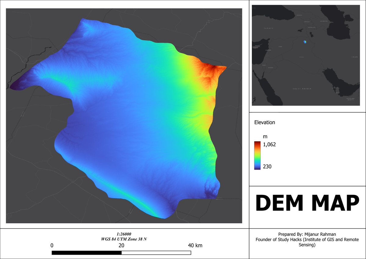
Quickly Download SRTM DEM Data for Any Study Area Using QGIS
Tutorial link: https://t.co/MmavOxFZdS
#SEO #QGIS #SRTM #DEM #RemoteSensing #GIS #Geospatial #Topography #ElevationData #Mapping #SpatialAnalysis #TerrainModeling #DigitalElevationModel #Geoinformatics

Join us at @AMEroundup Booth 1000 to explore how #SatelliteImagery and #ElevationData can support your #MineralExploration and #Mining goals and keep your projects moving forward. 🌍 🛰️

Join us at @AMEroundup Booth 1000 to explore how #SatelliteImagery and #ElevationData can support your #MineralExploration and #Mining goals and keep your projects moving forward. 🌍 🛰️
Book a meeting with our team: https://t.co/RQnvf6uBBQ


Global Mapper Pro offers machine learning-based Automatic Point Cloud Analysis tools, which feature custom training and classification. Take the all-in-one GIS software for a 14-day test run: https://t.co/7WeFeOya9q
-
#globalmapper #terrain #contourmap #elevationdata


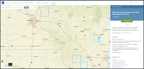
Wisconsin GIS specialists: 2022 @USGS lidar is now available on the Data Access Viewer for Green, Iowa, Polk, & Winnebago Counties!
https://t.co/tZyhUpJjC2 #ElevationData

Check out our case study on #waterconservation! Partnering with DCSE, we've helped Rancho Water achieve over 96% accuracy in #landcover classification using our hi-res #aerialimagery & #elevationdata - a big win for #sustainable water mgmt in California. https://t.co/PaIwaknLfR

We have spent years working in the world of civil engineering and know so many of the issues when it comes to data and data processing. It is one of the reasons why Equator came to life.
Let us help you get to the fun work faster.
#lidar #elevationdata #civilengineering

Day 1 of #PDAC2024 is here, and we're excited to chat with you about your mining and mineral exploration projects and how advanced satellite imagery and digital elevation solutions can help! Find us at Booth 614 🌏 🛰️ #SatelliteImagery #ElevationData

One site, all your topographic data needs!
We want to help make your workflow that much more streamlined.
#lidar #topographicdata #elevationdata

Have you subscribed to Equator yet? Sign up to see what everyone is talking about!
#lidar #topographydata #elevationdata


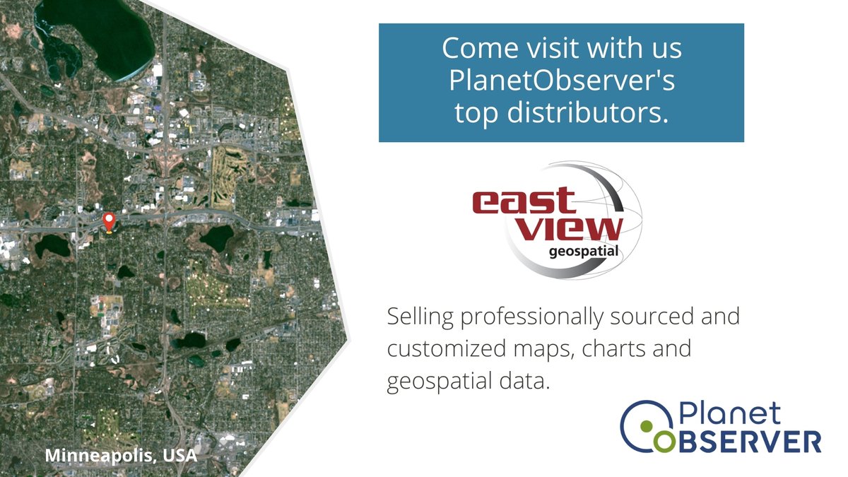
Introducing our partner for more than a decade: @EVGeospatial
East View Geospatial is a distributor of our #SatelliteImagery and #ElevationData products in the North American market, catering to diverse sectors including Aerospace, Simulation & Training, and Defense.
#Geospatial
The clock is ticking and only 3 days are left before our End of Year Offer expires⏰
Take advantage of our #PlanetSAT 10m #SatelliteImagery #Basemap and our #PlanetDEM 30m #ElevationData at an exclusive 30% Discount!💥
Don’t miss out and contact us now:
https://t.co/Xj87mRf2xY

The countdown has begun, and only 10 days are left to benefit from our End of Year Offer!
Enjoy a 30% Discount on #PlanetDEM 30m high-quality global #ElevationData, and on #PlanetSAT 10m #SatelliteImagery #Basemap 💥
Elevate your #Geospatial Projects now:
https://t.co/Xj87mRf2xY

Enhance your defense operations with #PlanetSAT 10m #SatelliteImagery #Basemap and #PlanetDEM 30m #ElevationData, both at a 30% discount💥. Our products are optimal for MODs and #GEOINT operations, being reliable and cost efficient.🛰️
More on our website:
https://t.co/JycOvdmMr6


🌏 New ArcGIS Living Atlas updates (Oct 2023) include:
High-resolution elevation 🏔 data for France, Nebraska, Italy, and beyond, a new feet measurement 📏 raster function, and more.
🔗 See details: https://t.co/l5Q6RZD2yy
#GIS #ElevationData #geospatial
Take a look at our high quality #PlanetDEM 30m Global #ElevationData. Ideal for civil and military applications.
Get it now with an exclusive 30% discount in our Year-End Offer! 💥
#GIS #GeospatialData #3D #3DMap
Click below for more info about PlanetDEM!
https://t.co/epY5Hbe0ai

PlanetObserver brings you exceptional #GeospatialData solutions. Get ready to enhance your #Geospatial projects at a 30% discount! Don't miss our End of Year Offer on #PlanetSAT #SatelliteImagery #Basemap and #PlanetDEM high quality global #ElevationData🌍
https://t.co/TXM8ECFOdZ

Last Seen Hashtags on Sotwe
RTEUpfront
Seen from Indonesia
fuckbigbrother
Seen from Spain
nsfwtwtًًً
Seen from Australia
สวิงกิ้งกทม
Seen from Thailand
TheChosen
Seen from Ecuador
กินฉี่
Seen from Thailand
athelina
Seen from Turkey
MatemáticasInteractivas
Seen from United States
desi randi
Seen from India
kiddo
Seen from United States
Most Popular Users

Elon Musk 
@elonmusk
240.1M followers

Barack Obama
@barackobama
119.3M followers

Donald J. Trump
@realdonaldtrump
111.6M followers

Cristiano Ronaldo
@cristiano
108.8M followers

Narendra Modi
@narendramodi
107M followers

Rihanna
@rihanna
97.2M followers

NASA
@nasa
92.1M followers

Justin Bieber
@justinbieber
90.5M followers

KATY PERRY
@katyperry
86.8M followers

Taylor Swift
@taylorswift13
80.6M followers

Lady Gaga
@ladygaga
72.1M followers

Kim Kardashian
@kimkardashian
69.4M followers

YouTube
@youtube
68.6M followers

Virat Kohli
@imvkohli
68.5M followers

Bill Gates
@billgates
63.4M followers

The Ellen Show
@theellenshow
62.5M followers

CNN
@cnn
61.9M followers

Neymar Jr
@neymarjr
61M followers

X
@x
60.9M followers

CNN Breaking News
@cnnbrk
59.9M followers