Top Tweets for #mappingTools

Announcing https://t.co/7eSO6jWgDy - Powered by Soar.
A powerful tool that simplifies georeferencing for everyone!
#MappingTools #Cartography #Georeference #Mapping


A lot of surveyors are still using outdated tools to calibrate land boundaries.
We @adollatech are building something different — smart, fast & field-ready.
If you work in mapping or boundary validation, you’ll want to keep an eye on this.
#SurveyTech #MappingTools #LandSurvey


🗺️ New Map Alert!
The Namibia Topographic Map is now available on the SAGTA Map Downloader — plus two new projects:
📚 South Africa & 🌍 Global Map Projects
🔗Visit the SAGTA Map Downloader: https://t.co/LgIXEyFrhK
#Kartoza #GIS #MappingTools


📊 Get the inside scoop on Java mapping frameworks. Our analysis of MapStruct vs. ModelMapper reveals their strengths and weaknesses. #JavaDev #MappingTools https://t.co/h7t7L9G8ML
🌟 MapStruct offers type-safe, generated code, while ModelMapper provides flexible runtime mapping. See how they stack up in our analysis! #JavaDev #MappingTools https://t.co/h7t7L9G8ML
🔍 Choosing between MapStruct and ModelMapper? Our analysis dives deep into performance, type-safety, and flexibility. #Java #MappingTools #Programming https://t.co/h7t7L9G8ML

This month, our #AppAMonth campaign features StreetComplete—an app that helps you fix missing map details with simple quests! 🚀
🔹 Trainer: @CMenttor
📍 Online Training
🔗 Register Now! https://t.co/EXRxGil1nL
#OSMGhana #StreetComplete #OpenStreetMap #MappingTools


It’s happening TODAY! Join us for a live online training on OSMAnd with @Qwajo_king🌍📍
📌 How to Join:
✅ Register now
✅ Get hands-on guidance from @Qwajo_king
✅ Start mapping today!
#OSMAnd #GIS #MappingTools #OSMGhana


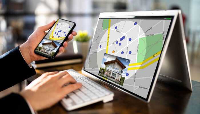
Unlock property ownership insights with mapping tools, GIS, and public records! 🏘️
Discover how you can simplify real estate research and transactions in our latest guide.
https://t.co/woCZOh9g88
#realestate #gis #mappingtools #propertyownership #realestateinvesting

🚀 Exciting news! Felt now integrates with Amazon Redshift. 🌍 Easily connect your geospatial data for real-time insights, visualizations, and more. 📊✨
Learn more in our latest blog! 👉 https://t.co/KfWaV3euEr
#GIS #DataViz #Redshift #SpatialData #MappingTools


In this quick guide, find out how you can find and overlay coordinates, measure map features and add buffers to your maps. Find out more: https://t.co/3Vk5ON1EQc #geographyteacher #mappingtools

@BoukacemZeg @schopfel ..and few slides for the "mapping tools" subject, extensively covered by @aarontay on his blog (thanks for sharing these insights !), e.g: https://t.co/sF9lnUq2Ck &
https://t.co/SKiEuPuFTj
#mappingtools #searchengines #search #bibliographicdatabases #visualthinking #opencitations
You can select and navigate between various maps in Digimap for Schools. Check out our short guide to get you started with our service: https://t.co/Jki3n8KkQ3 #geographyteacher #mappingtools
Explore les dashboards @TheLensOrg sur les données du labo. Extrêmement versatile; customisation des graph, exports (svg, data, etc)...
#dataviz #bibliometrics #mappingtools #searchengines #ESR


📍#GeoforGood23 Summit took place last week and the #SERVIRAmazonia team was well-represented 🙌🏼 The event gathered professionals worldwide using @Google #mappingtools for planetary #sustainability @googleearth @SERVIRGlobal @sig_gis @Imaflora @amazonacca 🌳 1/2


Shining a spotlight on the heart of #OHIO811: Our Operations team! Day after day, they ensure notices are handled with precision and care. The operations team is a vital part of keeping Ohio digging safely!
#operations #OHIO811 #oups #Excavation #MappingTools #SafeDigging

As the kiddos head back to school and we get into the swing of fall projects, remember that safety starts at home! Before you dig into any backyard ventures, always notify #OHIO811. Let's keep our future bright and safe!
#backtoschool #OHIO811 #oups #Excavation #MappingTools

Happy Labor Day from OHIO811! We want to wish everyone a safe Labor Day and remind you to always notify OHIO811 before you dig via the web at https://t.co/jeJtJVa8xg or call 811 before you dig!
#laborday #OHIO811 #Excavation #MappingTools #SafeDigging


Once again, we extend our sincere appreciation to all who contributed to the success of this event. Your dedication and hard work are truly appreciated. #opensource #mapping #efficiency #Wemezeker #GIS #geospatial #opendata #techconference #mappingtools #dataanalysis


Justin Gleeson @AIRO_MU demoing the Regional Development Monitor, an analytic #digitaldashboard with #mappingtools that will guide future planning frameworks and policies across ireland with @EMRAssembly @SouthernAssembl and @NWAssembly @OrdnanceIreland #regionaldevelopment

Last Seen Hashtags on Sotwe
Trends for you
Most Popular Users

Elon Musk 
@elonmusk
240.3M followers

Barack Obama
@barackobama
119.3M followers

Donald J. Trump
@realdonaldtrump
111.6M followers

Cristiano Ronaldo
@cristiano
109.5M followers

Narendra Modi
@narendramodi
107M followers

Rihanna
@rihanna
97.4M followers

NASA
@nasa
92.1M followers

Justin Bieber
@justinbieber
90.7M followers

KATY PERRY
@katyperry
87.1M followers

Taylor Swift
@taylorswift13
81M followers

Lady Gaga
@ladygaga
72.5M followers

Kim Kardashian
@kimkardashian
69.5M followers

Virat Kohli
@imvkohli
69.1M followers

YouTube
@youtube
68.6M followers

Bill Gates
@billgates
63.6M followers

The Ellen Show
@theellenshow
62.5M followers

CNN
@cnn
61.9M followers

Neymar Jr
@neymarjr
61.7M followers

X
@x
60.9M followers

Selena Gomez
@selenagomez
60.2M followers