An interactive map of the US offering 100+ data points to understand which state, county, town, and neighborhood is right for you.
Start exploring today!
I built a tool to explore 100+ data points for any US neighborhood: housing costs & trends, demographics, flood risk, commute times, air quality, schools, and more. Every US state, county, town, and neighborhood. All completely free.
https://t.co/8Z2x0PbGnR
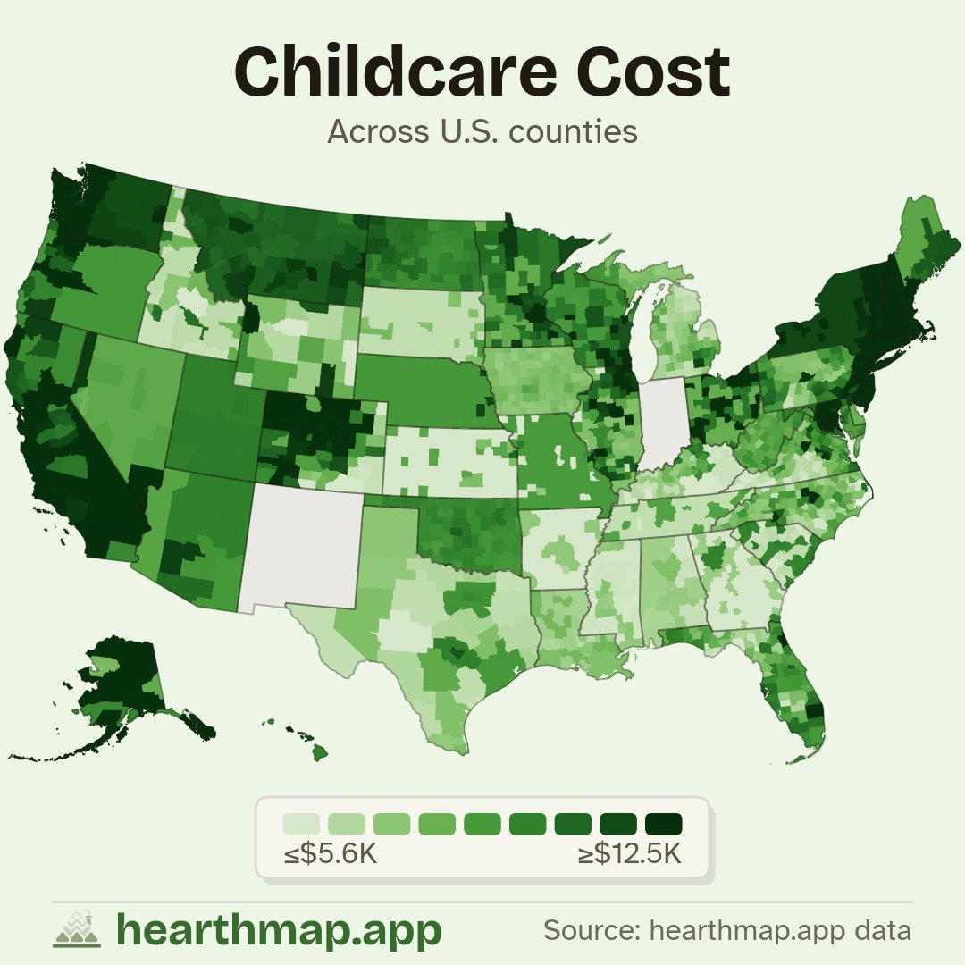
Childcare runs $26,900 a year in Arlington, Virginia and over $26k in San Francisco. The five cheapest counties on the map are all in Missouri, bottoming out near $2,200 in DeKalb County. A 12x spread for the same job of watching a kid. Where does your county land?
The hottest county in America is Inyo County, California, home of Death Valley, at a 77 degree average, with South Florida right behind. The coldest is Alaska's North Slope at 13 degrees. A 64-degree spread on one map. Where does your county sit on the thermometer?
Loudoun County, Virginia tops the US county map at $182k median household income, with Silicon Valley and the DC suburbs right behind. At the other end, Bullock County, Alabama gets by on $31k. Nearly a 6x gap inside one country. Where does your county land?
I got tired of juggling 10 different sites every time I researched a place to move.
So I built hearthmap: 110+ data points (housing, jobs, schools, climate) for every state, county, city, and town, on one free map.
Find where you fit, or just satisfy your data curiosity.
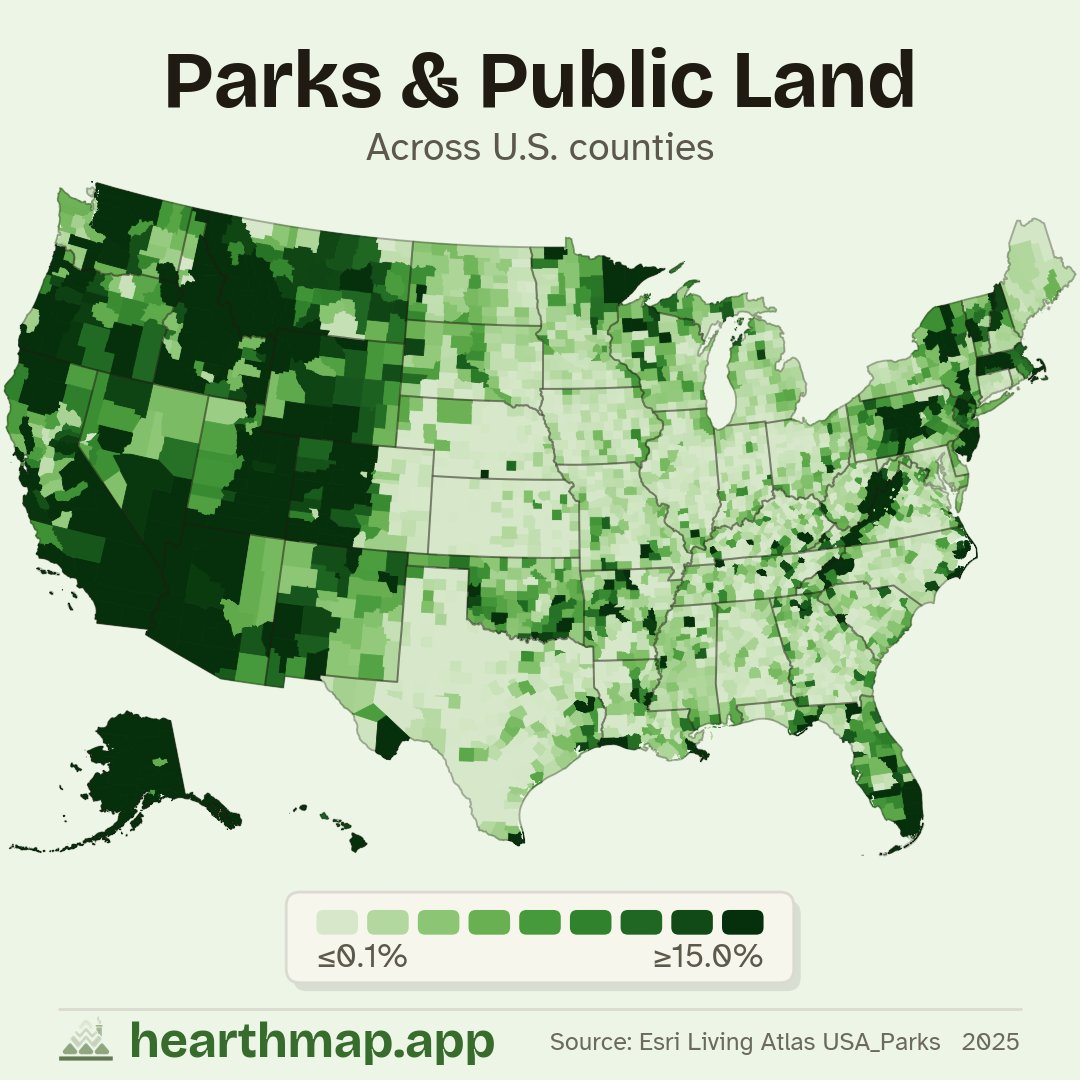
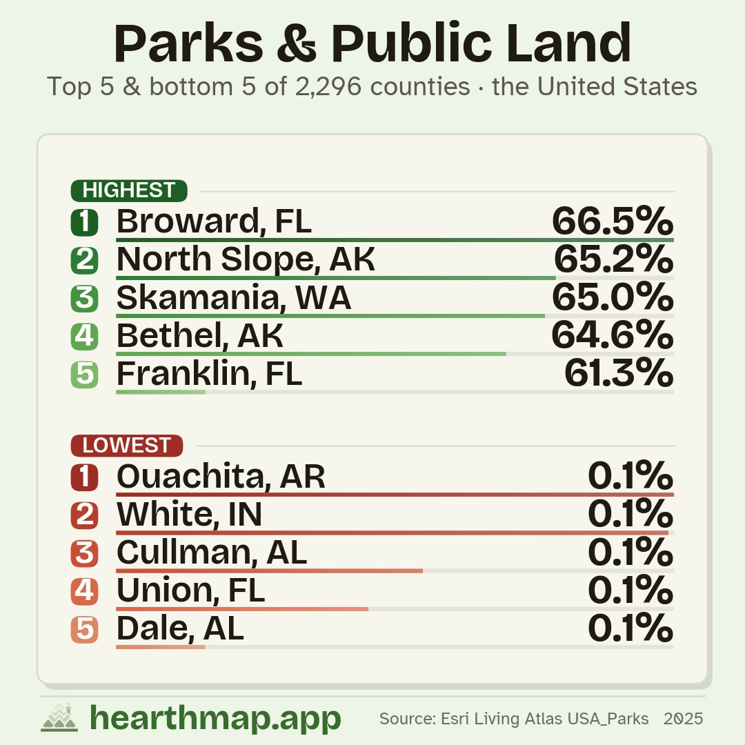
Nevada is basically one giant public land map, federal agencies hold about 80% of it, then you cross into the farm belt and Iowa or Kansas counties are nearly all private. The West runs deep green; most of the East and Midwest barely registers. Where does your county land?
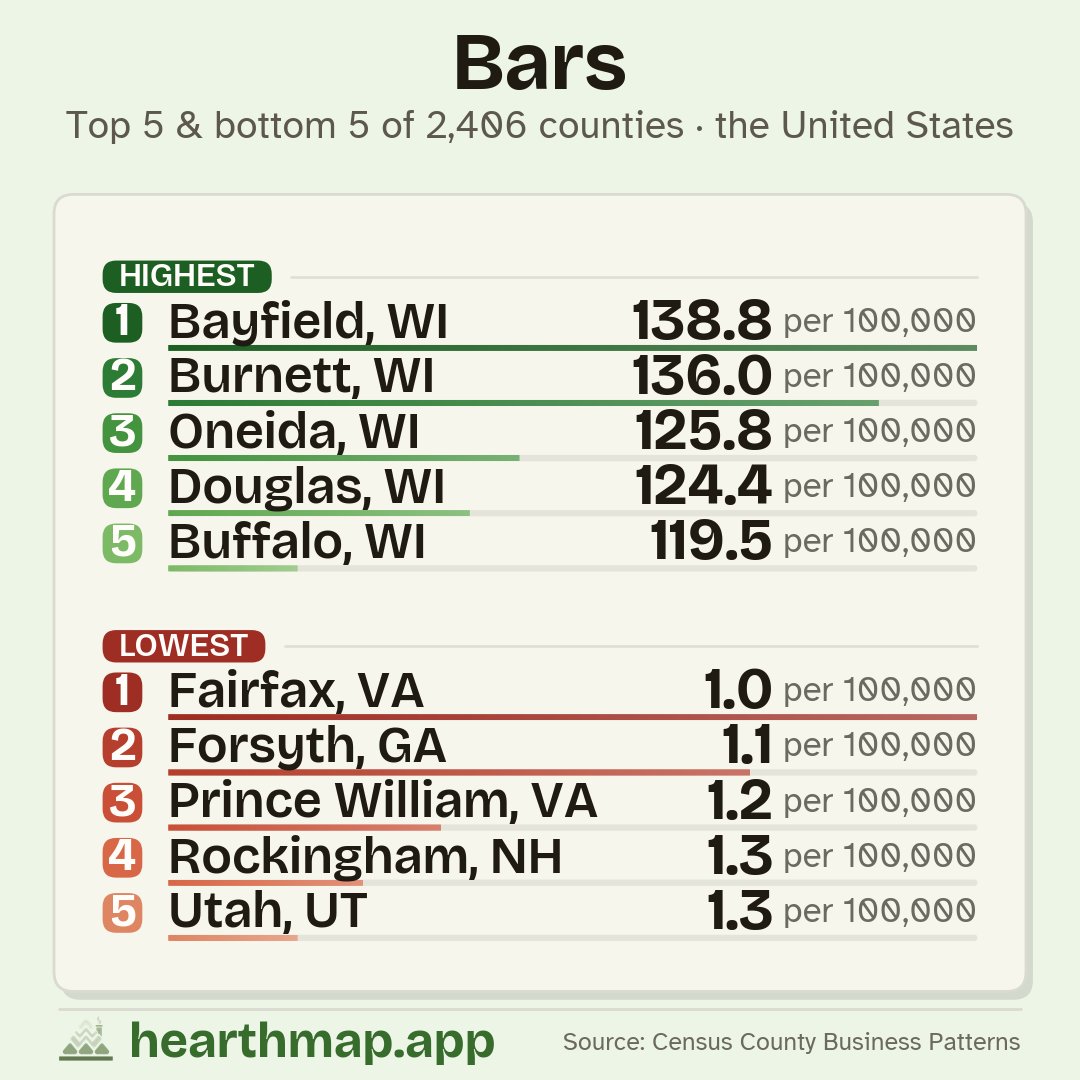
Iron County, Wisconsin runs about one bar per 240 people, the densest in the nation, and the Upper Midwest glows: a tavern belt across Wisconsin, the Dakotas, and Montana. Then the map darkens across the South, where dry counties stack up. Where does your county land?
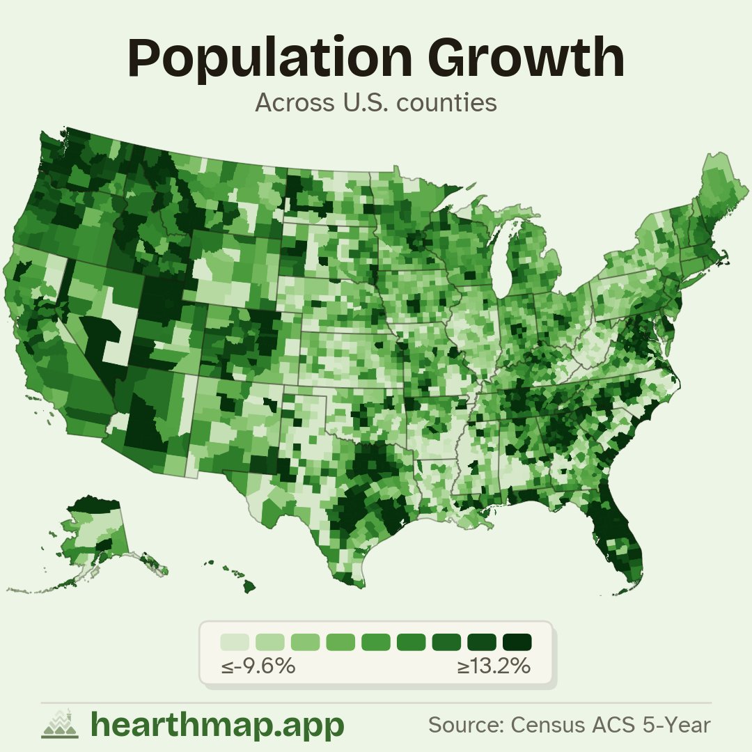
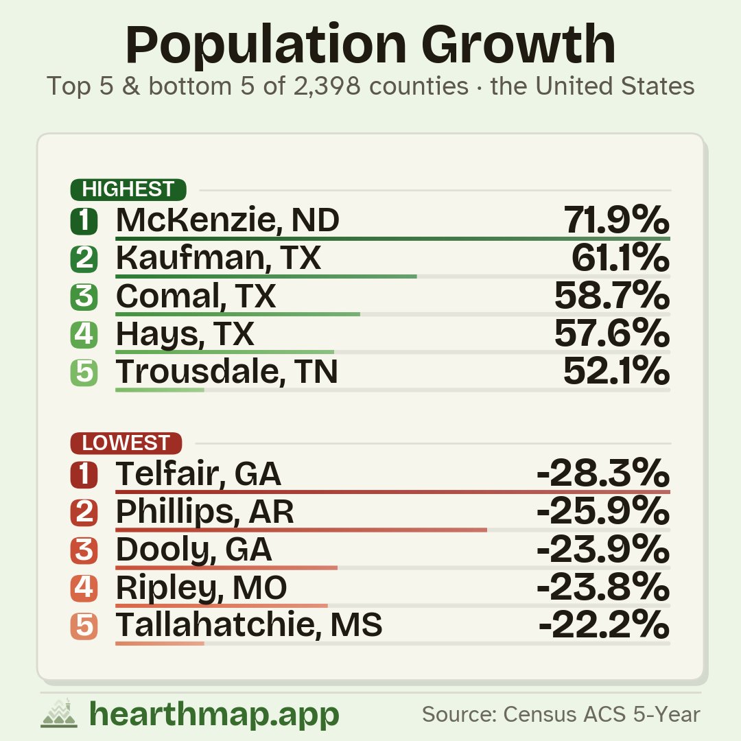
Madison County, Idaho led the country in growth while Yazoo County, Mississippi led the losses. The Texas suburbs and the Sun Belt keep booming as a band through the Great Plains and the Mississippi Delta quietly empties out. Where does your county land, growing or shrinking?
DC and Manhattan sit at one deep-blue extreme; the Great Plains and Appalachia at the red one. On the county map it is a sea of red rural counties broken by tight blue islands over cities and college towns. The split is urban vs rural, not North vs South. Where does yours land?
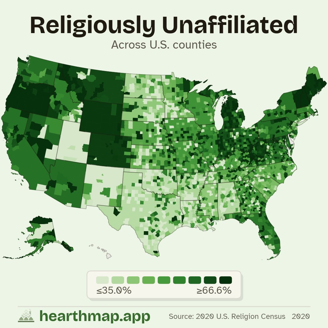
New Hampshire leads the entire country for religiously unaffiliated adults, with Vermont and Maine right behind. Then it falls off a cliff into the Deep South, where Mississippi and Arkansas counties sit near the bottom. Where does your county land on the map?
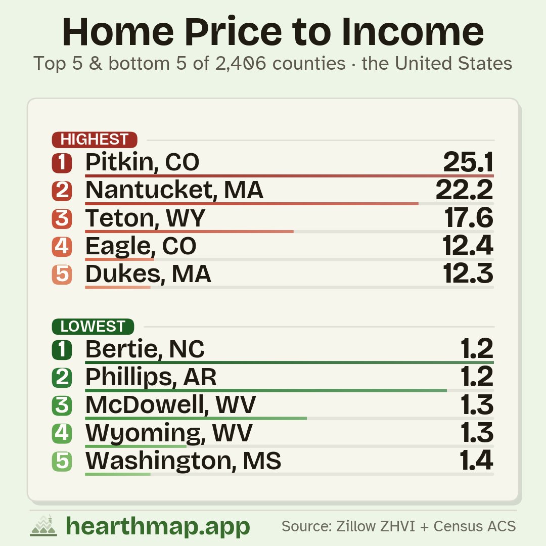
Los Angeles homes cost more than 12 times the typical local income, with the rest of coastal California close behind. In Iowa, Kansas, and the industrial Midwest it is closer to 3. Same country, completely different math on whether you can ever buy. Where does your county land?