Obayashi, M., & Yoshimitsu, J. (2026). Large-aperture time difference of arrival localization of submarine volcanic T-phase sources. Academia Earth and Planetary Science, 1(2). https://t.co/8QqAJfIPJT
Full paper
M. Perugu et al. (Published: 21 May 2026)
Seismological evidence of active faults in the offshore Nicobar region, Andaman Sea: insights from ocean-bottom seismometer data
https://t.co/jCqoT6LARJ
Full paper
Y. Yokota et al. (Published: 3 June 2026)
Decadal seafloor geodesy reveals constantly locked areas and temporal changes in the slip deficit rate along the Nankai Trough
https://t.co/ylET7XxTpp
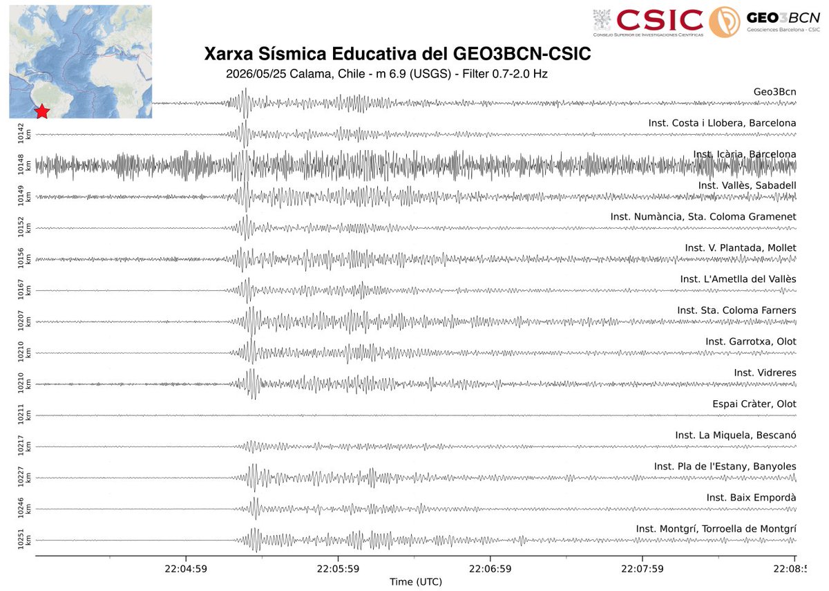
... i, unes hores desprès, enregistrament a la Xarxa Sismica Educativa del @GEO3BCN_CSIC de les ones generades per un terratrèmol de magnitud 6.9 amb epicentre al nord de Chile, a uns 10100 km de distància
Megathrust earthquakes are among Earth’s most destructive hazards. Oryan et al. developed the Coupling Cloud, which unifies and standardizes megathrust coupling models into one community-driven platform for easy visualization, comparison, and access.
NEW: NASA just made a flurry of announcements about its plan to build a Moon base. They also revealed that they will take not just one, but TWO futuristic rovers to the lunar surface.
And last summer, for NatGeo, I got to take them both for a test drive. https://t.co/jJV0tnzv9o
NEW: Sometimes stories are about major scientific breakthroughs, about the origin of life, the end of worlds—dramatic epiphanies about the cosmos.
And sometimes a flaming asteroid photobombs an erupting volcano.
Me @NYTScience https://t.co/kBt3JqsV7z
New method for early warning of volcanic eruptions
These faint signals can reveal the earliest stages of volcanic activity in real time. The research team tested the method for ten years at a volcanological ...
Read more: https://t.co/8YQJDKdwWG
Article: Carbon dioxide outgassing from the ocean associated with the passage of tropical cyclones has declined in recent decades, and may switch to being a net sink of CO2 under high-emission scenarios
https://t.co/rhFTpYrcT1
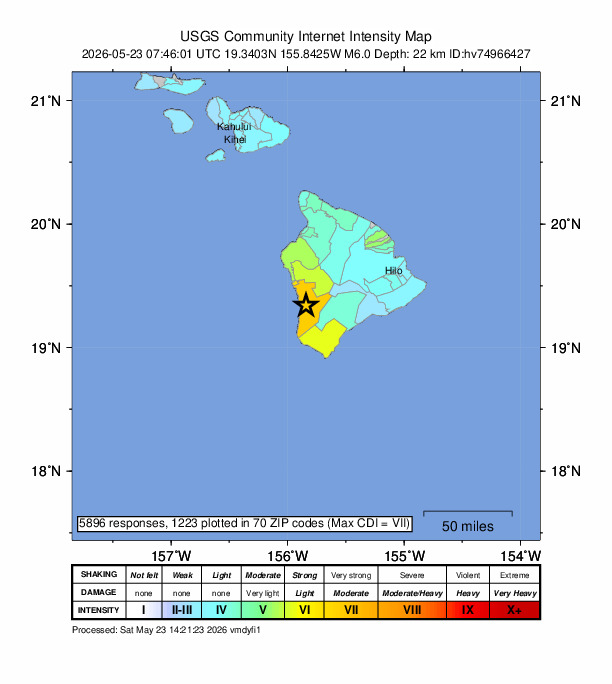
Aloha Hawaii! Felt shaking from last night's M6 quake on the west coast of the Big Island extended to neighboring islands. The Did You Feel It? page, aftershock forecast, and more can be found at:
https://t.co/CqnzFrIcI3
In Temblor's latest, @phivolcs_dost scientists explore recent earthquake swarms off the shores of the southern Philippine island of Mindanao, and compare what's happening to the devastating 1976 Moro Gulf earthquake.
https://t.co/sbSW2sKutm
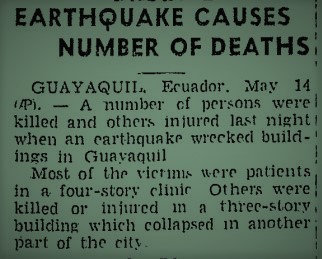
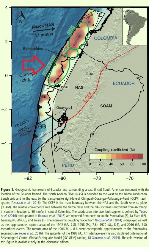
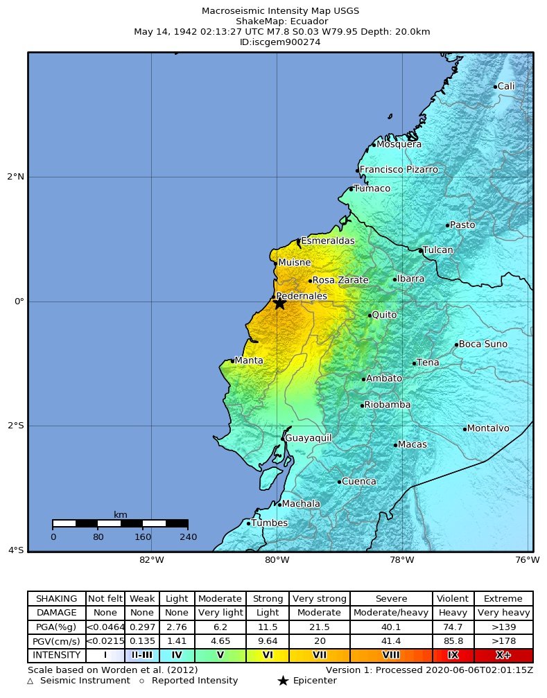
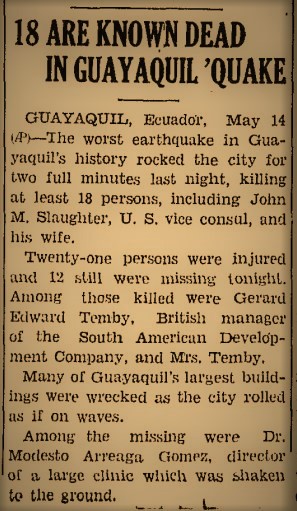
14 May 1942 2:13 UT (21:13 of 13th LT)
Mw7.8 #earthquake hit Pedernales, Pacific coast of Ecuador, killing 200 people, many at Guayaquil. Nazca subduction zone produced other large EQs in 1906, 1979 and 2016.
https://t.co/JnPm2nZgGE
https://t.co/S8JLyFIPF6
https://t.co/FtisT9awi8
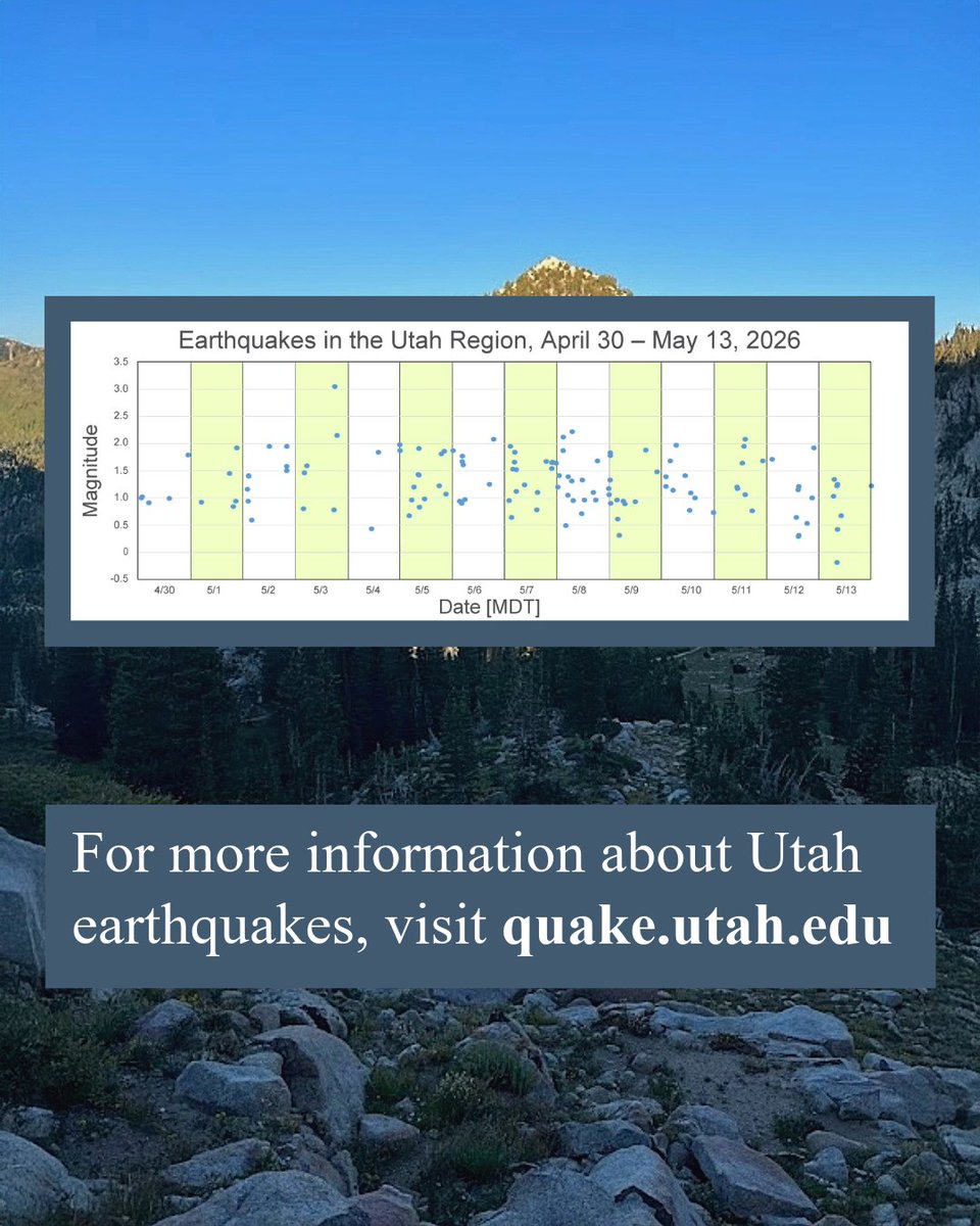
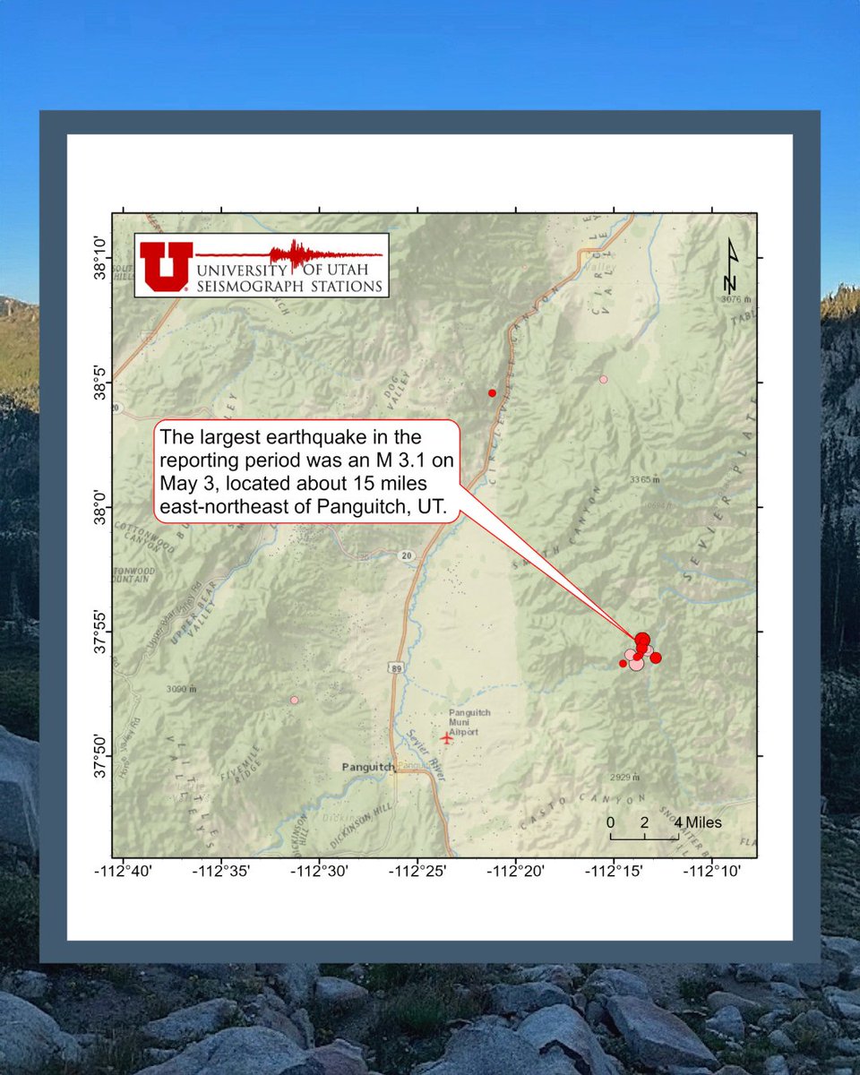
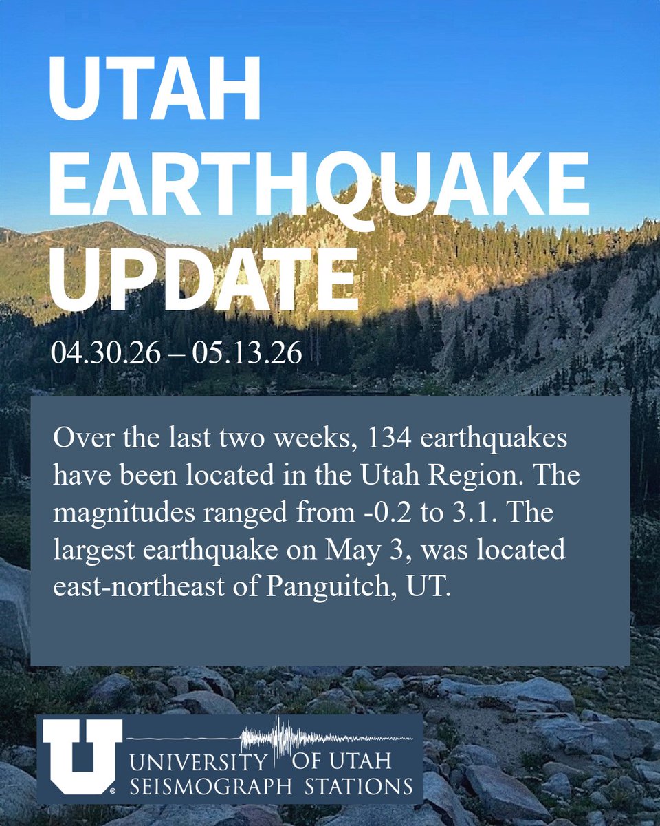
Over the last two weeks, 134 earthquakes have been located in the Utah Region. The magnitudes ranged from -0.2 to 3.1. The largest earthquake on May 3 was located east-northeast of Panguitch, UT.
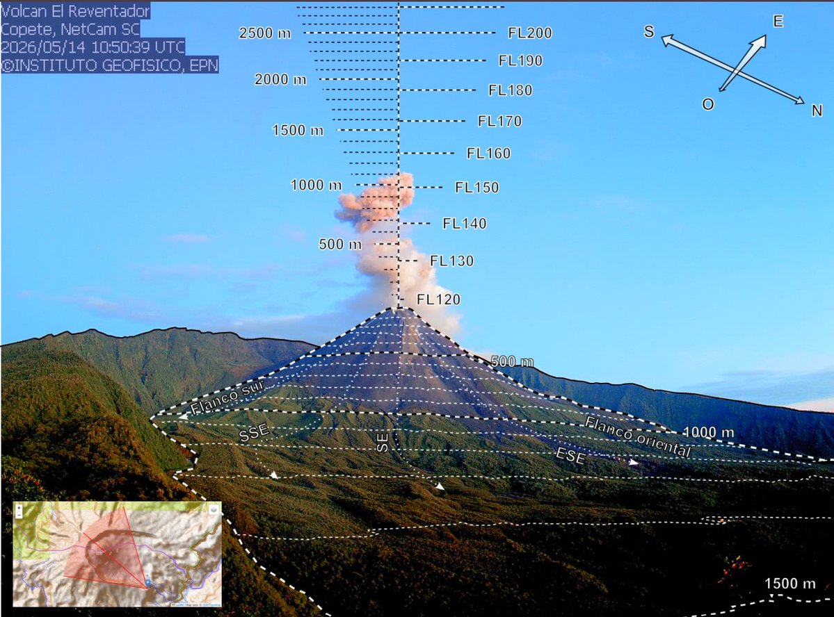
Informe Diario #ElReventador N° 2026-134
jueves 14 de mayo de 2026
Nivel de Actividad:
Superficial: Alta
Tendencia Superficial: Sin cambio
Interna: Moderada
Tendencia Interna: Sin cambio
Revisarlo en: https://t.co/tqjvTEy1gZ
Li, D., Xie, F., Wang, Q.-Y., Poli, P., Hibert, C., Cui, Y., et al. (2026). Decoupling seasonal seismic velocity changes on slow-moving slopes in southwest China using tree ensemble machine learning. Geophysical Research Letters, 53, e2025GL121238. https://t.co/tofQ43xB7m
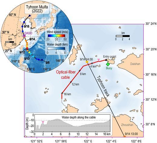
Typhoon Wind Speed Estimation via Microseismic Noise Recorded by Submarine Optical‐Fiber Distributed Acoustic Sensing #SRL
How can you determine sea surface wind speed from submarine cables?
https://t.co/QLc4NH9XcS