@CameronJNixon This was scenario I was considering today. Extreme CAPE can overcome many traditional limitations by producing extreme non-hydrostatic PGFs that induce rotation. WoFS had many southward moving off-hodograph members that resembled this type of scenario.
Some areas of low visibility are definitely possible tonight, please drive safely! Animation is probability of visibility less than a half mile. #mnwx#newx#sdwx#iawx
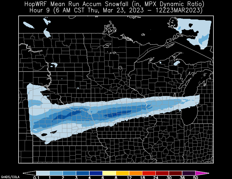
Overnight snow could accumulate to a couple/few inches in part of northern Nebraska & northern Iowa overnight, looking to wrap up by 6-7am per the 3Z ensemble. #iawx#newx https://t.co/gDp7skgKuS
You may have noticed, but the MPAS is temporarily off-line as we are utilizing that compute power for some reanalysis purposes for a presentation on the 25th Anniversary of the March 29, 1998 event at the @CentralIowaNWA conference! We hope to see you there! #mnwx#iawx
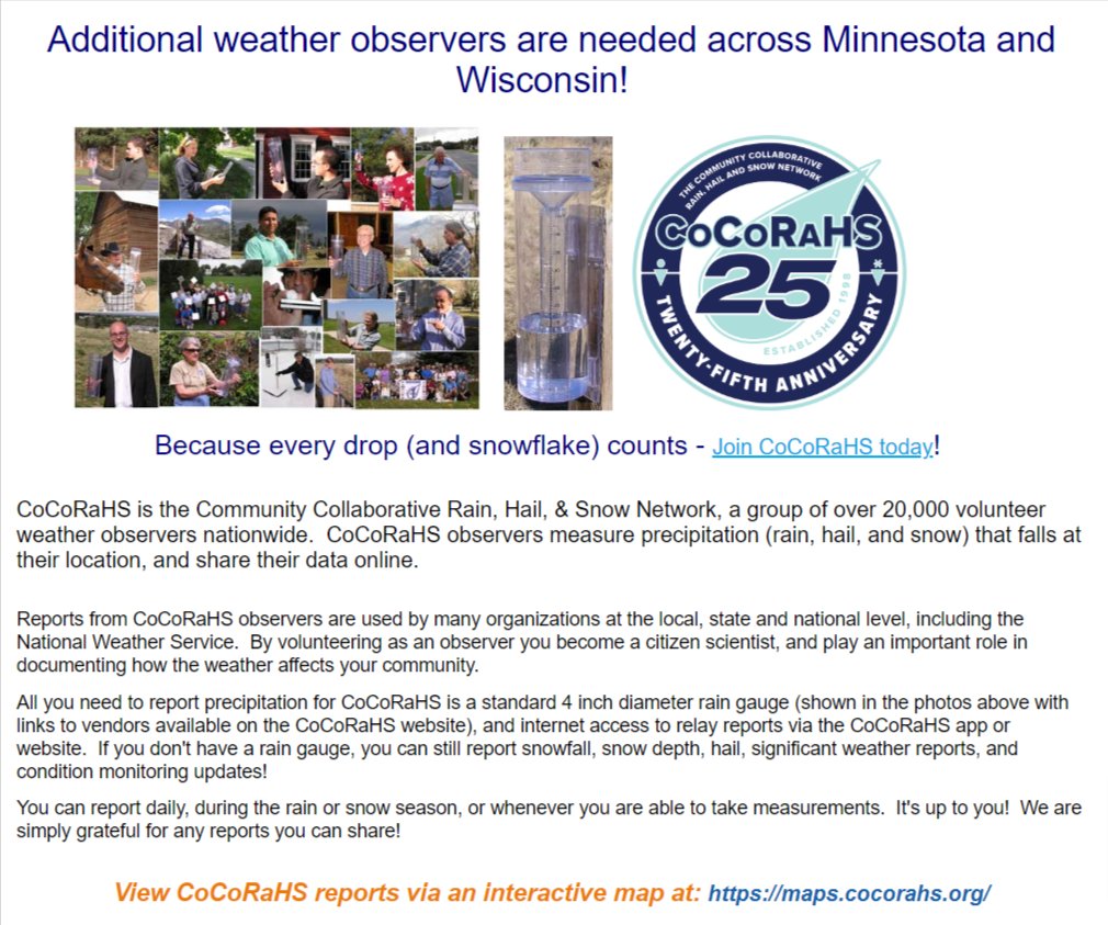
Weather observers needed across Minnesota and Wisconsin - Join CoCoRaHS, Please Retweet!
If you're in a rural area your observation would be really helpful, but additional observations are also welcome in more populated areas.
https://t.co/375gRAK8iT
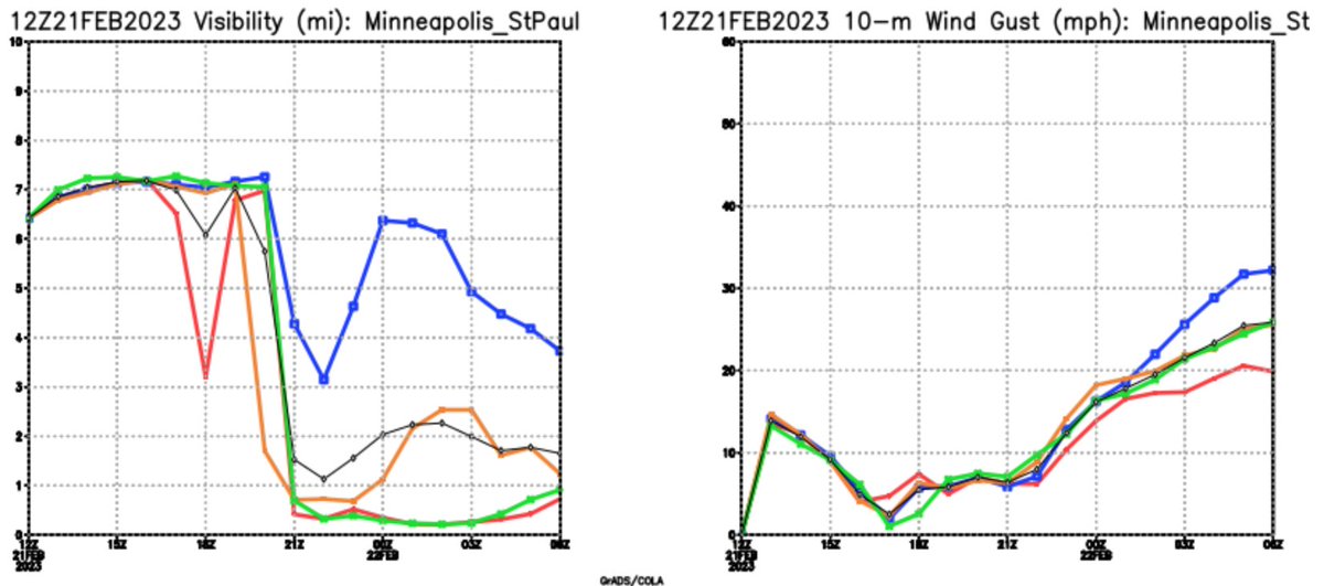
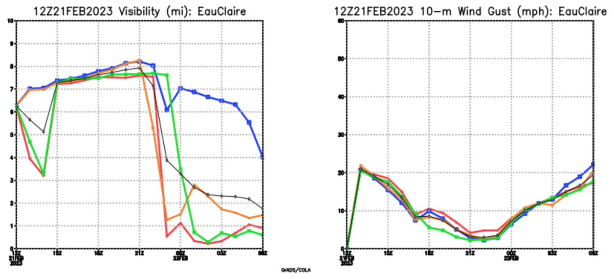
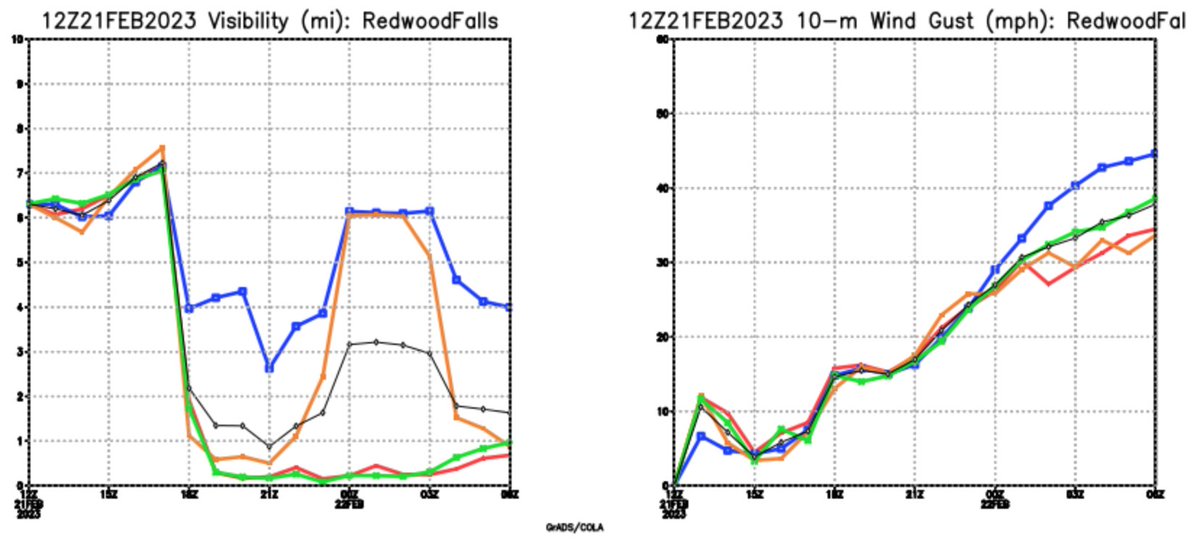
From the 12Z ensemble we look at the Aviation plumes. Here we can see across the region from RWF, to MSP, to EAU when the visibility dives due to snow starting and when the winds pick up. It will be a challenging late afternoon and evening! #mnwx#wiwx
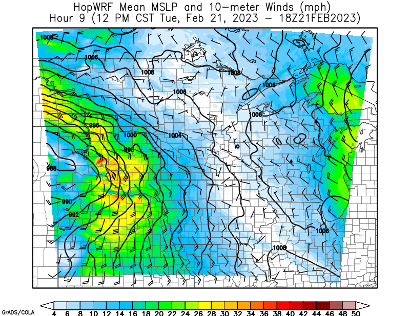
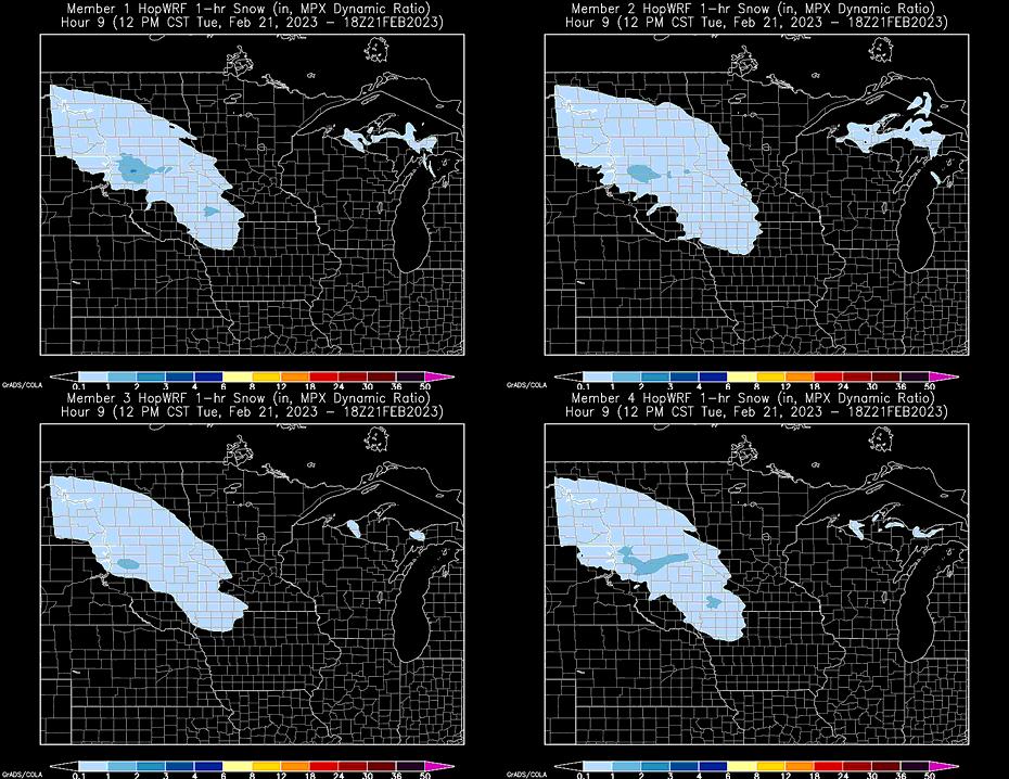
Looking at the ensemble this morning using the postage stamps you can see comparisons for both intensity of snow and the progression between individual members. Mean MSLP image shows the progress of the winds. Both images are for noon today. #sdwx#mnwx https://t.co/pU6yQLMwkV
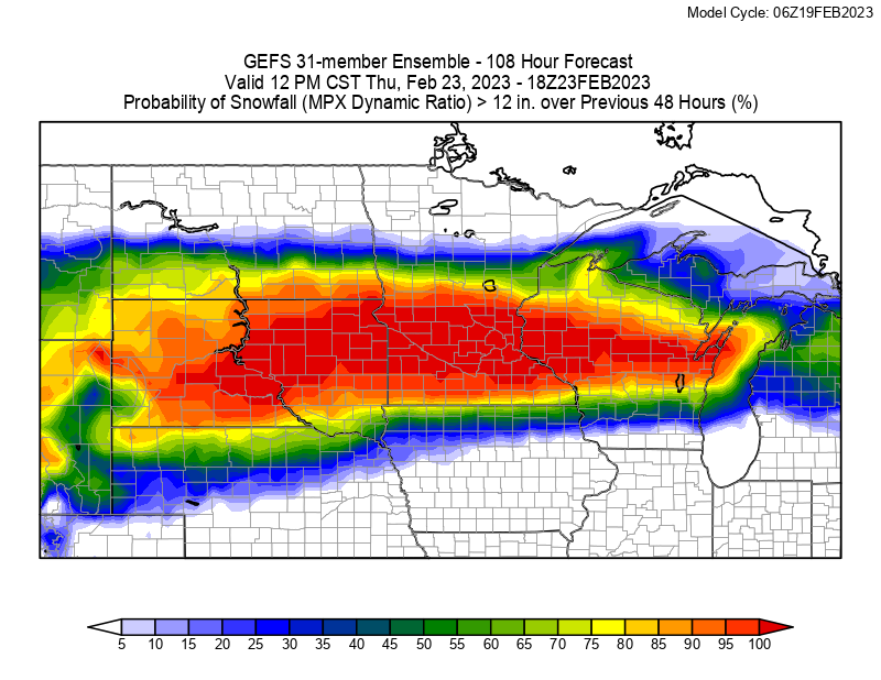
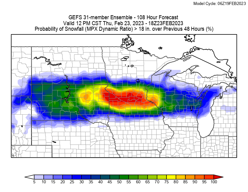
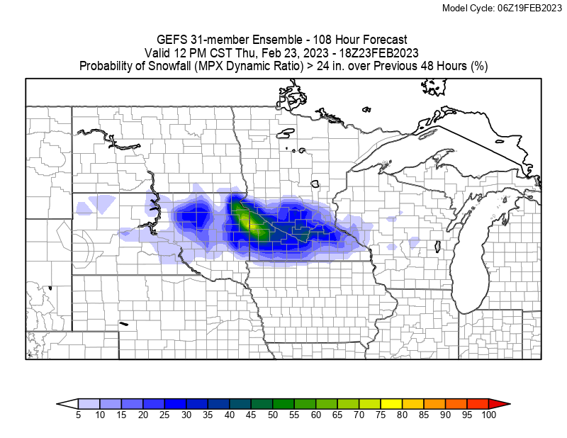
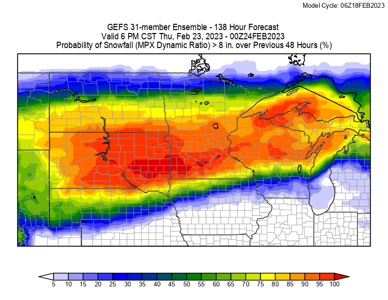
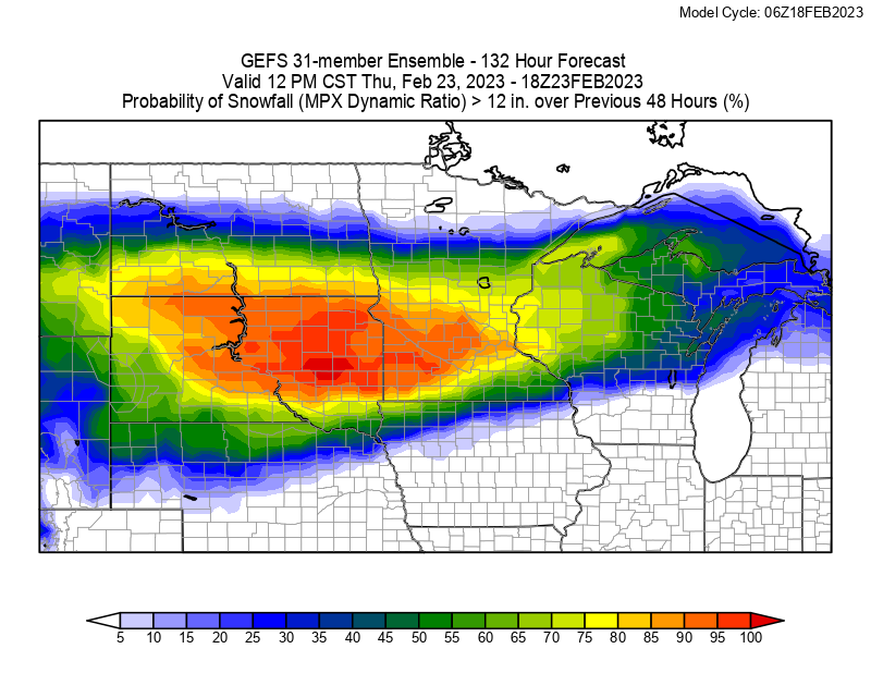
To say some of these probabilities are wild would be an understatement. The 6Z GEFS has 90%+ probabilities of 18” of snow mid-week. This is going to be a complicated multi-phase system so stay current on the forecast, it will change, it’s supposed to! #mnwx#sdwx#wiwx
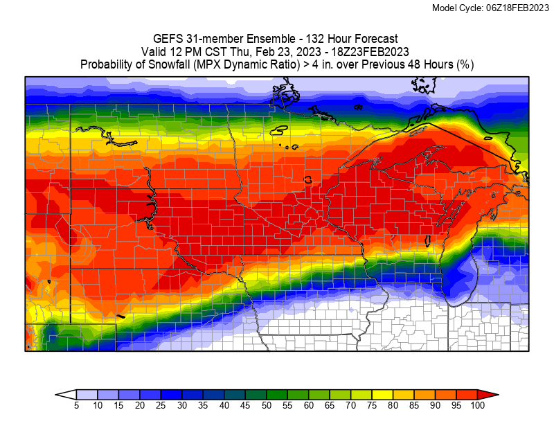
Another tool available on our website at https://t.co/pU6yQLMwkV is the dprog/dt tool. This lets you look at the past 12 runs of the GEFS to compare to current so you can see trends. In this case the probability of 4” of snow in the mid-week system approaching. #mnwx#wiwx#sdwx
We are closely monitoring the potential for a significant winter storm across the northern plains & upper Midwest mid-week. The following are from the 6Z GEFS, the 31-member ensemble of GFS. A probabilistic approach is needed this far out. Available at: https://t.co/1gL2wAtnv6
Are we there yet? No, not yet, maybe another couple inches of snow overnight, then it finally moves out. On the plus side, there won’t be a big rush of cold air behind this so salt and other road chemicals will help clear out roads pretty quickly once plowed.
Merry Christmas everyone! HopWRF is tracking the incoming snow today, here is the ensemble mean from the 15z ensemble of models. Drive carefully and we hope you have a great day! #ndwx#mnwx#sdwx