Preparing for application of our resources during an emergency, in such a manner that lives may be saved, health & efficiency maintained, & property protected.
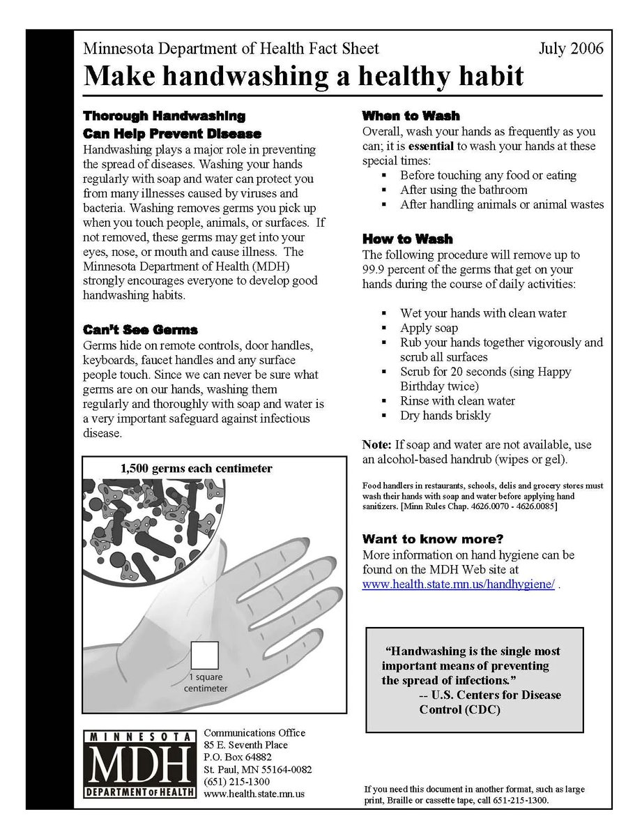
What is the best way to prevent illness and practice #DiseasePrep? Wash your hands often, especially:
- after going to the bathroom
- after touching your face
- before preparing food and eating
Have a new or unexplained rash, sores, or other symptoms of #monkeypox and believe you may have been exposed to the virus? Contact a healthcare provider for medical attention and evaluation.
Learn more: https://t.co/W6KvgRIw1m
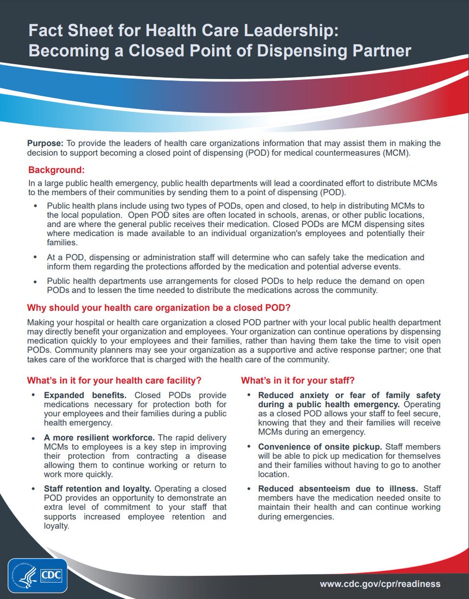
Would a Closed POD Agreement help your business? Learn more about it here: https://t.co/Vw2DMesW9Y. Reply to this tweet to see. Qualifications apply. #DiseasePrep
@HealthHoco seeks out partnerships with businesses, non-profits, & government agencies to protect the health of the public. Our community is stronger when we work together.
Are there any partnerships you can make to strengthen your #DiseasePrep plans? Share your ideas below.
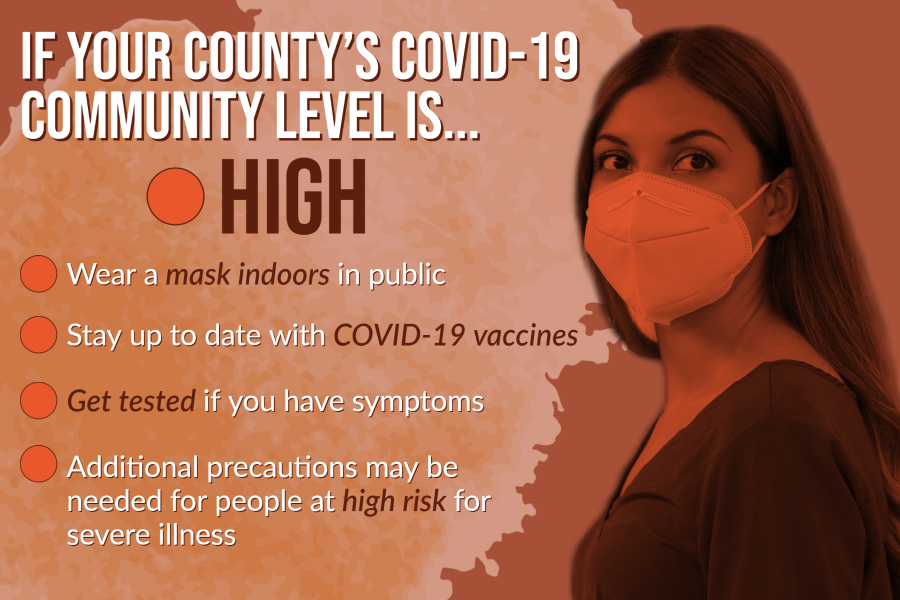
As long as #COVID19 spreads, mutations + variants are expected to occur. Omicron subvariant BA.5 is quickly spreading, causing many IN counties to have high COVID-19 community levels.
Know your county's level 🚦 https://t.co/WJfCAvgs9K
Get vaccinated 💉https://t.co/9FawURa0yn
Howard County remains in an area of Marginal Risk for severe weather today.
Thunderstorms are expected as early as late today into tonight. Damaging winds as the primary threat. Heavy rainfall is also possible which may produce localized flash flooding.
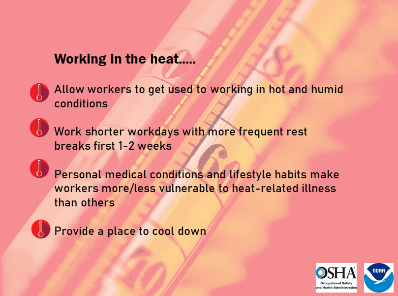
One of the most significant factors increasing the risk of heat illness is failing to follow safety guidelines when working in hot/humid conditions, particularly as an employer directing the actions of their employees. More information: https://t.co/4qtudck33Z
#INwx#nwsind
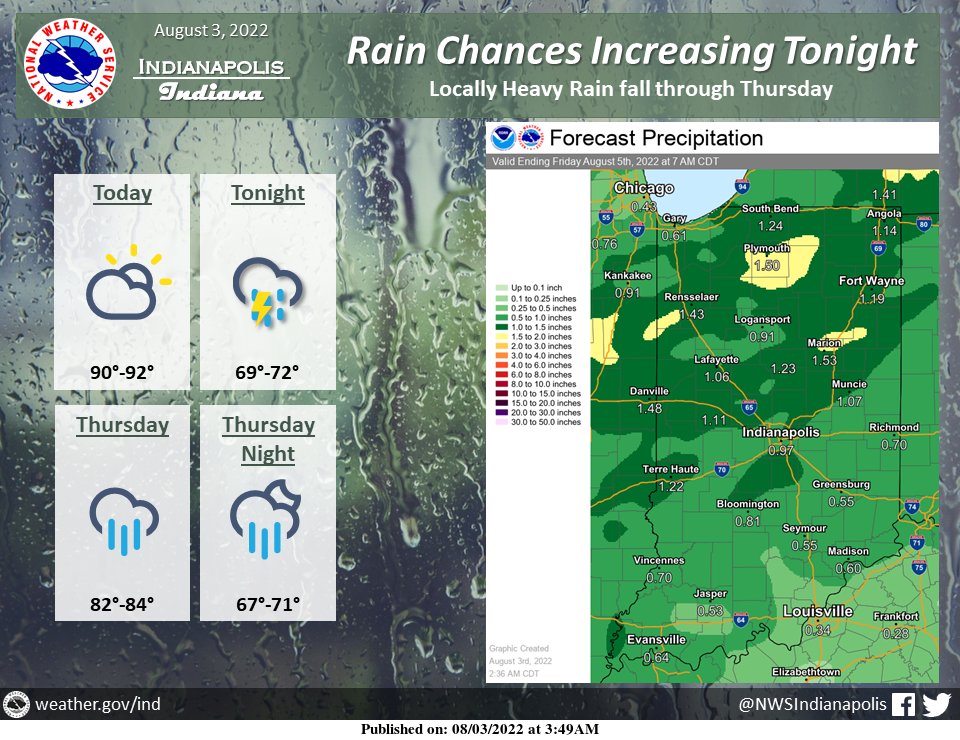
Heat index values today will be 95 to 105. If outside this afternoon, drink plenty of water and spend as much time in the shade as possible. Do not leave children or pets inside vehicles. Rain chances will increase tonight and Thursday. #INwx
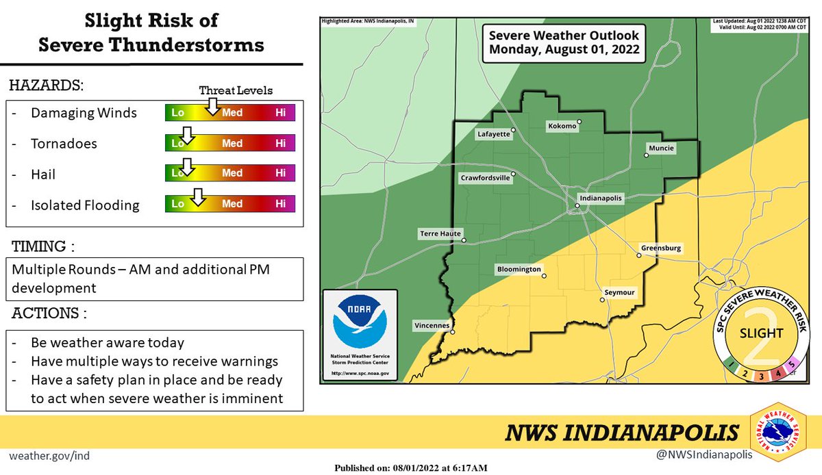
There is a slight risk of severe thunderstorms today, with multiple rounds possible, one this morning and additional development later this afternoon. Damaging winds, heavy rain, and localized flooding are the primary threats. Be weather aware today!
An Elwood officer as been killed in the line of duty early this morning. Our thoughts and prayers go out to all the lives that have been touch by the heartbreaking news. 💙🖤💙
Showers & thunderstorms remain in the forecast for the next several days, but dry weather is on the horizon. Some localized flooding is possible. The best chance of heavy rainfall will be south of Indianapolis. #INwx
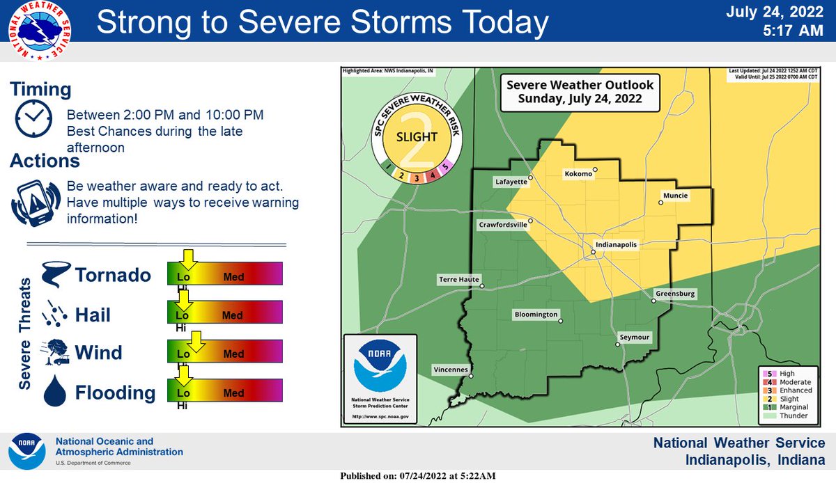
Showers and thunderstorms will develop across central #inwx today. Some of the storms may become severe, with damaging winds, large hail, and heavy rain the primary threats. An isolated tornado threat also exists. Timing of the severe storm threat is mainly between 2 and 10 PM.
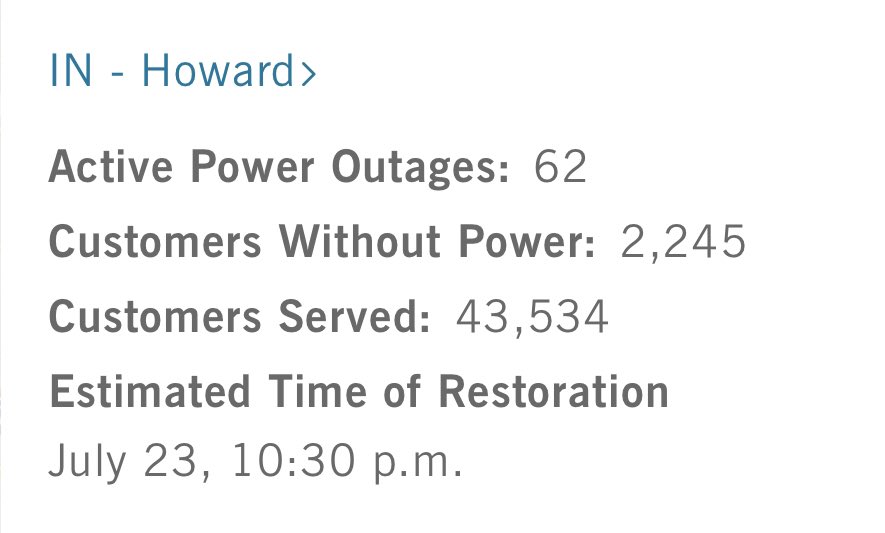
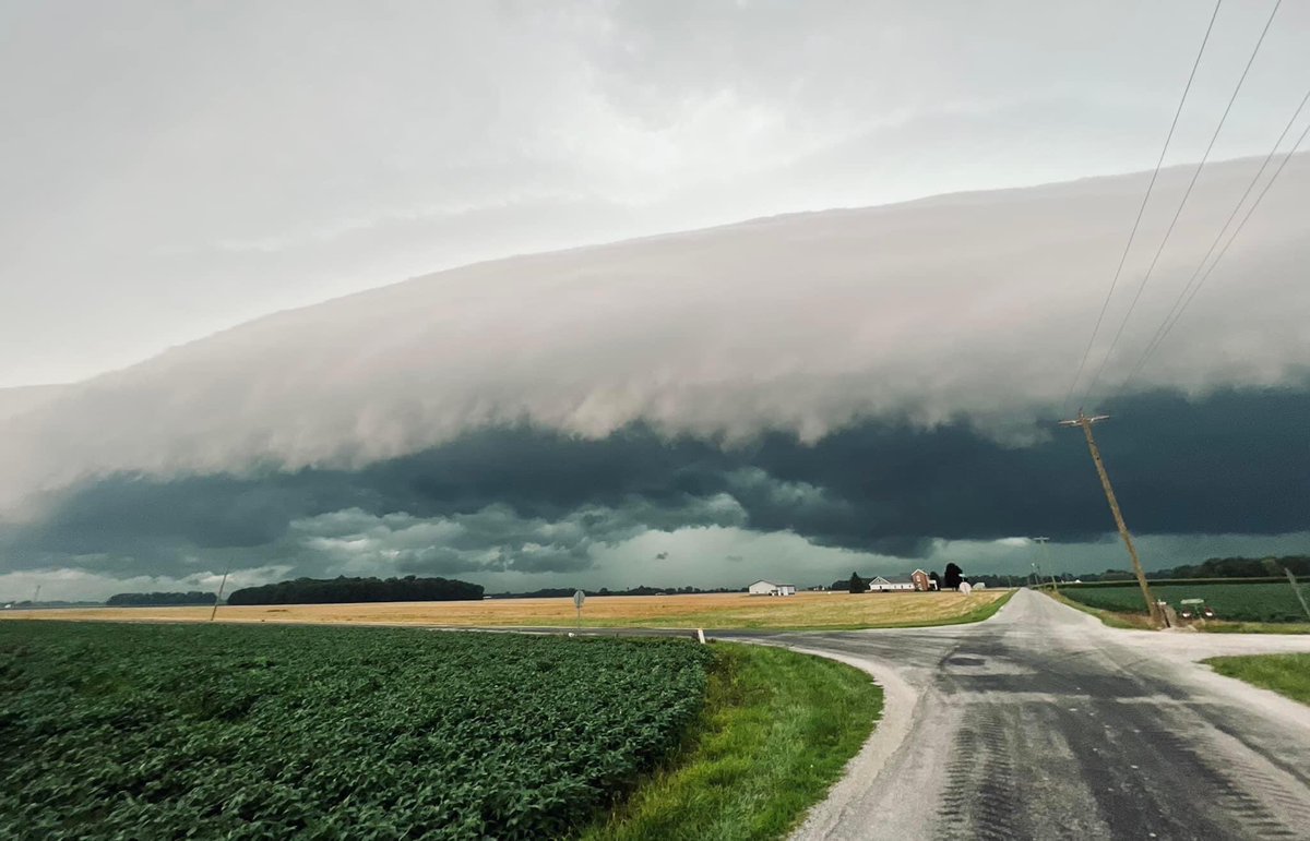
A look at the storm that kicked off the round of storms that have come through Howard County. This storm brought 60 mph wind gusts, which caused down trees & power lines throughout the county. Currently, 2,155 customers are still without power. Picture: William Black III
High winds have caused multiple reports of lines, poles, & trees down. Street Department, County/State Highway, all County/City Fire Departments, County/City Law Enforcement, Emergency Management, & Dispatch are currently working hard tend to all the reports coming in. Thank you!
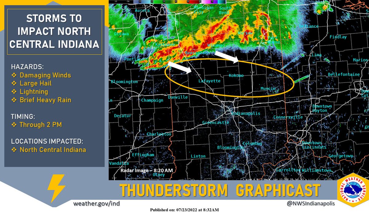
A storm complex this morning over northern Indiana should stretch into portions of north-central Indiana. Storms are expected to weaken some as they enter the forecast area but could still produce damaging winds and hail as well as lightning and brief heavy rain. #INwx
Howard County is now under a Severe Thunderstorm Warning until 9:30 AM.
At 8:39 AM, a severe thunderstorm was located 7 miles east of Monticello, moving southeast at 45 mph.
HAZARD...60 mph wind gusts.