Join us for a high-energy Friday exploring the world of #winter#weather with some hot #EDM tracks!
Fire 🔥 and Ice ❄️ for your Friday!!
https://t.co/JLLBFKz7DS
#snow#dancemusic#geotrek
Heavy #snow continues to fall in Midwest/ Great Lakes, with #cold blustery #weather in northeast. Watch ice skaters, skiers and pedestrians brave the #winter on our LIVE stream at https://t.co/dJif0EjwNf
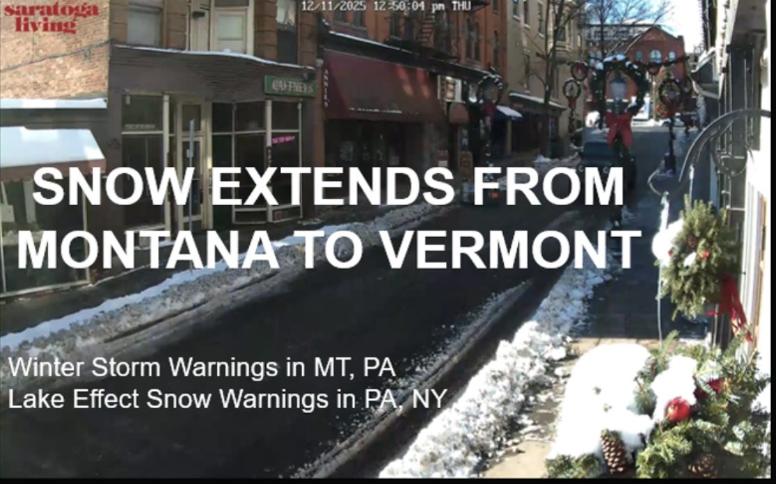
Check out this beautiful snowstorm in Burlington, Vermont on our LIVE winter weather cam. We’re streaming holiday music in the background! It’s a relaxing and festive way to wrap up your Monday.
LINK: https://t.co/8uwjGHtoae
❄️❄️❄️❄️❄️❄️❄️❄️
#snow#winter#weather#holiday
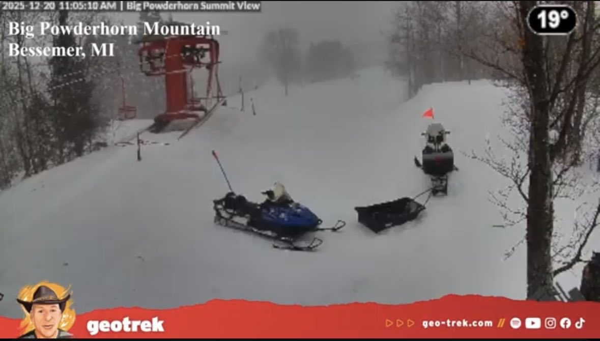
Snow is really blowing around the UP of Michigan today! ❄️❄️❄️Join us on a winter-weather adventure around the country with LIVE cams and holiday music! ❄️❄️❄️LINK: https://t.co/4Zpx6PNhTV #snow#winter#weather#holiday
Want to watch winter from the comfort of your living room? ❄️ ⛄️ 🥶
Check out GeoTrek’s LIVE winter weather cams rotating footage around the country to the soundtrack of upbeat holiday music!
LINK: https://t.co/2LBXCjE75h
#snow#winter#weather#holidays#cold
A strong atmospheric wave in the Trop Atlantic will likely (90%) develop into a TD or TS Gabrielle over the next 7 days, as it tracks west. Models predict modest strengthening, and a weak to moderate tropical storm could approach the Eastern Caribbean around 6-7 days from now.
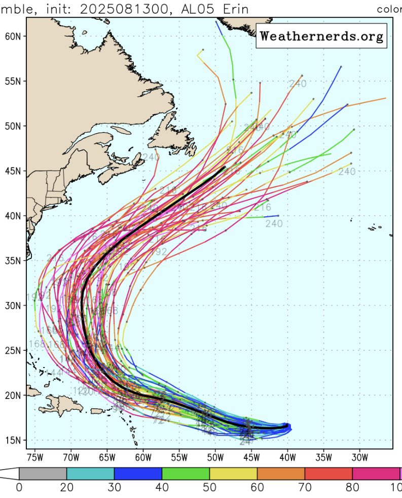
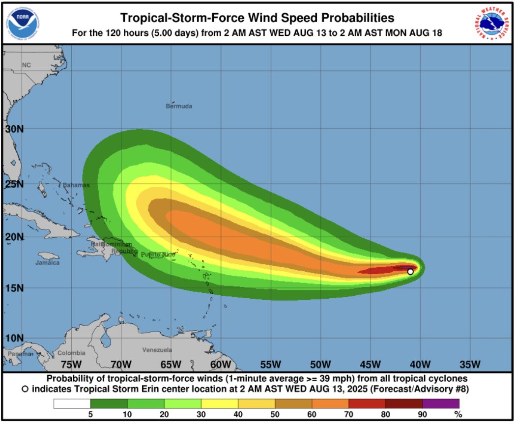
#Erin forecast to become a major #hurricane over the weekend, but it should stay out to sea and not directly impact U.S. or Canada. Here is the latest Euro ensemble model. #HurricaneErin
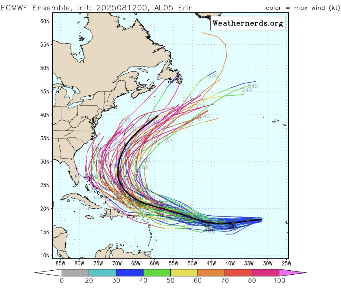
Although #TSErin is forecast to intensify into a major #hurricane this weekend, the models curve it towards the north and keep it out to sea, without direct impact to the U.S. The NHC forecasts a 20% chance of development in the SW Gulf, but the models do not develop this system.
#TropicalStormErin is forecast to intensify into a major hurricane as it tracks west across the Atlantic. However, model consensus curves the track to the north, keeping it out to sea and making it unlikely that it will directly impact the U.S. #Erin#hurricane
A dangerous outbreak of wildfires is underway across the Hill Country, Central Texas, South Texas, and the Coastal Bend. Additional fires have been reported in the Edwards Pleateau. Extremely critical wildfire danger will continue through sunset with west/northwest winds gusting to 60 MPH. You can track the fires with WatchDuty (https://t.co/kCGelCyX8H).
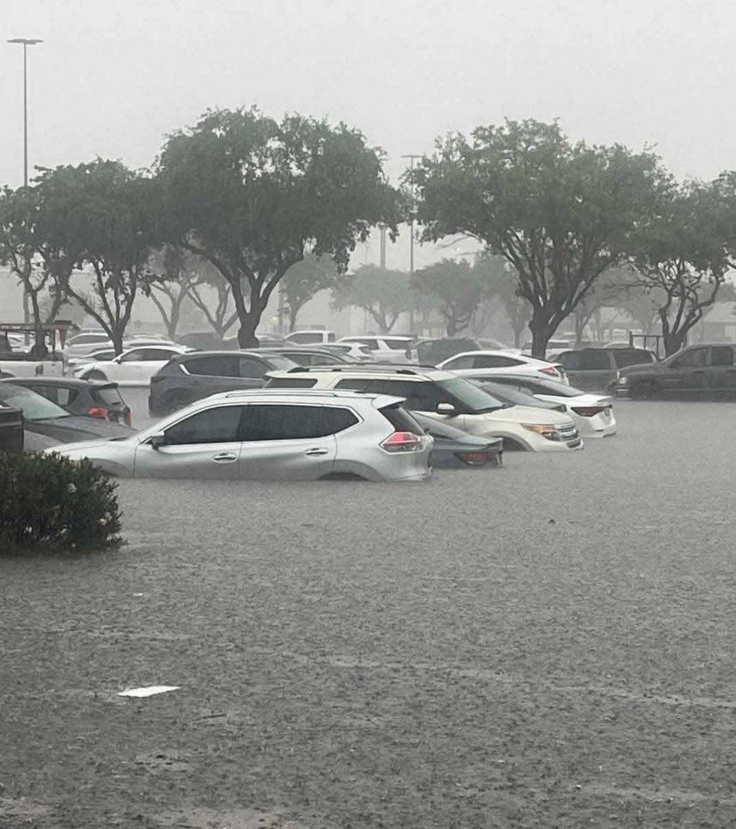
Expect flooding from both storm surge and heavy rain along the Upper Texas Coast this afternoon and tonight. Rainfall should reach 2-3”, with isolated pockets of 4”. A strong east wind will blow loose objects around and could bring down small tree limbs. #weather#flood#Texas
The #DFW metroplex woke up to a cold rain today. This will transition to freezing rain, sleet and snow, with up to 2-5 inches of snow and 1/10 inch of ice. Expect treacherous driving conditions and numerous accidents today. Graphic from NWS. #snow#ice#winter#weather
A new #fire started this evening in #hollywoodhills, CA. It’s called the #SunsetFire. An hour ago it had burned 20 acres - now it’s up to 50 acres and rapidly growing.
This threatens to become a very impactful fire, as it races down the hills and threatens homes and businesses.
Cal Fire provides very detailed maps of the Southern California fires. Two of the biggest fires are Palisades (15,000 acres - 0% contained) and Eaton (10,000 acres - 0% contained).
Link: https://t.co/Q3ZmZ1gldc
#fires#PalisadesFire#EatonFire#California#CaliforniaWildfires