Mid-Atlantic and Carolinas Face Severe Thunderstorms Today with Tornado Risk
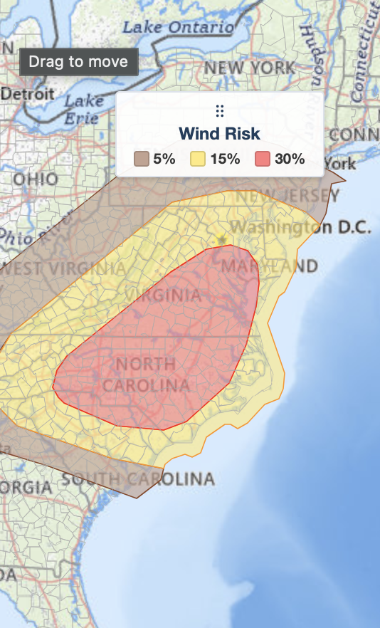
Severe thunderstorms are expected across the Mid-Atlantic and Carolinas on July 28, 2026, with a 30% risk of damaging winds, isolated tornadoes, and large hail. The greatest threat stretches from southeastern Virginia into central North Carolina, where supercell thunderstorms could produce destructive wind gusts and a few tornadoes. Major cities including Washington, D.C., Baltimore, Richmond, Norfolk, Raleigh, Greensboro, Charlotte, and Wilmington are in the risk area. More than 21.1 million people are located within today's highest-risk corridor for damaging winds. Stay weather aware, monitor forecasts, and be prepared to act quickly if warnings are issued.
https://t.co/Xdr6tDpSVt
#SevereWeather #TornadoRisk #MidAtlantic #NorthCarolina #Virginia
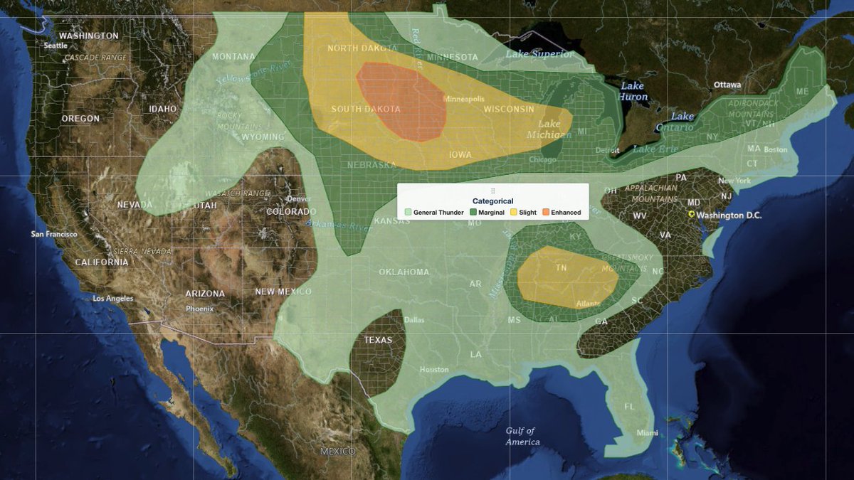
More than 2.1 million people are within today's SPC Slight and Enhanced Risk areas across northern New York and New England. Estimated population impact:
• 👥 Population: 2,139,700
• 🏠 Housing Units: 1,146,959
• 💼 Daytime Workers: 936,448
• 🏕️ Mobile Home Parks: 628
Weather Analysis Visualization Environment (WAVE) is iAlert's professional weather analysis platform more at: https://t.co/C8dlGyfId4
#SevereWeather #SPC #NortheastWeather #WeatherTech #iAlertWAVE
iAlert just launched a completely redesigned web interface, making it faster and easier to analyze weather from any device.
🎥 Video exports for social media and broadcast
🌩️ Live Weather Radar
🛰️ GOES Satellite Imagery
📈 GFS, HRRR, ECMWF, and IFS Model Analysis
🌀 Hurricane Tracker
🌪️ Storm Reports
Our new Lightning Detection Alerts are also now live, just in time for the peak summer storm season.
Whether you are a weather enthusiast, emergency manager, broadcaster, or storm chaser, iAlert gives you powerful weather analysis tools in one place.
Learn more at: https://t.co/BH3JS5LEhN
#Weather #Meteorology #WeatherRadar #Satellite #Hurricane #StormChasing #WeatherAnalysis #Lightning #SevereWeather #Forecast #GOES #ECMWF #GFS #HRRR #WeatherTools #iAlert #Wx #WeatherCommunity #StormReports #WeatherNerd