Tornado Warning: Radar Rotation Near Catawba, NC
Radar shows a strong, merged cluster of storms just southwest of Catawba, NC, moving southeast near 20 mph. The National Weather Service has a Tornado Warning in effect until 7:00 PM EDT for Catawba, Iredell, and Lincoln counties, tied to this storm.
Radar indicates rotation with this cell (radar indicated rotation), and radar estimated rain rates up to about 4.9 inches per hour at the core. Based on radar motion, the storm is estimated to reach Catawba around 6:37 PM, Maiden near 6:44 PM, Sherrills Ford near 6:51 PM, and Terrell near 6:58 PM.
Note this is a broad, contiguous area of storms rather than one clean cell, so the exact center is hard to pin down from radar alone. The recent trend shows reflectivity and core area easing back over the last several radar frames, but the storm remains under the active Tornado Warning.
The National Weather Service says to take cover now: move to a basement or interior room on the lowest floor of a sturdy building and stay away from windows.
#NorthCarolina #TornadoWarning #SevereWeather
Severe storm line sweeps DC area toward Annapolis; tornado watch issued
Radar shows a line of strong to severe thunderstorms racing east-northeast across central Maryland, radar indicated motion near 30 knots. Cells are moving from the Aspen Hill/Silver Spring area toward Ashton and Highland by 6:02-6:03 PM, and on toward Annapolis by about 6:47 PM.
The National Weather Service has Severe Thunderstorm Warnings up for Howard and Montgomery counties, for DC/Montgomery/Prince George's/Fairfax, for Anne Arundel and Prince George's, and for Kent County, all through 6:15-7:00 PM. A Tornado Watch is in effect until 10 PM for central and northern Maryland, DC, and northern Virginia, per the NWS.
A second cluster near Rosedale is intensifying quickly on radar, with radar indicated rotation (cyclonic shear) as it heads toward Nottingham by 6:05 PM. A third storm near Bainbridge is also strengthening rapidly on radar with rotation showing, tracking toward Rising Sun and Colora by 6:05-6:07 PM. Neither confirms a tornado on the ground.
Radar estimated rain rates are running very heavy, up to the low teens of inches per hour in the strongest cores. This is a rate, not a total. A Flash Flood Warning from the NWS covers Anne Arundel, Baltimore County, and Baltimore City through 8:15 PM. Follow NWS instructions: move to an interior room if a tornado threatens, and never drive through flooded roads.
Mid-Atlantic and Carolinas Face Severe Thunderstorms Today with Tornado Risk
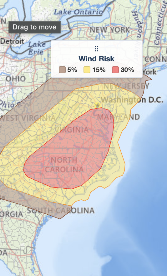
Severe thunderstorms are expected across the Mid-Atlantic and Carolinas on July 28, 2026, with a 30% risk of damaging winds, isolated tornadoes, and large hail. The greatest threat stretches from southeastern Virginia into central North Carolina, where supercell thunderstorms could produce destructive wind gusts and a few tornadoes. Major cities including Washington, D.C., Baltimore, Richmond, Norfolk, Raleigh, Greensboro, Charlotte, and Wilmington are in the risk area. More than 21.1 million people are located within today's highest-risk corridor for damaging winds. Stay weather aware, monitor forecasts, and be prepared to act quickly if warnings are issued.
https://t.co/Xdr6tDpSVt
#SevereWeather #TornadoRisk #MidAtlantic #NorthCarolina #Virginia
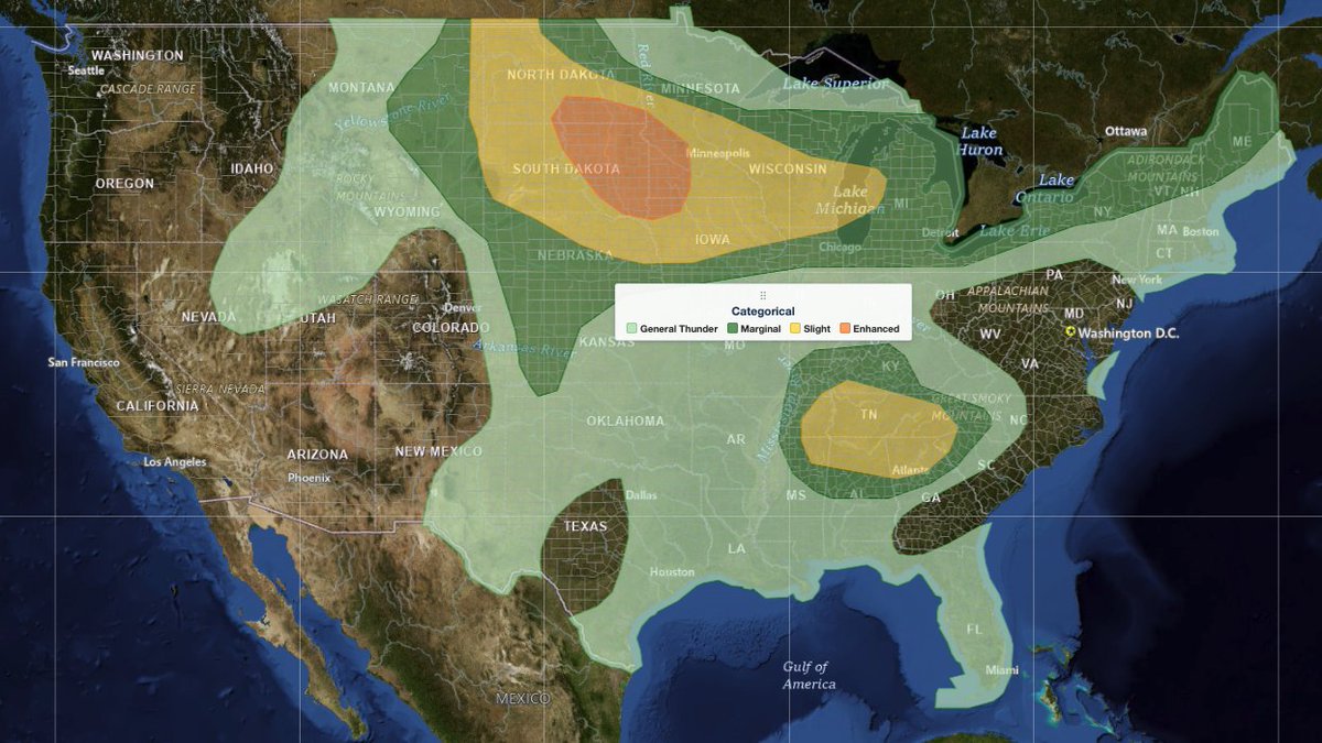
More than 2.1 million people are within today's SPC Slight and Enhanced Risk areas across northern New York and New England. Estimated population impact:
• 👥 Population: 2,139,700
• 🏠 Housing Units: 1,146,959
• 💼 Daytime Workers: 936,448
• 🏕️ Mobile Home Parks: 628
Weather Analysis Visualization Environment (WAVE) is iAlert's professional weather analysis platform more at: https://t.co/C8dlGyfId4
#SevereWeather #SPC #NortheastWeather #WeatherTech #iAlertWAVE