The launchpad just got airborne.
Project ALE: Air-Launched Effects is our exploration of UAV-to-UAV aerial deployment, where one drone carries, positions, and deploys another mid-air, extending the mission beyond any single platform's reach.
This is what indigenous R&D looks like when the question is not "can we" but "what comes next." Know more https://t.co/IEmXxD2r28
#ExperimentationNeverStops #AirLaunchedEffects #DroneInnovation #IndigenousDefence #ideaForgeLabs
NOTE: ideaForge Labs | Experimental capabilities under active development. Not indicative of a finalised product, feature, or operational deployment.
Today, we’re introducing a new member of the ideaForge team.
Meet Dia - our #AI-powered #CustomerSupport Assistant, built to deliver faster, smarter, and always-on support.
From answering calls and registering complaints to providing real-time ticket updates, #Dia helps streamline support operations while ensuring queries reach the expert team when needed.
Available 24×7 and designed for mission-critical environments, Dia is built to support the people operating in the field - whenever they need it.
What does great customer support mean to you? Tell us in the comments.👉
#ideaForge #AISupport #CustomerFirst
@ankit_ideaForge, @Joee_vipul
#Mining operations generate some of the most complex terrain challenges in any industry. Active extraction changes surface geometry continuously, waste dumps shift, voids deepen, and closure planning demands volume accuracy that conventional surveying cannot reliably deliver at scale.
Aerial #LiDAR mapping gives mining and reclamation teams centimetre-accurate terrain data across active pits, waste dumps, and closure zones, supporting extraction planning, regulatory compliance, and land restoration with #survey-grade confidence.
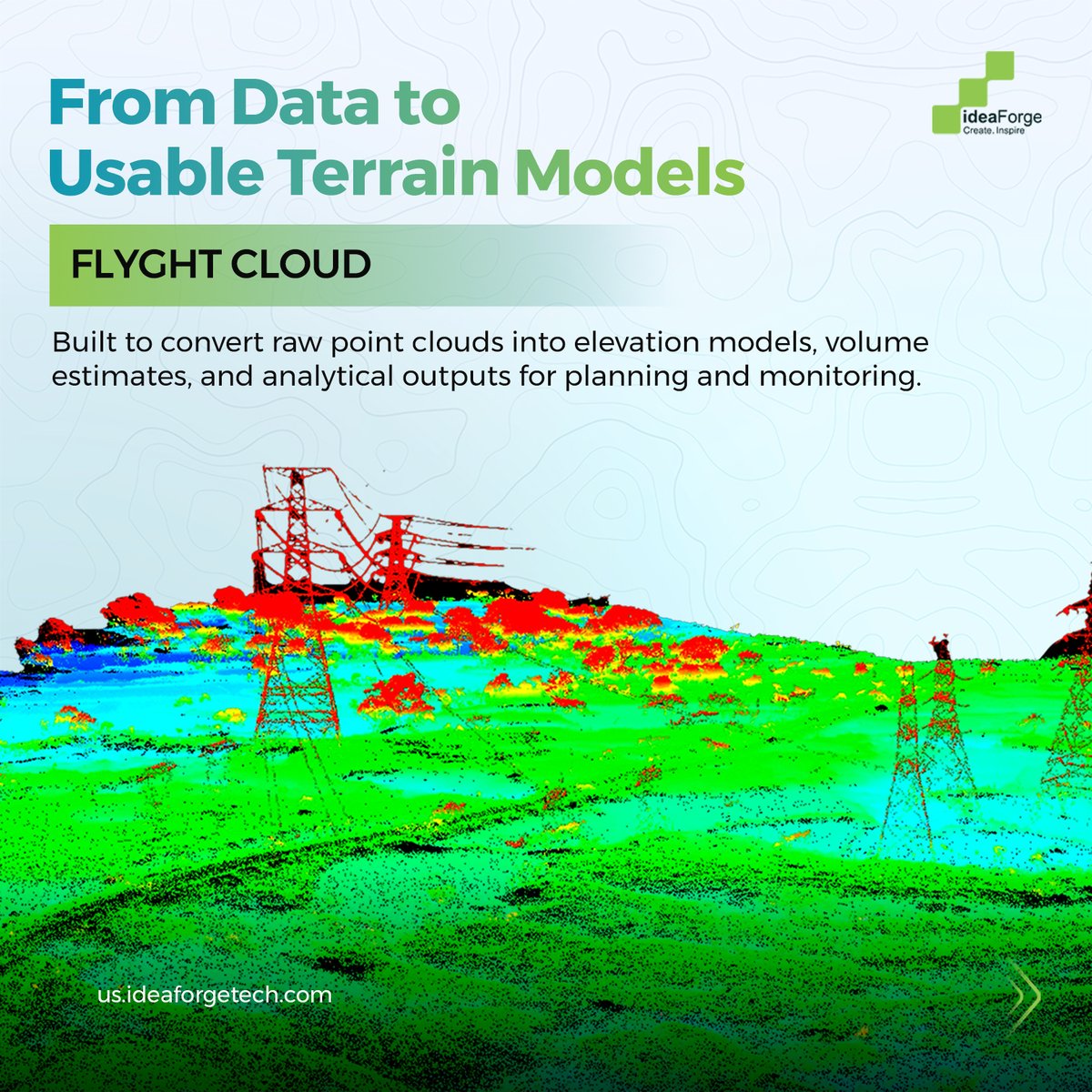
With #Q6V2Geo integrated with #Shodham payloads and insights delivered on #FlyghtCloud, ideaForge's aerial LiDAR solution brings high-density point cloud data to every phase of the mining lifecycle.
Sign up today to see how LiDAR-powered mapping and analytics come together on Flyght Cloud: https://t.co/rDRHtVGozt
#GeospatialData #MiningTech #Mapping #UAV #DroneMapping
A significant step in our international expansion journey.
We are partnering with Japan-based Digital Media Professionals Inc. (@DMP_GPU_IP_AI) to co-develop next-generation #AI-powered drones - integrating DMP's Di1 edge AI SoC into our #UAV platforms for defence, security, and industrial applications. DMP will serve as our go-to-market partner in Japan, supporting distribution, customer engagement, training, and after-sales services.
Commenting on the collaboration, our Co-founder & CEO @ankit_ideaForge said, "Our vision is to build next-generation intelligent #UnmannedAircraftSystems by seamlessly integrating advanced design, engineering, #manufacturing capabilities, and #AI technologies."
DMP Chairman, President & CEO Tatsuo Yamamoto added, "This #MoU accelerates Di1's deployment while enabling DMP to bring ideaForge's rugged, high-endurance, and resilient #drones to Japan's defence, security, and industrial markets."
Read the full story: https://t.co/Ve2Ww5ySME
What truly defines a modern drone isn’t just the platform - it’s the #payload it carries.
As operations in #modernwarfare environments become more complex, drone payloads have evolved from basic daylight imaging to systems capable of all-condition #sensing, terrain intelligence, modular configurations, #onboardAI processing, and resilient performance in #GNSS-denied and contested environments.
This evolution reflects a deeper shift. Payloads are no longer just sensors - they are becoming intelligent, mission-adaptive systems that influence how data is captured, processed, and acted upon in real time.
Our latest #infographic breaks down how military #drone payload capabilities have expanded across sensing, mapping, analysis, and operational resilience, and what this means for the next phase of unmanned operations.
💬Which payload capability do you see becoming most critical as drone operations evolve in contested environments?
#dronetechnology #defencetechnology #militarytech #ideaForge
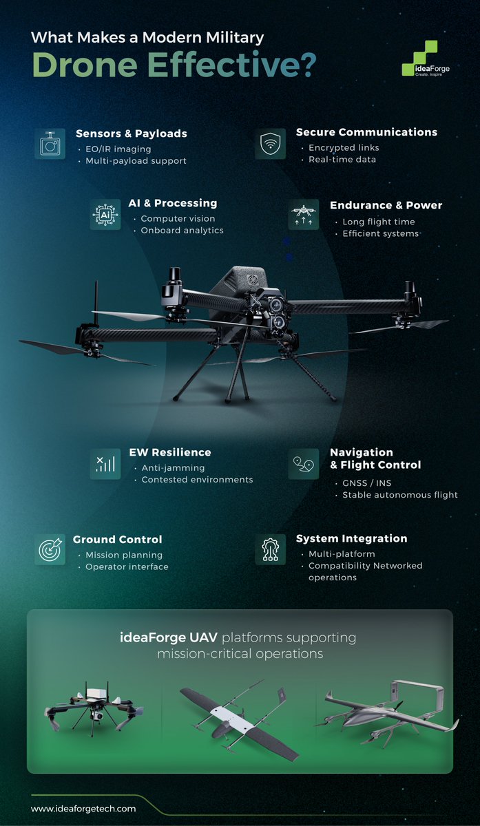
Modern conflicts are increasingly defined not just by platforms - but by the technologies that enable them to operate in contested environments.
From #electronicwarfare and #GPS disruption to the growing role of #AI in decision support, drones today are being pushed to operate with greater resilience, intelligence, and coordination.
This shift has made one thing clear: effectiveness is no longer about the drone alone. It’s about how well systems such as sensors, secure communications, onboard processing, navigation, and #EW resilience work together to deliver reliable performance in real-world conditions.
Our latest #infographic breaks down the core building blocks behind modern UAV effectiveness - and what enables these systems to perform when it matters most. Take a closer look👇
💬 In your view, what’s becoming the biggest challenge for drone operations today - connectivity, autonomy, or resilience?
#dronetechnology #uav #defencetechnology #militaryinnovation #ideaForge #modernwarfare
The battlefield has evolved. Has your observation capability?
For decades, the Forward Observer has been the eyes of the battlefield - skilled, exposed, and critical to mission success. But modern warfare demands more.
Introducing #ZOLT - the Digital Observer. With #AI-assisted battlefield analysis, real-time #aerialintelligence, and automated fire-correction support, ZOLT helps #artillery units engage targets with greater precision, speed, and confidence, while keeping soldiers safer on the ground.
ZOLT - The Tactical Edge, Reimagined. Know more → https://t.co/Mc167zOjws
What do you think is the biggest challenge in modern battlefield observation? Share your thoughts below.
Note: Visuals in this video are AI-generated representations for illustrative purposes.
#ideaForge #DefenceTechnology #BattlefieldAwareness #MilitaryTechnology
In 2008, when drone technology was nascent and commercial autopilot systems virtually non-existent, BlueFire Autopilot emerged as the world's smallest and lightest #autopilot. By 2009, it was already being supplied to Indian government labs - ahead of even the first open-source solutions like ArduPilot and PX4.
100% designed and developed in India, #BlueFire embodies operational sovereignty and strategic autonomy: smart #failsafe systems that instinctively activate during #communication loss, extreme weather, low battery, or #GNSS failure - ensuring mission continuity under real-world stress conditions.
Today, BlueFire continues to power our #UAV systems with zero foreign dependencies, contributing to India's #supplychain resilience and self-reliance in critical defense technology.
This is #indigenous innovation in action - field-proven, mission-ready, and built for strategic autonomy. Learn more about our indigenization journey: https://t.co/vGI29iEDo2
#StrategicAutonomy #SelfReliance #OperationalSovereignty #IndigenizewithideaForge #BuiltDifferent
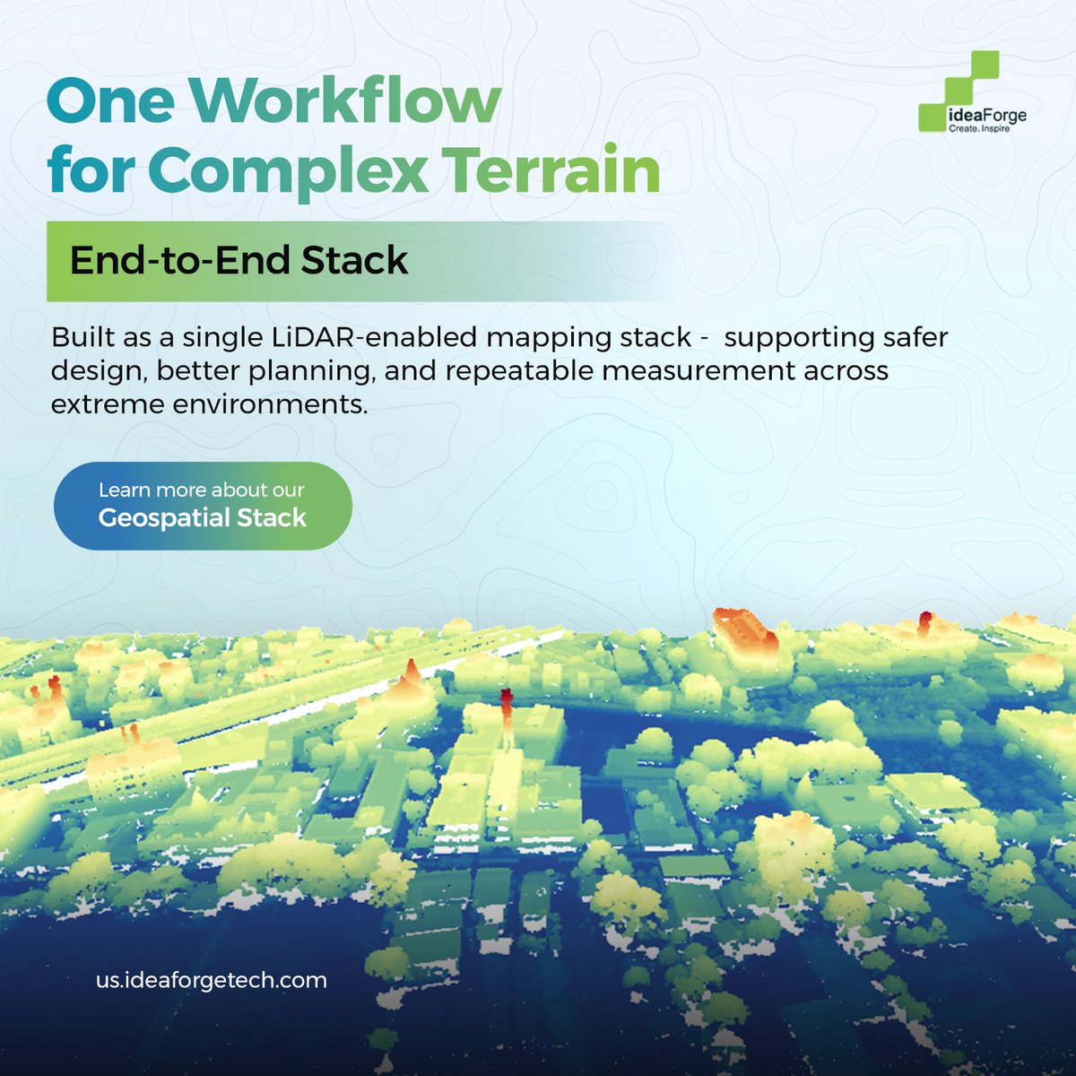
Happy World LiDAR Day. In #extreme terrain, decisions rely on data that can be trusted. Our geospatial stack uses aerial #LiDAR and terrain #analytics to turn hard-to-reach landscapes into usable elevation and volume data. https://t.co/xnT6JF1zom
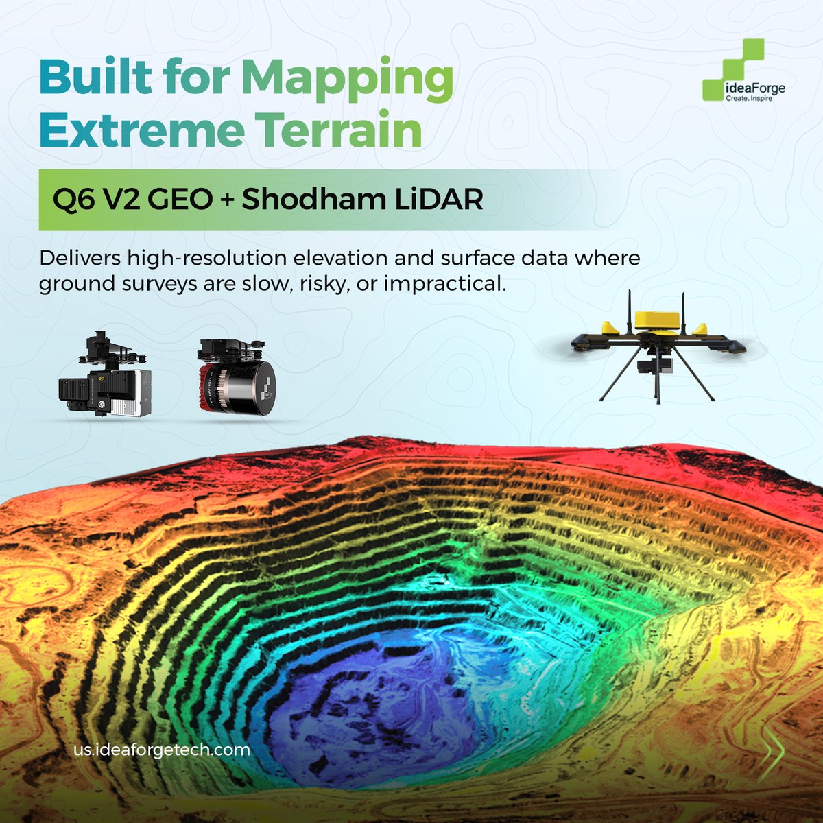
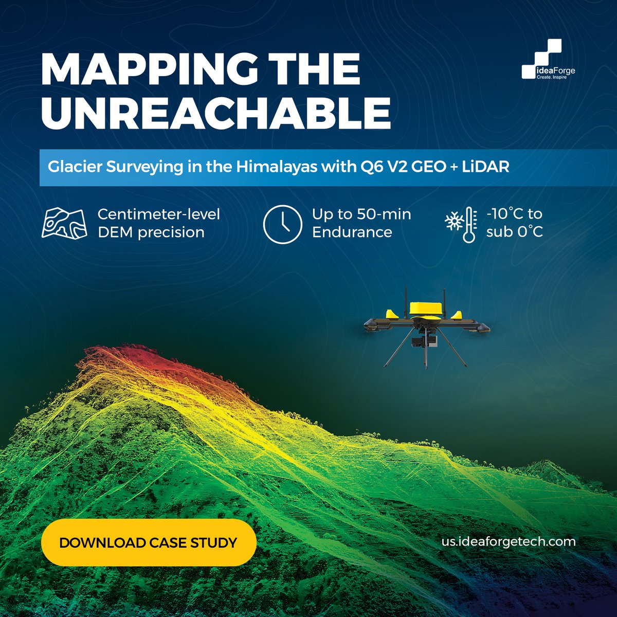
Mapping terrain conventional surveys cannot reach. This #WorldLiDARWeek, learn how #Q6V2GEO with #LiDAR generates centimeter-accurate elevation models in high-altitude glacier regions where access is limited & ground surveys are hazardous. Download now- https://t.co/uNkVKW4mQY
The New Eyes of India’s Armed Forces
From the Himalayas to dense forests and contested borders, India’s security challenges demand more than episodic surveillance. They demand persistence, autonomy, and high-fidelity intelligence.
In his latest opinion piece published in @BWBusinessworld, our Co-founder & CEO @ankit_ideaForge examines how #UAVs are redefining situational awareness for the Indian Army, enabling continuous #intelligence, operating in electronically contested environments, and reducing risk to soldiers on the ground.
As warfare becomes increasingly asymmetric and information-driven, #drones are no longer just force multipliers. They are foundational infrastructure for modern defence.
Read the full article to understand why indigenous, EW-resilient UAVs are shaping the future of India’s security architecture - https://t.co/OXP7g7VHYQ
#NationalSecurity #IndigenousInnovation #IndianArmy #AerialIntelligence #FutureOfWarfare
As geospatial capabilities mature, the focus is shifting from individual tools to connected systems.
In this conversation, our Co-founder & CEO, @ankit_ideaForge explores how interoperability, shared standards, and collaboration are shaping the next phase of geospatial intelligence. The discussion looks at how data from UAVs, platforms, and sensors can come together to support integrated workflows, coordinated decisions, and real-world outcomes.
The session also touches on India’s evolving role in building scalable geospatial platforms and what lies ahead as digital twins and continuous monitoring become more central to spatial intelligence. Watch the full conversation - https://t.co/OOSGHeLM9Z
#GeospatialIntelligence #SpatialEcosystems #DigitalTwins #Interoperability #DroneTechnology
Designed for #survey-grade outcomes, #Q6V2GEO delivers reliable, repeatable #geospatial intelligence across demanding missions.
Because critical decisions are only as strong as the data behind them. Learn more https://t.co/igBpICuqYM
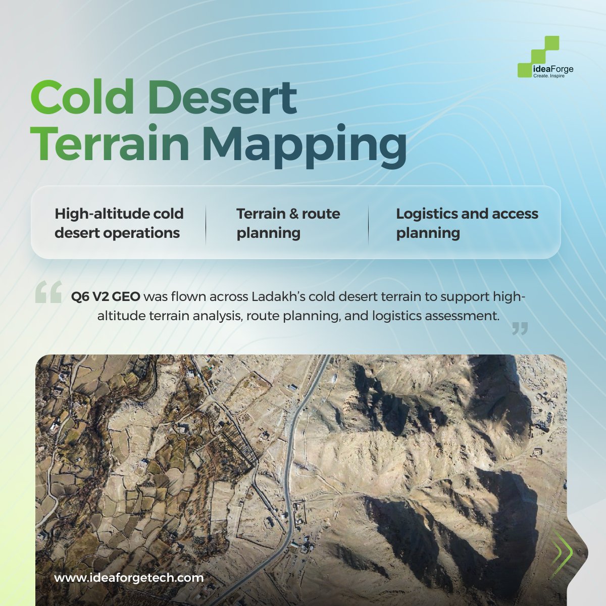
Built for #highaltitude cold desert operations.
#Q6V2GEO was deployed across #Ladakh to support terrain analysis, #route planning, and logistics assessment in extreme conditions.
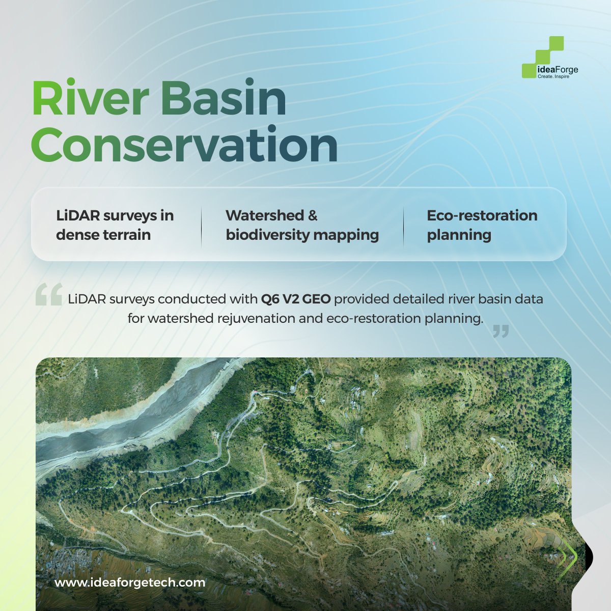
#LiDAR-driven insights in dense and complex terrain.
#Q6V2GEO enabled detailed river basin #surveys for watershed analysis, biodiversity mapping, and eco-restoration planning.
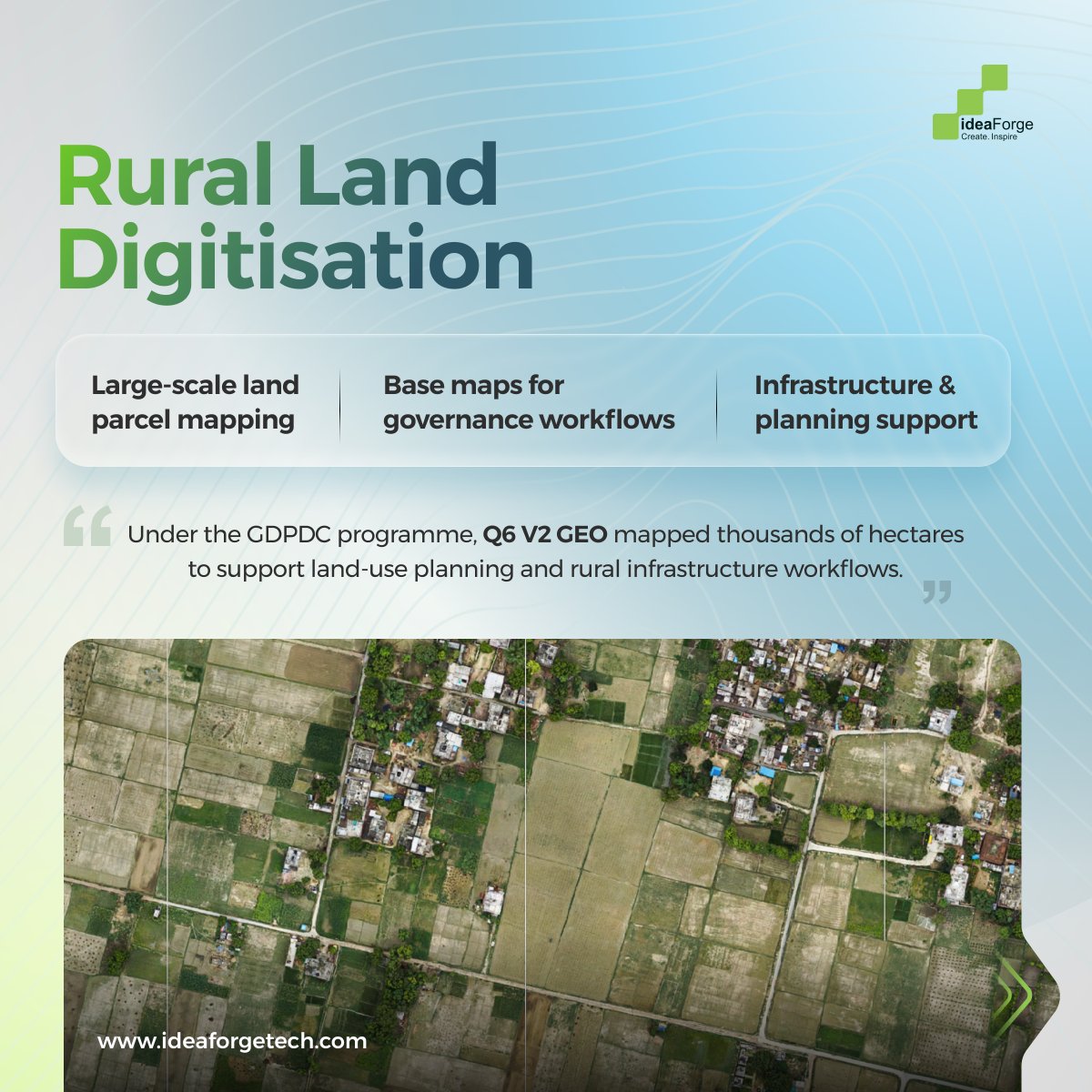
#Mapping at scale for governance workflows.
Under the #GDPDC programme, #Q6V2GEO mapped thousands of hectares to support land-use planning, base maps, and #rural infrastructure development.
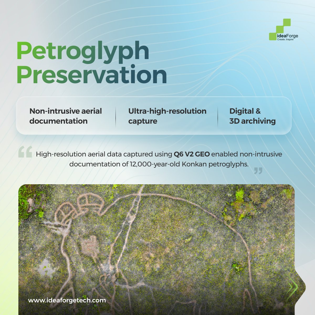
Non-intrusive #documentation where preservation matters.
Ultra-high-resolution aerial capture using #Q6V2GEO enabled digital and 3D archiving of 12,000-year-old Konkan #petroglyphs.
Mapping risk before it moves.
Q6 V2 GEO supports high-altitude #terrain modelling in #GNSS-challenged environments, generating data for avalanche risk assessment and early-warning studies in the #Himalayas.
When accuracy defines outcomes, mapping becomes mission-critical. #Q6V2GEO delivers survey-grade intelligence for missions where data quality shapes decisions. Know more ↓
Brain Behind the Bird | Episode 7: Handheld Remote Video Terminal (RVT)
Mission awareness shouldn’t be limited to the pilot alone. A handheld Remote Video Terminal enables commanders, observers, and field teams to view live UAV video in real time, without controlling the aircraft.
By sharing the same visual context across teams, RVTs support faster interpretation, coordinated responses, and informed decisions where it matters most, on the ground.
More episodes of #brainbehindthebird coming soon as we decode the technology powering real-world UAV operations. Explore how our platforms enhance mission awareness: https://t.co/KeabUwcNO7
#uavtechnology #missionawareness #situationalawareness #defencetech #aerialintelligence #droneoperations