This is an absolutely insane radar loop.
Typhoon Dolphin has completely defied her near-term strength and trajectory forecasts by executing multiple, trochoidal loop-de-loops over Japan’s Ryukyu Islands at a much stronger intensity than originally predicted.
You may be noticing lots of flashes in the sky tonight.
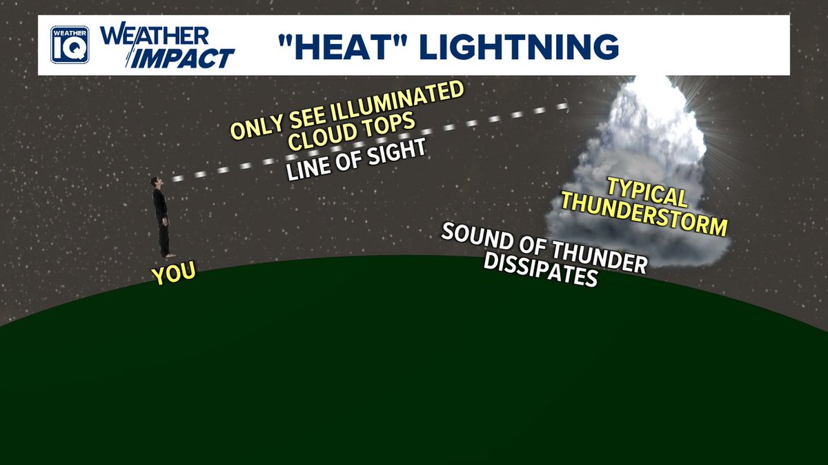
It's a classic "heat lightning" setup -- we have some distant thunderstorms tonight.
Tall clouds allow the lightning to be seen for 40-50+ miles at night.
Heat doesn't cause lightning, that's a myth. On hot summer nights, a lot of times there are tall storms far away, and we can see the flashes but not hear the sound. That's where "heat lightning" comes from.
This is wild, the HAFS was somehow right. Went from small beast, to EWRC dead weight, back to a compact core. Never seen a storm come back from that before.
In July, the equatorial subsurface east of the dateline was warmer than it has ever been since 1979, beating 1997's peak by 0.36°C! This value tends to peak in the fall so we may still have more to go. Yet another record broken by this very strong El Niño event!
Imho, #Dolphin is a good example of how southerly wind shear can increase the chance of eyewall replacement cycles in an intense tropical cycle by increasing azimuthal asymmetries within the inner core.
Northerly shear typically suppresses these asymmetries (e.g. #Melissa)
I personally think that Super Typhoon #Dolphin is for sure dropping to the very low 900s at least, with already 160 kt winds right now.
That presentation is insane, and we could see a sub 900 very soon.
This evolution of internal EW mechanisms is extremely similar to Melissa now, this was undergoing whilst Melissa reanalysis est. ~160-165kts phase, which gives reason towards 155kts intensity approaching soon, currently 150kts.
Let’s be perfectly honest here. The ONLY reason certain weenie accounts are now dwelling on the negative PDO is because they want an excuse to downplay this El Niño. All of their other copes (RONI, SOI, Modoki, MEI) over the last 4 months have been miserable failures
I never took the HMON model seriously in forecasting #Bertha to realign and reintensify prior to landfall in Louisiana despite the northeasterly shear.
This prediction rested on cyclonic propagation of deep convection and moisture into the up-shear quadrants (north side) which simply never showed signs of materializing. Deep convection struggled to cross the 29N line all day yesterday.
This is a good example of how operational forecasters can verify key aspects of computer model TC forecasts in real-time, allowing human-in-the-loop bias corrections. That discernment remains necessary in some cases.
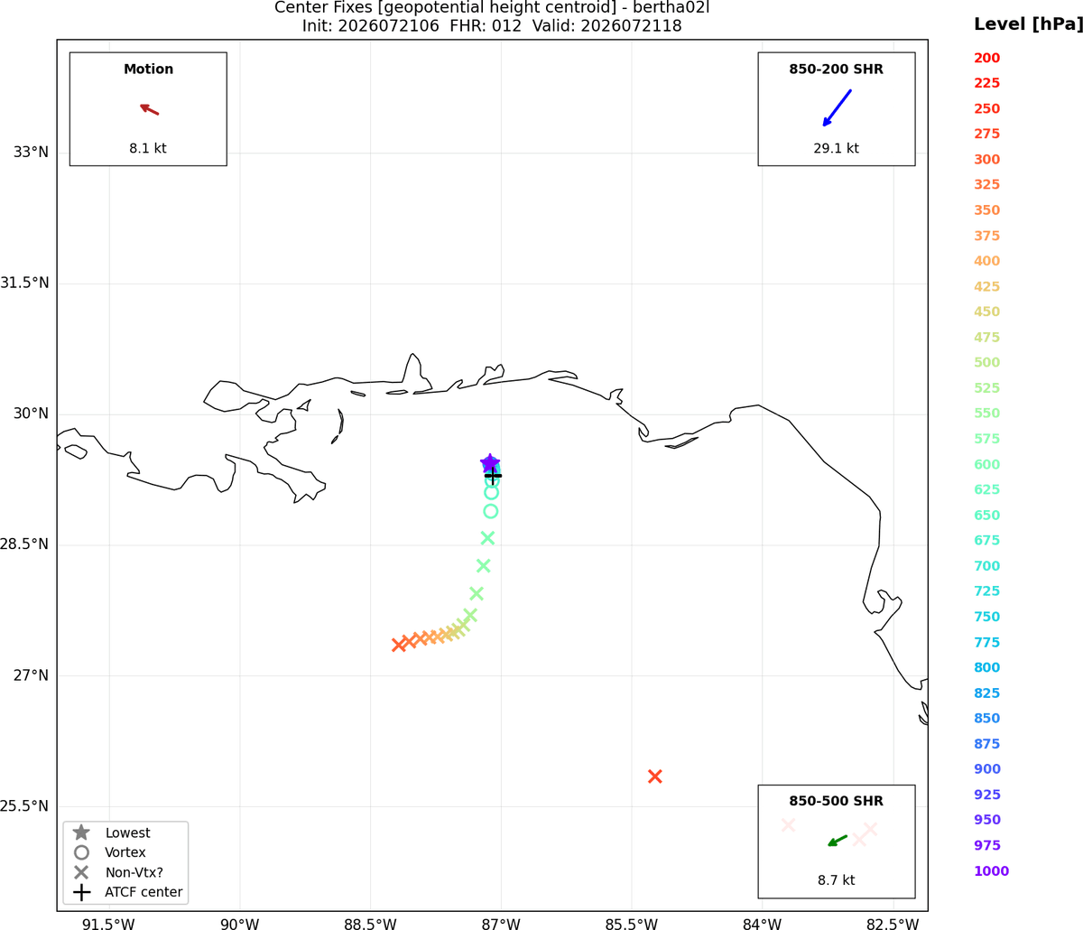
#Bertha is an impressively decoupled tropical cyclone. The LLC is over 100 miles away from the main convective complex! Yet the LLC remains very well defined, so a relocation would be difficult. Most likely it will remain weak and disorganized
Not all tropical storms or hurricanes are created equally and they shouldn’t be treated as such.
Bertha is bringing virtually no rain, very little wind, and very little land threats to the Gulf coasts. Mostly rough surf.
It’s okay to say that!
People will trust you more if you’re honest with them. Don’t tell them it’s hazardous outside if it’s not. Explain to them why it isn’t.
They’ll trust you more for the next one.
#Bertha
Looking at visible imagery, it looks like #Bertha has become more tilted since earlier today, with the mid-level center displaced quite a bit south of the low-level center due to shear.
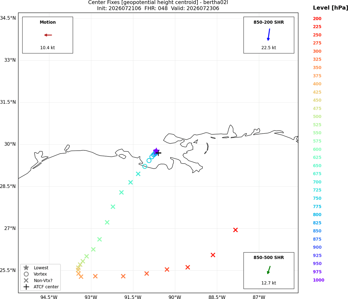
Hurricane models have picked up on this structure quite well. HAFS and HWRF show the tilt continuing, with the low-level center moving inland over Southern Louisiana.
HMON shows a new low-level center developing under the mid-level center as it moves over water south of Louisiana, but so far most models are not jumping on this solution. Something to keep an eye on, but probably not the most likely solution.
Also worth noting that the shear will continue for the next few days.
#Bertha is definitely among the ugliest TCs i've seen. Persistent northerly shear has kept the bulk of the convective activity displaced to the south, keeping the LLC exposed. Notably, a recon flight this morning has found winds up near 50kt and steady pressure falls, so it seems slight strengthening has occurred despite the disheveled appearance.
With recon starting to find some stronger winds on the SE side, #Bertha wants to make a run at joining her twin #Barry as the ugliest hurricanes (or is it a halficane?) in Atlantic history.
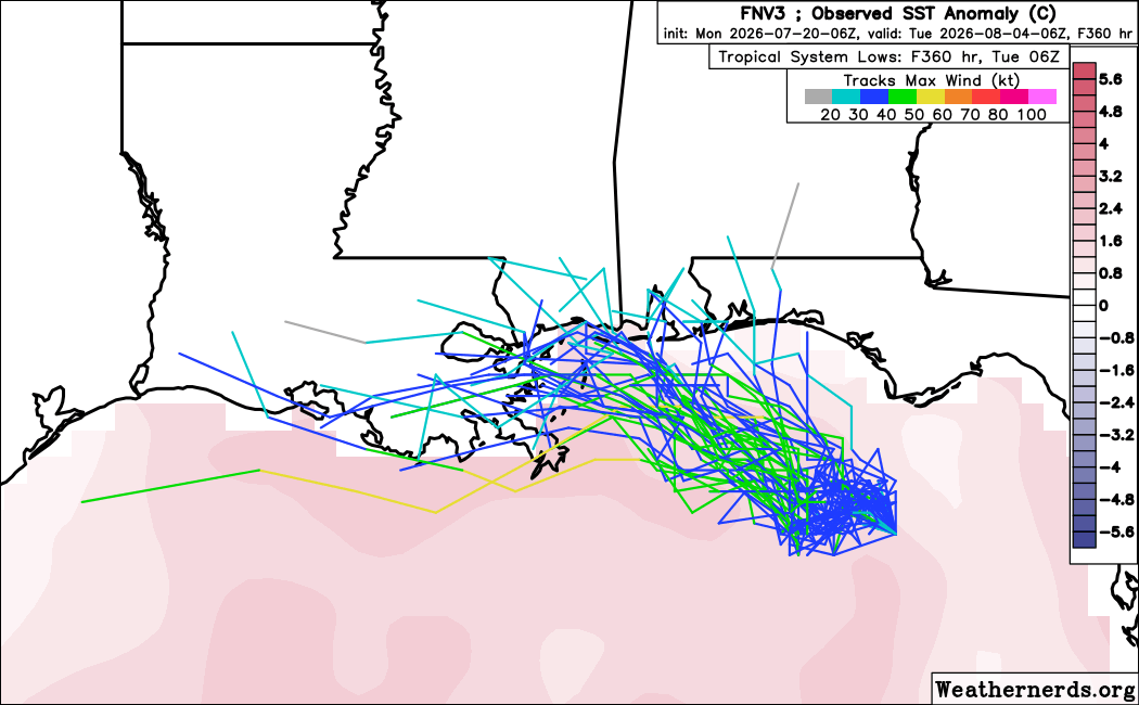
As of this morning, DeepMind has now pretty much dropped the cluster that sends a hurricane towards Texas. It looks like TD2 will probably be a TS but stay fairly weak and move into the Mississippi Delta region.