Big thanks to the @FoxWeather team and @AriWeather for having me on tonight! Always an honor to share in the science with such an incredible group of meteorologists. 🌀✨⚡️
You can find my full interview below!
Very rapid strengthening of the El Niño ongoing as the current WWB continues. Passing +1°C anomalies with RONI, which means that soon it will be at moderate Niño strength. Crazy for early June!
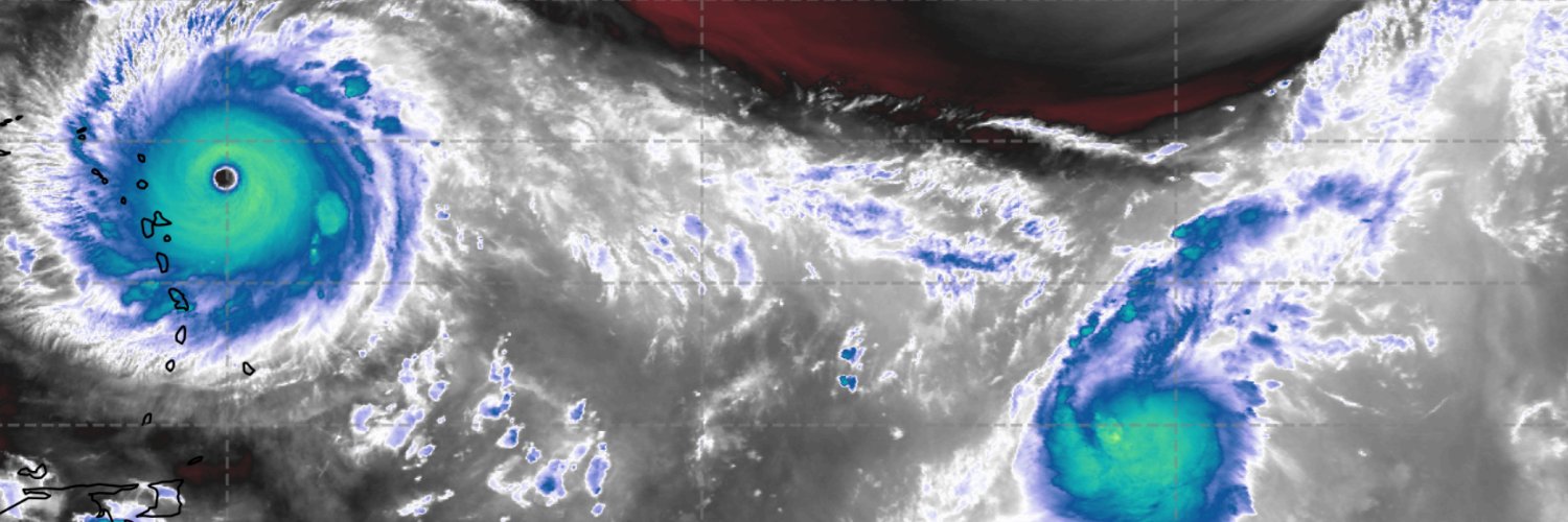
Tropical storm #Amanda has been designated this morning and has decent organization in the low and mid levels according to recent microwave data. The official forecast is for 55kt; however, I wouldn't be surprised if it makes a brief run at hurricane status given this MW progression and its rather small size.
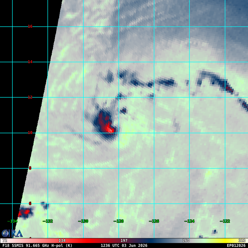
It is quite possible that invest #90E is already a Tropical Cyclone. Note the curved band structure apparent on MW and Satellite data, with an increase in central convection overnight.
@rushtropicalwx Very bold to put this out given the current suppressive factors in place. I think we will struggle to even reach 80 ACE this year. We’ll see!
Today is the conventional start of Hurricane Season, and the state of the Atlantic basin continues to be unhealthy. In addition to the classic -amo pattern showing up on -gbl mean plots, the emergence of El Nino this spring will promote increased shear and fewer opportunities for genesis this season.
As promised, here's @WeathermanAAA_ and my 2026 hurricane outlook for the Atlantic! Pretty straightforward: a strong-to-super El Niño, combined with a relatively cool Atlantic, should make this season a decently below-average season. As always, be prepared, it only takes one storm!
Tropical storm #Jangmi has slowly started to organize over the last day, now attempting to fire deep central convection to align/deepen its vortex. Initially, moderate shear and a relatively dry environment worked to broaden out its already large/monsoonal structure, so it's taken time and a lot of work to spin-up vorticity.
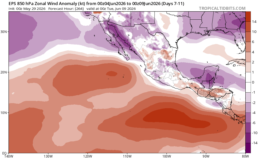
The next period to monitor for EPAC TC potential will occur further eastward as a few equatorial wavemodes superimpose (constructively interfere) with eachother, briefly yielding a strong intraseasonal pulse. This will bolster LL westerlies/cyclonic vorticity E of 120W.
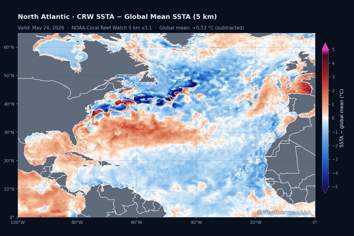
Nice depiction by AAA. This shows the relative sea surface temp anomalies. It subtracts the global mean which allows you to see where the Atlantic is relative warmer and relatively cooler than the other oceans. In this way, you can more easily infer where tropical activity is more likely and less likely. The main development region is not favored. If any place in the Atlantic is favored, it is the subtropics where sea surface temps are record warm.
SST anomaly + records plot shows that the current warmth in the subtropical atlantic is the highest its been for this date since 1985.
This will work to further stabilize the deep tropics this season, which will already be hindered given the effects of El Nino.
Absolutely classic sub-surface profile animation here. Note the buildup of heat in the maritime continent propagating eastward through the abundance of DKWs this spring.